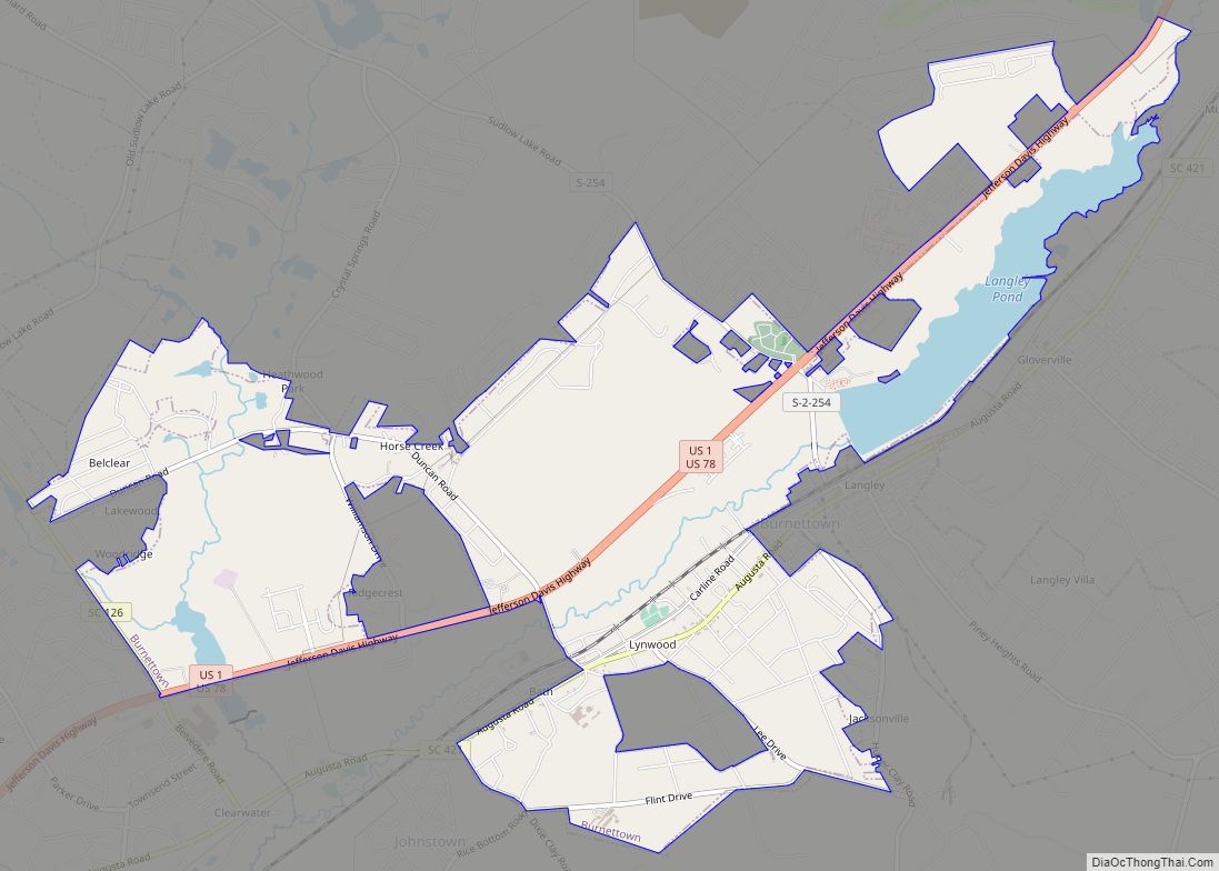
Burnettown is a town in Aiken County, South Carolina, United States. The population was 3,105 at the 2020 census. It is part of the Augusta, Georgia metropolitan area. Burnettown is located in historic Horse Creek Valley.
| Name: | Burnettown town |
|---|---|
| LSAD Code: | 43 |
| LSAD Description: | town (suffix) |
| State: | South Carolina |
| County: | Aiken County |
| Elevation: | 180 ft (50 m) |
| Total Area: | 6.05 sq mi (15.67 km²) |
| Land Area: | 5.51 sq mi (14.27 km²) |
| Water Area: | 0.54 sq mi (1.40 km²) |
| Total Population: | 3,105 |
| Population Density: | 563.52/sq mi (217.59/km²) |
| ZIP code: | 29851 |
| Area code: | 803, 839 |
| FIPS code: | 4510270 |
| GNISfeature ID: | 1231108 |
| Website: | www.burnettown.com |
Online Interactive Map
Click on ![]() to view map in "full screen" mode.
to view map in "full screen" mode.
Burnettown location map. Where is Burnettown town?
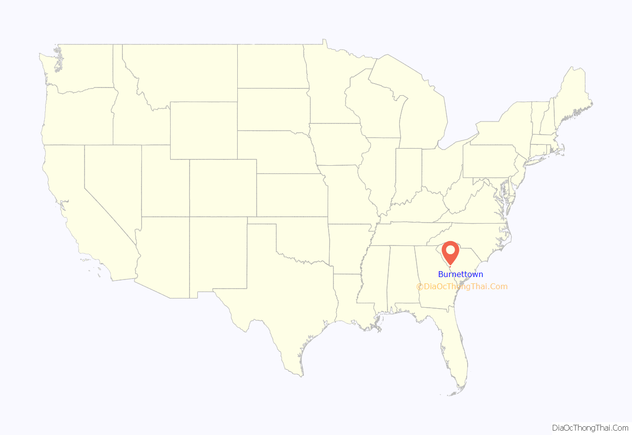
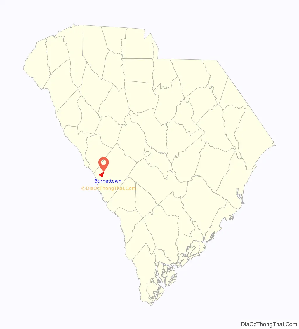
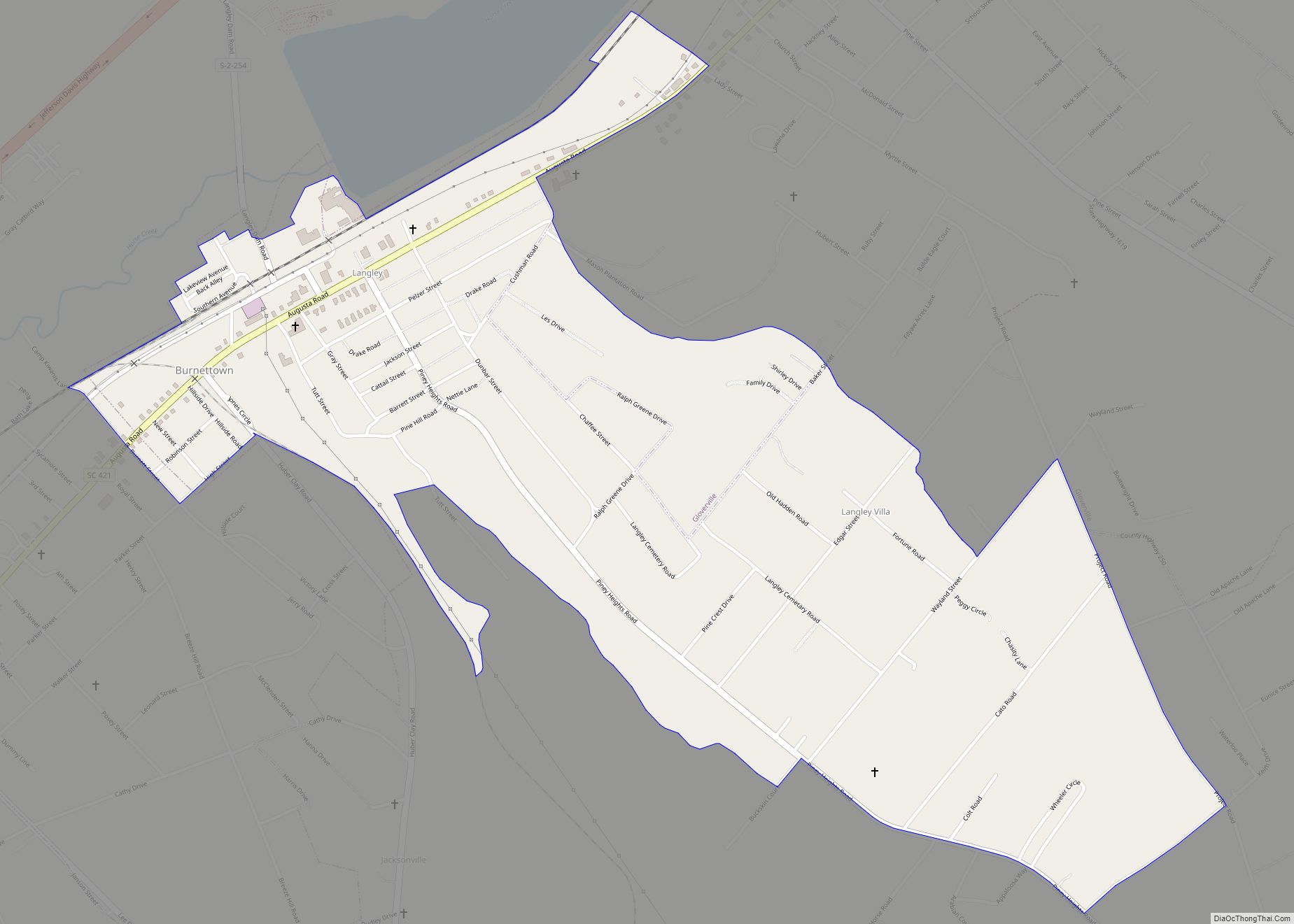
Burnettown Road Map
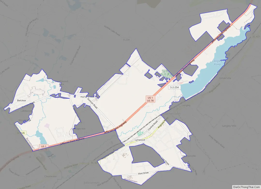
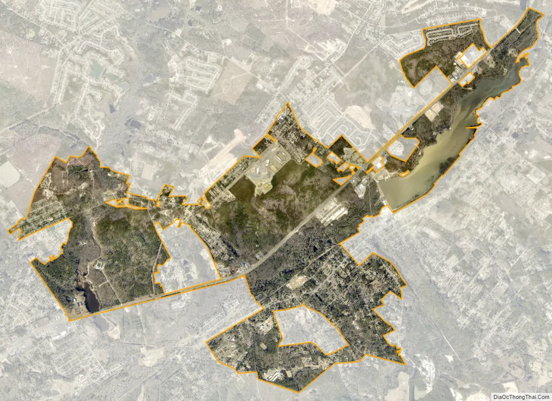
Burnettown city Satellite Map
Geography
Burnettown is located at 33°30′44″N 81°52′14″W / 33.51222°N 81.87056°W / 33.51222; -81.87056 (33.512272, -81.870520) in western Aiken County. It lies along U.S. Route 1 and 78, 7 miles (11 km) east of downtown Augusta, Georgia, and 10 miles (16 km) west of Aiken. It is bordered by the census-designated place (CDP) of Clearwater to the west, by an outer portion of the city of North Augusta to the northwest, by the CDPs of Gloverville and Langley to the east, and by the unincorporated community of Bath to the south.
According to the United States Census Bureau, the town has a total area of 6.0 square miles (15.6 km), of which 5.5 square miles (14.2 km) is land and 0.54 square miles (1.4 km), or 9.17%, is water, consisting primarily of Langley Pond, a reservoir on Horse Creek.
See also
Map of South Carolina State and its subdivision:- Abbeville
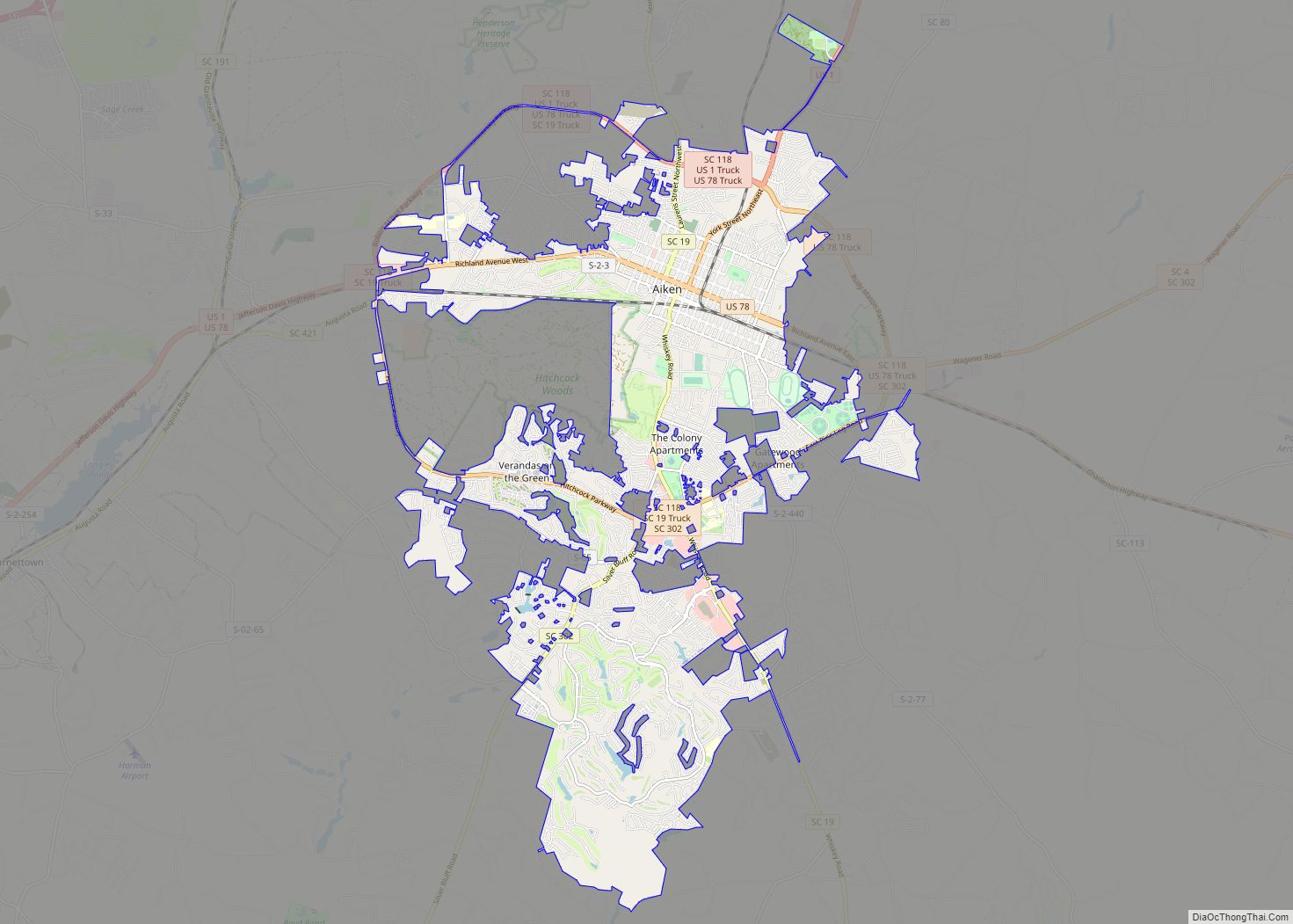
- Aiken
- Allendale
- Anderson
- Bamberg
- Barnwell
- Beaufort
- Berkeley
- Calhoun
- Charleston
- Cherokee
- Chester
- Chesterfield
- Clarendon
- Colleton
- Darlington
- Dillon
- Dorchester
- Edgefield
- Fairfield
- Florence
- Georgetown
- Greenville
- Greenwood
- Hampton
- Horry
- Jasper
- Kershaw
- Lancaster
- Laurens
- Lee
- Lexington
- Marion
- Marlboro
- McCormick
- Newberry
- Oconee
- Orangeburg
- Pickens
- Richland
- Saluda
- Spartanburg
- Sumter
- Union
- Williamsburg
- York
- Alabama
- Alaska
- Arizona
- Arkansas
- California
- Colorado
- Connecticut
- Delaware
- District of Columbia
- Florida
- Georgia
- Hawaii
- Idaho
- Illinois
- Indiana
- Iowa
- Kansas
- Kentucky
- Louisiana
- Maine
- Maryland
- Massachusetts
- Michigan
- Minnesota
- Mississippi
- Missouri
- Montana
- Nebraska
- Nevada
- New Hampshire
- New Jersey
- New Mexico
- New York
- North Carolina
- North Dakota
- Ohio
- Oklahoma
- Oregon
- Pennsylvania
- Rhode Island
- South Carolina
- South Dakota
- Tennessee
- Texas
- Utah
- Vermont
- Virginia
- Washington
- West Virginia
- Wisconsin
- Wyoming