Fort Mill, also known as Fort Mill Township, is a town in York County, South Carolina, United States. It is a suburb of Charlotte, North Carolina. As of 2020 census, the population of the town was 24,521. Some businesses and residents in the Indian Land community of neighboring Lancaster County share a Fort Mill mailing address, but the official town boundary extends only within York County.
The Fort Mill area is home to notable businesses such as the headquarters of Carolina Crown Drum and Bugle Corps (who were DCI World Champions in 2013), LPL Financial, Continental Tire the Americas (Lancaster County), LLC., CompuCom Systems, Diversey, Inc., Sunbelt Rentals, Domtar, Springs Industries, AECOM (Lancaster County), Shutterfly, Red Ventures (Lancaster County), Daimler Trucks North America, and Puckerbutt Pepper Company, known for originally producing the Carolina Reaper.
| Name: | Fort Mill town |
|---|---|
| LSAD Code: | 43 |
| LSAD Description: | town (suffix) |
| State: | South Carolina |
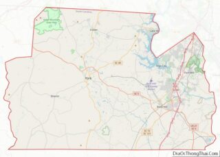
| County: | York County |
| Elevation: | 623 ft (190 m) |
| Land Area: | 19.71 sq mi (51.04 km²) |
| Water Area: | 0.26 sq mi (0.68 km²) |
| Population Density: | 1,244.34/sq mi (480.43/km²) |
| ZIP code: | 29715, 29716, 29708 |
| Area code: | 803, 839 |
| FIPS code: | 4526890 |
| GNISfeature ID: | 1247805 |
| Website: | fortmillsc.gov |
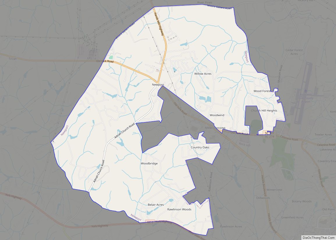
Online Interactive Map
Click on ![]() to view map in "full screen" mode.
to view map in "full screen" mode.
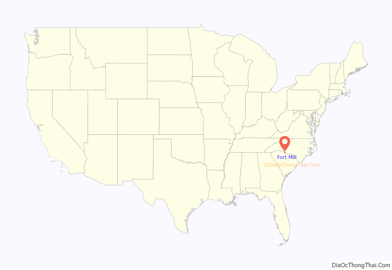
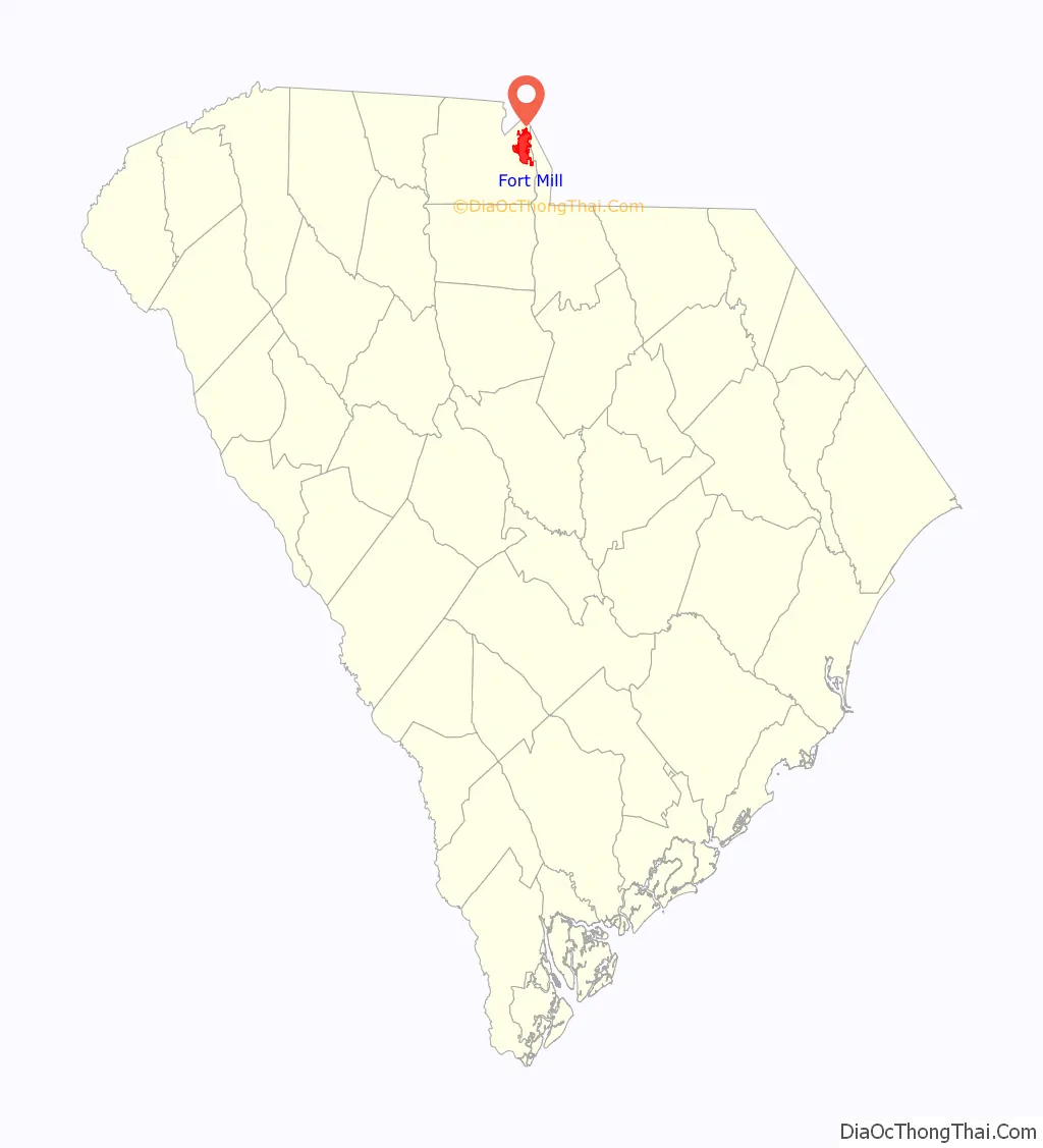
Fort Mill location map. Where is Fort Mill town?
History
The town of Fort Mill was established in 1873, getting its name from its location between two points, the first, a fort constructed by British in colonial times to protect the Catawba Indians from marauding tribes to the north, and the second point of Webb’s Mill. The Catawba Indians made their home in present-day Fort Mill for many years. Scots-Irish settlers began arriving in the 1750s and 1760s and a small settlement soon developed. Fort Mill grew rapidly in the late 19th century as textile mills were established. After many textile mill shut-downs the town continued to grow rapidly and became a major suburb of Charlotte.
Highlights in Fort Mill’s history include:
- In the mid-18th century, Thomas Spratt and his wife Elizabeth were traveling through upper South Carolina in their wagon. They spent a night among the friendly Catawba Indians and were invited to stay and live in the area on a large tract of land given to them. They became the first white settlers in the Fort Mill area and their descendants still reside there. Their descendant, John Spratt, represented the area in the U.S. House of Representatives from 1983 to 2011.
- The town of Fort Mill was the site of the last Confederate Government Cabinet meeting (1865). Jefferson Davis and the Confederate Cabinet passed through the area during their flight from Richmond in 1865. The last meeting of the full Confederate Cabinet was held at the White Homestead in Fort Mill. Fort Mill’s Confederate Park contains the nation’s only monument to slaves laboring on the Confederate side of the American Civil War.
- In the 1970s and 1980s, Fort Mill was the home to TV evangelist Jim Bakker’s now defunct Heritage USA (now reopened as Heritage International Ministries).
The Banks-Mack House, Fort Mill Downtown Historic District, Mack-Belk House, Mills House, Nation Ford Road, National Guard Armory, Spratt Cemetery, Springfield Plantation House, Thornwell-Elliott House, Unity Presbyterian Church Complex, John M. White House, William Elliott White House, and Wilson House are listed on the National Register of Historic Places.
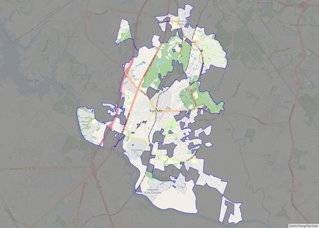
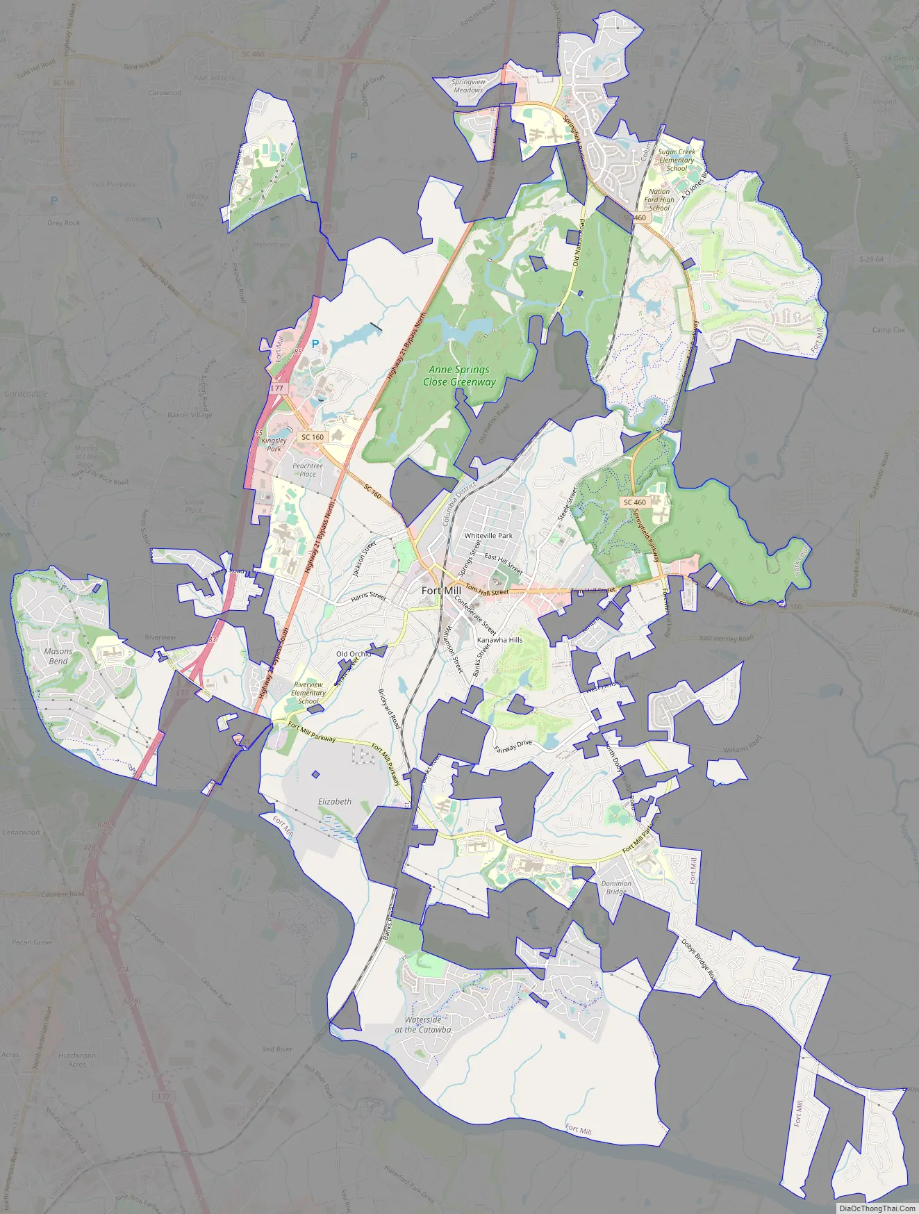
Fort Mill Road Map
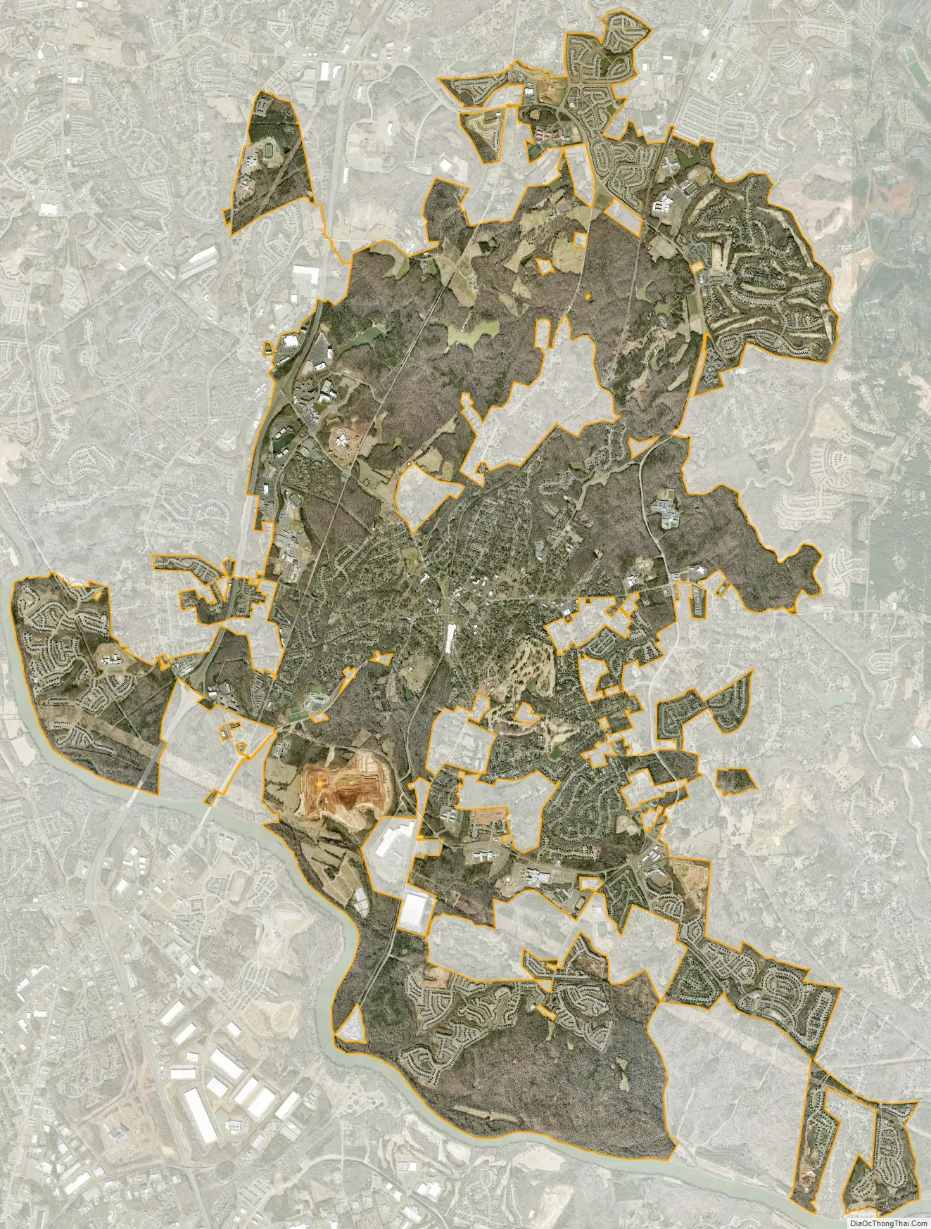
Fort Mill city Satellite Map
Geography
According to the United States Census Bureau, the town has a total area of 4.6 square miles (12 square kilometres), of which 4.6 square miles (12 square kilometres) is land and 0.1 square miles (0.26 square kilometres) (1.30%) is water. Interstate 77 passes through the western portions of the town, and exit 85 is signed “South Carolina Highway 160/Fort Mill.” SC 160 is the main east–west street in Fort Mill.
The town of Fort Mill held a final public hearing in October 2008 on a proposed annexation that doubled the town’s physical size. Fort Mill has three golf courses. The town also maintains six parks: Harris Street Park, Steele Street Park, Doby Bridge Park, Calhoun Street Park, Veterans Park and Walter Elisha Park. Three of the six parks have picnic shelters, children’s playgrounds, and restrooms. Doby Bridge and Harris Street Parks have lighted baseball fields, with Steele Street and Harris Street Parks having basketball courts, and Steele Street Park having a small water park. The town also maintains a banquet hall rentable through the parks and recreation department.
Climate
Fort Mill is located in a humid subtropical climate, Cfa in the Köppen climate classification. This means that the city experiences four distinct seasons, although the variation between the seasons is not as pronounced as in other parts of the United States. Generally, daytime maximum temperatures in the summer are around 90 °F (32 °C), with nighttime low temperatures of approximately 70 °F (21 °C). In winter, daytime maxima average around 50 °F (10 °C) while nighttime low temperatures are near 30 °F (−1 °C). Occasional readings as high as 105 °F (41 °C) are seen, reaching a high of 108 °F (42 °C) in 2007 or as low as −5 °F (−21 °C) in 1989. Summers are generally humid and prone to thunderstorms, while winters are rainy with sleet and occasional snow. Snow might fall during the winter but usually does not accumulate or persist as ground cover. Fort Mill experiences rainfall related to tropical cyclones but is generally too far inland to experience damaging winds. Fort Mill has not had any direct hits from any tropical systems since 1989, when Hurricane Hugo devastated the area.
The most common soil in Fort Mill is Cecil series.
See also
Map of South Carolina State and its subdivision:- Abbeville
- Aiken
- Allendale
- Anderson
- Bamberg
- Barnwell
- Beaufort
- Berkeley
- Calhoun
- Charleston
- Cherokee
- Chester
- Chesterfield
- Clarendon
- Colleton
- Darlington
- Dillon
- Dorchester
- Edgefield
- Fairfield
- Florence
- Georgetown
- Greenville
- Greenwood
- Hampton
- Horry
- Jasper
- Kershaw
- Lancaster
- Laurens
- Lee
- Lexington
- Marion
- Marlboro
- McCormick
- Newberry
- Oconee
- Orangeburg
- Pickens
- Richland
- Saluda
- Spartanburg
- Sumter
- Union
- Williamsburg
- York
- Alabama
- Alaska
- Arizona
- Arkansas
- California
- Colorado
- Connecticut
- Delaware
- District of Columbia
- Florida
- Georgia
- Hawaii
- Idaho
- Illinois
- Indiana
- Iowa
- Kansas
- Kentucky
- Louisiana
- Maine
- Maryland
- Massachusetts
- Michigan
- Minnesota
- Mississippi
- Missouri
- Montana
- Nebraska
- Nevada
- New Hampshire
- New Jersey
- New Mexico
- New York
- North Carolina
- North Dakota
- Ohio
- Oklahoma
- Oregon
- Pennsylvania
- Rhode Island
- South Carolina
- South Dakota
- Tennessee
- Texas
- Utah
- Vermont
- Virginia
- Washington
- West Virginia
- Wisconsin
- Wyoming