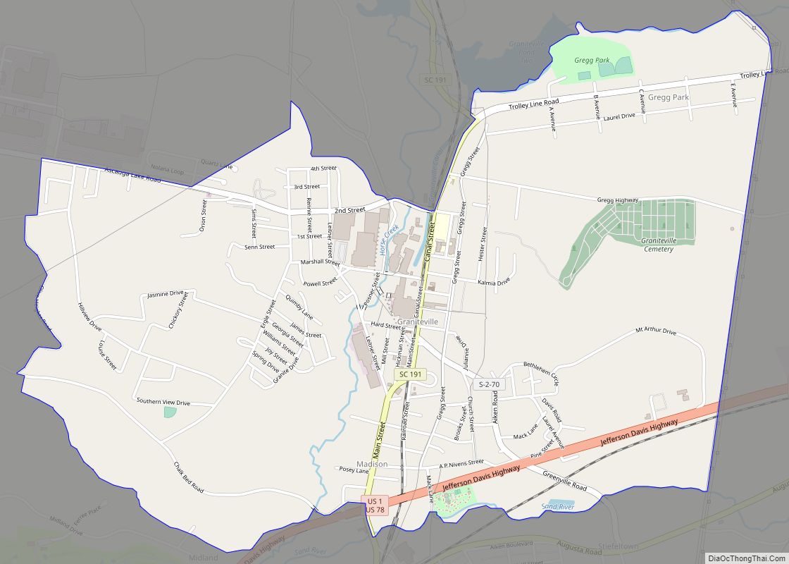
Graniteville is a census-designated place (CDP) in Aiken County, South Carolina, United States. The population was 2,614 at the 2010 census. It lies along U.S. Route 1, five miles (8.0 km) west of Aiken in Horse Creek Valley, which originates in the nearby town of Vaucluse.
Graniteville is part of the Augusta, Georgia metropolitan area, also known as the C.S.R.A. or Central Savannah River Area.
| Name: | Graniteville CDP |
|---|---|
| LSAD Code: | 57 |
| LSAD Description: | CDP (suffix) |
| State: | South Carolina |
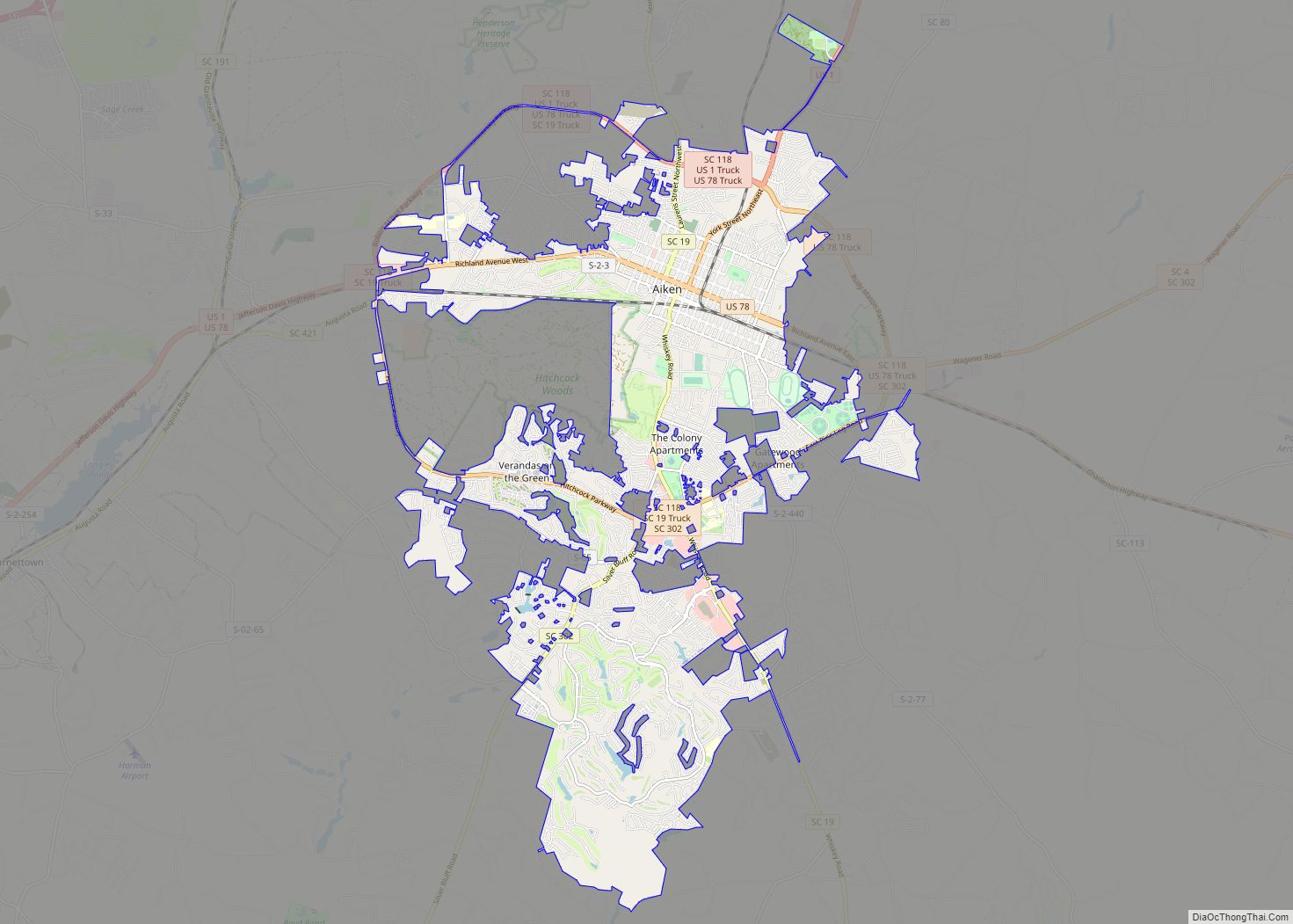
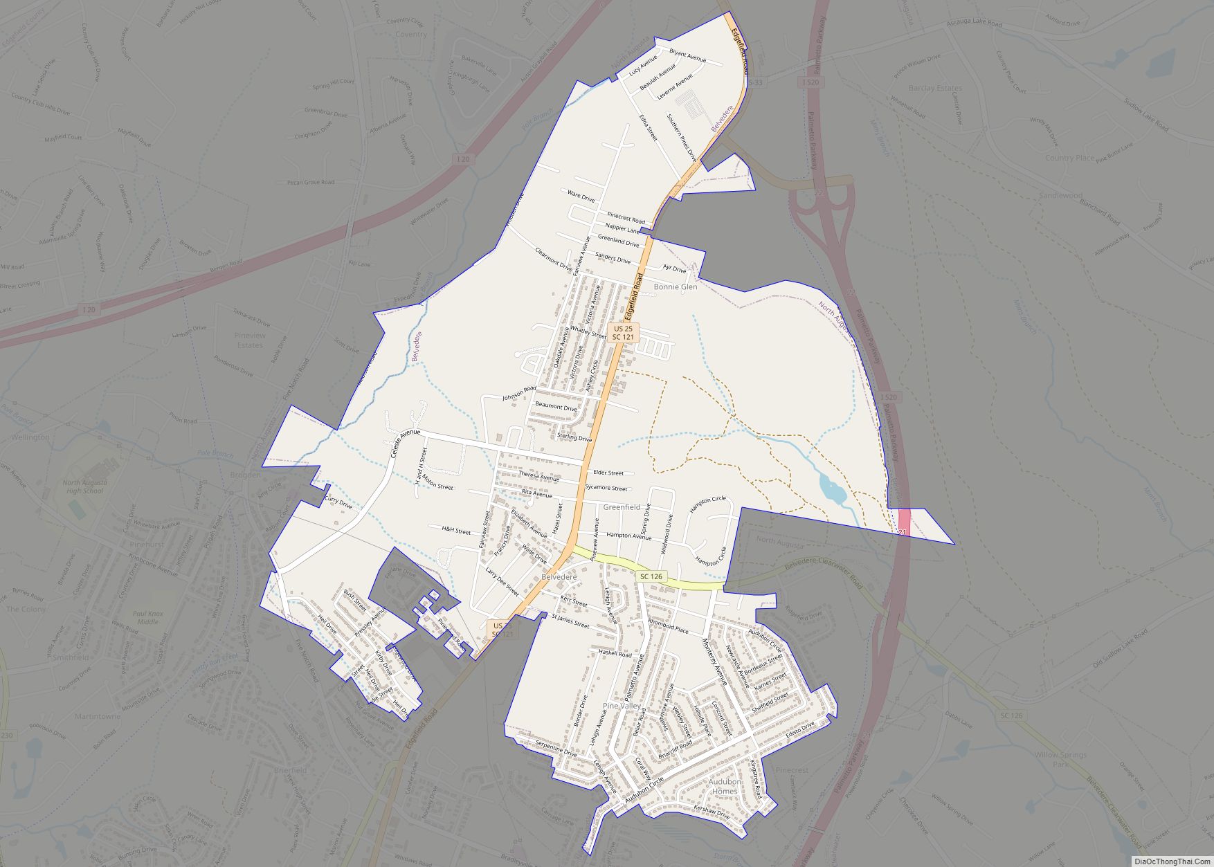
| County: | Aiken County |
| Founded: | 1845 |
| Elevation: | 227 ft (69 m) |
| Total Area: | 3.32 sq mi (8.61 km²) |
| Land Area: | 3.31 sq mi (8.56 km²) |
| Water Area: | 0.02 sq mi (0.05 km²) |
| Total Population: | 2,439 |
| Population Density: | 737.53/sq mi (284.79/km²) |
| ZIP code: | 29829 |
| FIPS code: | 4530265 |
Online Interactive Map
Click on ![]() to view map in "full screen" mode.
to view map in "full screen" mode.
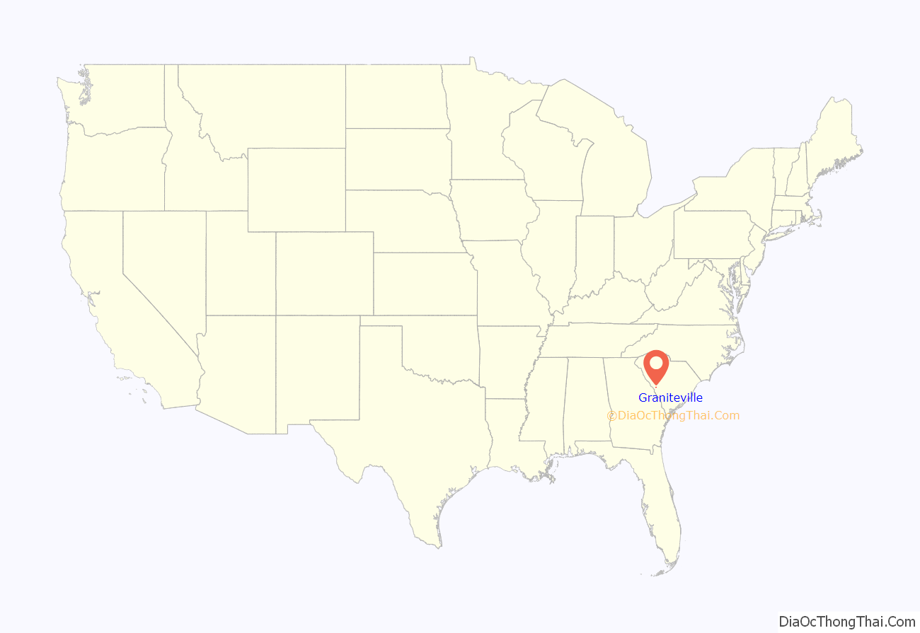
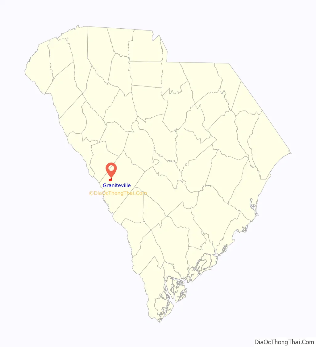
Graniteville location map. Where is Graniteville CDP?
History
Graniteville dates back to 1845 when William Gregg built the South’s first large-scale cotton mill in what became known as Graniteville. His paternalistic mill town included 90 homes, several boarding houses, six stores, two churches, and a school for the mill workers and their families. The community got its name because most of those original buildings were constructed of blue granite. Gregg required the children of mill workers to attend the public school he instituted, and violators were fined. As such, Graniteville holds the distinction of having the first compulsory education system in the Southern United States.
The Graniteville Historic District was listed on the National Register of Historic Places in 1978.
On January 6, 2005, a Norfolk Southern Railway freight train struck a parked train on the spur leading to Avondale’s Stevens Steam Plant. One of two train cars that were carrying liquid chlorine ruptured, releasing a poisonous chlorine cloud. Nine people were killed, more than 550 injured, and more than 5,400 were displaced from their homes for more than a week. The town built a memorial in a small park at the intersection of Canal Street and Aiken Road, and on May 20, 2006, the memorial was dedicated to the people who died in the crash.
In 2008, there were talks about incorporating the villages of Graniteville, Vaucluse, and Warrenville; as a result, the towns approved a referendum to vote on whether or not to incorporate. If approved, the municipality would have had an area of around 20 square miles (52 km). The referendum was defeated by a two-to-one margin in August 2008.
Graniteville Road Map
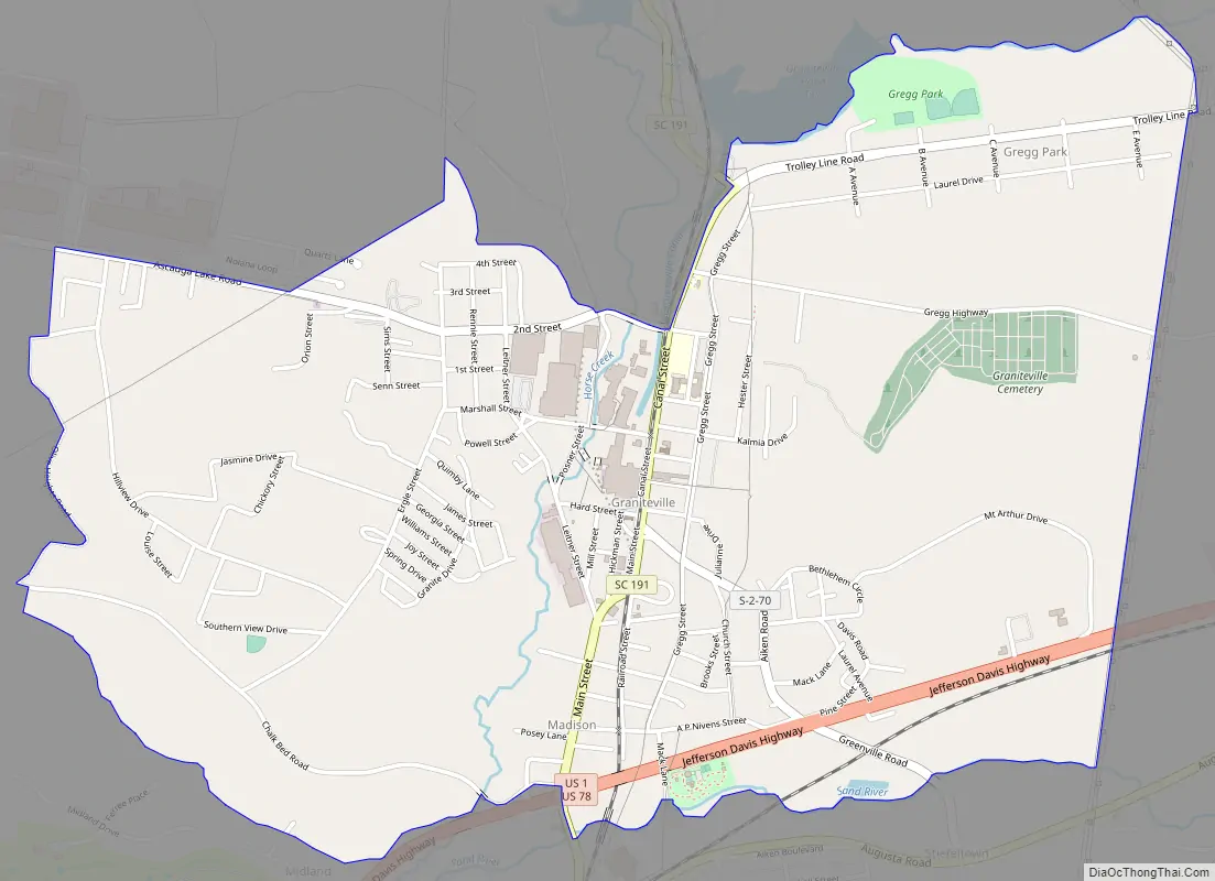
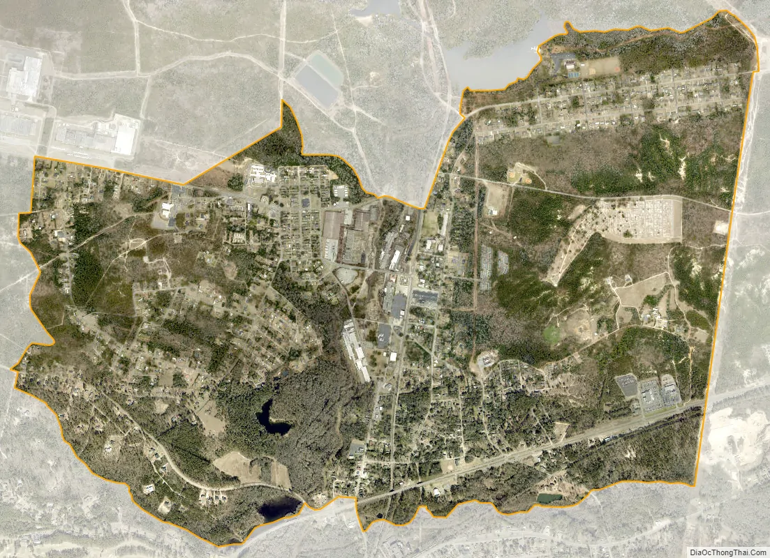
Graniteville city Satellite Map
See also
Map of South Carolina State and its subdivision:- Abbeville
- Aiken
- Allendale
- Anderson
- Bamberg
- Barnwell
- Beaufort
- Berkeley
- Calhoun
- Charleston
- Cherokee
- Chester
- Chesterfield
- Clarendon
- Colleton
- Darlington
- Dillon
- Dorchester
- Edgefield
- Fairfield
- Florence
- Georgetown
- Greenville
- Greenwood
- Hampton
- Horry
- Jasper
- Kershaw
- Lancaster
- Laurens
- Lee
- Lexington
- Marion
- Marlboro
- McCormick
- Newberry
- Oconee
- Orangeburg
- Pickens
- Richland
- Saluda
- Spartanburg
- Sumter
- Union
- Williamsburg
- York
- Alabama
- Alaska
- Arizona
- Arkansas
- California
- Colorado
- Connecticut
- Delaware
- District of Columbia
- Florida
- Georgia
- Hawaii
- Idaho
- Illinois
- Indiana
- Iowa
- Kansas
- Kentucky
- Louisiana
- Maine
- Maryland
- Massachusetts
- Michigan
- Minnesota
- Mississippi
- Missouri
- Montana
- Nebraska
- Nevada
- New Hampshire
- New Jersey
- New Mexico
- New York
- North Carolina
- North Dakota
- Ohio
- Oklahoma
- Oregon
- Pennsylvania
- Rhode Island
- South Carolina
- South Dakota
- Tennessee
- Texas
- Utah
- Vermont
- Virginia
- Washington
- West Virginia
- Wisconsin
- Wyoming