West Jordan is a city in Salt Lake County, Utah, United States. It is a suburb of Salt Lake City. According to the 2020 Census, the city had a population of 116,961, placing it as the third most populous in the state. The city occupies the southwest end of the Salt Lake Valley at an elevation of 4,330 feet (1,320 m). Named after the nearby Jordan River, the limits of the city begin on the river’s western bank and end in the eastern foothills of the Oquirrh Mountains, where Kennecott Copper Mine, the world’s largest man-made excavation, is located.
Settled in the mid-19th century, the city has developed into its own regional center. As of 2012, the city has four major retail centers; with Jordan Landing being one of the largest mixed-use planned developments in the Intermountain West. Companies headquartered in West Jordan include Mountain America Credit Union, Lynco Sales & Service, SME Steel, and Cyprus Credit Union. The city has one major hospital, Jordan Valley Medical Center, and a campus of Salt Lake Community College.
City landmarks include Gardner Village, established in 1850, and South Valley Regional Airport, formerly known as “Salt Lake Airport #2”. The airport serves general aviation operations as well as a base for the 211th Aviation Regiment of the Utah Army National Guard flying Apache and Black Hawk helicopters.
| Name: | West Jordan city |
|---|---|
| LSAD Code: | 25 |
| LSAD Description: | city (suffix) |
| State: | Utah |
| County: | Salt Lake County |
| Incorporated: | 1941 |
| Elevation: | 4,373 ft (1,333 m) |
| Total Area: | 32.33 sq mi (83.73 km²) |
| Land Area: | 32.33 sq mi (83.73 km²) |
| Water Area: | 0.00 sq mi (0.00 km²) |
| Total Population: | 116,961 |
| Population Density: | 3,617.72/sq mi (1,396.88/km²) |
| ZIP code: | 84081, 84084, 84088 |
| Area code: | 385, 801 |
| FIPS code: | 4982950 |
| GNISfeature ID: | 1434086 |
| Website: | www.westjordan.utah.gov |
Online Interactive Map
Click on ![]() to view map in "full screen" mode.
to view map in "full screen" mode.
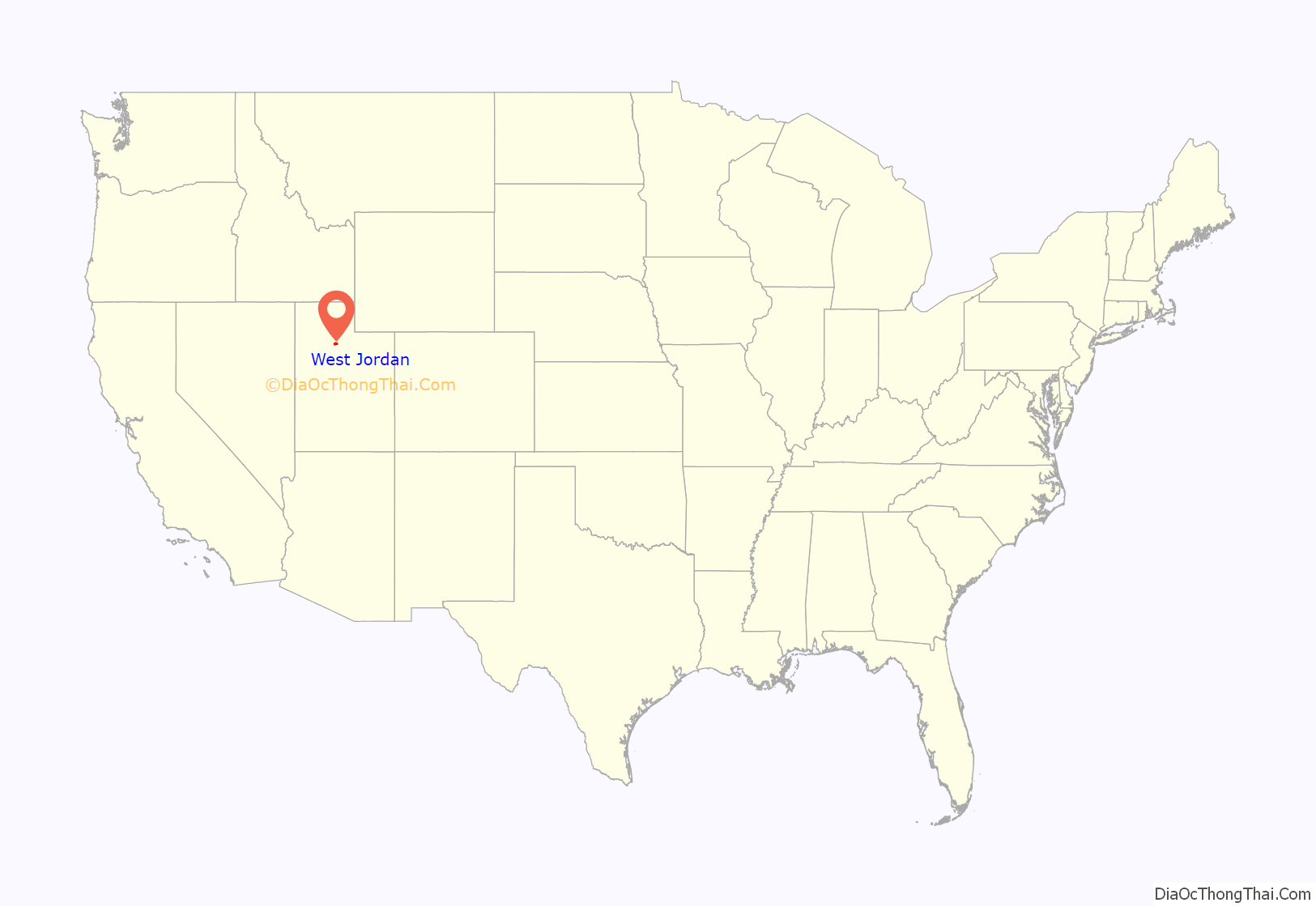
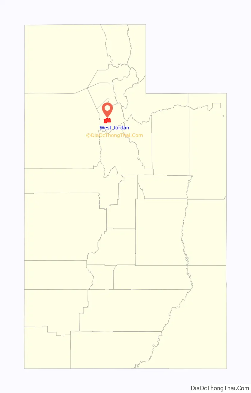
West Jordan location map. Where is West Jordan city?
History
West Jordan received its name from Mormon settlers who entered the Salt Lake Valley in 1847 under the leadership of their prophet, Brigham Young. These first European-Americans named the river flowing west of their first settlement, Salt Lake City, the Western Jordan, a reference to the River Jordan in Jordan. The name was later simplified to “Jordan River”. Like its Middle Eastern namesake, the Jordan River flows from a fresh water lake (Utah Lake) to an inland salt sea (Great Salt Lake). West Jordan was founded around 1849 on the western banks of the Jordan River.
One of the first sawmills in the area was built in 1850 in the city by Archibald Gardner. Gardner was a devout Mormon whose legacy can still be seen in modern West Jordan. His collection of mills and houses, now historic, have been renovated into a specialty shopping district known as Gardner Village.
Early West Jordan relied primarily on agriculture, mills, and mining activity to form the base of its economy. The first leather tannery west of the Mississippi River was constructed in the city in 1851.
Today, West Jordan is one of the fastest-growing cities in Utah. Growth has been phenomenal, beginning in the 1970s and continuing unabated since. The population grew from 4,221 in 1970 to 27,327 in 1980, 42,892 in 1990, and 68,336 in 2000, reaching 103,712 according to the 2010 Census. Sears chose the city as its first Sears Grand location, a new store concept, which opened its doors in 2003 at the Jordan Landing shopping center. Transportation issues along with school overcrowding are the city’s top concerns as it attempts to deal with rapid population growth.
Current major construction projects include a new main campus for the Salt Lake Community College, the expansion of Jordan Valley Hospital, and Midvale’s current transit-oriented development on the east border in the Jordan River bed.
West Jordan has become a regional center for government services. The Veteran’s Park Area includes City Hall, the Thomas Rees Justice Center that houses the West Jordan Police and Justice Court. Also included in the area is Fire Station 52, the Salt Lake County Health Department, Utah Third District Court, the Salt Lake District Attorney’s Office, and the Viridian Events Center and Library. The Park also includes a rodeo area, a senior center, and Gene Fuller Recreation Center, name after former boxing great Gene Fullmer.
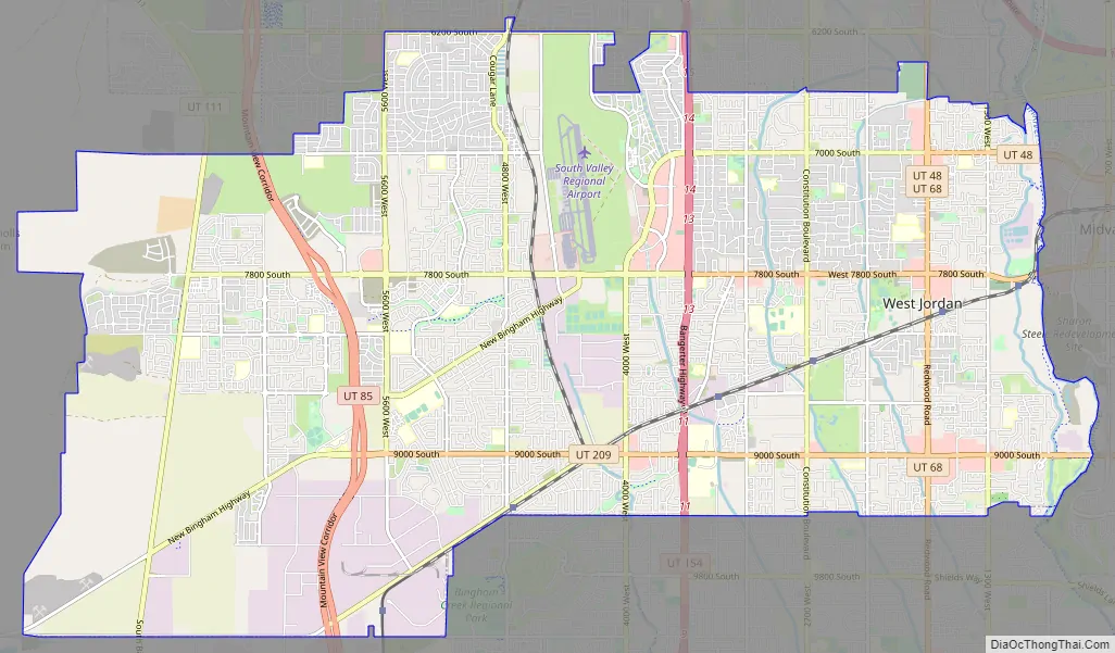
West Jordan Road Map
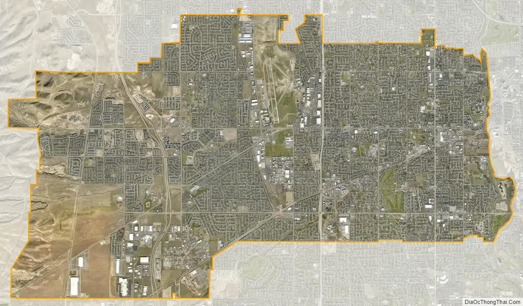
West Jordan city Satellite Map
Geography
According to the United States Census Bureau, the city has a total area of 30.9 square miles (80.0 km), all land.
West Jordan is bordered on the west by the Oquirrh Mountains and on the east by the Jordan River. The western neighborhoods of Welby, Copper Hills, and Jordan Hills are rapidly growing regions located along the lower slopes of the eastern Oquirrh Mountains. The fastest development is currently taking place between 4800 West and State Route 111, a highway that traverses the slopes of the Oquirrh Mountains.
The city lies approximately 18 miles (29 km) southwest of downtown Salt Lake City. The city is bordered on the north by Taylorsville and Kearns, on the south by South Jordan, on the east by Sandy, Murray and Midvale, on the west by Copperton, and on the extreme northwestern corner by West Valley City.
See also
Map of Utah State and its subdivision: Map of other states:- Alabama
- Alaska
- Arizona
- Arkansas
- California
- Colorado
- Connecticut
- Delaware
- District of Columbia
- Florida
- Georgia
- Hawaii
- Idaho
- Illinois
- Indiana
- Iowa
- Kansas
- Kentucky
- Louisiana
- Maine
- Maryland
- Massachusetts
- Michigan
- Minnesota
- Mississippi
- Missouri
- Montana
- Nebraska
- Nevada
- New Hampshire
- New Jersey
- New Mexico
- New York
- North Carolina
- North Dakota
- Ohio
- Oklahoma
- Oregon
- Pennsylvania
- Rhode Island
- South Carolina
- South Dakota
- Tennessee
- Texas
- Utah
- Vermont
- Virginia
- Washington
- West Virginia
- Wisconsin
- Wyoming