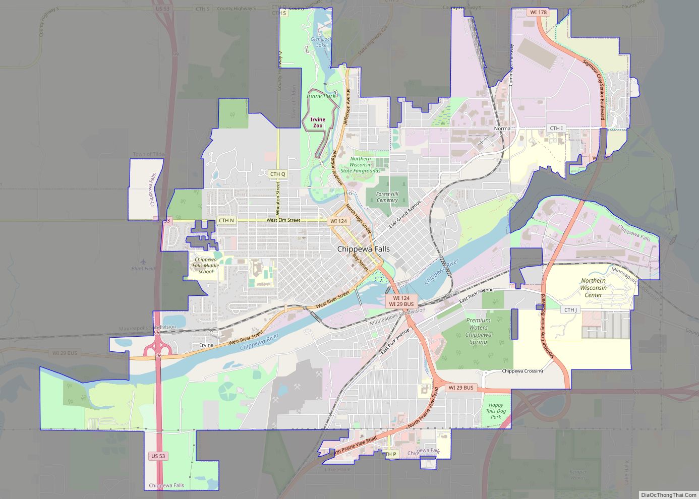
Chippewa Falls is a city located on the Chippewa River in Chippewa County in the northwestern part of the U.S. state of Wisconsin. The population was 14,778 in the 2021 census. Incorporated as a city in 1869, it is the county seat of Chippewa County.
The city’s name originated from its location on the Chippewa River, which is named after the Ojibwe Native Americans. Chippewa is an alternative rendition of Ojibwe.
Chippewa Falls is the birthplace of Seymour Cray, known as the “father of supercomputing”, and the headquarters for the original Cray Research. It is also the home of the Jacob Leinenkugel Brewing Company, the Heyde Center for the Arts, a showcase venue for artists and performers; Irvine Park, and the annual Northern Wisconsin State Fair. Chippewa Falls is 15 miles (24 km) from the annual four-day music festivals Country Fest and Rock Fest.
| Name: | Chippewa Falls city |
|---|---|
| LSAD Code: | 25 |
| LSAD Description: | city (suffix) |
| State: | Wisconsin |
| County: | Chippewa County |
| Elevation: | 820 ft (250 m) |
| Total Area: | 11.86 sq mi (30.72 km²) |
| Land Area: | 11.32 sq mi (29.31 km²) |
| Water Area: | 0.54 sq mi (1.41 km²) |
| Total Population: | 14,731 |
| Population Density: | 1,301.7/sq mi (502.6/km²) |
| Area code: | 715 & 534 |
| FIPS code: | 5514575 |
| GNISfeature ID: | 1563041 |
| Website: | ci.chippewa-falls.wi.us |
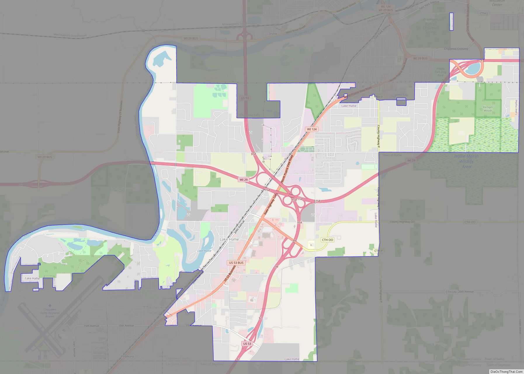
Online Interactive Map
Click on ![]() to view map in "full screen" mode.
to view map in "full screen" mode.
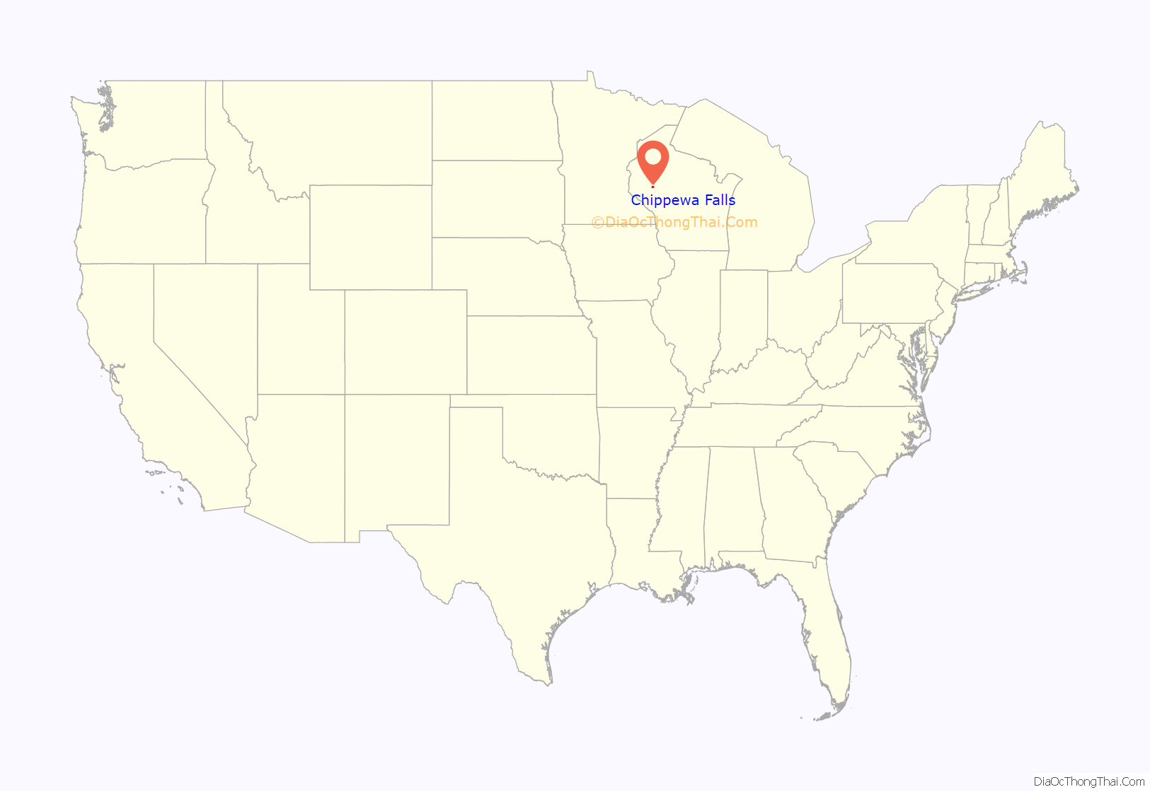
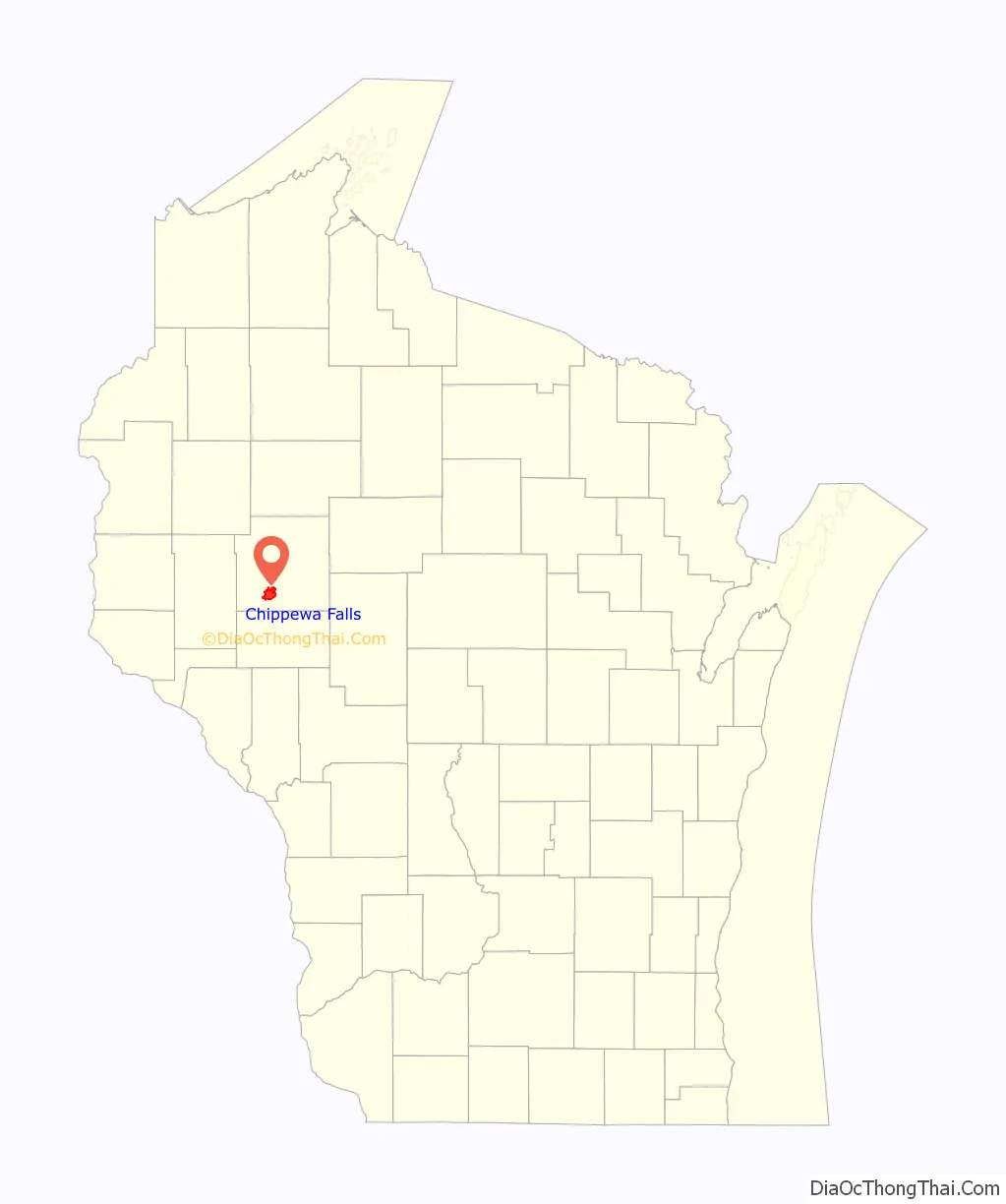
Chippewa Falls location map. Where is Chippewa Falls city?
History
For thousands of years the Chippewa River was a water highway through a wilderness of forests and swamps, travelled by Ojibwe people, Lakota and others. More recently, Indians guided European explorers up the river and around the Falls. Pierre LeSueur “discovered” the Chippewa Spring in 1700 when this area was part of New France. Jonathan Carver traveled up the river with his party in 1768 when the area was claimed by Britain.
White settlement of the Chippewa Falls area began in 1838, when Lyman Warren and his mostly-Chippewa wife started a farm and blacksmith shop five miles above the Falls. As agreed at the 1825 treaty of Prairie du Chien, Warren was to act as a sub-agent for the U.S. government to the Chippewas. Intertwined with that, Warren’s farm served as a trading post for the American Fur Company.
The Chippewa River’s watershed held a huge amount of valuable timber – more than the Wisconsin River, and before railroad and roads, the only way to transport much of it out was down the river, through what would become Chippewa Falls. When the 1837 Treaty of St. Peters opened this part of northern Wisconsin to logging, Jean Brunett led a team up the Chippewa River to build a sawmill at the Falls. With great effort and expense, they managed to build the first mill there. It survived until June of 1846, when a storm flooded the river and destroyed most of the millworks. The mill was rebuilt quickly and sawing resumed.
A settlement grew around the sawmill at the Falls, and in 1854 Chippewa Falls was chosen to be the seat of Chippewa County. A school, a post office, a mercantile store, the first churches, and the first newspaper had all opened by 1857. The city incorporated in 1869 with about 2,500 people. In the 1870s boardwalks were added along Bridge Street, gas streetlights were installed, and a telephone line was run up from Eau Claire.
Railroads also arrived in the 1870s. In 1870, the West Wisconsin Railway had built a line from St. Paul, Minnesota, to Milwaukee, running ten miles to the south through Eau Claire. In 1875 the Eau Claire and Chippewa Falls Railway connected that line from Eau Claire to Chippewa Falls. In 1880, the CF&W was joined by the Wisconsin and Minnesota Railway pushing its way west from Abbotsford. This was followed in 1881 by the Chippewa Falls & Northern Railroad, which built a line north from Chippewa Falls to Bloomer, eventually extending it to Superior.
Lumbering continued to grow. By the 1880s the Chippewa valley held the best stand of white pine left in the Midwest. The sawmill at Chippewa Falls was run by the Chippewa Lumber and Boom Company, and the company’s logging crews cut trees on their lands upstream in winter and drove logs down to the sawmill at the Falls each spring. The company employed 400 people and the mill at Chippewa was said to be “the largest sawmill under one roof in the world.”
The Chippewa Spring gained renewed attention in 1887 when politician Thaddeus C. Pound founded the Chippewa Springs Health Club, and at one point oversaw the company that bottled the spring water for sale. A Spring House was built over the original spring in 1893. It remains today, across from the modern water bottling plant on Park Ave.
Other industries started in the 1880s and 1890s: flour mills, a brewery, a woolen mill, cigar factories, a shoe factory, and a broom factory. By 1902 it had become clear that the pineries were not as inexhaustible as many had thought, and a group of business leaders began to promote more diverse industries. They succeeded in starting more shoe factories, a sugar beet factory, and a glove factory. The big sawmill closed in 1911, but the other industries kept the community going. By 1920 the city had fifty manufacturers who employed 3,000 workers.
Chippewa Falls Road Map
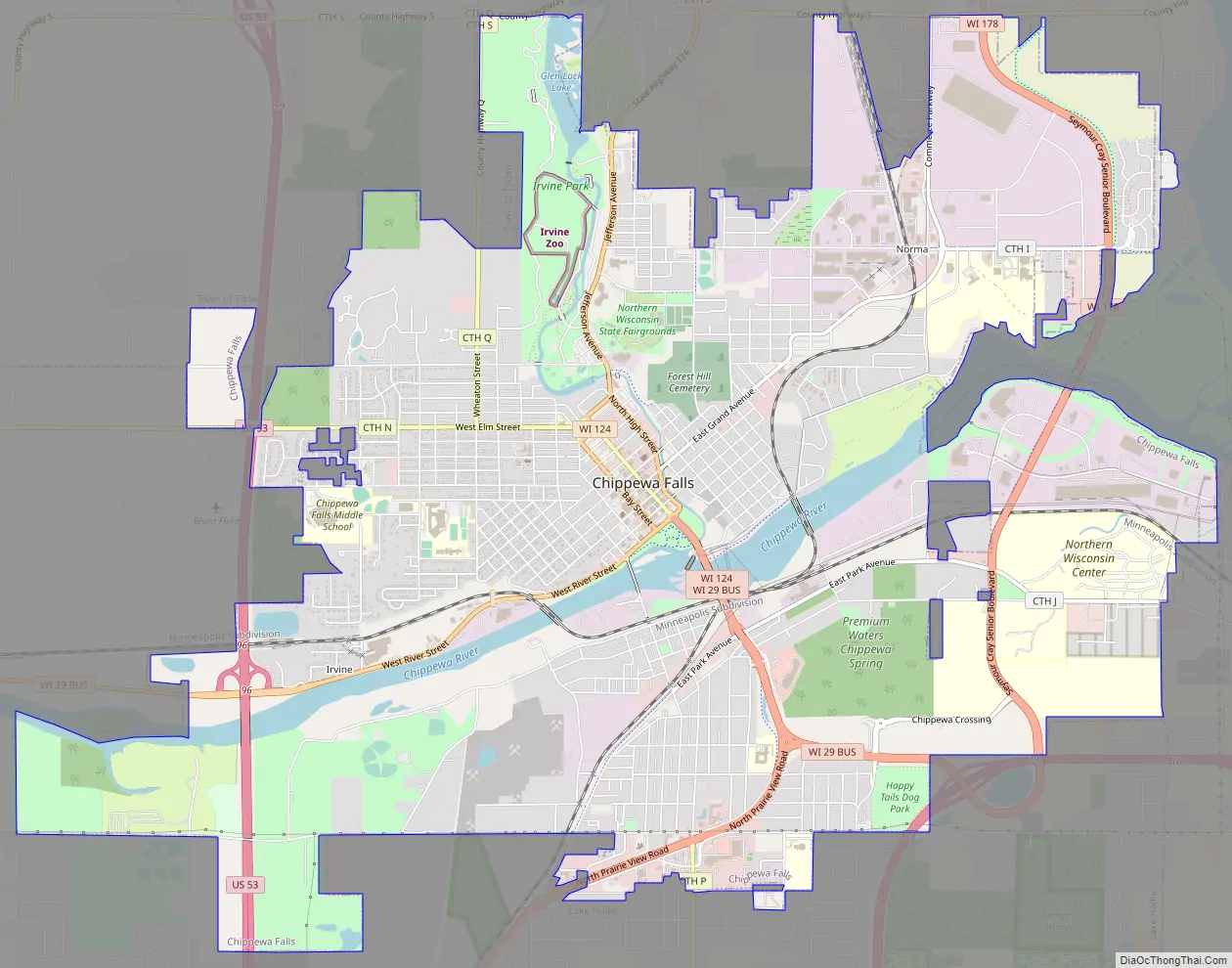
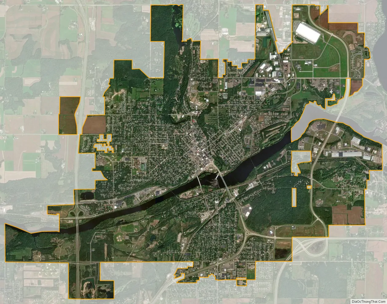
Chippewa Falls city Satellite Map
Geography
Chippewa Falls is located along the north bank of the Chippewa River approximately three miles west of Lake Wissota.
According to the United States Census Bureau, the city has a total area of 11.86 square miles (30.7 km), of which 11.32 square miles (29.3 km) is land and 0.54 square miles (1.4 km) is water.
See also
Map of Wisconsin State and its subdivision:- Adams
- Ashland
- Barron
- Bayfield
- Brown
- Buffalo
- Burnett
- Calumet
- Chippewa
- Clark
- Columbia
- Crawford
- Dane
- Dodge
- Door
- Douglas
- Dunn
- Eau Claire
- Florence
- Fond du Lac
- Forest
- Grant
- Green
- Green Lake
- Iowa
- Iron
- Jackson
- Jefferson
- Juneau
- Kenosha
- Kewaunee
- La Crosse
- Lafayette
- Lake Michigan
- Lake Superior
- Langlade
- Lincoln
- Manitowoc
- Marathon
- Marinette
- Marquette
- Menominee
- Milwaukee
- Monroe
- Oconto
- Oneida
- Outagamie
- Ozaukee
- Pepin
- Pierce
- Polk
- Portage
- Price
- Racine
- Richland
- Rock
- Rusk
- Saint Croix
- Sauk
- Sawyer
- Shawano
- Sheboygan
- Taylor
- Trempealeau
- Vernon
- Vilas
- Walworth
- Washburn
- Washington
- Waukesha
- Waupaca
- Waushara
- Winnebago
- Wood
- Alabama
- Alaska
- Arizona
- Arkansas
- California
- Colorado
- Connecticut
- Delaware
- District of Columbia
- Florida
- Georgia
- Hawaii
- Idaho
- Illinois
- Indiana
- Iowa
- Kansas
- Kentucky
- Louisiana
- Maine
- Maryland
- Massachusetts
- Michigan
- Minnesota
- Mississippi
- Missouri
- Montana
- Nebraska
- Nevada
- New Hampshire
- New Jersey
- New Mexico
- New York
- North Carolina
- North Dakota
- Ohio
- Oklahoma
- Oregon
- Pennsylvania
- Rhode Island
- South Carolina
- South Dakota
- Tennessee
- Texas
- Utah
- Vermont
- Virginia
- Washington
- West Virginia
- Wisconsin
- Wyoming