Fredonia is a town in Ozaukee County, Wisconsin, United States. The population was 2,903 at the 2000 census. The Village of Fredonia is surrounded by the town. The unincorporated communities of Little Kohler and Waubeka are also located in the town.
| Name: | Fredonia village |
|---|---|
| LSAD Code: | 47 |
| LSAD Description: | village (suffix) |
| State: | Wisconsin |
| County: | Ozaukee County |
| Incorporated: | 1847; 176 years ago (1847) |
| Elevation: | 899 ft (274 m) |
| Total Area: | 35.0 sq mi (90.5 km²) |
| Land Area: | 34.7 sq mi (89.8 km²) |
| Water Area: | 0.3 sq mi (0.8 km²) |
| Total Population: | 2,903 |
| Population Density: | 83.8/sq mi (32.3/km²) |
| Area code: | 262 |
| FIPS code: | 5527550 |
| Website: | www.town.fredonia.wi.us |
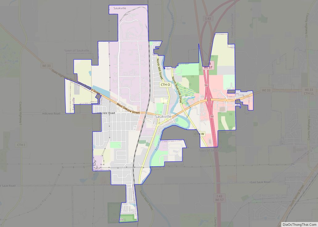
Online Interactive Map
Click on ![]() to view map in "full screen" mode.
to view map in "full screen" mode.
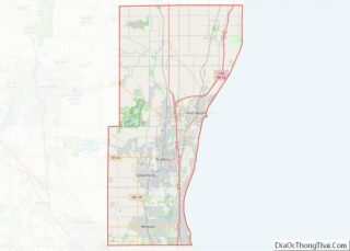
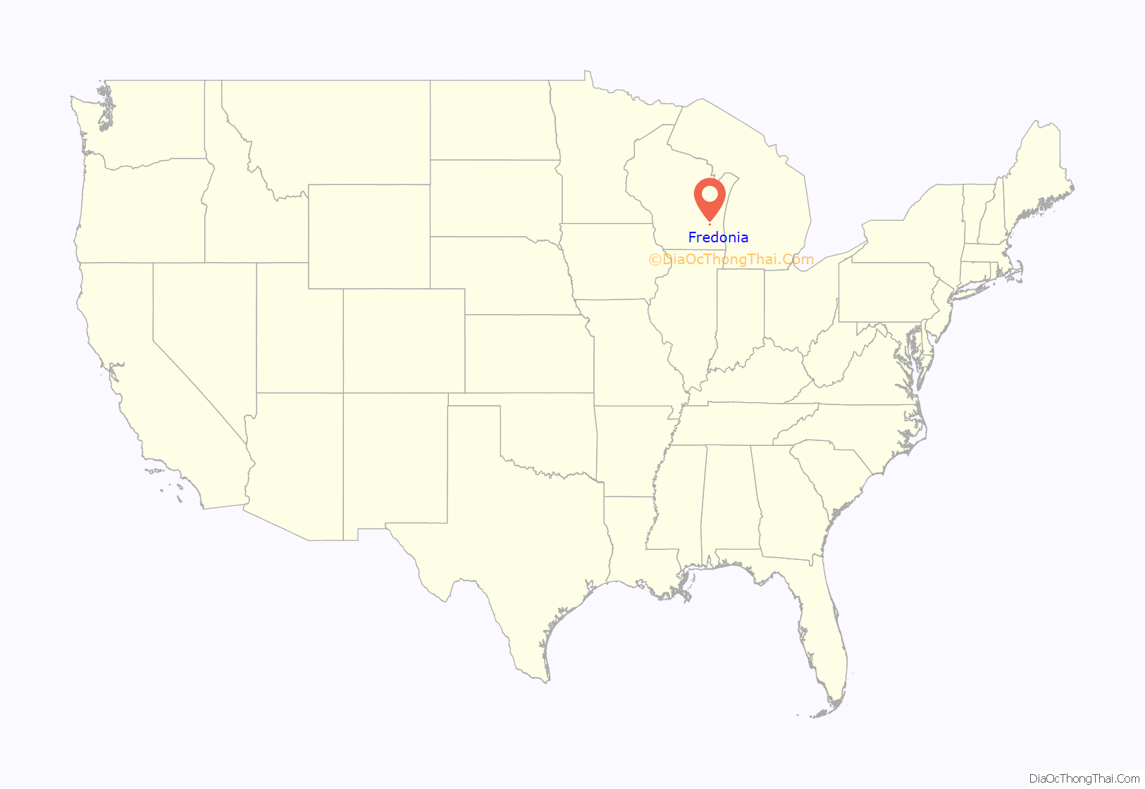
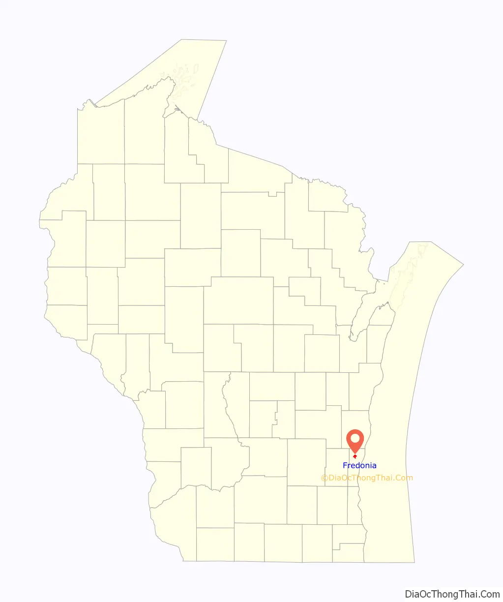
Fredonia location map. Where is Fredonia village?
History
The land that became the Fredonia was originally inhabited by Native Americans, including the Potawatomi tribe, who surrendered the land to the United States government in 1833 through the 1833 Treaty of Chicago. While many Native people moved west of the Mississippi River to Kansas, some chose to remain, and were referred to as “strolling Potawatomi” in contemporary documents because many of them were migrants who subsisted by squatting on their ancestral lands, which were now owned by white settlers. One such group was led by Chief Waubeka, who maintained a winter camp in the Ozaukee County community that bears his name as late as 1845. Eventually the Potawatomi who evaded forced removal gathered in northern Wisconsin, where they formed the Forest County Potawatomi Community.
Fredonia was part of the Town of Port Washington until 1847, when the Town of Fredonia was created and named after Fredonia, New York. A post office called Fredonia has been in operation since 1850.
Waubeka was the town’s population center until the 1870s. In 1873, the Chicago, Milwaukee & St. Paul Railway construction Fredonia Station, which laid the foundation for the Village of Fredonia, which incorporated from some of the town’s land in 1922.
Camp Fredonia, an Allied prisoner of war camp that held 330 German prisoners of war, was located in the unincorporated community of Little Kohler in the town. Forty-six U.S. combat veterans guarded the camp under the command of Captain Ray Thill, a native of Belgium, Wisconsin. The camp opened on June 15, 1945, and closed in January 1946. The headquarters was located in the Louis Glunz Hall on Fredonia-Kohler Road, while the prisoners slept in tents in a fenced enclosure. Most of the prisoners worked on local farms harvesting peas and sugar beets. Some were contracted to work at canneries in West Bend, Thiensville, Saukville and Belgium.
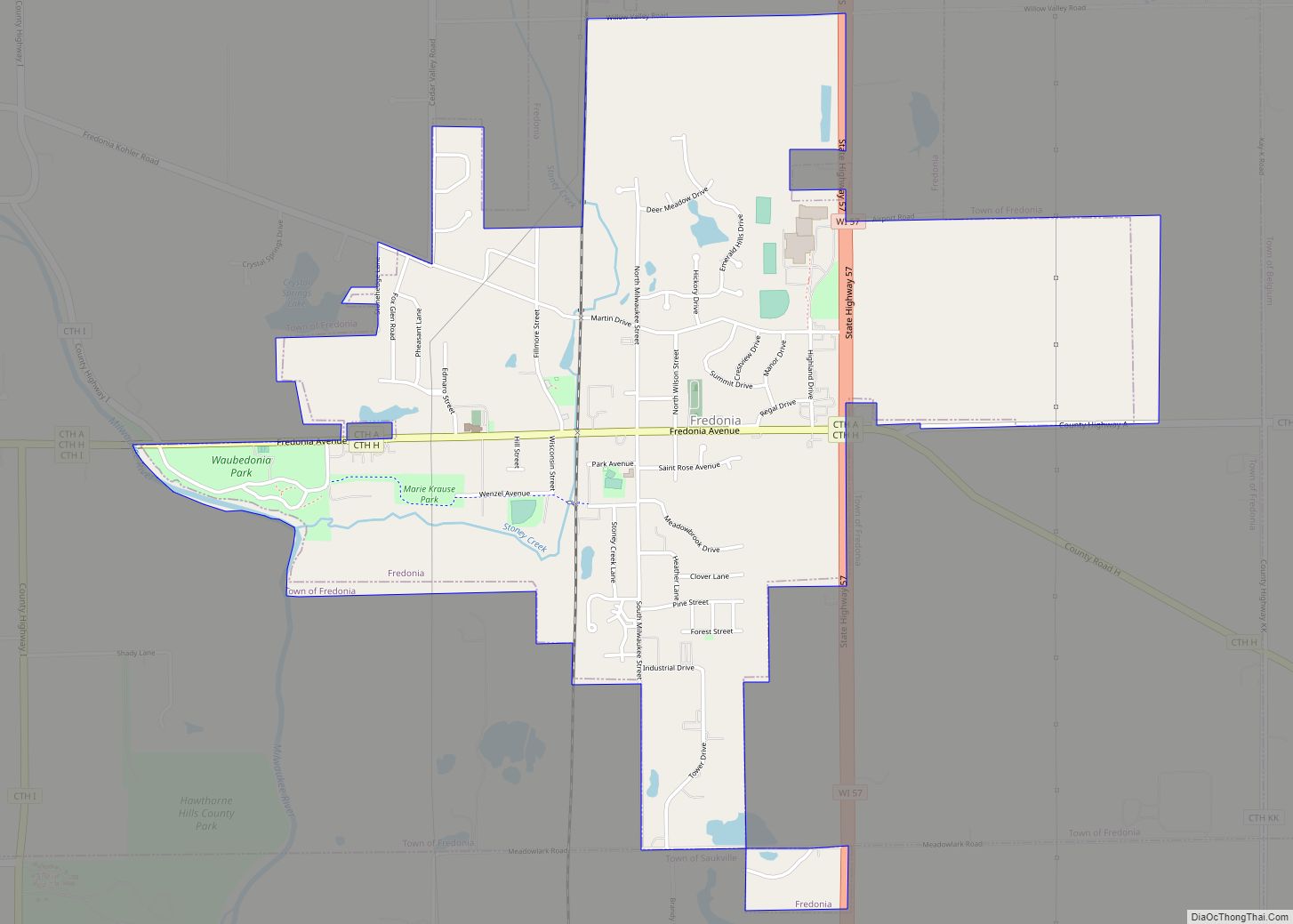
Fredonia Road Map

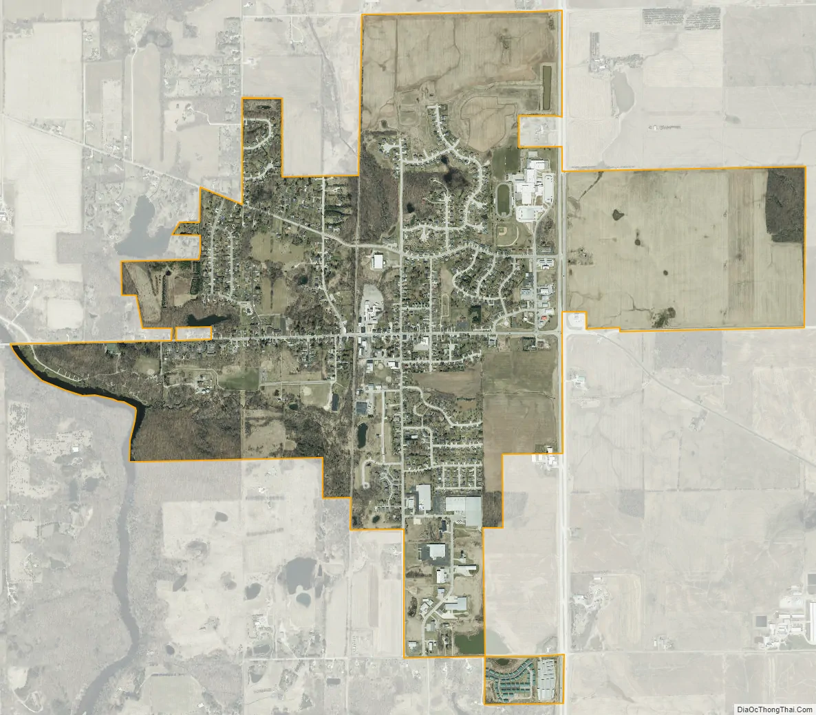
Fredonia city Satellite Map
Geography
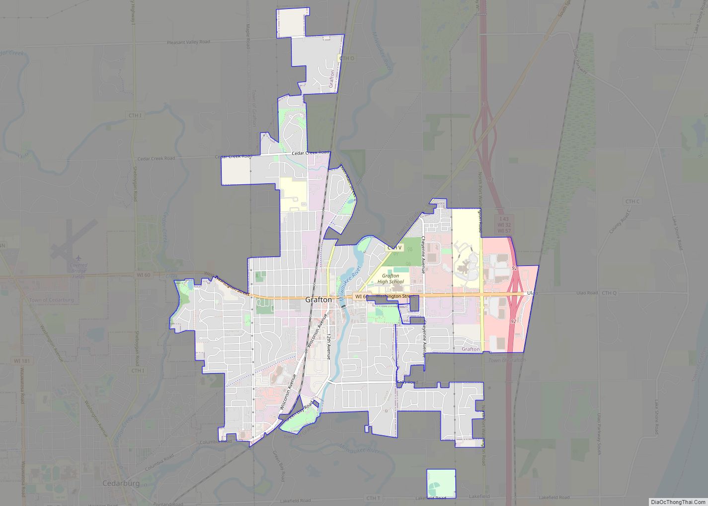
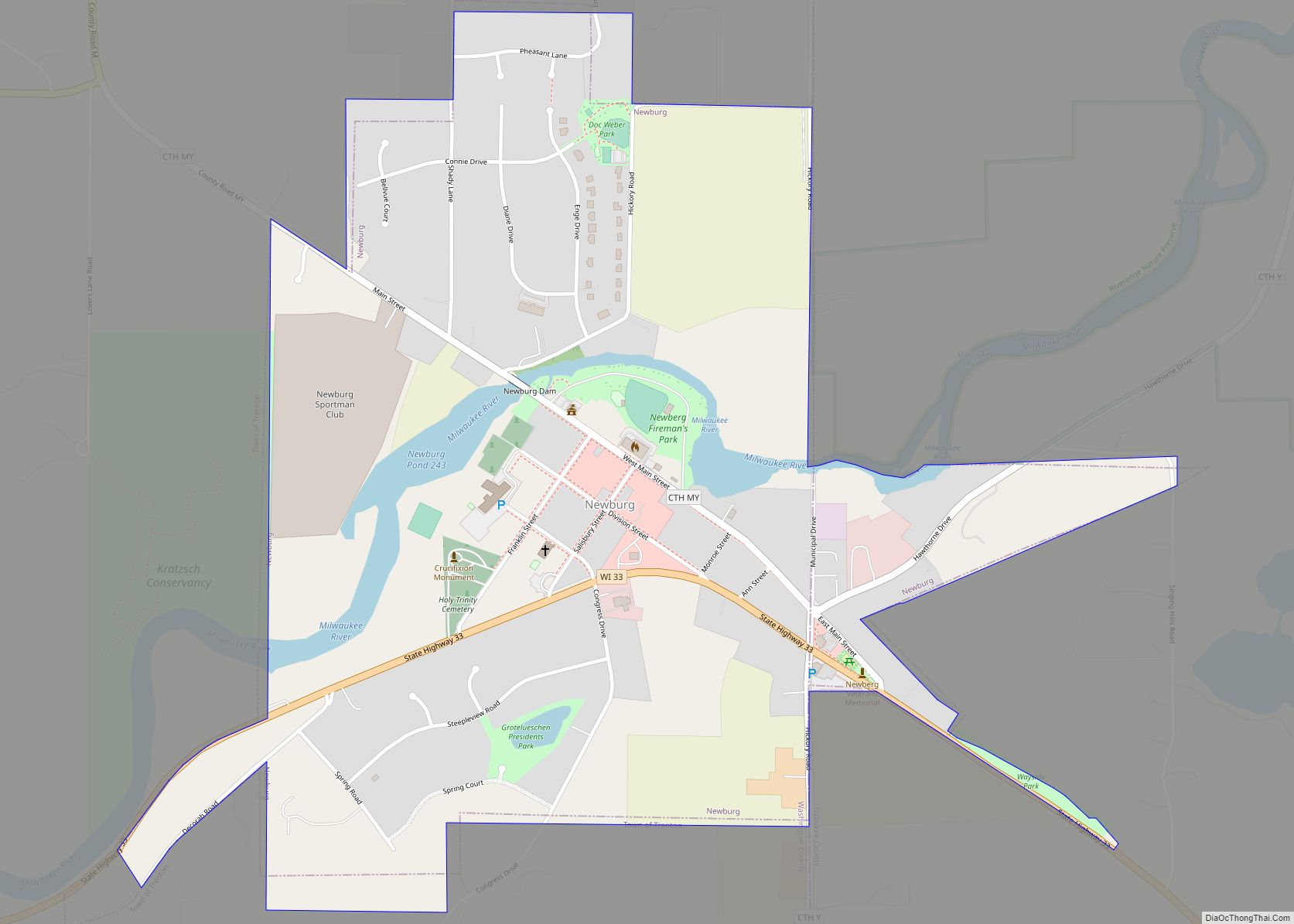
According to the United States Census Bureau, the town has a total area of 35.0 square miles (90.5 km), of which, 34.7 square miles (89.8 km) of it is land and 0.3 square miles (0.8 km) of it (0.86%) is water. The Village of Fredonia is located in what was formerly the southwestern quadrant of the Town of Fredonia. The town borders the Town of Sherman to the north, the Town of Belgium to the east, the Town of Saukville to the south, and the Town of Farmington to the west. The unincorporated communities of Little Kohler and Waubeka are in the western part of the town.
The town is located in the Southeastern Wisconsin glacial till plains that were created by the Wisconsin glaciation during the most recent ice age. The area has some subterranean Silurian limestone formations that are part of the Racine Dolomite that stretches through eastern Wisconsin and Illinois. The rocks are visible at several quarries along the Milwaukee River, including one site where the only known Silurian phyllocarid fossils in Wisconsin were discovered.
Before white settlers arrived in the area, much of the Fredonia area was an upland forest dominated by American beech and sugar maple trees. Much of the original forest was cleared to prepare the land for agriculture, although some of the town’s nature preserves have characteristically pre-settlement forests. The area also has many bogs and swamps in the kettles left behind by the glaciers. The areas include the wetlands around Spring Lake and the bog in the Huiras Lake Woods and Bog State Natural Area. Fredonia’s wetlands have extensive stands of white cedar and tamarack as well as shrub carrs and sedge meadows.
As land development continues to reduce wild areas, wildlife is forced into closer proximity with human communities like Fredonia. Large mammals, including white-tailed deer, coyotes, North American river otters and red foxes can be seen in the town. Many birds, including great blue herons and wild turkeys are found in the town, with the Huiras Lake Woods and Bog State Natural Area providing a habitat for many bird species.
The region struggles with many invasive species, including the emerald ash borer, common carp, reed canary grass, the common reed, purple loosestrife, garlic mustard, Eurasian buckthorns, and honeysuckles.
See also
Map of Wisconsin State and its subdivision:- Adams
- Ashland
- Barron
- Bayfield
- Brown
- Buffalo
- Burnett
- Calumet
- Chippewa
- Clark
- Columbia
- Crawford
- Dane
- Dodge
- Door
- Douglas
- Dunn
- Eau Claire
- Florence
- Fond du Lac
- Forest
- Grant
- Green
- Green Lake
- Iowa
- Iron
- Jackson
- Jefferson
- Juneau
- Kenosha
- Kewaunee
- La Crosse
- Lafayette
- Lake Michigan
- Lake Superior
- Langlade
- Lincoln
- Manitowoc
- Marathon
- Marinette
- Marquette
- Menominee
- Milwaukee
- Monroe
- Oconto
- Oneida
- Outagamie
- Ozaukee
- Pepin
- Pierce
- Polk
- Portage
- Price
- Racine
- Richland
- Rock
- Rusk
- Saint Croix
- Sauk
- Sawyer
- Shawano
- Sheboygan
- Taylor
- Trempealeau
- Vernon
- Vilas
- Walworth
- Washburn
- Washington
- Waukesha
- Waupaca
- Waushara
- Winnebago
- Wood
- Alabama
- Alaska
- Arizona
- Arkansas
- California
- Colorado
- Connecticut
- Delaware
- District of Columbia
- Florida
- Georgia
- Hawaii
- Idaho
- Illinois
- Indiana
- Iowa
- Kansas
- Kentucky
- Louisiana
- Maine
- Maryland
- Massachusetts
- Michigan
- Minnesota
- Mississippi
- Missouri
- Montana
- Nebraska
- Nevada
- New Hampshire
- New Jersey
- New Mexico
- New York
- North Carolina
- North Dakota
- Ohio
- Oklahoma
- Oregon
- Pennsylvania
- Rhode Island
- South Carolina
- South Dakota
- Tennessee
- Texas
- Utah
- Vermont
- Virginia
- Washington
- West Virginia
- Wisconsin
- Wyoming