Saukville is a town in Ozaukee County, Wisconsin, United States. The Village of Saukville is located in the town’s southeast quadrant. The population was 1,755 at the 2000 census.
Menominee and Sauk Native Americans lived in the area until the 1830s when the U.S. Federal Government forced them to leave Wisconsin. The first white settlers in the mid-1840s, and the Town of Saukville was organized in 1848. The early settlers were farmers, and dairy farming became the primary economic activity by the early 1900s. The Village of Saukville incorporated from some of the town’s land in 1915, and while the village has become increasingly industrial, agriculture still plays a major role in the Town of Saukville’s economy.
The town has thousands of acres of undeveloped, biodiverse bogs, coniferous swamps, and primeval beech-maple forests. The largest of the community’s natural areas is the 2,200-acre Cedarburg Bog State Natural Area. The town’s bogs are a habitat for many endangered species, birds, and carnivorous plants. Among other landforms, the Cedarburg Bog contains a string bog—a geographic feature that seldom occurs as far south as Wisconsin—which contains many plant species rarely seen outside remote parts of Canada.
| Name: | Saukville village |
|---|---|
| LSAD Code: | 47 |
| LSAD Description: | village (suffix) |
| State: | Wisconsin |
| County: | Ozaukee County |
| Incorporated: | 1848; 175 years ago (1848) |
| Elevation: | 896 ft (237 m) |
| Total Area: | 33.3 sq mi (86.4 km²) |
| Land Area: | 32.7 sq mi (84.6 km²) |
| Water Area: | 0.7 sq mi (1.8 km²) |
| Total Population: | 1,755 |
| Population Density: | 53.7/sq mi (20.7/km²) |
| Area code: | 262 |
| FIPS code: | 5571700 |
| Website: | townsaukville.org |
Online Interactive Map
Click on ![]() to view map in "full screen" mode.
to view map in "full screen" mode.
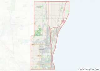
Saukville location map. Where is Saukville village?


History
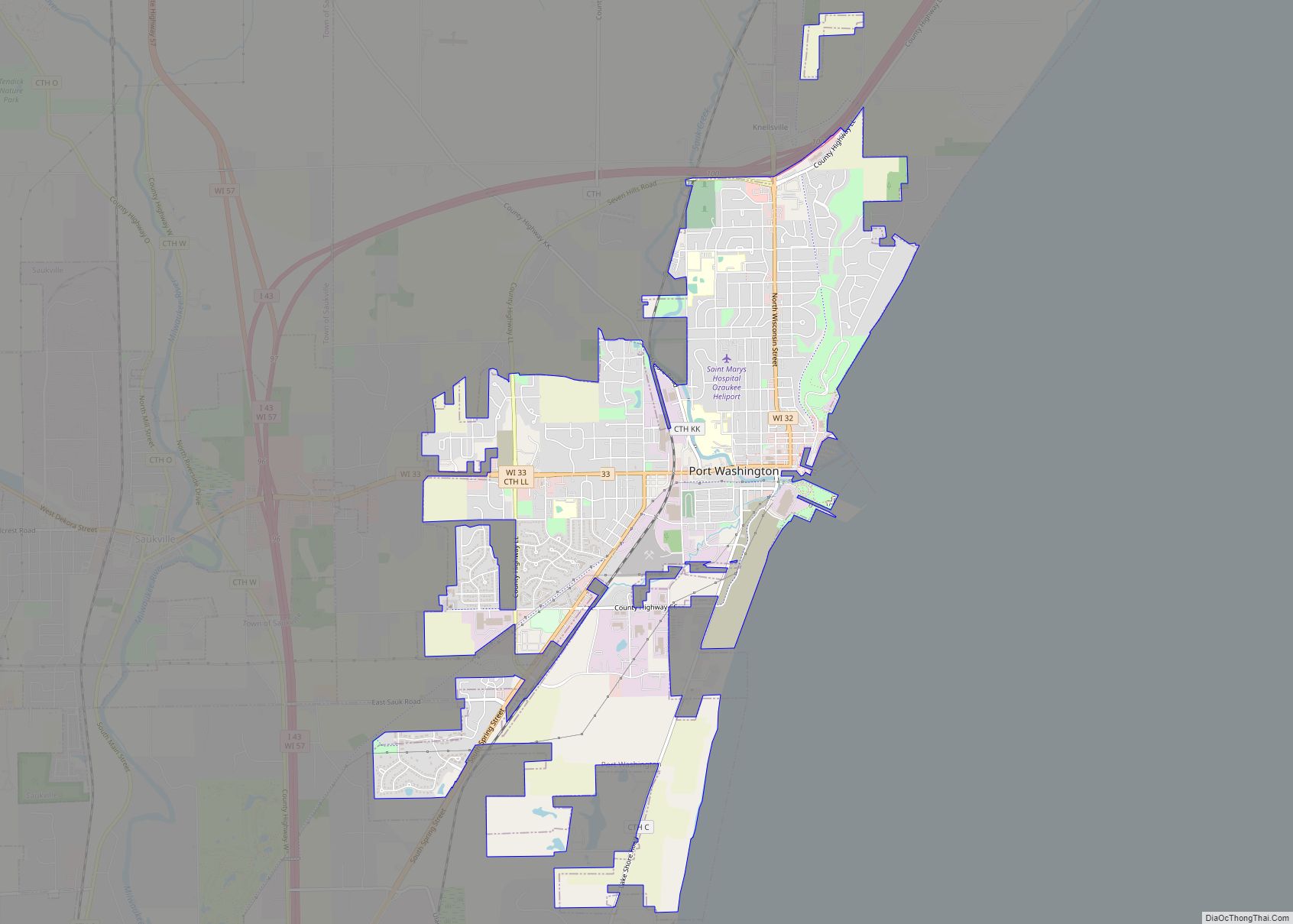
Saukville was the site of a Native American village at the crossroads of two trails, one of which became the north-south Green Bay Road and the other the east-west Dekora Road. Also located on the banks of the Milwaukee River, the village’s inhabitants were probably Menominee and Sauk people. The Native Americans were forced to leave Wisconsin in the 1830s, and white settlers arrived in the area around 1845 and began to build along Green Bay Road.
Saukville was part of the town of Port Washington until 1848 when the Town of Saukville was established. Throughout the 19th and early 20th centuries, Saukville was a rural community with many dairy farmers. In 1871, a rail line was constructed through Saukville. It would eventually become part of the Chicago, Milwaukee & St. Paul Railway.
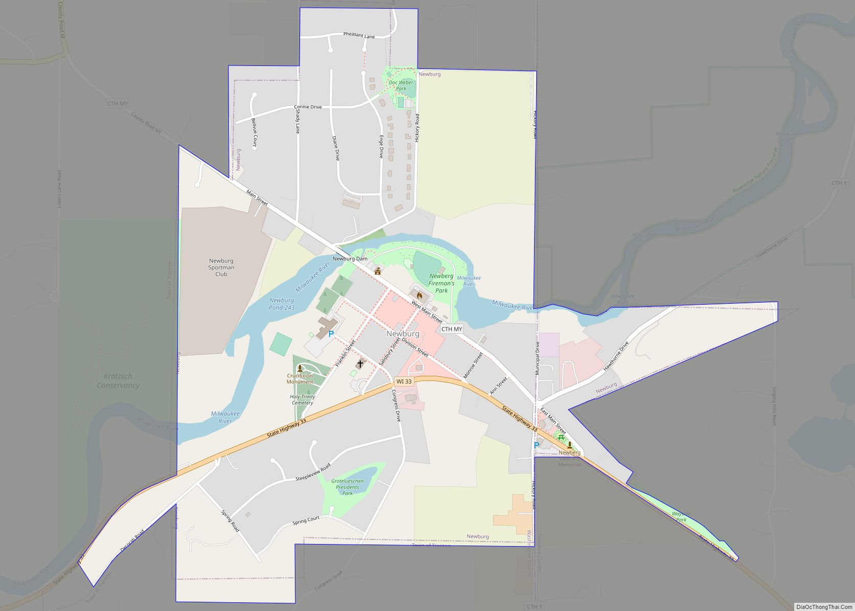
The Village of Saukville incorporated out of some of the Town of Saukville’s land in 1915. In 1973, the Village of Newburg incorporated from some of the Town of Saukville’s land as well as land from the neighboring Town of Trenton in Washington County.
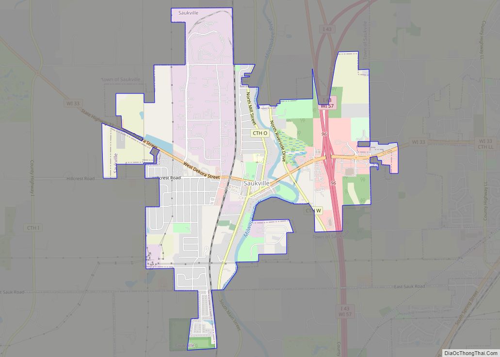
Saukville Road Map

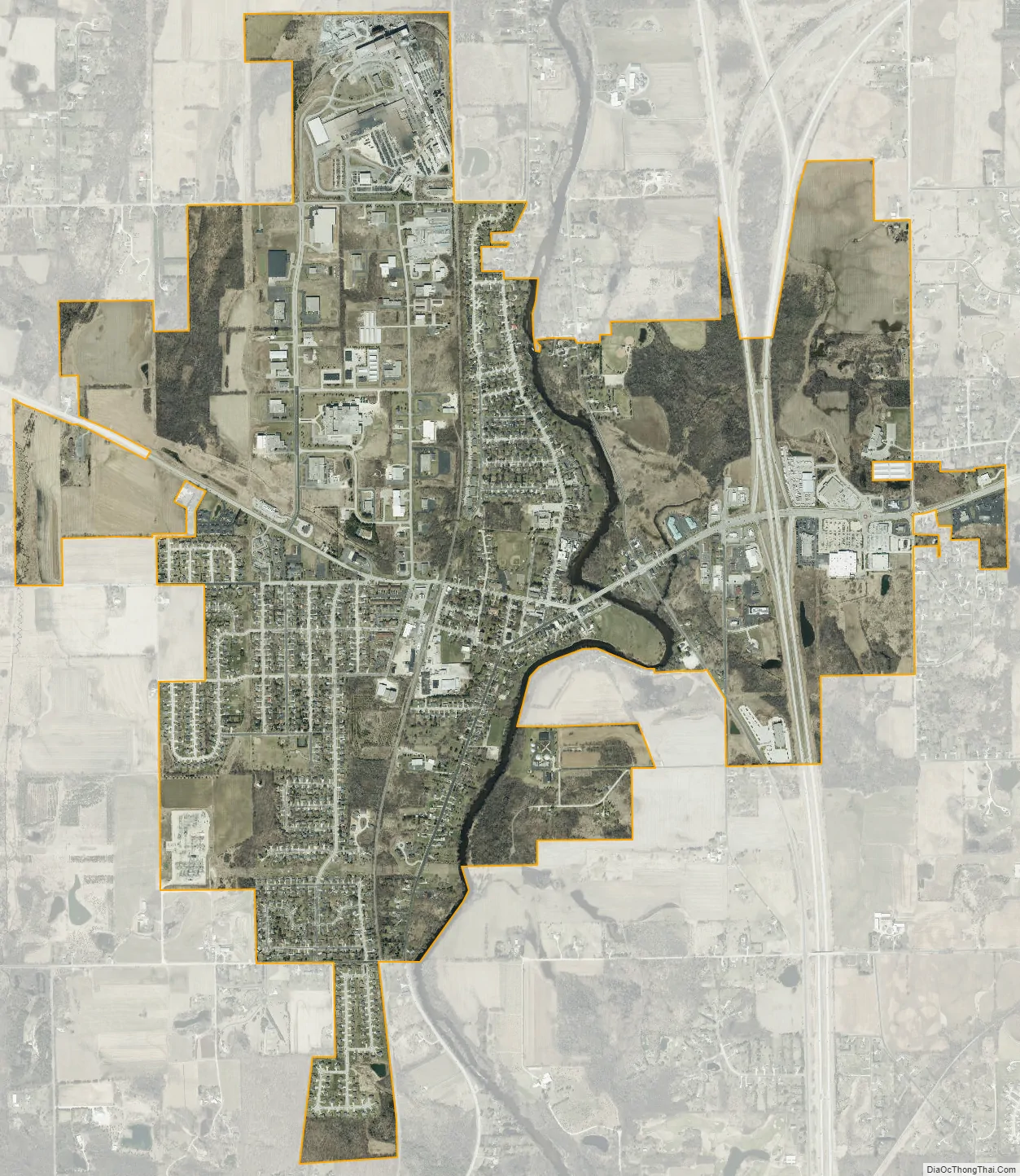
Saukville city Satellite Map
Geography
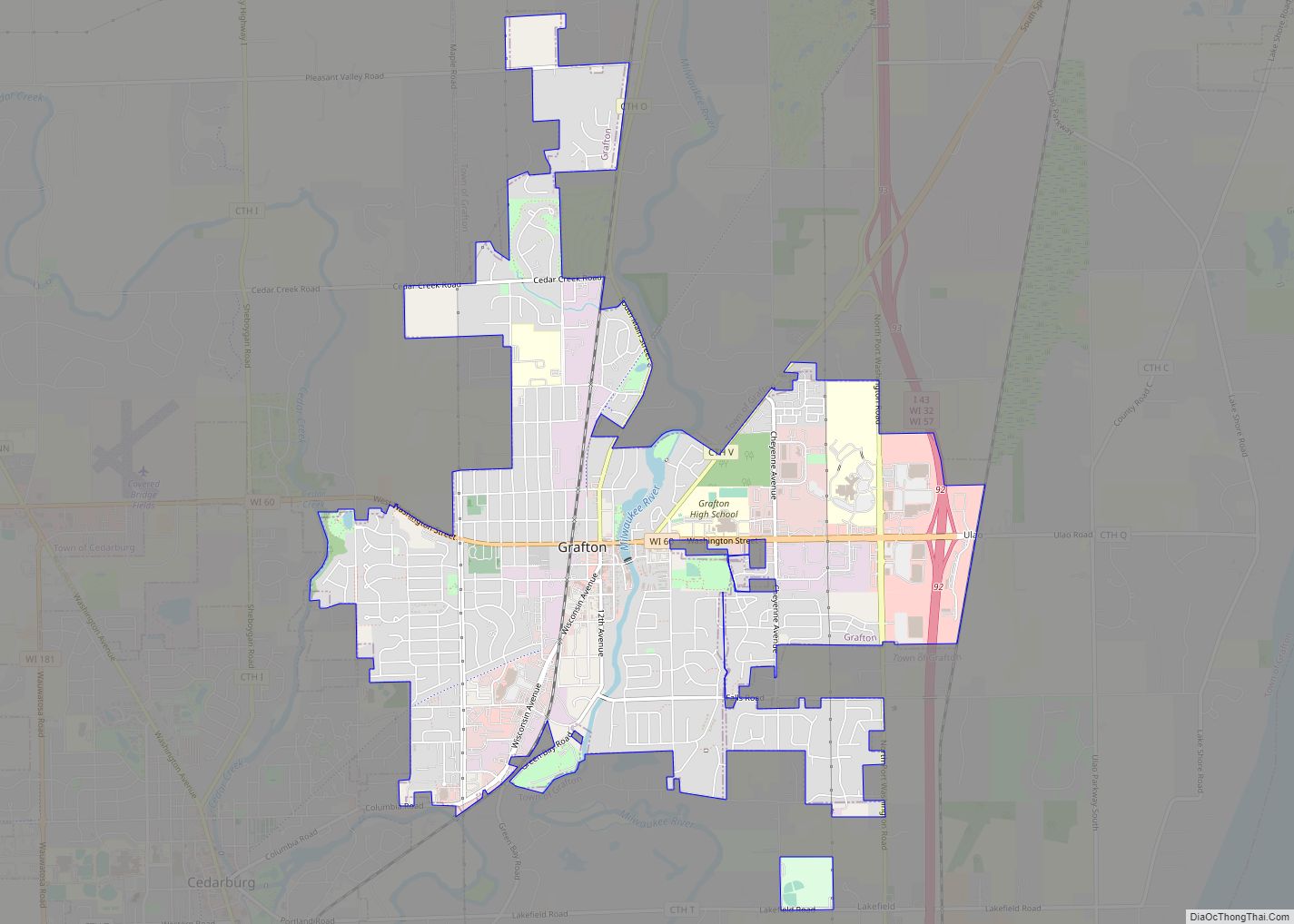
According to the United States Census Bureau, the town has a total area of 33.3 square miles (86.4 km), of which, 32.7 square miles (84.6 km) of it is land and 0.7 square miles (1.8 km) of it (2.04%) is water. The Village of Saukville is located in what was formerly the town’s southeast quadrant. The town borders Waubeka, the Town of Fredonia, and the Village of Fredonia to the north; the Town of Port Washington to the east; the Town of Grafton and the Cedarburg (town), Wisconsin to the south; and the Town of Trenton and the Village of Newburg to the west.
The town is located in the Southeastern Wisconsin glacial till plains that were created by the Wisconsin glaciation during the most recent ice age. The town has many glacial landforms, including kames, kettles, and moraines. Much of the community is located on the Racine Dolomite formation that stretches through eastern Wisconsin and Illinois. The formation contains Silurian marine fossils, and while much of the rock lies between 25 and 50 feet below the surface, the fossils of a prehistoric reef can be seen in some old quarries in the northern part of the Village of Saukville as well as in the 50-foot-high bluff along the Milwaukee River at Riveredge Nature Center.
Before white settlers arrived in the area, the Saukville area was an upland forest dominated by American beech and sugar maple trees. There were also white cedars growing along the Milwaukee River and several thousand acres of coniferous swamp in Saukville’s southwest quadrant. Much of the original forest—with the exception of the coniferous swamps—was cleared to prepare the land for agriculture. The Cedarburg Beech Woods State Natural Area in the western part of the town has old growth endemic trees with minimal damage from logging and retains the character of the pre-settlement beech-maple forests.
The town has many nature preserves and other undisturbed natural areas, the largest of which is the Cedarburg Bog State Natural Area, a 2,200-acre National Natural Landmark with high biodiversity, which is home to many endangered plant and animal species. The largest and best preserved bog in eastern Wisconsin, it contains two lakes, extensive white cedar and tamarack coniferous swamps, and the southernmost string bog on Earth. The bog is a habitat for several carnivorous plant species, including bladderworts, pitcher plants, and round-leafed sundews. The U.S. Fish and Wildlife Service also considers the Cedarburg Bog to be an important habitat for the endangered Hine’s emerald dragonfly.
Other bogs in the town include black spruce swamps, which rarely occur at such southerly latitudes. Other bog plants that occur in Saukville include leatherleaf, snakemouth orchids, grass-pink orchids, bog-rosemary, winterberry, blueberry, and cranberry. The town is also a habitat for the threatened forked aster plant and the American gromwell, which is a state-designated special concern plant species.
As land development continues to reduce wild areas, wildlife is forced into closer proximity with human communities like Saukville. Large mammals, including white-tailed deer, coyotes, North American river otters and red foxes can be seen in the town. Many birds, including great blue herons and wild turkeys are found in the town with the many swamps and bogs providing a habit birds such as the osprey.
The region struggles with many invasive species, including the emerald ash borer, common carp, reed canary grass, the common reed, purple loosestrife, garlic mustard, Eurasian buckthorns, and honeysuckles.
See also
Map of Wisconsin State and its subdivision:- Adams
- Ashland
- Barron
- Bayfield
- Brown
- Buffalo
- Burnett
- Calumet
- Chippewa
- Clark
- Columbia
- Crawford
- Dane
- Dodge
- Door
- Douglas
- Dunn
- Eau Claire
- Florence
- Fond du Lac
- Forest
- Grant
- Green
- Green Lake
- Iowa
- Iron
- Jackson
- Jefferson
- Juneau
- Kenosha
- Kewaunee
- La Crosse
- Lafayette
- Lake Michigan
- Lake Superior
- Langlade
- Lincoln
- Manitowoc
- Marathon
- Marinette
- Marquette
- Menominee
- Milwaukee
- Monroe
- Oconto
- Oneida
- Outagamie
- Ozaukee
- Pepin
- Pierce
- Polk
- Portage
- Price
- Racine
- Richland
- Rock
- Rusk
- Saint Croix
- Sauk
- Sawyer
- Shawano
- Sheboygan
- Taylor
- Trempealeau
- Vernon
- Vilas
- Walworth
- Washburn
- Washington
- Waukesha
- Waupaca
- Waushara
- Winnebago
- Wood
- Alabama
- Alaska
- Arizona
- Arkansas
- California
- Colorado
- Connecticut
- Delaware
- District of Columbia
- Florida
- Georgia
- Hawaii
- Idaho
- Illinois
- Indiana
- Iowa
- Kansas
- Kentucky
- Louisiana
- Maine
- Maryland
- Massachusetts
- Michigan
- Minnesota
- Mississippi
- Missouri
- Montana
- Nebraska
- Nevada
- New Hampshire
- New Jersey
- New Mexico
- New York
- North Carolina
- North Dakota
- Ohio
- Oklahoma
- Oregon
- Pennsylvania
- Rhode Island
- South Carolina
- South Dakota
- Tennessee
- Texas
- Utah
- Vermont
- Virginia
- Washington
- West Virginia
- Wisconsin
- Wyoming