Sauk City is a village in Sauk County, Wisconsin, United States. The population was 3,518 as of the 2020 census. The first incorporated village in the state, the community was founded by Agoston Haraszthy and his business partner, Robert Bryant. The village is adjacent to Prairie du Sac; together, these twin villages are referred to as Sauk Prairie.
| Name: | Sauk City village |
|---|---|
| LSAD Code: | 47 |
| LSAD Description: | village (suffix) |
| State: | Wisconsin |
| County: | Sauk County |
| Elevation: | 741 ft (226 m) |
| Total Area: | 1.76 sq mi (4.57 km²) |
| Land Area: | 1.54 sq mi (3.99 km²) |
| Water Area: | 0.22 sq mi (0.58 km²) |
| Total Population: | 3,518 |
| Population Density: | 2,261.52/sq mi (873.22/km²) |
| Area code: | 608 |
| FIPS code: | 5571650 |
| GNISfeature ID: | 1573732 |
| Website: | http://www.saukcity.net |
Online Interactive Map
Click on ![]() to view map in "full screen" mode.
to view map in "full screen" mode.
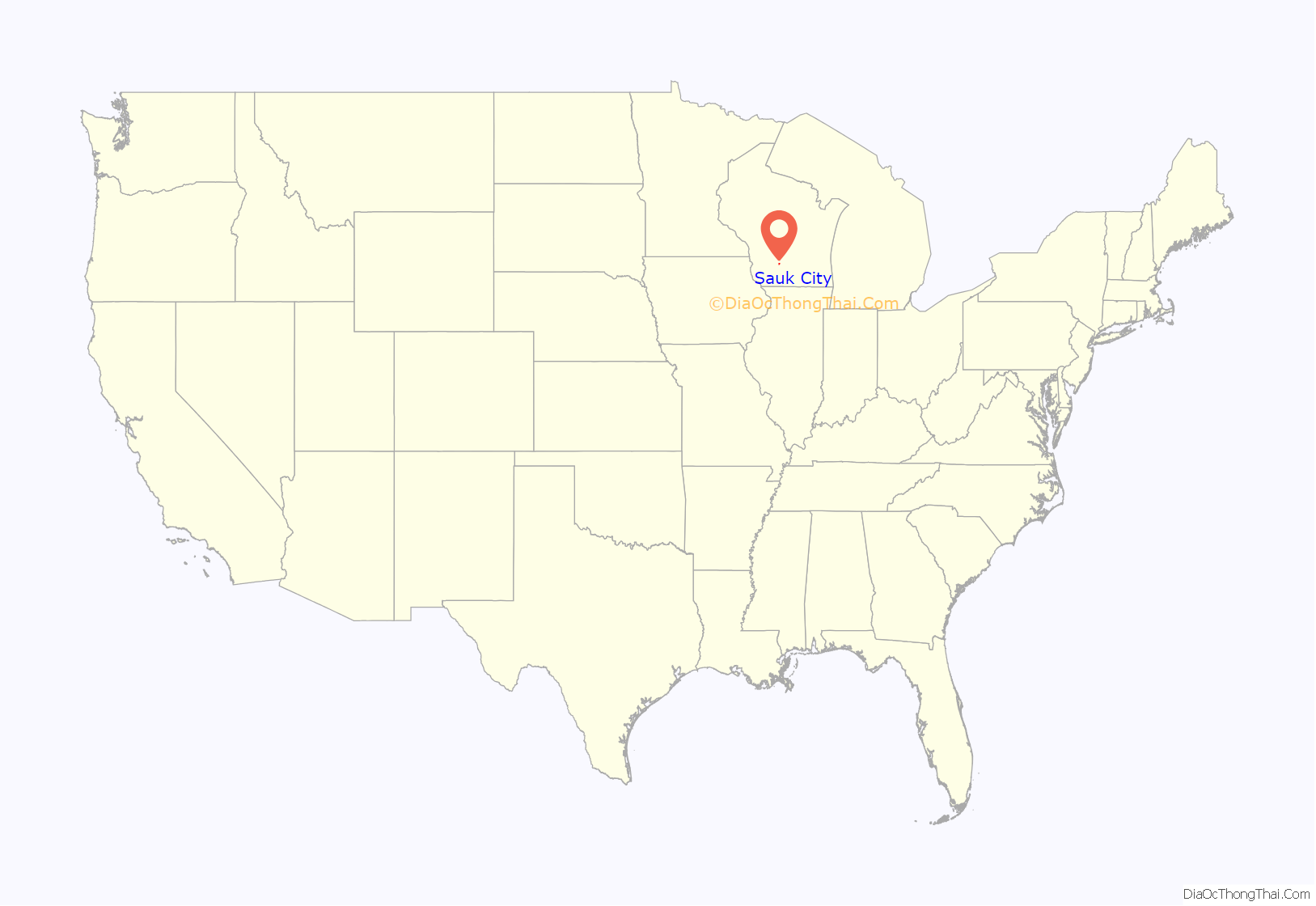
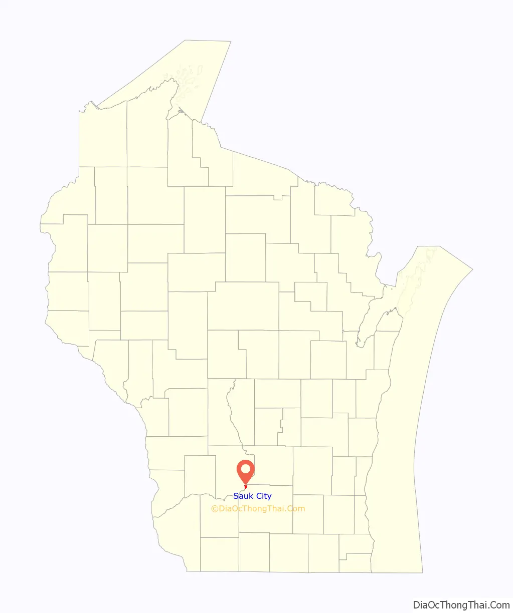
Sauk City location map. Where is Sauk City village?
History
Impressed by the beautiful scenery, Agoston Haraszthy, a charismatic Hungarian sometimes called “Count” Haraszthy, purchased a small plot of land along the Wisconsin River in 1840. Later, with his English-born business partner, Robert Bryant, Haraszthy bought additional land and founded the town of Haraszthy (originally called Széptáj, Hungarian for “beautiful place”).
In 1849, the name of the town was changed to Westfield. Three years later, in 1852, it was changed again, this time to the current name of Sauk City. The community was incorporated as a village in 1854, making Sauk City the oldest incorporated village in the state.
In 1852, German immigrants founded the Sauk City Free Congregation (Freie Gemeinde). This group, a liberal religious society, celebrated German music, literature, and culture. It met in a private home until 1884, when Park Hall was built as a meeting house. The building is now home to the Sauk County Free Congregation, a Unitarian Universalist fellowship.
In the Harper’s Weekly magazine of November 21, 1914, Sauk City was named “America’s Foremost City”. The article cited a pageant, attended by 4000 people, which enacted scenes from the village’s history, and concluded with the naming of the school principal as the Civic Secretary, charged with making the school the center of the life of the town. To that end, the ballot box was transferred from the town hall to the school house.
On August 28, 1977, Sauk City made national headlines when, during setup for an upcoming circus performance, a fully-grown elephant escaped and stampeded through the village‘s nearby nursing home, completely destroying the ceiling in one of the main hallways. Despite the damage, no one was injured as the incident took place during lunchtime when the residents were in their rooms or the dining area, which the elephant did not enter.
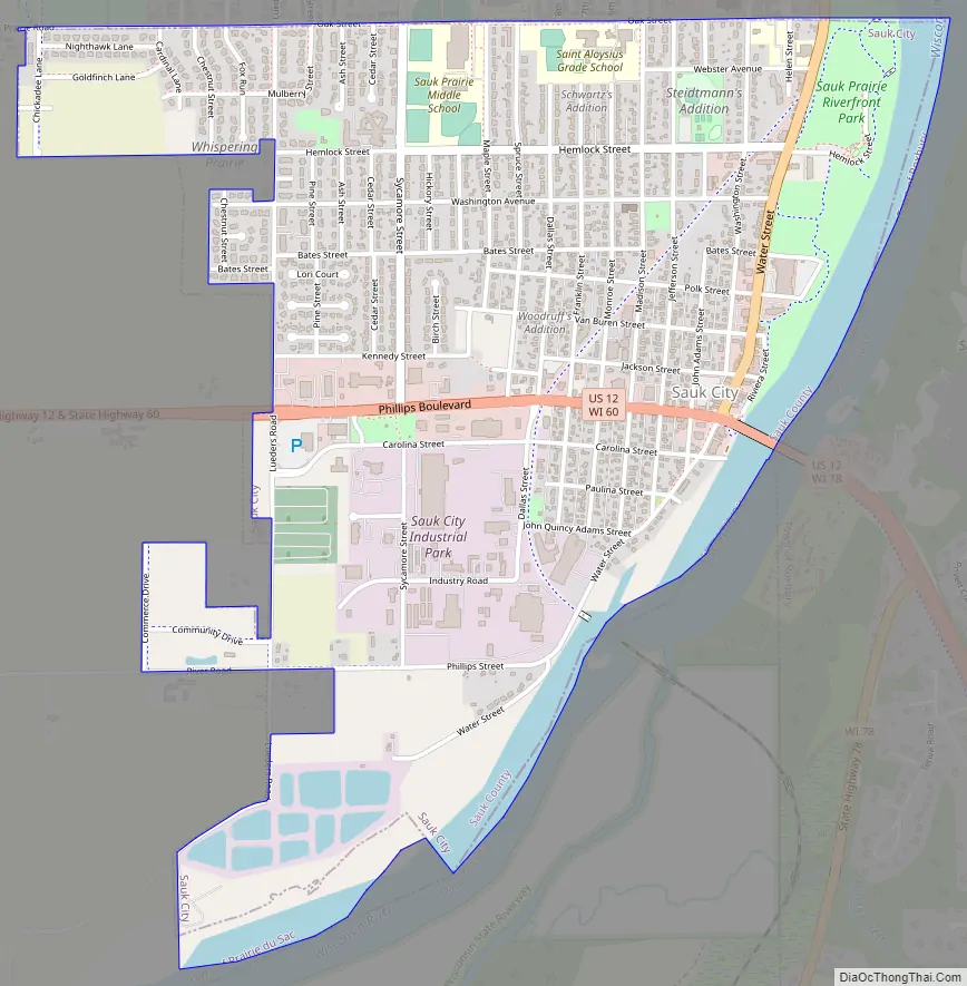
Sauk City Road Map
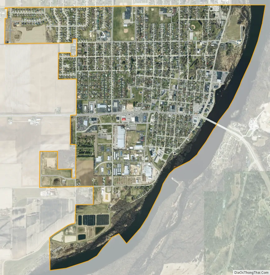
Sauk City city Satellite Map
Geography
Sauk City is located at 43°16′27″N 89°43′42″W / 43.27417°N 89.72833°W / 43.27417; -89.72833 (43.274130, -89.728310). It is on U.S. Route 12, approximately 18 miles (29 km) northwest of suburban Madison.
According to the United States Census Bureau, the village has a total area of 1.76 square miles (4.56 km), of which 1.54 square miles (3.99 km) is land and 0.22 square miles (0.57 km) is water.
See also
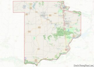
Map of Wisconsin State and its subdivision:- Adams
- Ashland
- Barron
- Bayfield
- Brown
- Buffalo
- Burnett
- Calumet
- Chippewa
- Clark
- Columbia
- Crawford
- Dane
- Dodge
- Door
- Douglas
- Dunn
- Eau Claire
- Florence
- Fond du Lac
- Forest
- Grant
- Green
- Green Lake
- Iowa
- Iron
- Jackson
- Jefferson
- Juneau
- Kenosha
- Kewaunee
- La Crosse
- Lafayette
- Lake Michigan
- Lake Superior
- Langlade
- Lincoln
- Manitowoc
- Marathon
- Marinette
- Marquette
- Menominee
- Milwaukee
- Monroe
- Oconto
- Oneida
- Outagamie
- Ozaukee
- Pepin
- Pierce
- Polk
- Portage
- Price
- Racine
- Richland
- Rock
- Rusk
- Saint Croix
- Sauk
- Sawyer
- Shawano
- Sheboygan
- Taylor
- Trempealeau
- Vernon
- Vilas
- Walworth
- Washburn
- Washington
- Waukesha
- Waupaca
- Waushara
- Winnebago
- Wood
- Alabama
- Alaska
- Arizona
- Arkansas
- California
- Colorado
- Connecticut
- Delaware
- District of Columbia
- Florida
- Georgia
- Hawaii
- Idaho
- Illinois
- Indiana
- Iowa
- Kansas
- Kentucky
- Louisiana
- Maine
- Maryland
- Massachusetts
- Michigan
- Minnesota
- Mississippi
- Missouri
- Montana
- Nebraska
- Nevada
- New Hampshire
- New Jersey
- New Mexico
- New York
- North Carolina
- North Dakota
- Ohio
- Oklahoma
- Oregon
- Pennsylvania
- Rhode Island
- South Carolina
- South Dakota
- Tennessee
- Texas
- Utah
- Vermont
- Virginia
- Washington
- West Virginia
- Wisconsin
- Wyoming