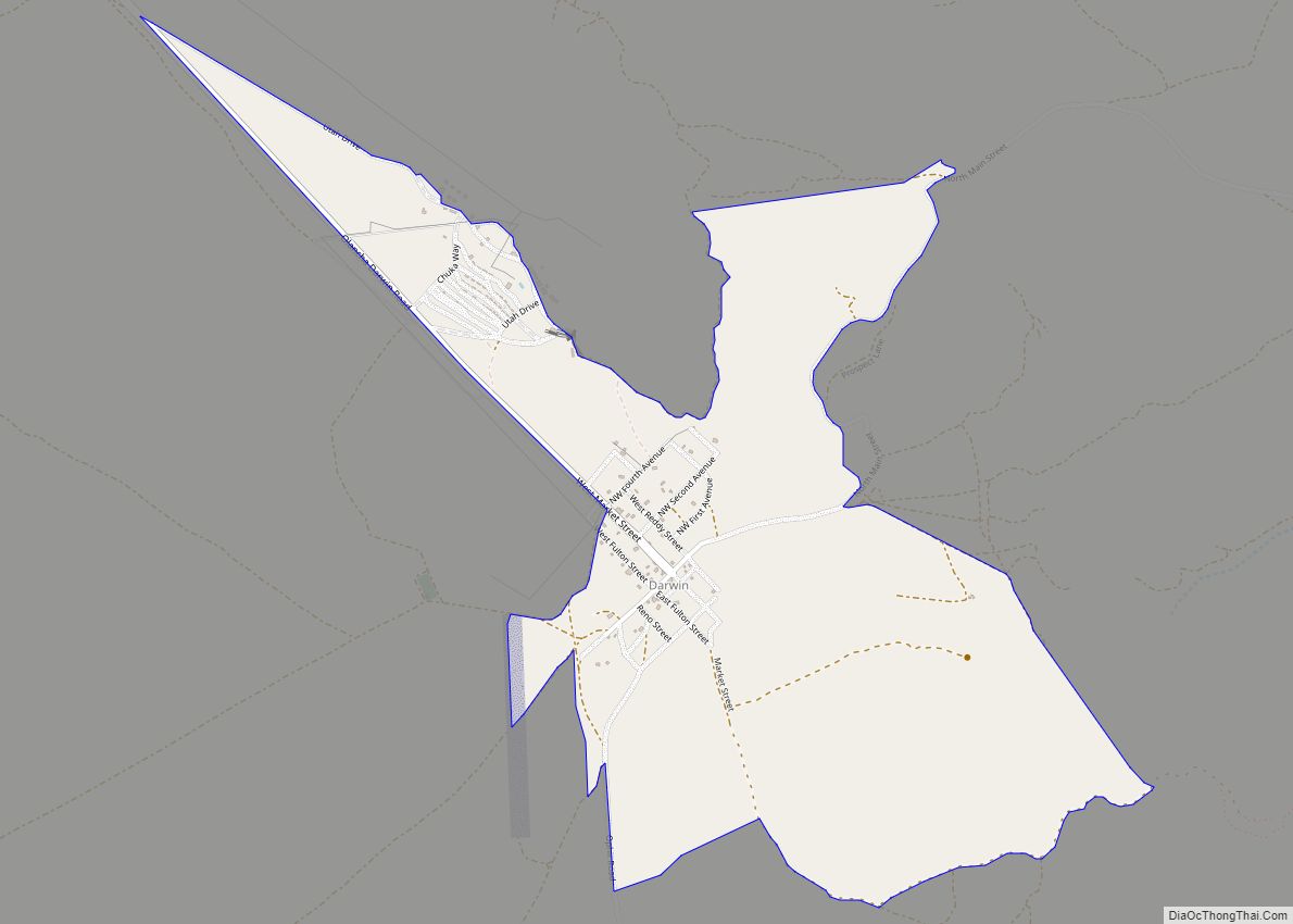
Bishop (formerly Bishop Creek) is a city in California, United States. It is the largest populated place and only incorporated city in Inyo County. Bishop is located near the northern end of the Owens Valley, at an elevation of 4,150 feet (1,260 m). The city was named after Bishop Creek, flowing out of the Sierra Nevada; the creek was named after Samuel Addison Bishop, a settler in the Owens Valley. Bishop is a commercial and residential center, while many vacation destinations and tourist attractions in the Sierra Nevada are located nearby.
The population of the city was 3,879 at the 2010 Census, up from 3,575 at the 2000 Census. The population of the built-up zone containing Bishop is much larger; more than 14,500 people live in a compact area that includes Bishop, West Bishop, Dixon Lane-Meadow Creek, and the Bishop Paiute Reservation. It is by far the largest settlement in Inyo County.
A number of western films were shot in Bishop, including movies starring John Wayne, Charlton Heston and Joel McCrea.
| Name: | Bishop city |
|---|---|
| LSAD Code: | 25 |
| LSAD Description: | city (suffix) |
| State: | California |
| County: | Inyo County |
| Incorporated: | May 6, 1903 |
| Elevation: | 4,150 ft (1,260 m) |
| Land Area: | 1.86 sq mi (4.83 km²) |
| Water Area: | 0.05 sq mi (0.12 km²) 2.5% |
| Population Density: | 2,048.82/sq mi (791.14/km²) |
| ZIP code: | 93514, 93515 |
| FIPS code: | 0606798 |
| Website: | www.cityofbishop.com |
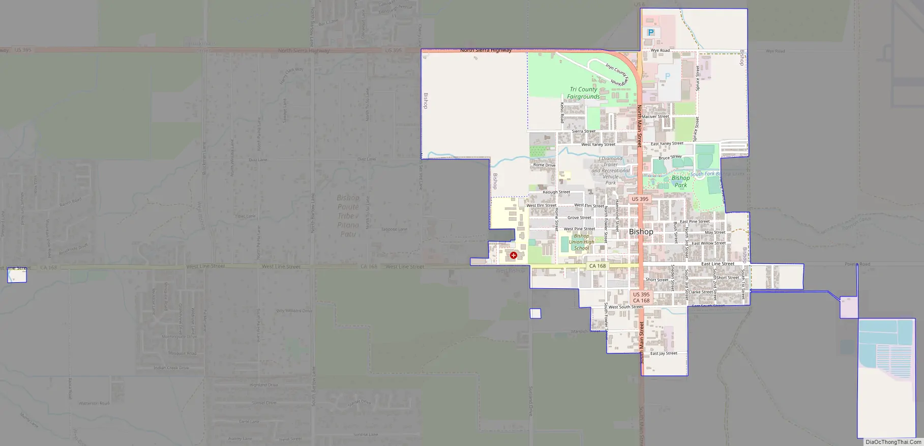
Online Interactive Map
Click on ![]() to view map in "full screen" mode.
to view map in "full screen" mode.
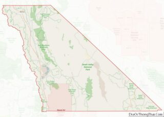
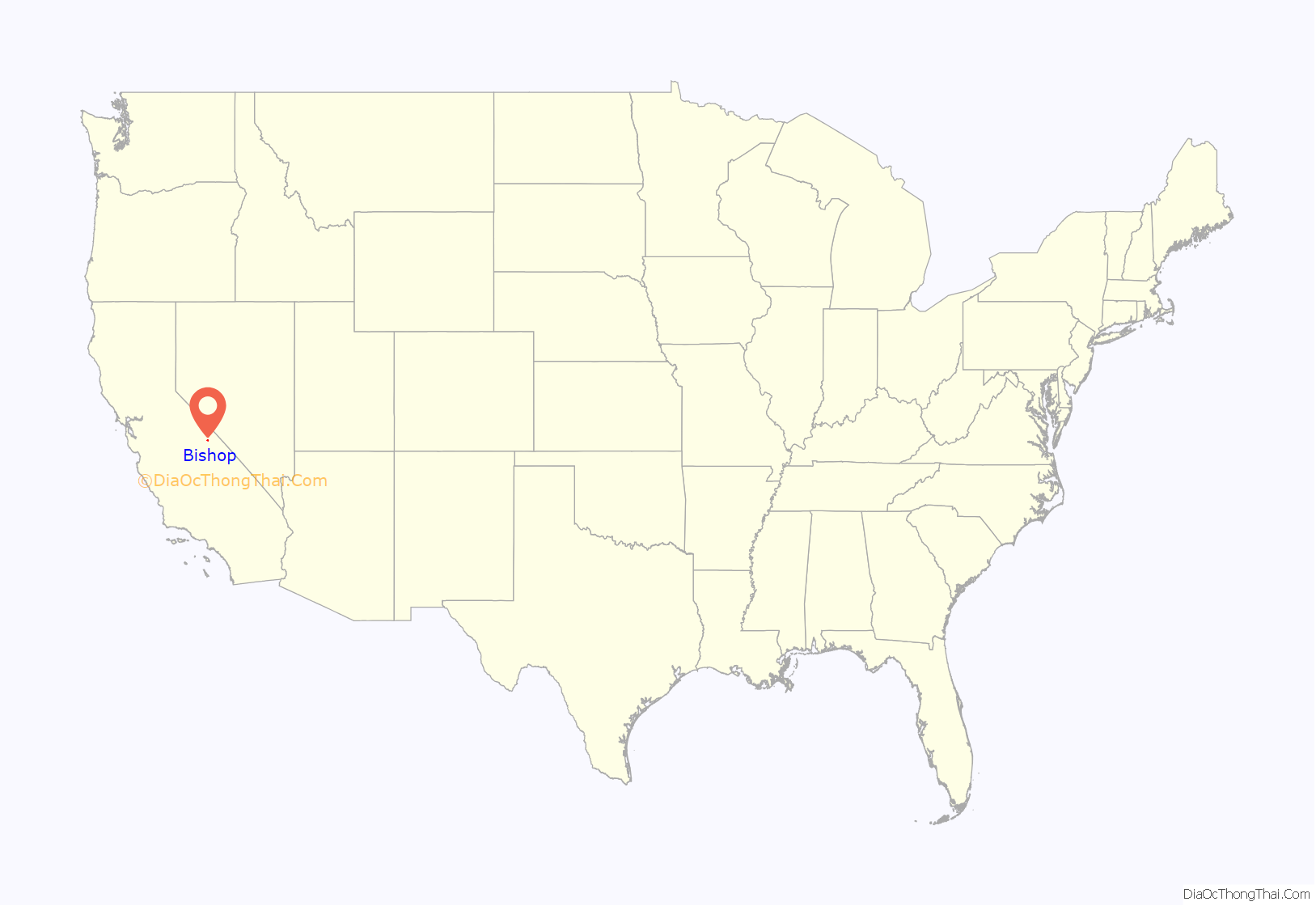
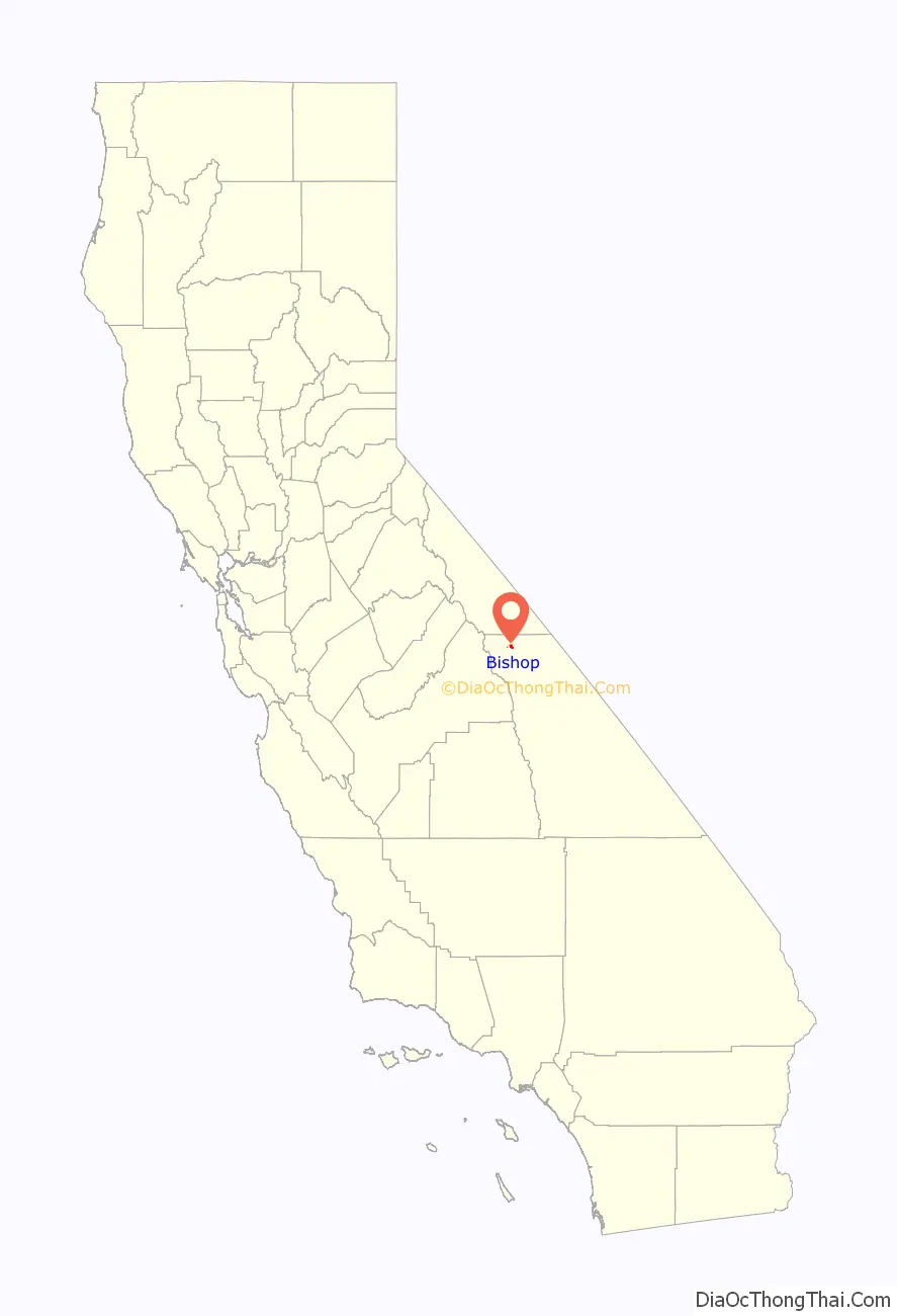
Bishop location map. Where is Bishop city?
History
The Bishop Creek post office operated from 1870 to 1889 and from 1935 to 1938. The first Bishop post office opened in 1889.
In order to support the growth aspirations of the City of Los Angeles, water was diverted from the Owens River into the Los Angeles Aqueduct in 1913. From the 1910s to 1930s, the Los Angeles Department of Water and Power purchased much of the valley for water rights and control. The result was substantial change to the Owens Valley culture and environment. The economy of Bishop suffered when farmers sold their land. Jack Foley, a Bishop resident and sound effects specialist, mitigated the economic loss by persuading several Los Angeles studio bosses that the town of Bishop would be ideal as a location to shoot westerns.
History and heritage
The City of Bishop was named for one of the first European settlers in the area, Samuel A. Bishop. Owens Lake was named for Richard Owens, a member of John C. Fremont’s 1845 exploration party which included Kit Carson and Ed Kern. Later the entire valley became known as The Owens Valley (see First Settlers below). The Paiute Indians called Owens Lake by the name of “Pacheta” and the Owens River “Wakopee.” Geographically, Inyo County is today the second largest county in California with a population of slightly over 18,000 residents. The county is so big that several eastern states put together would fit neatly within its boundaries. Inyo County contains both the highest and lowest points in the contiguous United States; Mt. Whitney, 14,496 feet (4,418 m) above sea level, and Badwater in Death Valley, 282 feet (86 m) below sea level. The “Inyo” in Inyo County is commonly believed to be a Paiute word meaning “dwelling place of the great spirit,” although some scholars are now convinced that it is a mistranslation of the word Indio, which is Spanish for Indian. It is possible that the Paiute were trying to explain to the earliest English speaking settlers in the Owens Valley that this was their land by using a form of “Indio” they had learned from other Indian tribes, who in turn, had learned it from the Spanish or Mexicans, not realizing that not all Europeans spoke the same language. Thus Inyo may actually mean “Indian Land.”
First American settlers
The first American explorers in the Owens Valley of Eastern California included the famous mountain men Jedediah Smith in 1826 and Joseph Walker in 1834. This remote area of California had never been explored by the Spanish and even though it was shown as Mexican territory on early maps, the Eastern Sierra region remained unvisited by them. Present day Walker Lake in western Nevada, the Walker River on the California/Nevada border and Walker Pass in the southern Sierra were named for their discoverer, Joseph Walker.
The most renowned early explorer to visit the area was John C. Fremont. He was the first Republican candidate to run for President of the United States in 1856 and later a famous Union Civil War general. Officially sanctioned by the federal government, his 1845 mapping party to the Eastern Sierra included the celebrated Indian scout Kit Carson, for whom the capitol of Nevada, Carson City, was named. Also in the party were Ed Kern for whom Kern County, California was named, and Richard Owens, who gave his name to the Owens Lake near Lone Pine and later the Owens Valley itself. Fremont lost a cannon that he had brought along in case of Indian attacks near present-day Bridgeport, California (about 80 miles [130 km] north of Bishop).
The City of Bishop came into being due to the need for beef in a booming mining camp some eighty miles to the north, Aurora, Nevada, (Aurora was believed to be on the California side of the border at that time and was the county seat of Mono County, California). In 1861 cattlemen drove herds of cattle some three hundred miles from the great San Joaquin Valley of California, through the southern Sierra at Walker Pass, up the Owens Valley, and then through Adobe Meadows to Aurora. Along the way, some cattlemen noticed that the unsettled northern Owens Valley was perfect for raising livestock.
To avoid the long journey from the other side of the mountains, a few of them decided to settle in the valley. Driving some 600 head of cattle and 50 horses, Samuel Addison Bishop, his wife, and several hired hands arrived in the Owens Valley on August 22, 1861, from Fort Tejón in the Tehachapi Mountains. Along with Henry Vansickle, Charles Putnam, Allen Van Fleet, and the McGee brothers, Bishop was one of the first white settlers in the valley.
The cattlemen were soon followed by sheepmen who initially struggled with a lack of forage for their stock in the area. Remnants of these early settlers’ stone corrals and fences can still be seen north of Bishop along Highway 395 in Round Valley (barb wire fencing was not invented until 1873). Establishing a homestead, the San Francis Ranch, along the creek which still bears his name, Samuel Bishop set up a market to sell beef to the miners and business owners in Aurora.
One of the residents of Aurora at that time was a young Samuel Clemens who later gained fame as author Mark Twain (see Twain’s Roughing It for his comments on this area).
By 1862, a frontier settlement (and later town), known as Bishop Creek, was established a couple of miles east of the San Francis Ranch. Though the town continues to prosper, the only reminder of Samuel Bishop’s ranch today is a monument placed near the original site at the corner of Highway 168 West and Red Hill Road, two miles west of downtown Bishop.
In 1866, the County of Inyo was established from part of Tulare County. The Eastern High Sierra and the Owens Valley was the westernmost frontier in America at that time. In 1871, Daniel Bruhn was one of 41 wranglers herding some 3,000 wild Spanish mustangs from Stockton, California, to Texas. Their travels took them over the High Sierra and into the remote Owens Valley, where they lost over 500 head of horses. The descendants of those mustangs still roam wild on the California/Nevada border just north of Bishop.
Water conflicts of the Owens Valley
Between 1905 and 1907, most of the land in the Owens Valley was purchased from farmers and ranchers at bargain prices by William Mulholland, superintendent of the Water Department for the City of Los Angeles under the guise of a local irrigation project. Their real goal was to send Owens Valley water south to Los Angeles. By the time the now famous Los Angeles Aqueduct was completed in 1913, it was too late for valley residents to take any action.
The aqueduct, 223 miles (359 km) long, used no pumping stations and only gravity siphons to send water from the Owens Valley to Southern California. The City of Los Angeles receives 70% of its water from the Owens Valley and the Eastern High Sierra. With the diversion of water to Los Angeles, the Owens Lake and lower Owens River dried up and many valley residents were forced to pack up and leave the area forever. For a number of years, Owens Valley residents expressed much animosity toward the City of Los Angeles as can be seen in Dry Ditches, a little book of poems published in 1934 by the Parcher family of Bishop. The Owens Valley–City of Los Angeles conflict was the inspiration of the 1974 film Chinatown, starring Jack Nicholson.
Native American cultural heritage
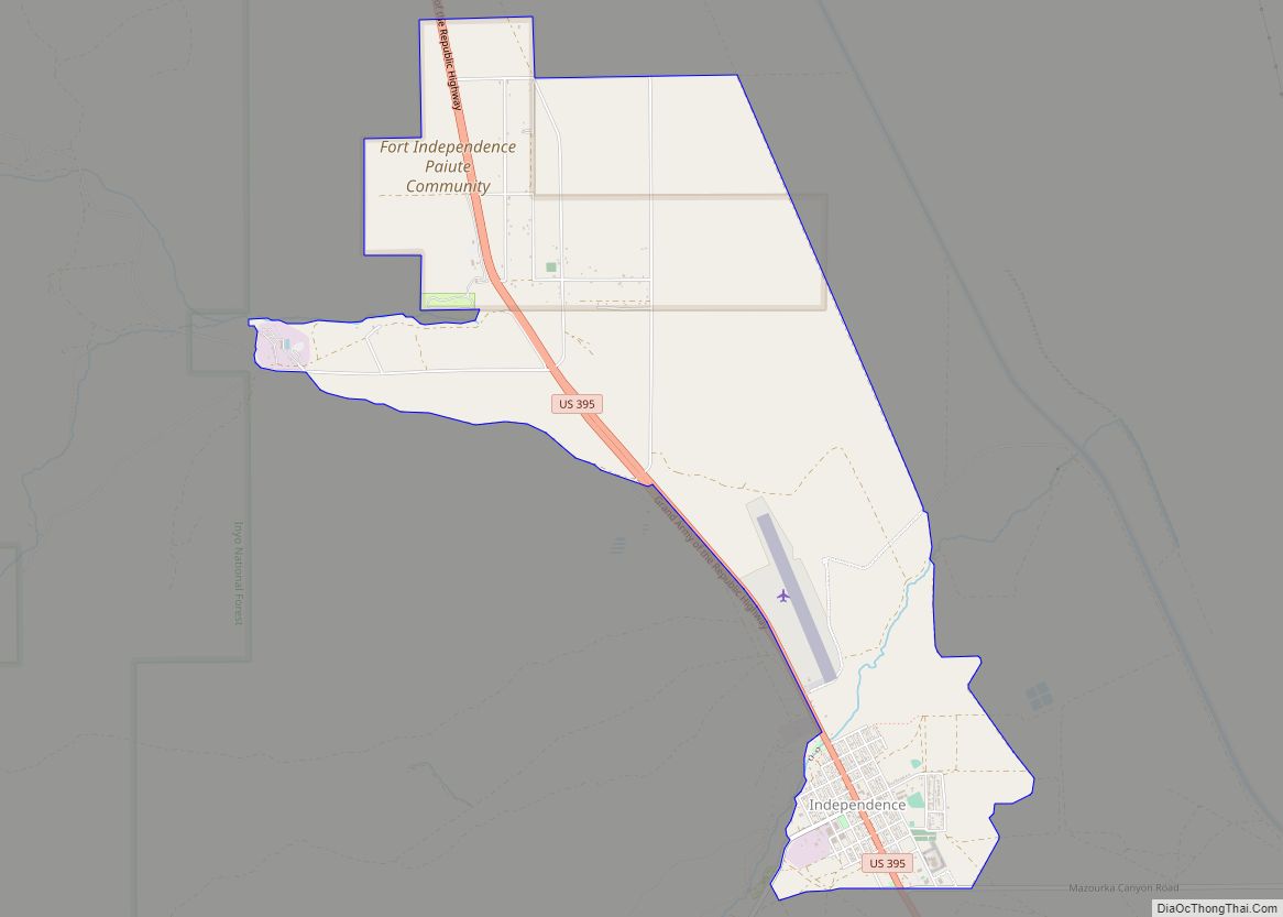
Indigenous peoples still live in and near Bishop. They now reside on four reservations. The southernmost is the Lone Pine Indian Reservation; northward is Fort Independence Reservation and Big Pine Indian Reservation. The largest and northernmost is the Bishop Indian Reservation.
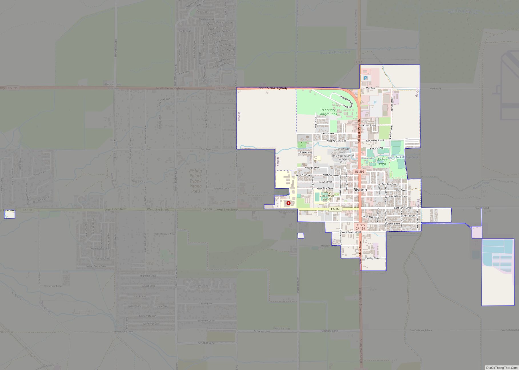
Bishop Road Map
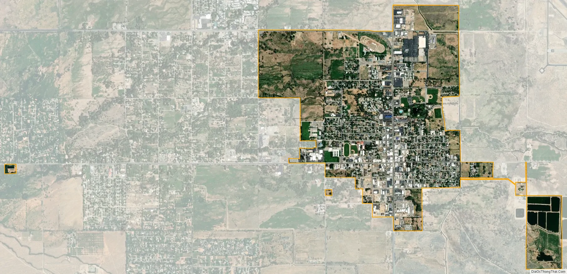
Bishop city Satellite Map
Geography
Bishop lies west of the Owens River at the northern end of the Owens Valley.
The city is located on U.S. Route 395, the main north–south artery through the Owens Valley, connecting the Inland Empire to Reno, Nevada. US 395 also connects Bishop to Los Angeles via State Route 14 through Palmdale. Bishop is the western terminus of U.S. Route 6. The Paiute-Shoshone Indians of the Bishop Community of the Bishop Colony control land just west of the town. The Los Angeles Department of Water and Power (DWP) controls much of the upstream and surrounding area.
Bishop is immediately to the east of the Sierra Nevada, and west of the White Mountains. Numerous peaks are within a short distance of Bishop, including Mount Humphreys (13,986 ft; 4,263 m) to the west, White Mountain Peak (14,242 ft; 4,341 m) to the northeast, and pyramidal Mount Tom (13,658 ft; 4,163 m) northwest of town. Basin Mountain (13,187 ft; 4,019 m) is viewed to the west from Bishop as it rises above the Buttermilks.
According to the United States Census Bureau, the city has a total area of 1.9 square miles (4.9 km), over 97% of it land.
Bishop is known as the “Mule Capital of the World” and a week-long festival called Bishop Mule Days has been held since 1969 during the week of Memorial Day, celebrating the contributions of pack mules to the area. The festival attracts many tourists, primarily from the Southern California area.
Bishop is well known in the rock climbing community. Near the city are numerous climbing spots that attract visitors from around the world. There are over 2,000 bouldering problems in Bishop. The two main types of rock are volcanic tuff (at the Happy and Sad boulders) and granite (at the Buttermilks).
Notable locations
- Ancient Bristlecone Pine Forest
- Bishop Area Chamber of Commerce
- Bishop Visitors Bureau
- Eastern Sierra Regional Airport
- Inyo National Forest Supervisor’s Office
- Keoughs Hot Springs
- Laws Rail Museum
- Paiute Indian Reservation
- Paiute-Shoshone Cultural Center Museum
See also
Map of California State and its subdivision:- Alameda
- Alpine
- Amador
- Butte
- Calaveras
- Colusa
- Contra Costa
- Del Norte
- El Dorado
- Fresno
- Glenn
- Humboldt
- Imperial
- Inyo
- Kern
- Kings
- Lake
- Lassen
- Los Angeles
- Madera
- Marin
- Mariposa
- Mendocino
- Merced
- Modoc
- Mono
- Monterey
- Napa
- Nevada
- Orange
- Placer
- Plumas
- Riverside
- Sacramento
- San Benito
- San Bernardino
- San Diego
- San Francisco
- San Joaquin
- San Luis Obispo
- San Mateo
- Santa Barbara
- Santa Clara
- Santa Cruz
- Shasta
- Sierra
- Siskiyou
- Solano
- Sonoma
- Stanislaus
- Sutter
- Tehama
- Trinity
- Tulare
- Tuolumne
- Ventura
- Yolo
- Yuba
- Alabama
- Alaska
- Arizona
- Arkansas
- California
- Colorado
- Connecticut
- Delaware
- District of Columbia
- Florida
- Georgia
- Hawaii
- Idaho
- Illinois
- Indiana
- Iowa
- Kansas
- Kentucky
- Louisiana
- Maine
- Maryland
- Massachusetts
- Michigan
- Minnesota
- Mississippi
- Missouri
- Montana
- Nebraska
- Nevada
- New Hampshire
- New Jersey
- New Mexico
- New York
- North Carolina
- North Dakota
- Ohio
- Oklahoma
- Oregon
- Pennsylvania
- Rhode Island
- South Carolina
- South Dakota
- Tennessee
- Texas
- Utah
- Vermont
- Virginia
- Washington
- West Virginia
- Wisconsin
- Wyoming