Ramona is a census-designated place (CDP) in San Diego County, California. The population was 20,292 at the 2010 census.
The name Ramona also refers to an unincorporated community (with some plans to incorporate) that includes both the Ramona CDP and the adjacent CDP of San Diego Country Estates. The population of the two CDPs, which does not include the fringe areas surrounding the CDPs, was 30,301 at the 2010 census, up from 25,223 at the 2000 census. The Ramona Community Planning Area had a population of 33,404 at the 2000 census. The January 1, 2006, population of the Ramona Community Planning Area is estimated to be 36,405 by the San Diego Association of Governments (SANDAG). USDA Hardiness Zones are 9b and 10a.
| Name: | Ramona CDP |
|---|---|
| LSAD Code: | 57 |
| LSAD Description: | CDP (suffix) |
| State: | California |
| County: | San Diego County |
| Elevation: | 1,430 ft (436 m) |
| Total Area: | 38.433 sq mi (99.539 km²) |
| Land Area: | 38.412 sq mi (99.485 km²) |
| Water Area: | 0.021 sq mi (0.054 km²) 0.05% |
| Total Population: | 20,292 |
| Population Density: | 530/sq mi (200/km²) |
| ZIP code: | 92065 |
| FIPS code: | 0659346 |
| GNISfeature ID: | 1652781 |
Online Interactive Map
Click on ![]() to view map in "full screen" mode.
to view map in "full screen" mode.
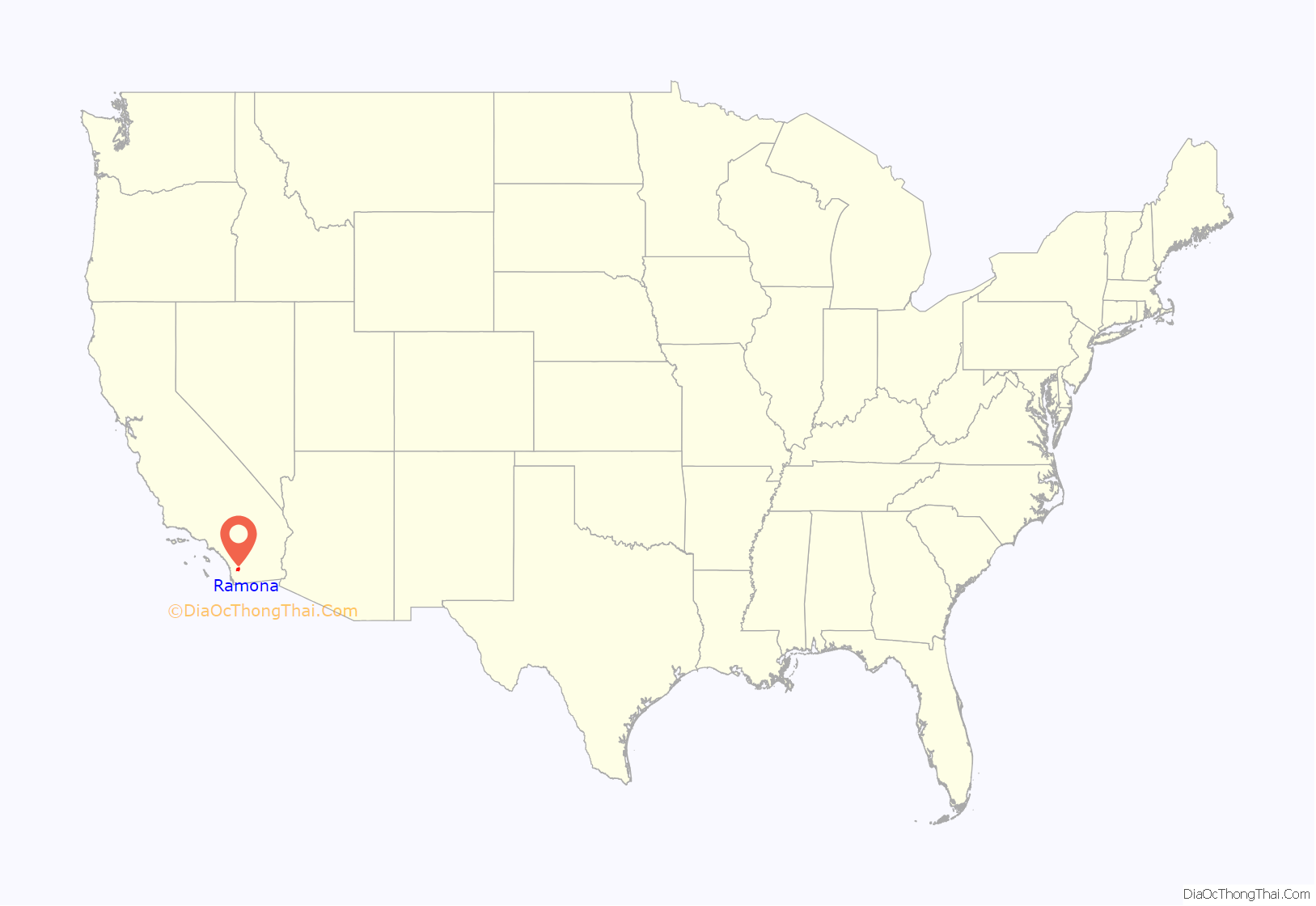
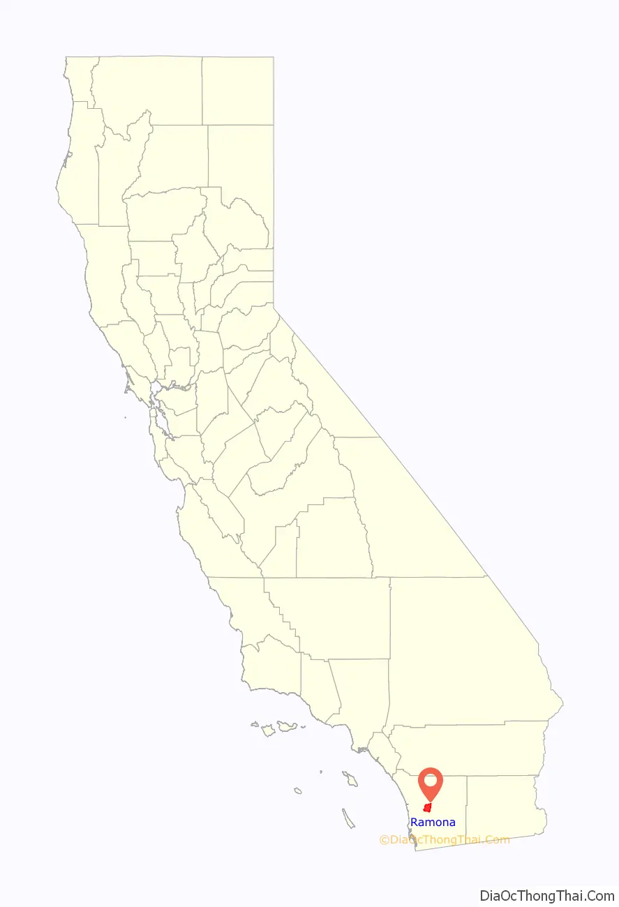
Ramona location map. Where is Ramona CDP?
History
Early times
Before it was permanently settled, the Ramona area was inhabited by the Kumeyaay Nation of Native Americans (Diegueño), a semi-nomadic people, who established annual settlements there as they moved between coastal and inland grounds. Their presence is indicated by archeological evidence such as rock paintings, etchings, and grinding stones used to grind acorns into meal for bread.
During Mexican governance of California, Rancho Valle de Pamo (also called Rancho Santa María) was a 17,709-acre (71.67 km) Mexican land grant that occupied the Santa Maria Valley and was centered on present-day Ramona.
The first post office was called Nuevo. The town took the name Ramona in 1886, when a land speculation syndicate, headed by Milton Santee, “organized the Santa Maria Land & Water Company and acquired 3,200 acres (13 km) for a townsite in the Santa Maria Valley and named it Ramona”. The next year the town reverted to Nuevo because there was another town, in Los Angeles County, called Ramona. However, the other town did not flourish, and when it was finally abandoned the present-day Ramona took that name. Today in Ramona, there stands a Mexican restaurant named “Nuevo Grill” in remembrance of the town’s original name. The restaurant even features a few old pictures that date back to when the town was still called Nuevo.
In 1886, Theophile Verlaque built the town’s first house next to Amos’ store. The Verlaque house, located at 645 Main Street in Ramona, is now home to the Ramona Pioneer Historical Society and its Guy B. Woodward Museum, and in 1991 was listed on the National Register of Historic Places.
The Santa Maria Land & Water Company called its project “Ramona”. When the name of the town changed from Nuevo to Ramona is subject to dispute. In The Glory Years, by Frank F. Pourade (1964, Copley Press, republished by the San Diego Historical Society), the author indicates that the Santa Maria Land & Water Company syndicate changed the name in 1886. However, the San Diego City and County Directory for 1886–87 lists the town as Nuevo. And the Ramona Town Hall website says this concerning the dedication of the building:
Concerned about the plight of Native Americans in southern California and elsewhere, and inspired by her friend Harriet Beecher Stowe’s novel Uncle Tom’s Cabin, Helen Hunt Jackson’s novel Ramona was published in November 1884. It was an instant success.
The Ramona Town Hall was listed on the National Register of Historic Places in 1994. It has also been known as Town Hall of Nuevo, and Barnett Hall. The Hall was built on two lots donated by Milton Santee, who as noted above headed up the Santa Maria Land & Water Company syndicate. Augustus and Martha Barnett donated the $17,000 “to the towns people of Nuevo, on Washington’s Birthday, February 22, 1894.” Ramona Town Hall was designed by architect William S. Hebbard, who later, with his partner, Irving Gill, produced San Diego’s best architecture until its breakup in 1907. The building is one of the largest, and oldest, adobe structures in southern California. Photographs of William Hebbard and Ramona Town Hall may be viewed on this San Diego Historical Society page, and on the Ramona Town Hall website.
As noted in a Ramona Home Journal article:
Recent history
In the 1960s, boxer Archie Moore held a training camp called “Salt Mine” which trained George Foreman and Muhammad Ali. Moore fought from 1936 until 1963 and battled the top names in boxing at the time, including Rocky Marciano, Floyd Patterson and Muhammad Ali. He won 185 of his 219 bouts before retiring at 49 years old after losing to Ali. Moore’s connection to San Diego was his retreat, the Salt Mine Training Camp in Ramona. He called it “Salt Mine” because he said he worked as hard there to get ready for fights as anyone did in a salt mine. The property, at the foot of Mt. Woodson, included 120 acres (49 ha) with five homes, a boxing ring, a sweatbox (steam room) and miles of winding country roads and trails that Moore used for road work. Moore often encountered rattlesnakes and even mountain lions on his runs.
On Mother’s Day, May 13, 1973, Ramona entered the national spotlight. 55-year-old former-tennis-great-turned-hustler, Bobby Riggs, challenged the then 30-year-old women’s world number-one player, Margaret Court, to a match. The match was staged at Ramona’s San Diego Country Estates. Riggs won easily, 6–2, 6–1. He later lost to Billie Jean King in The Battle of the Sexes at the Astrodome in Houston, Texas, on September 20, 1973.
The Cedar Fire began in Ramona approximately 3 miles (5 km) east of the San Diego Country Estates area, on October 25, 2003. The fire would eventually consume approximately 280,000 acres (1,133 km), burn 2,820 buildings (including 2,232 homes), and take 15 lives. The Cedar Fire was the largest fire in California history at the time. In her book, A Canyon Trilogy, author Chi Varnado, a longtime Ramona resident, described many of the hardships the victims faced in the aftermath of the fire.
The Witch Fire began near Ramona near the area called Witch Creek on October 21, 2007. By three days later it had burned approximately 195,000 acres (789 km) in San Diego County with over 640 homes destroyed, 250 damaged, and 12 firefighters injured according to the San Diego Union Tribune. Roads into the town were closed. On October 24 the Witch Fire merged with another fire called the Poomacha which had originated in the area of the La Jolla Indian Reservation. Along with more than 10 other fires burning in San Diego County at the same time, the Witch-Poomacha fire helped cause the largest mandatory evacuations in U.S. history, with over 500,000 people displaced as of October 24.
In January 2006, Ramona Valley was designated the country’s 162nd American Viticultural Area (AVA) by the Alcohol and Tobacco Tax and Trade Bureau, which recognized the area for its distinctive microclimate, elevation, and soil attributes.
In May 2009, a grade 6 student at Mt. Woodson Elementary, Natalie Jones, was forbidden from delivering a class presentation on assassinated gay San Francisco city councillor Harvey Milk because her principal, and later the school district, declared it a “sensitive” issue that not all parents might want their children to learn about. The American Civil Liberties Union labeled the school district’s actions as censorship and stepped in to give the school district five days to reverse its decision, and promise never to do anything like it again, or they would launch a lawsuit on Natalie’s behalf. The school district did not immediately respond.
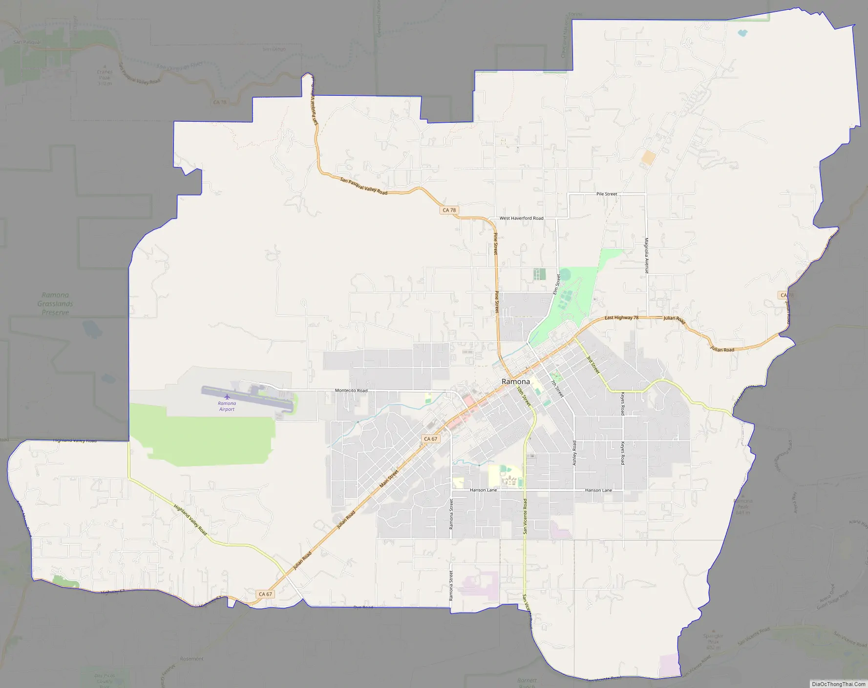
Ramona Road Map
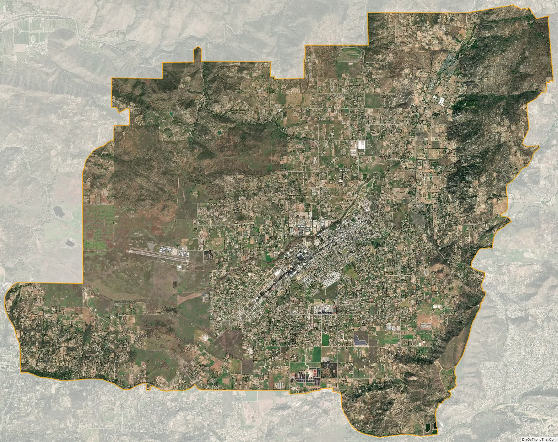
Ramona city Satellite Map
Geography
According to the United States Geological Survey Ramona is located at 33°2′30″N 116°52′5″W / 33.04167°N 116.86806°W / 33.04167; -116.86806 within the Santa Maria Valley. This is near the intersection of State Route 67 and State Route 78 and near the economic center of Ramona. The elevation is 1,391 ft (424 m) above sea level (at Ramona Airport).
Because Ramona is not an incorporated city, there are no city limits by which to measure its area. There are primarily three geographic areas by which the land area of Ramona is measured: 1. The boundaries of the Ramona Municipal Water District (approximately 75 square miles (194 km)); 2. The boundaries of the Ramona Unified School District (approximately 150 square miles (390 km)), and; 3. The boundaries of the Ramona Community Planning Area. The last is the primary area utilized by San Diego County’s regional planning agency, the San Diego Association of Governments (SANDAG).
The Ramona Community Planning Area encompasses more than 84,000 acres (340 km) (over 130 square miles (340 km)) in central San Diego County. The RCPA includes the unincorporated town of Ramona, California, and is located in the foothills of the Laguna Mountains. It is located east northeast of the City of Poway (with which it shares a boundary), east southeast of the City of Escondido, north of Lakeside, California and west southwest of Santa Ysabel, California.
The RCPA consists primarily of the Santa Maria Valley and the San Vicente Valley, and the steep or mountainous terrain surrounding them. It also includes the Ballena Valley east of town, and Bandy Canyon and a small portion of the southern edge of the San Pasqual Valley. In the San Pasqual Valley, the RCPA abuts the City of San Diego.
The historical town center of Ramona is located in the Santa Maria Valley. This valley was the Rancho Santa Maria, a Mexican land grant. The San Vicente Valley was formerly part of the Rancho Cañada de San Vicente y Mesa del Padre Barona Mexican land grant. The San Diego Country Estates subdivision in Ramona is located in the San Vicente Valley. The Barona Indian Reservation, not part of the RCPA, is also within part of the Rancho Cañada de San Vicente y Mesa del Padre Barona Mexican land grant.
Map of the Ramona Community Planning Area.
According to the United States Census Bureau, the Ramona CDP covers an area of 38.4 square miles (99 km), 99.95% of it land, and 0.05% of it water.
See also
Map of California State and its subdivision:- Alameda
- Alpine
- Amador
- Butte
- Calaveras
- Colusa
- Contra Costa
- Del Norte
- El Dorado
- Fresno
- Glenn
- Humboldt
- Imperial
- Inyo
- Kern
- Kings
- Lake
- Lassen
- Los Angeles
- Madera
- Marin
- Mariposa
- Mendocino
- Merced
- Modoc
- Mono
- Monterey
- Napa
- Nevada
- Orange
- Placer
- Plumas
- Riverside
- Sacramento
- San Benito
- San Bernardino
- San Diego
- San Francisco
- San Joaquin
- San Luis Obispo
- San Mateo
- Santa Barbara
- Santa Clara
- Santa Cruz
- Shasta
- Sierra
- Siskiyou
- Solano
- Sonoma
- Stanislaus
- Sutter
- Tehama
- Trinity
- Tulare
- Tuolumne
- Ventura
- Yolo
- Yuba
- Alabama
- Alaska
- Arizona
- Arkansas
- California
- Colorado
- Connecticut
- Delaware
- District of Columbia
- Florida
- Georgia
- Hawaii
- Idaho
- Illinois
- Indiana
- Iowa
- Kansas
- Kentucky
- Louisiana
- Maine
- Maryland
- Massachusetts
- Michigan
- Minnesota
- Mississippi
- Missouri
- Montana
- Nebraska
- Nevada
- New Hampshire
- New Jersey
- New Mexico
- New York
- North Carolina
- North Dakota
- Ohio
- Oklahoma
- Oregon
- Pennsylvania
- Rhode Island
- South Carolina
- South Dakota
- Tennessee
- Texas
- Utah
- Vermont
- Virginia
- Washington
- West Virginia
- Wisconsin
- Wyoming


