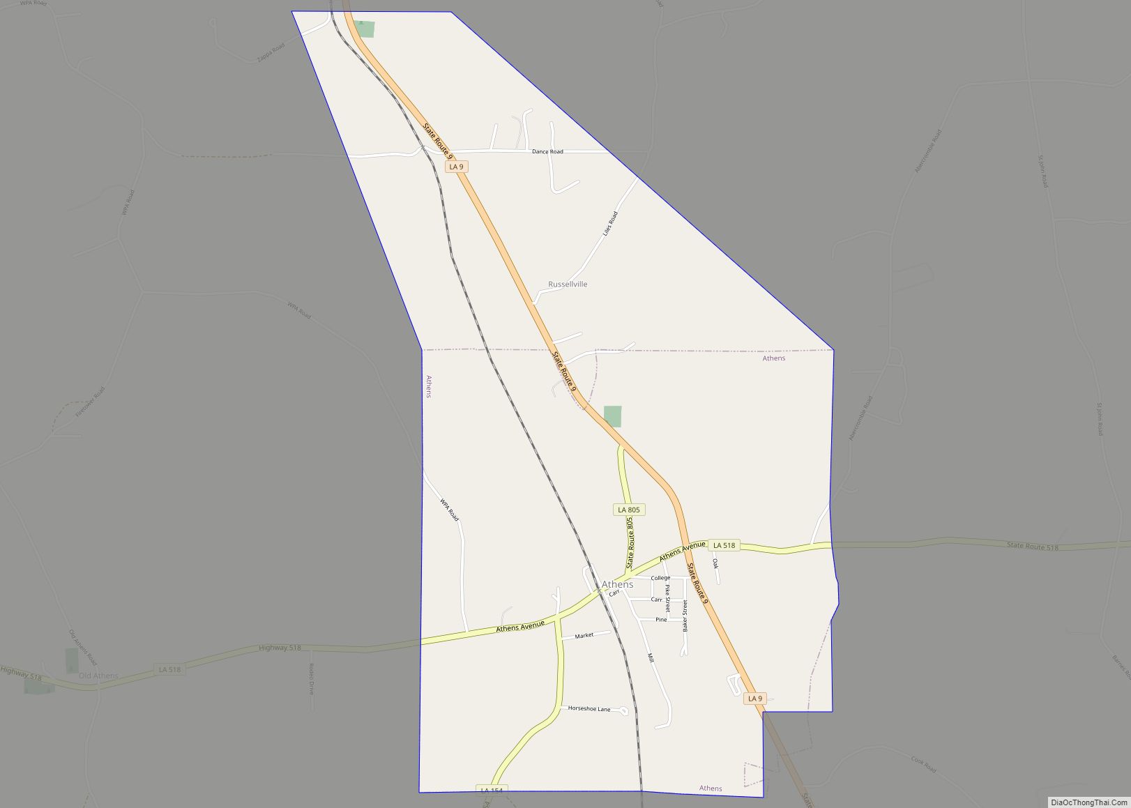
Athens is a village in Claiborne Parish, Louisiana, United States. The population was 249 at the 2010 census.
| Name: | Athens village |
|---|---|
| LSAD Code: | 47 |
| LSAD Description: | village (suffix) |
| State: | Louisiana |
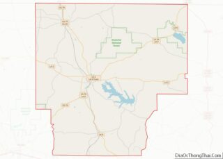
| County: | Claiborne Parish |
| Incorporated: | 1902 |
| Elevation: | 302 ft (92 m) |
| Total Area: | 3.50 sq mi (9.07 km²) |
| Land Area: | 3.50 sq mi (9.07 km²) |
| Water Area: | 0.00 sq mi (0.00 km²) |
| Total Population: | 237 |
| Population Density: | 67.69/sq mi (26.13/km²) |
| Area code: | 318 |
| FIPS code: | 2203320 |
| Website: | www.athensla.com |
Online Interactive Map
Click on ![]() to view map in "full screen" mode.
to view map in "full screen" mode.
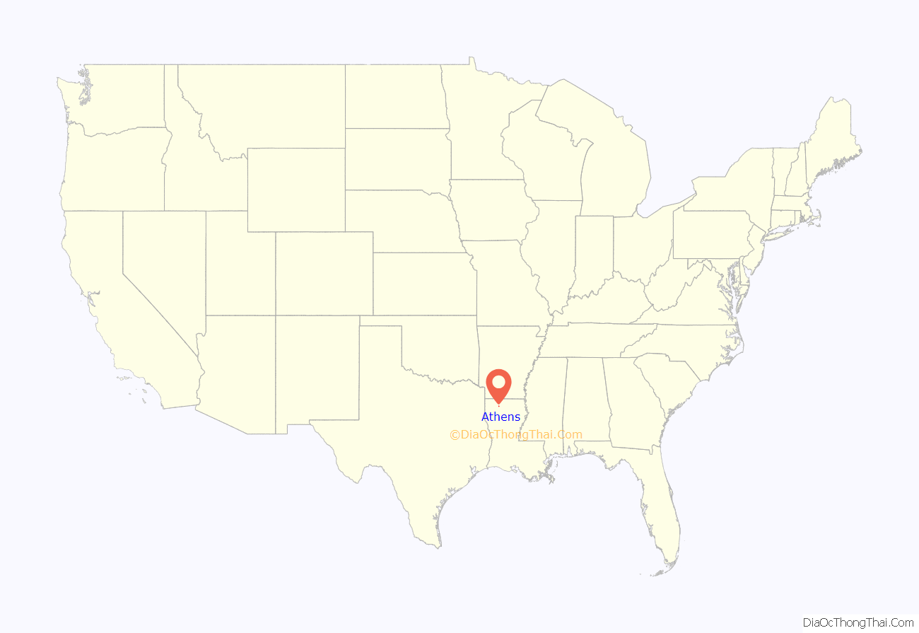
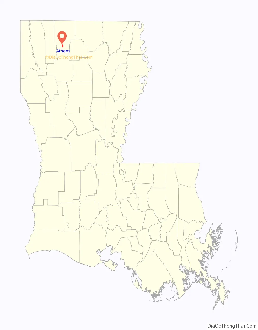
Athens location map. Where is Athens village?
History
The village was named after the ancient city of Athens, capital of Greece. Athens became the parish seat of Claiborne Parish in 1846, but in 1848, fire destroyed the courthouse and all the records in it. Soon thereafter, the Claiborne Parish Police Jury decided to move the parish seat to its present location in Homer.
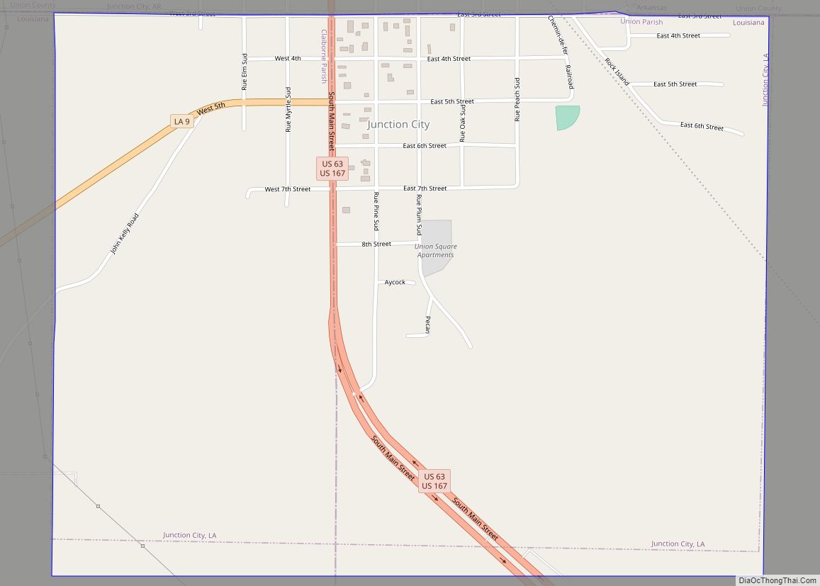
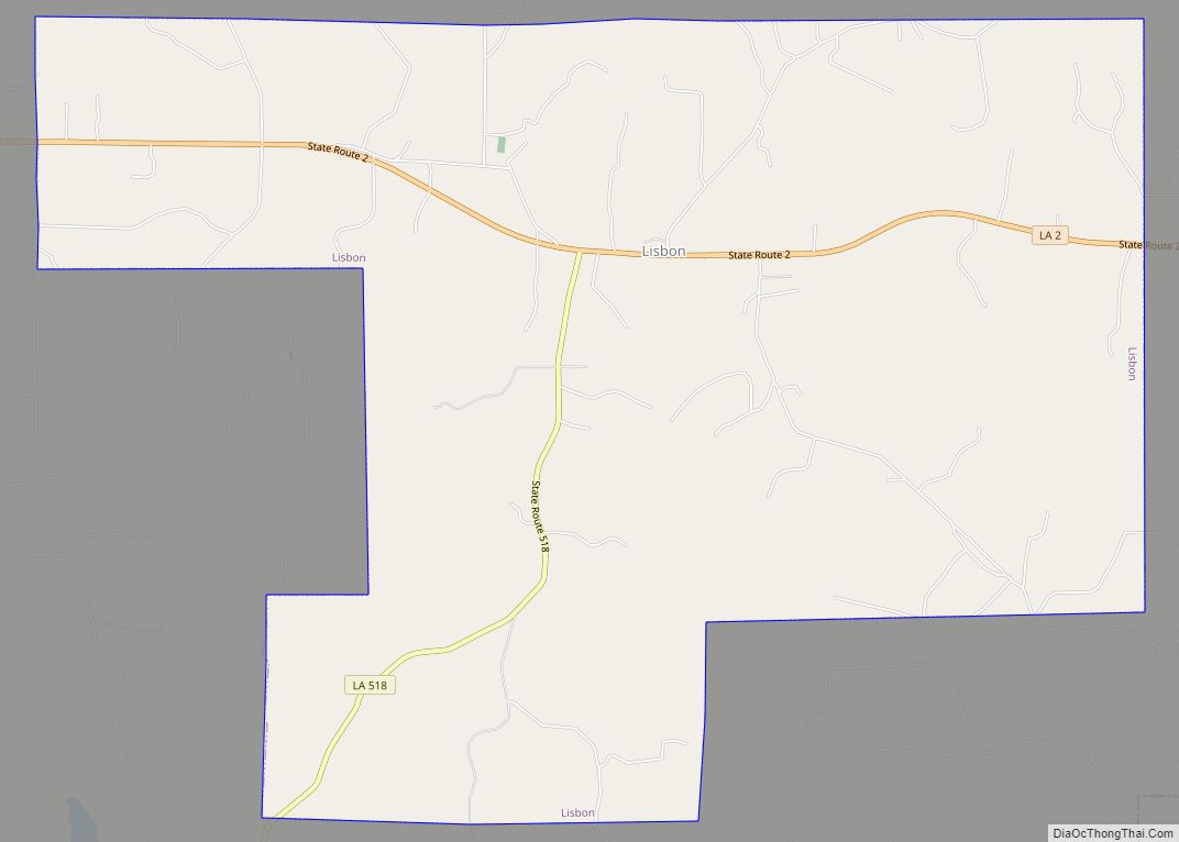
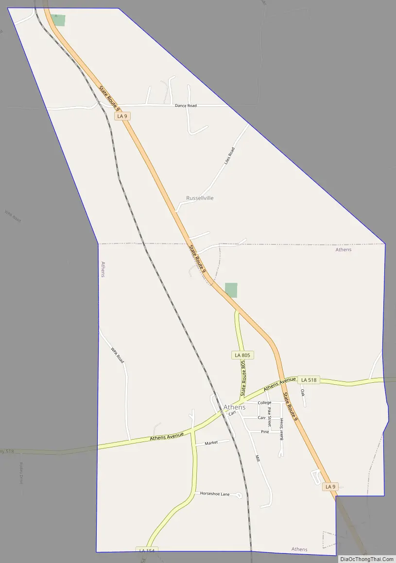
Athens Road Map
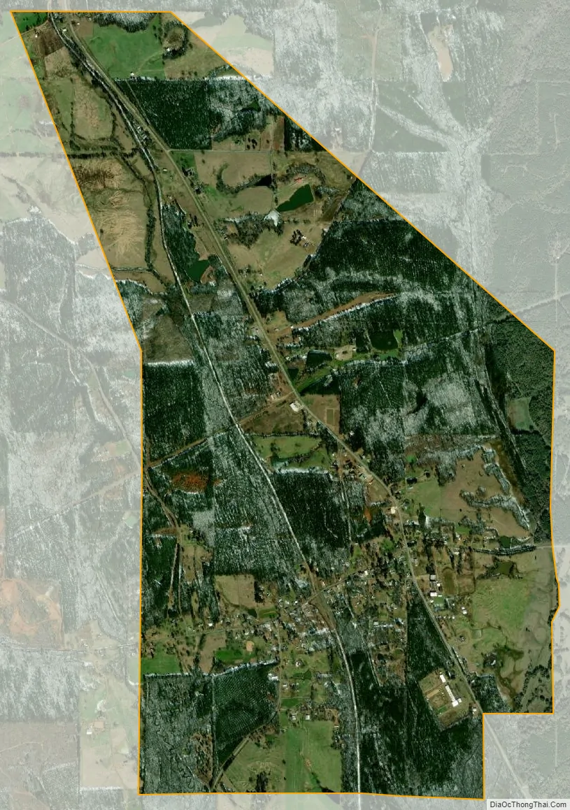
Athens city Satellite Map
Geography
Athens is located at 32°39′1″N 93°1′28″W / 32.65028°N 93.02444°W / 32.65028; -93.02444 (32.650219, -93.024492).
According to the United States Census Bureau, the village has a total area of 5.7 km (2.2 sq mi), all land.
See also
Map of Louisiana State and its subdivision:- Acadia
- Allen
- Ascension
- Assumption
- Avoyelles
- Beauregard
- Bienville
- Bossier
- Caddo
- Calcasieu
- Caldwell
- Cameron
- Catahoula
- Claiborne
- Concordia
- De Soto
- East Baton Rouge
- East Carroll
- East Feliciana
- Evangeline
- Franklin
- Grant
- Iberia
- Iberville
- Jackson
- Jefferson
- Jefferson Davis
- La Salle
- Lafayette
- Lafourche
- Lincoln
- Livingston
- Madison
- Morehouse
- Natchitoches
- Orleans
- Ouachita
- Plaquemines
- Pointe Coupee
- Rapides
- Red River
- Richland
- Sabine
- Saint Bernard
- Saint Charles
- Saint Helena
- Saint James
- Saint John the Baptist
- Saint Landry
- Saint Martin
- Saint Mary
- Saint Tammany
- Tangipahoa
- Tensas
- Terrebonne
- Union
- Vermilion
- Vernon
- Washington
- Webster
- West Baton Rouge
- West Carroll
- West Feliciana
- Winn
- Alabama
- Alaska
- Arizona
- Arkansas
- California
- Colorado
- Connecticut
- Delaware
- District of Columbia
- Florida
- Georgia
- Hawaii
- Idaho
- Illinois
- Indiana
- Iowa
- Kansas
- Kentucky
- Louisiana
- Maine
- Maryland
- Massachusetts
- Michigan
- Minnesota
- Mississippi
- Missouri
- Montana
- Nebraska
- Nevada
- New Hampshire
- New Jersey
- New Mexico
- New York
- North Carolina
- North Dakota
- Ohio
- Oklahoma
- Oregon
- Pennsylvania
- Rhode Island
- South Carolina
- South Dakota
- Tennessee
- Texas
- Utah
- Vermont
- Virginia
- Washington
- West Virginia
- Wisconsin
- Wyoming