Ball is a town in Rapides Parish, just north of Pineville, Louisiana, United States. Established in 1972, it is part of the Alexandria, Louisiana Metropolitan Statistical Area. The population was 4,000 at the 2010 census, an increase of 8.7 percent over the 2000 tabulation of 3,681.
| Name: | Ball town |
|---|---|
| LSAD Code: | 43 |
| LSAD Description: | town (suffix) |
| State: | Louisiana |
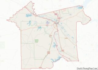
| County: | Rapides Parish |
| Incorporated: | May 1972 |
| Elevation: | 161 ft (49 m) |
| Total Area: | 7.95 sq mi (20.59 km²) |
| Land Area: | 7.95 sq mi (20.59 km²) |
| Water Area: | 0.00 sq mi (0.00 km²) |
| Total Population: | 3,961 |
| Population Density: | 498.18/sq mi (192.34/km²) |
| Area code: | 318 |
| FIPS code: | 2204055 |
| Website: | http://www.ball.govoffice2.com/ |
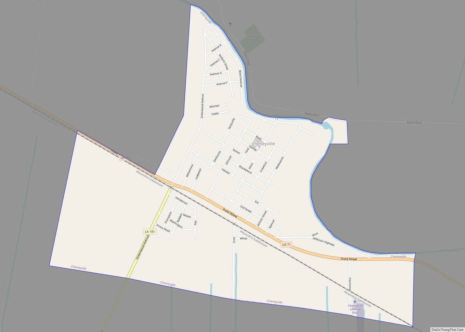
Online Interactive Map
Click on ![]() to view map in "full screen" mode.
to view map in "full screen" mode.
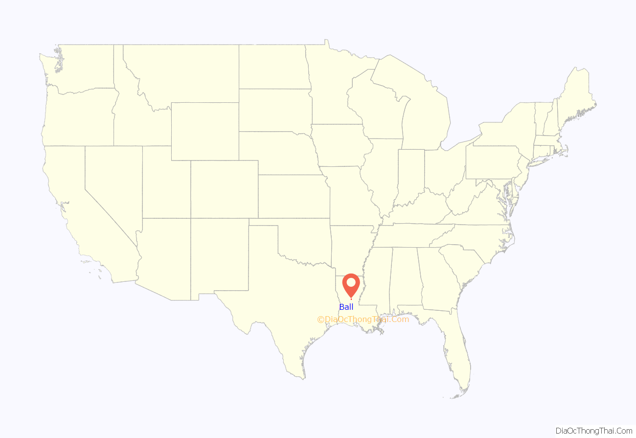
Ball location map. Where is Ball town?
History
Ball had its start as a logging town with a sawmill.
The earliest record of settlers in Ball dates to between 1840 and 1863. In 1893 Captain Chittenden Edwin Ball, a native of Union County, Kentucky, who captained steamboats up the Red River to Alexandria, named a sawmill town after himself. The captain settled in Rapides Parish in the late 1880s, where he established the Sweet Home Mill. In 1940 Camp Livingston was constructed, bringing with it job opportunities and a population boom. The number of military personnel stationed at Camp Livingston reached a peak of 42,500 in 1942. The end of World War II in 1945 brought about the closing of the base but many families decided to stay in the community. Discussion of incorporation began in the 1960’s and in May 1972 incorporation was completed with the finalization of the town charter under “The Lawrason Act”.
In 2011, former mayor Roy Hebron, a Democrat, was sentenced to four years imprisonment for corruption. Hebron intended to return to the office after his election on November 6, 2018, when he handily unseated the Republican incumbent, Neil S. Kavanagh, 817 (56 percent) to 380 (26 percent). Another 254 votes (18 percent) went to a second Republican candidate, Gene Decker. However, Hebron was unable to be sworn in because of a constitutional amendment passed in the November 2018 election which prevents felons from holding office for five years after the conclusion of their sentences.
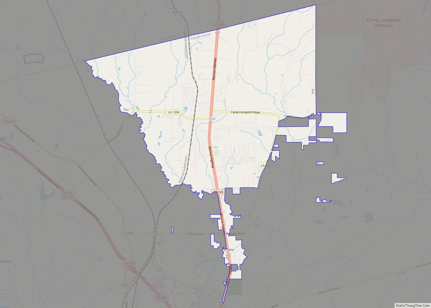
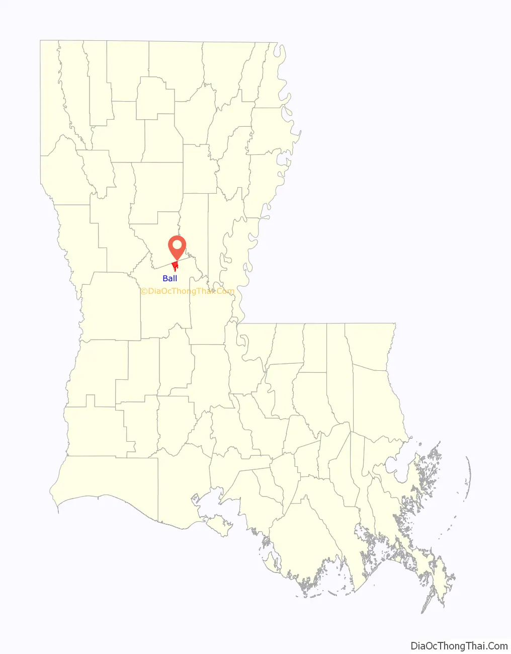
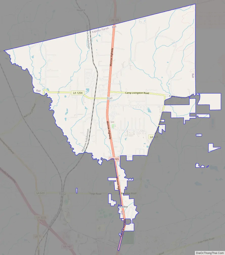
Ball Road Map
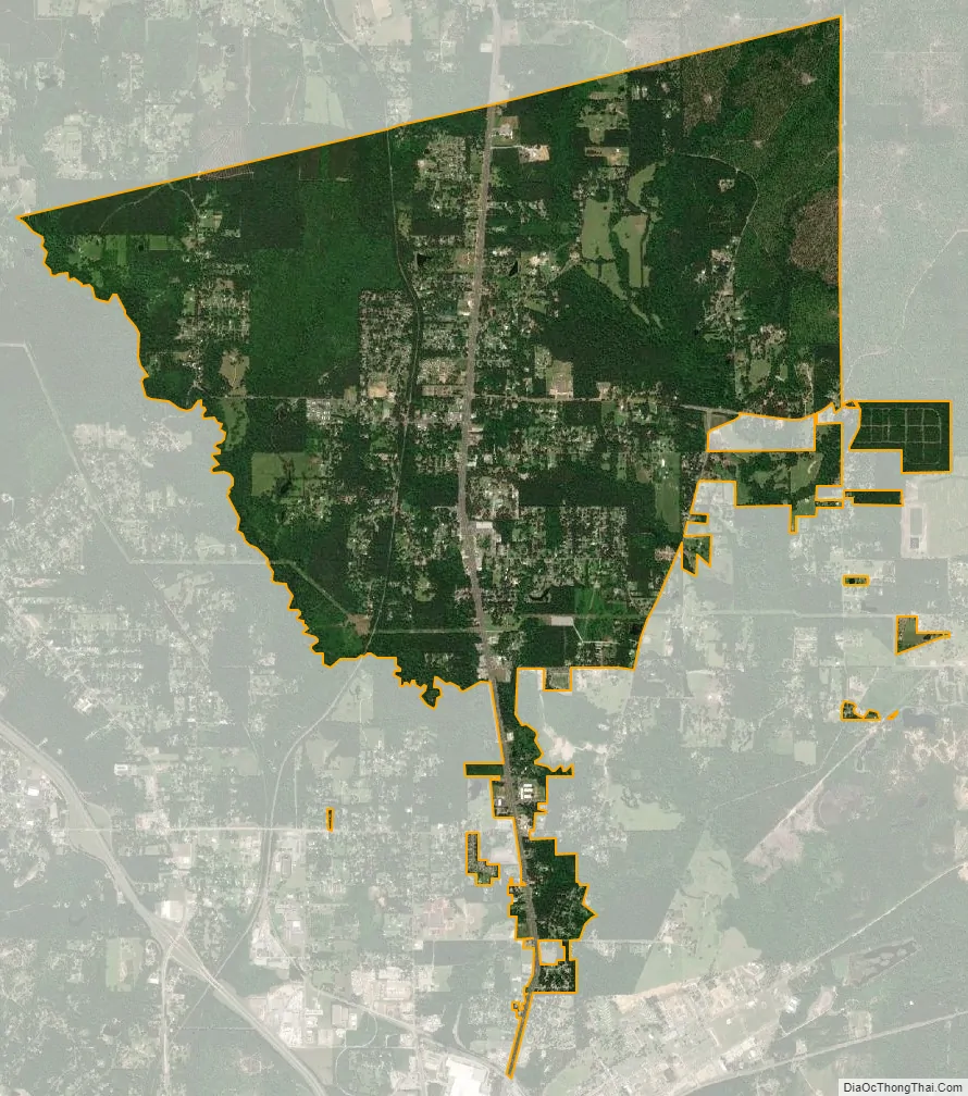
Ball city Satellite Map
Geography
Ball is located at 31°24′29″N 92°24′8″W / 31.40806°N 92.40222°W / 31.40806; -92.40222 (31.407930, -92.402316).
According to the United States Census Bureau, the town has a total area of 8.0 square miles (21 km), all land.
Climate
This climatic region is typified by large seasonal temperature differences, with warm to hot (and often humid) summers and cold (sometimes severely cold) winters. The heat has a heavy feel and can be dangerous due to the heat index which is caused by humid air. According to the Köppen Climate Classification system, Ball has a humid subtropical climate, abbreviated “Cfa” on climate maps.
See also
Map of Louisiana State and its subdivision:- Acadia
- Allen
- Ascension
- Assumption
- Avoyelles
- Beauregard
- Bienville
- Bossier
- Caddo
- Calcasieu
- Caldwell
- Cameron
- Catahoula
- Claiborne
- Concordia
- De Soto
- East Baton Rouge
- East Carroll
- East Feliciana
- Evangeline
- Franklin
- Grant
- Iberia
- Iberville
- Jackson
- Jefferson
- Jefferson Davis
- La Salle
- Lafayette
- Lafourche
- Lincoln
- Livingston
- Madison
- Morehouse
- Natchitoches
- Orleans
- Ouachita
- Plaquemines
- Pointe Coupee
- Rapides
- Red River
- Richland
- Sabine
- Saint Bernard
- Saint Charles
- Saint Helena
- Saint James
- Saint John the Baptist
- Saint Landry
- Saint Martin
- Saint Mary
- Saint Tammany
- Tangipahoa
- Tensas
- Terrebonne
- Union
- Vermilion
- Vernon
- Washington
- Webster
- West Baton Rouge
- West Carroll
- West Feliciana
- Winn
- Alabama
- Alaska
- Arizona
- Arkansas
- California
- Colorado
- Connecticut
- Delaware
- District of Columbia
- Florida
- Georgia
- Hawaii
- Idaho
- Illinois
- Indiana
- Iowa
- Kansas
- Kentucky
- Louisiana
- Maine
- Maryland
- Massachusetts
- Michigan
- Minnesota
- Mississippi
- Missouri
- Montana
- Nebraska
- Nevada
- New Hampshire
- New Jersey
- New Mexico
- New York
- North Carolina
- North Dakota
- Ohio
- Oklahoma
- Oregon
- Pennsylvania
- Rhode Island
- South Carolina
- South Dakota
- Tennessee
- Texas
- Utah
- Vermont
- Virginia
- Washington
- West Virginia
- Wisconsin
- Wyoming