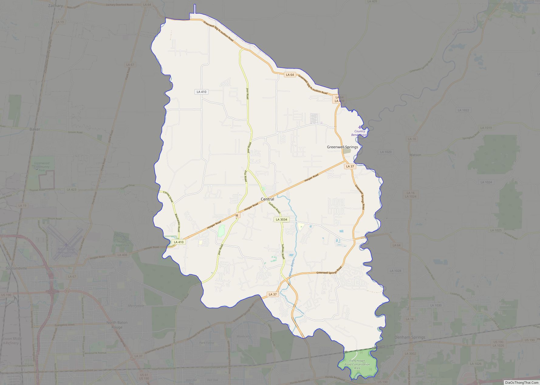
Central is a city in the U.S. state of Louisiana, second largest city in East Baton Rouge Parish, and part of the Baton Rouge metropolitan statistical area. The state’s newest incorporated city in April 2005, Central had a 2020 census population of 29,565.
| Name: | Central city |
|---|---|
| LSAD Code: | 25 |
| LSAD Description: | city (suffix) |
| State: | Louisiana |
| County: | East Baton Rouge Parish |
| Elevation: | 66 ft (20 m) |
| Total Area: | 62.53 sq mi (161.95 km²) |
| Land Area: | 62.26 sq mi (161.24 km²) |
| Water Area: | 0.27 sq mi (0.71 km²) |
| Total Population: | 29,565 |
| Population Density: | 474.89/sq mi (183.35/km²) |
| Area code: | 225 |
| FIPS code: | 2213960 |
| Website: | centralgov.com |
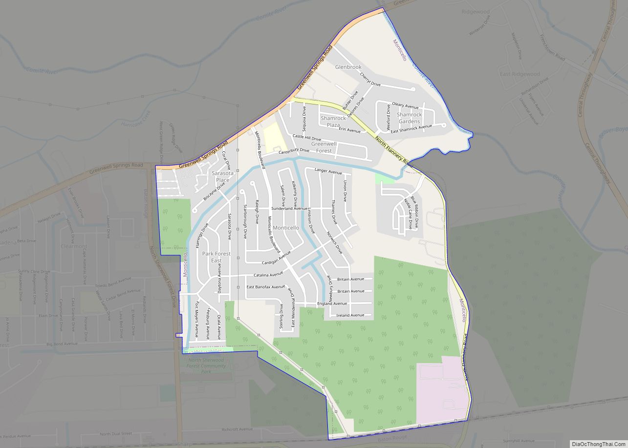
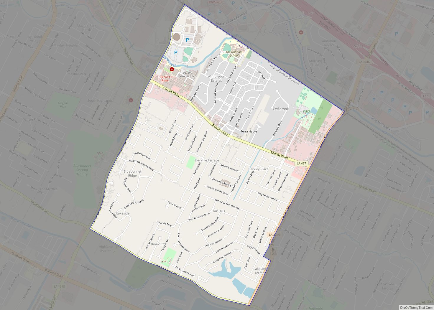
Online Interactive Map
Click on ![]() to view map in "full screen" mode.
to view map in "full screen" mode.
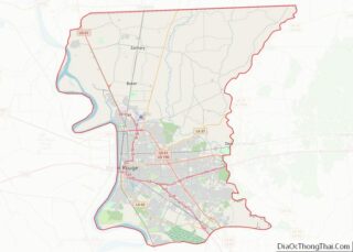
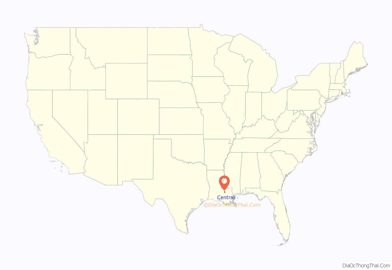
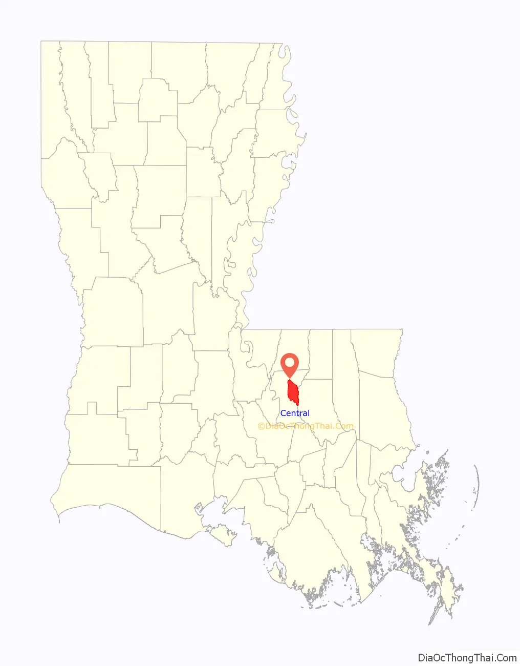
Central location map. Where is Central city?
History
Long an unincorporated suburb of Baton Rouge, the citizens of Central voted to incorporate as a city on April 23, 2005, despite opposition from the parish.
Businessman Russell Starns headed the incorporation movement, saying it was based on residents’ desire to establish a school system separate from that of East Baton Rouge Parish. The Louisiana State Legislature allowed Central to operate a separate school system only after the city incorporated.
It had about 25,000 residents when it incorporated. Former Central High School principal Shelton “Mac” Watts became the temporary mayor upon the incorporation of the city. Formal elections were held on April 1, 2006, in which voters elected incumbent Watts with 86 percent of the 18,000 votes cast.
In November 2006, the voters of the state passed a constitutional amendment authorizing the creation of the Central Community School District. The amendment authorized Central to govern its own public school system. Central operates its own police and fire departments. Other services, such as water, sewerage, trash, and emergency medical services are still operated by the city-parish. Utilities are provided by DEMCO and Entergy.
On January 9, 2007, Governor Kathleen Blanco appointed the interim members of the new Central Community School Board. The board appointed Mike Faulk as the first superintendent. The new school system began operation on July 1, 2007.
Television station WAFB reported “Central was one of the areas of East Baton Rouge Parish that sustained significant flooding” in the 2016 Louisiana floods. Mayor Jr. Shelton stated that the number of people living in Central who were affected by the flooding was 25,000.
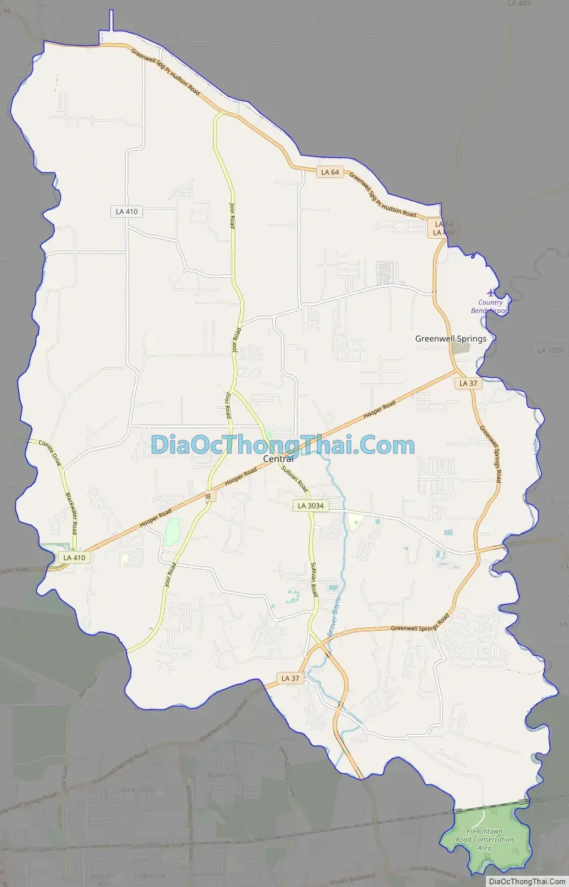
Central Road Map
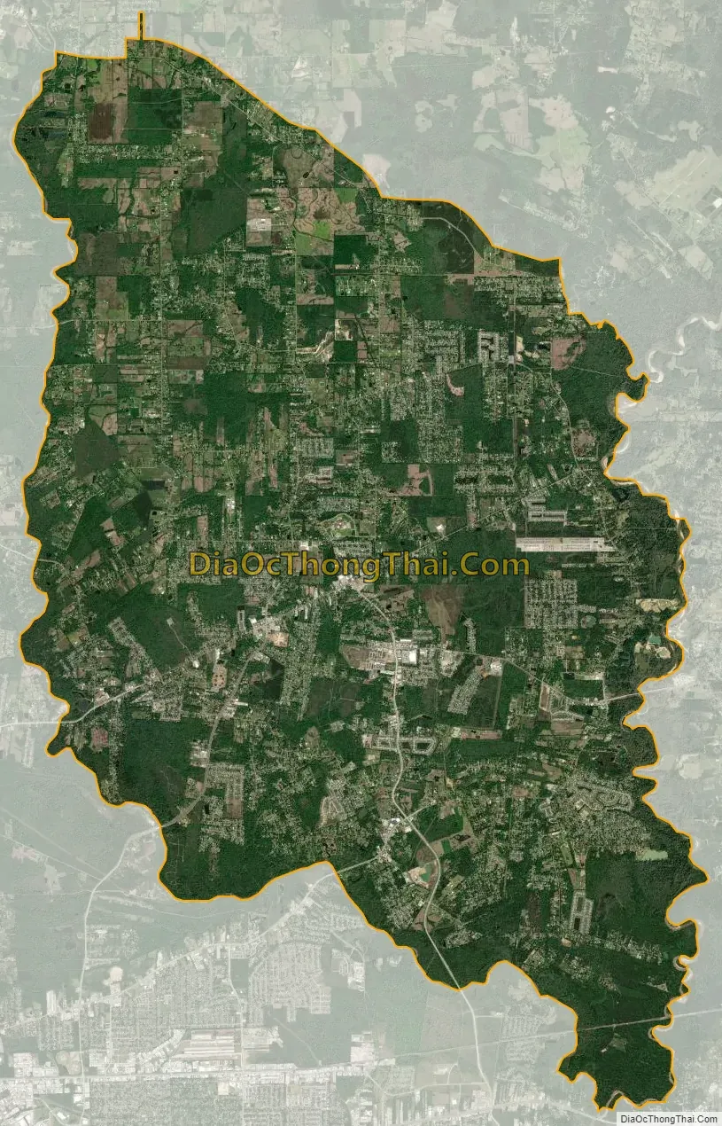
Central city Satellite Map
Geography
The city of Central is located in the east-central part of East Baton Rouge. It is situated between two rivers with the Comite River on its west border and the Amite River, which forms the border with Livingston Parish. These two rivers converge at the southern borders of the city.
Louisiana Highway 408 passes through the center of Central, leading west 7 miles (11 km) to Interstate 110 in the northern part of Baton Rouge. Downtown Baton Rouge is 13 miles (21 km) southwest of Central. Louisiana Highway 37 passes through the eastern part of Central, leading northeast 30 miles (48 km) to Greensburg, southwest 8 miles (13 km) to Monticello, and southwest 18 miles (29 km) to Baton Rouge.
According to the U.S. Census Bureau, the total area of Central is 62.5 square miles (161.9 km), of which 62.2 square miles (161.2 km) is land and 0.3 square miles (0.7 km), or 0.44%, is water.
See also
Map of Louisiana State and its subdivision:- Acadia
- Allen
- Ascension
- Assumption
- Avoyelles
- Beauregard
- Bienville
- Bossier
- Caddo
- Calcasieu
- Caldwell
- Cameron
- Catahoula
- Claiborne
- Concordia
- De Soto
- East Baton Rouge
- East Carroll
- East Feliciana
- Evangeline
- Franklin
- Grant
- Iberia
- Iberville
- Jackson
- Jefferson
- Jefferson Davis
- La Salle
- Lafayette
- Lafourche
- Lincoln
- Livingston
- Madison
- Morehouse
- Natchitoches
- Orleans
- Ouachita
- Plaquemines
- Pointe Coupee
- Rapides
- Red River
- Richland
- Sabine
- Saint Bernard
- Saint Charles
- Saint Helena
- Saint James
- Saint John the Baptist
- Saint Landry
- Saint Martin
- Saint Mary
- Saint Tammany
- Tangipahoa
- Tensas
- Terrebonne
- Union
- Vermilion
- Vernon
- Washington
- Webster
- West Baton Rouge
- West Carroll
- West Feliciana
- Winn
- Alabama
- Alaska
- Arizona
- Arkansas
- California
- Colorado
- Connecticut
- Delaware
- District of Columbia
- Florida
- Georgia
- Hawaii
- Idaho
- Illinois
- Indiana
- Iowa
- Kansas
- Kentucky
- Louisiana
- Maine
- Maryland
- Massachusetts
- Michigan
- Minnesota
- Mississippi
- Missouri
- Montana
- Nebraska
- Nevada
- New Hampshire
- New Jersey
- New Mexico
- New York
- North Carolina
- North Dakota
- Ohio
- Oklahoma
- Oregon
- Pennsylvania
- Rhode Island
- South Carolina
- South Dakota
- Tennessee
- Texas
- Utah
- Vermont
- Virginia
- Washington
- West Virginia
- Wisconsin
- Wyoming