Clarence is a village in Natchitoches Parish, Louisiana, United States. The population was 499 at the 2010 census. It is located some seven miles east of the parish seat of Natchitoches and is part of the Natchitoches Micropolitan Statistical Area.
Still owned by descendants of its founders, Grayson Barbeque, with a smokehouse, is the best known business in Clarence. It is located on U.S. Highway 71 near the intersection with U.S. Highway 84, which leads to Winnfield.
| Name: | Clarence village |
|---|---|
| LSAD Code: | 47 |
| LSAD Description: | village (suffix) |
| State: | Louisiana |
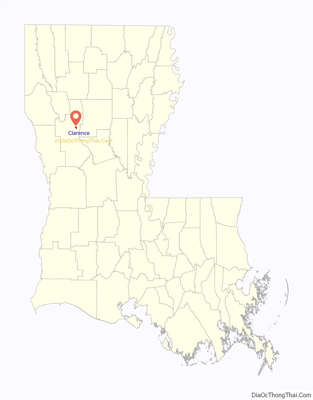
| County: | Natchitoches Parish |
| Total Area: | 1.58 sq mi (4.08 km²) |
| Land Area: | 1.57 sq mi (4.07 km²) |
| Water Area: | 0.00 sq mi (0.01 km²) |
| Total Population: | 326 |
| Population Density: | 207.38/sq mi (80.09/km²) |
| ZIP code: | 71414 |
| Area code: | 318 |
| FIPS code: | 2215745 |
Online Interactive Map
Click on ![]() to view map in "full screen" mode.
to view map in "full screen" mode.
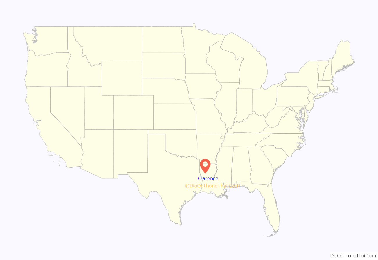
Clarence location map. Where is Clarence village?
History
The Harrisonburg Road or the Natchez Trace ran through the area as it crossed Louisiana into Texas to connect with the El Camino Real.
Clarence Road Map
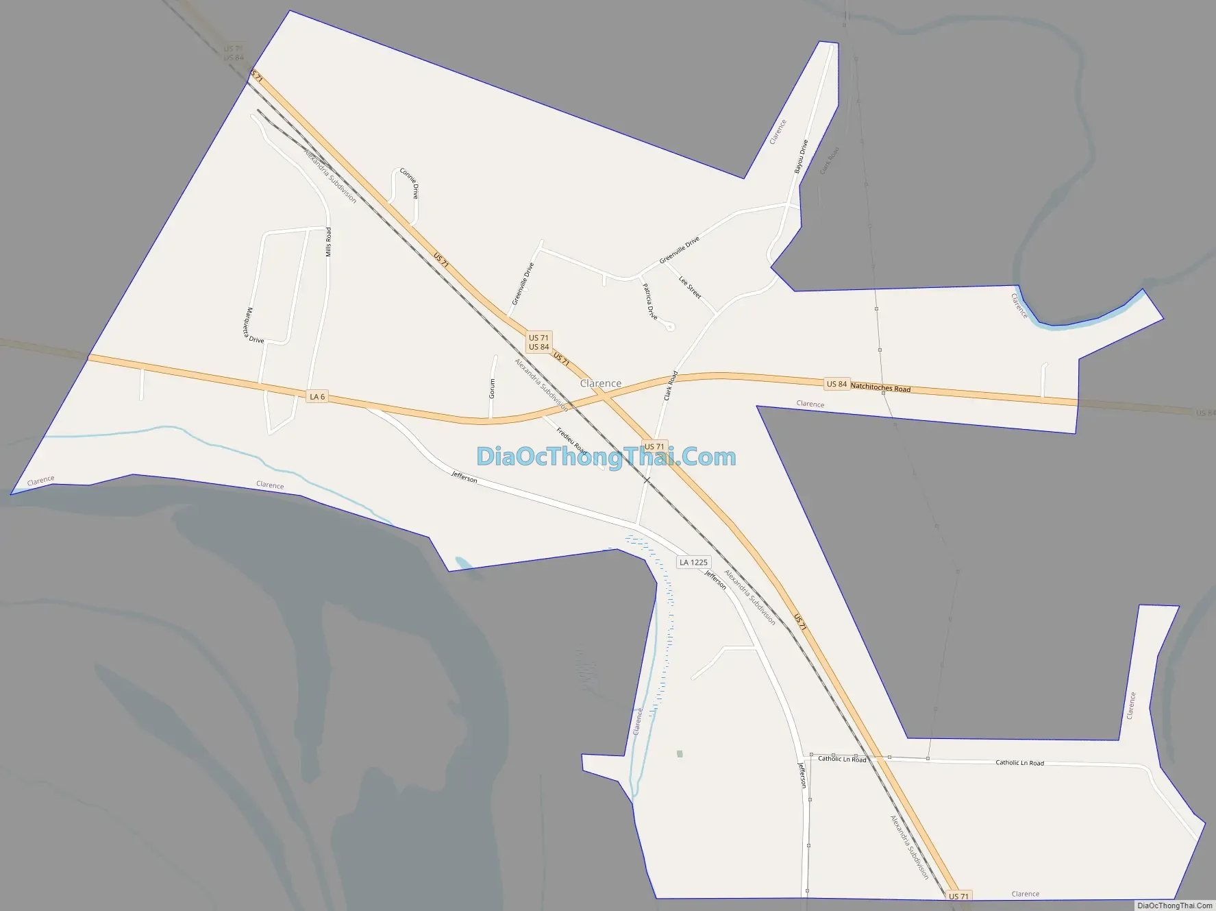
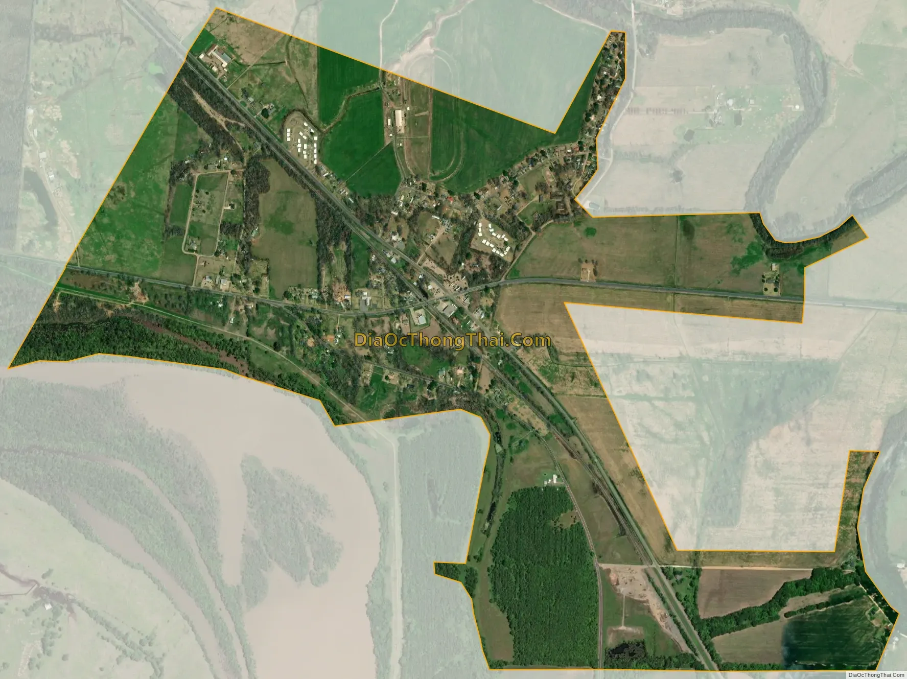
Clarence city Satellite Map
Geography
Clarence is located at 31°49′13″N 93°1′44″W / 31.82028°N 93.02889°W / 31.82028; -93.02889 (31.820143, −93.028773).
According to the United States Census Bureau, the village has a total area of 1.6 square miles (4.1 km), all land.
Climate
Climate is characterized by relatively high temperatures and evenly distributed precipitation throughout the year. The Köppen Climate Classification subtype for this climate is “Cfa”. (Humid Subtropical Climate).
See also
Map of Louisiana State and its subdivision:- Acadia
- Allen
- Ascension
- Assumption
- Avoyelles
- Beauregard
- Bienville
- Bossier
- Caddo
- Calcasieu
- Caldwell
- Cameron
- Catahoula
- Claiborne
- Concordia
- De Soto
- East Baton Rouge
- East Carroll
- East Feliciana
- Evangeline
- Franklin
- Grant
- Iberia
- Iberville
- Jackson
- Jefferson
- Jefferson Davis
- La Salle
- Lafayette
- Lafourche
- Lincoln
- Livingston
- Madison
- Morehouse
- Natchitoches
- Orleans
- Ouachita
- Plaquemines
- Pointe Coupee
- Rapides
- Red River
- Richland
- Sabine
- Saint Bernard
- Saint Charles
- Saint Helena
- Saint James
- Saint John the Baptist
- Saint Landry
- Saint Martin
- Saint Mary
- Saint Tammany
- Tangipahoa
- Tensas
- Terrebonne
- Union
- Vermilion
- Vernon
- Washington
- Webster
- West Baton Rouge
- West Carroll
- West Feliciana
- Winn
- Alabama
- Alaska
- Arizona
- Arkansas
- California
- Colorado
- Connecticut
- Delaware
- District of Columbia
- Florida
- Georgia
- Hawaii
- Idaho
- Illinois
- Indiana
- Iowa
- Kansas
- Kentucky
- Louisiana
- Maine
- Maryland
- Massachusetts
- Michigan
- Minnesota
- Mississippi
- Missouri
- Montana
- Nebraska
- Nevada
- New Hampshire
- New Jersey
- New Mexico
- New York
- North Carolina
- North Dakota
- Ohio
- Oklahoma
- Oregon
- Pennsylvania
- Rhode Island
- South Carolina
- South Dakota
- Tennessee
- Texas
- Utah
- Vermont
- Virginia
- Washington
- West Virginia
- Wisconsin
- Wyoming