Elton is a town in Jefferson Davis Parish, Louisiana, United States. The population was 992 at the 2020 census, down from 1,128 at the 2010 census. It is part of the Jennings Micropolitan Statistical Area.
| Name: | Elton town |
|---|---|
| LSAD Code: | 43 |
| LSAD Description: | town (suffix) |
| State: | Louisiana |
| County: | Jefferson Davis Parish |
| Elevation: | 49 ft (15 m) |
| Total Area: | 1.66 sq mi (4.30 km²) |
| Land Area: | 1.66 sq mi (4.30 km²) |
| Water Area: | 0.00 sq mi (0.00 km²) |
| Total Population: | 992 |
| Population Density: | 597.23/sq mi (230.60/km²) |
| Area code: | 337 |
| FIPS code: | 2223620 |
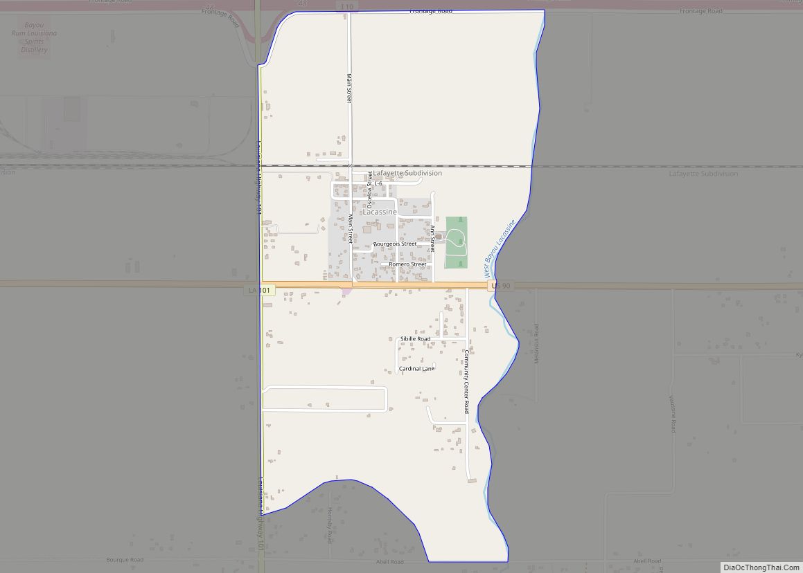
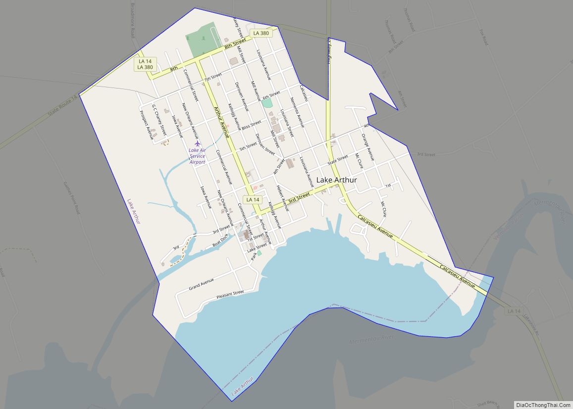
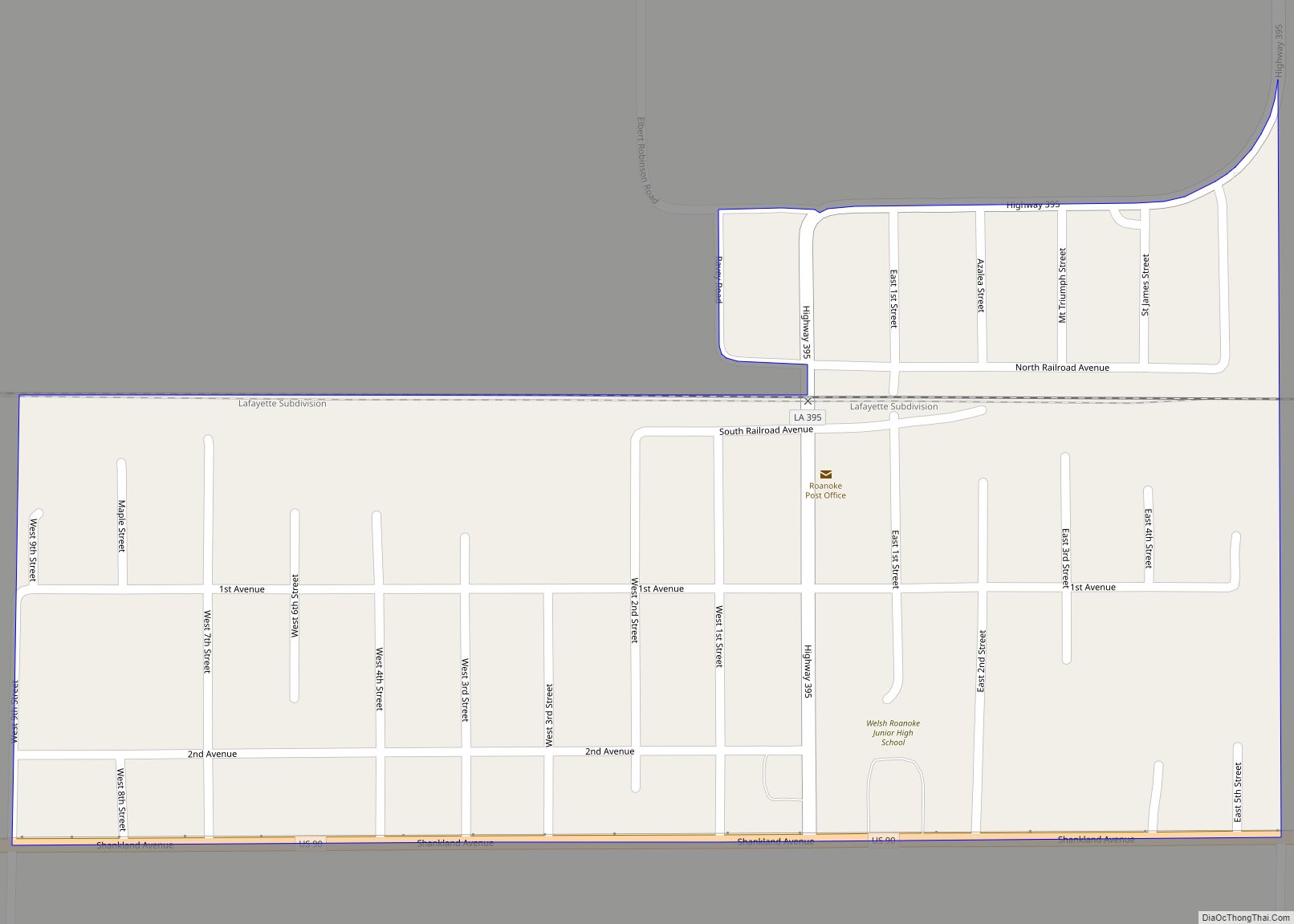
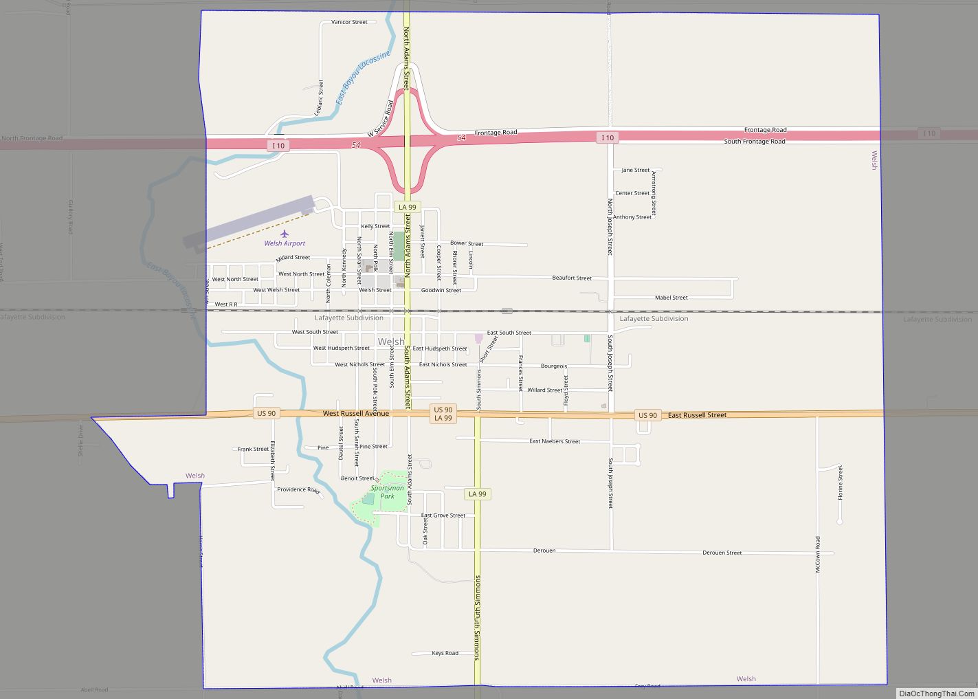
Online Interactive Map
Click on ![]() to view map in "full screen" mode.
to view map in "full screen" mode.
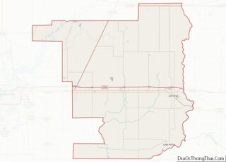
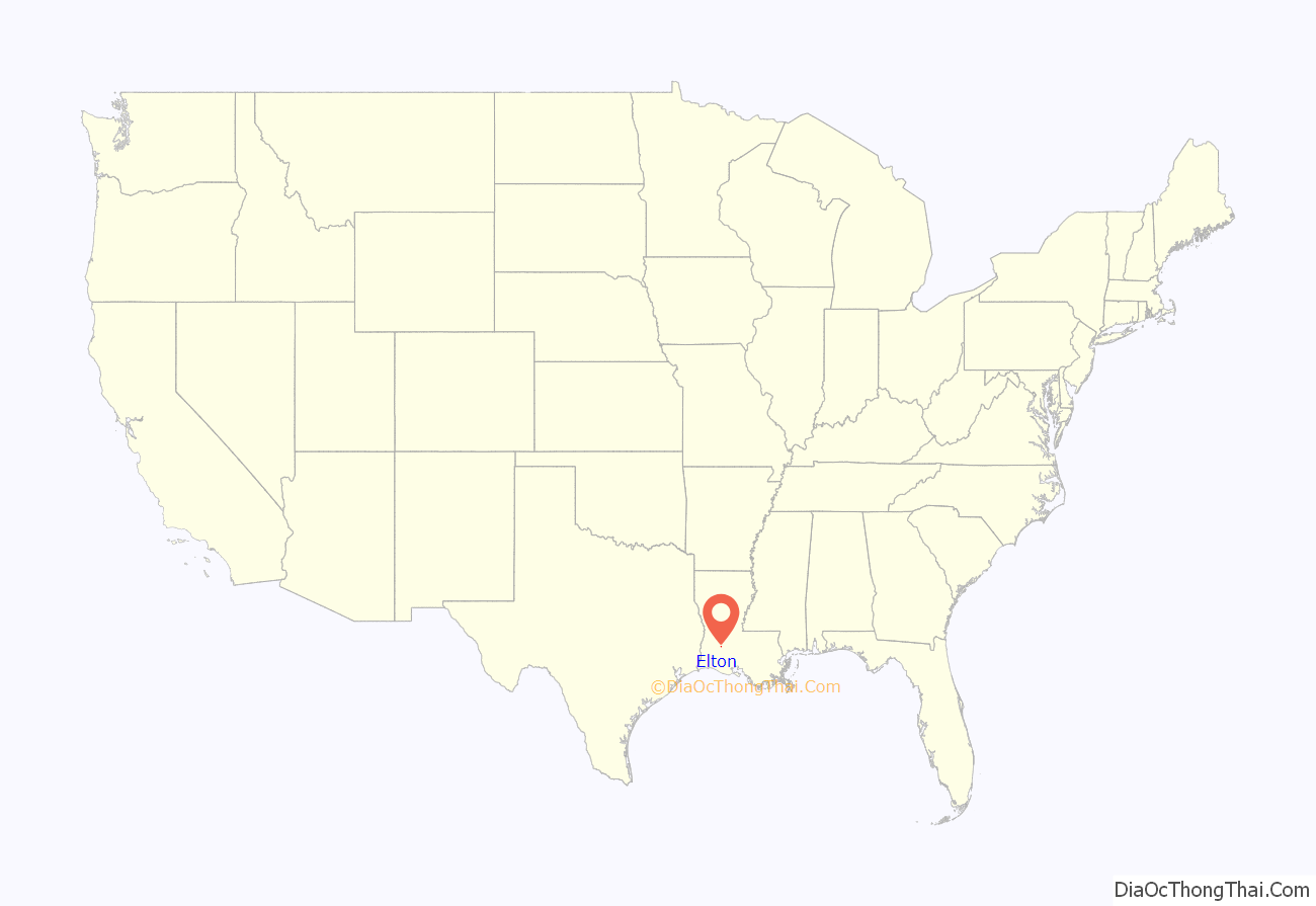
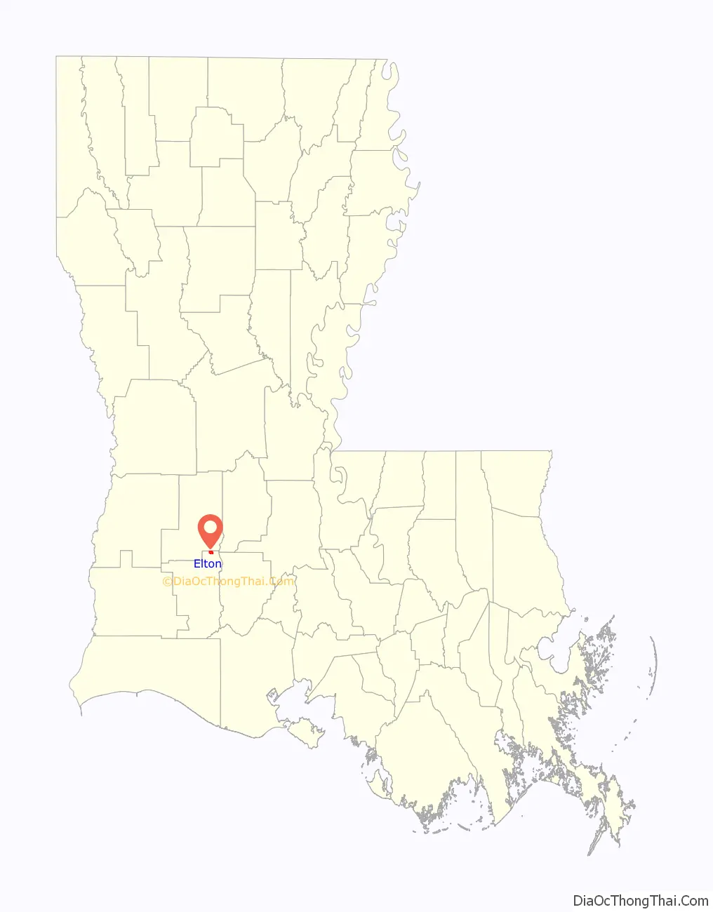
Elton location map. Where is Elton town?
History
The wife of pioneer settler J. M. Henderson is said to have chosen the name “Elton” for her home town from a book in which she read of an English town named Elton. That was probably the town on the northwest coast of England in County Durham near Middlesbrough. Elton, Louisiana, was incorporated as a village in 1911.
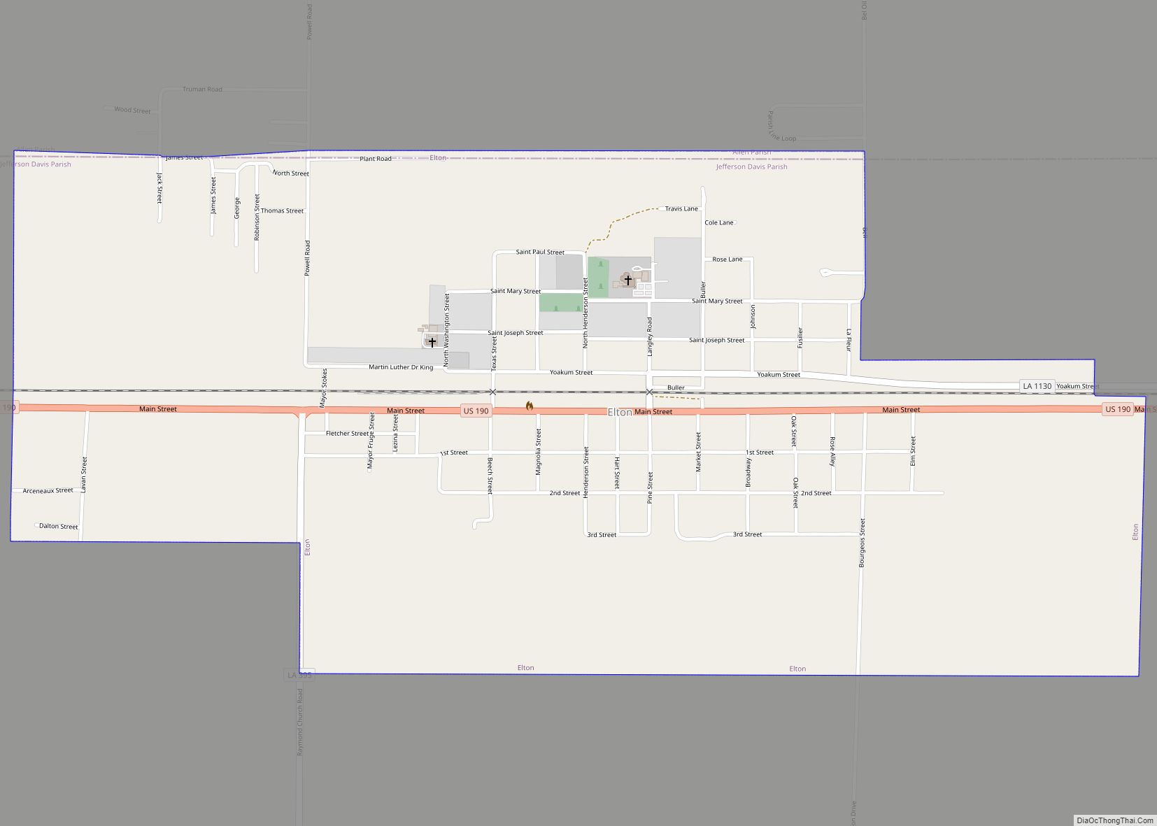
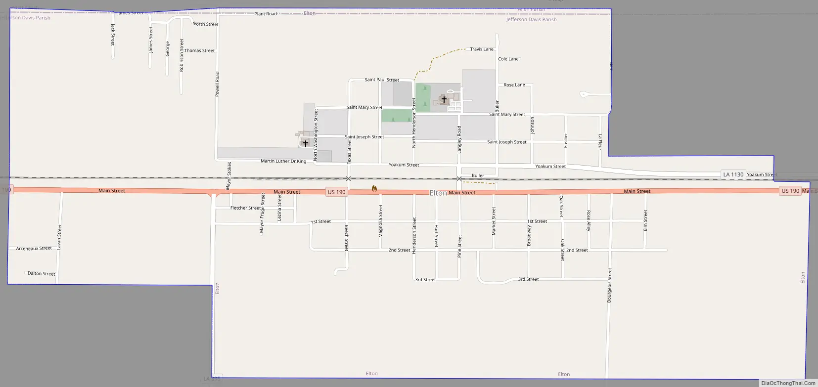
Elton Road Map
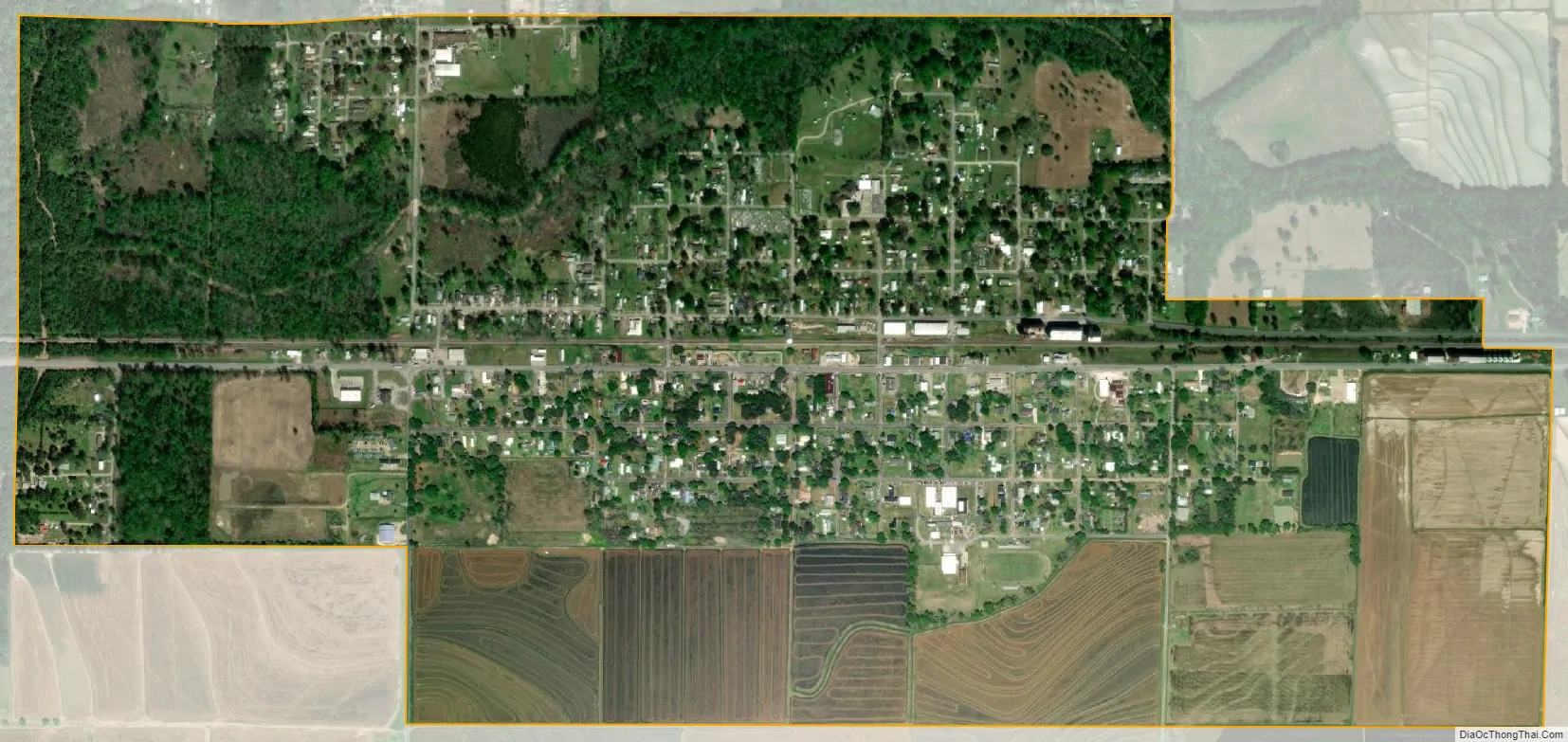
Elton city Satellite Map
Geography
Elton is in northeast Jefferson Davis Parish and is bordered to the north by Allen Parish. U.S. Route 190 passes through the town, leading east 16 miles (26 km) to Eunice and west 9 miles (14 km) to Kinder. Jennings, the Jefferson Davis Parish seat, is 26 miles (42 km) to the south of Elton via Louisiana Highway 26.
According to the United States Census Bureau, the town of Elton has a total area of 1.7 square miles (4.3 km), all land.
See also
Map of Louisiana State and its subdivision:- Acadia
- Allen
- Ascension
- Assumption
- Avoyelles
- Beauregard
- Bienville
- Bossier
- Caddo
- Calcasieu
- Caldwell
- Cameron
- Catahoula
- Claiborne
- Concordia
- De Soto
- East Baton Rouge
- East Carroll
- East Feliciana
- Evangeline
- Franklin
- Grant
- Iberia
- Iberville
- Jackson
- Jefferson
- Jefferson Davis
- La Salle
- Lafayette
- Lafourche
- Lincoln
- Livingston
- Madison
- Morehouse
- Natchitoches
- Orleans
- Ouachita
- Plaquemines
- Pointe Coupee
- Rapides
- Red River
- Richland
- Sabine
- Saint Bernard
- Saint Charles
- Saint Helena
- Saint James
- Saint John the Baptist
- Saint Landry
- Saint Martin
- Saint Mary
- Saint Tammany
- Tangipahoa
- Tensas
- Terrebonne
- Union
- Vermilion
- Vernon
- Washington
- Webster
- West Baton Rouge
- West Carroll
- West Feliciana
- Winn
- Alabama
- Alaska
- Arizona
- Arkansas
- California
- Colorado
- Connecticut
- Delaware
- District of Columbia
- Florida
- Georgia
- Hawaii
- Idaho
- Illinois
- Indiana
- Iowa
- Kansas
- Kentucky
- Louisiana
- Maine
- Maryland
- Massachusetts
- Michigan
- Minnesota
- Mississippi
- Missouri
- Montana
- Nebraska
- Nevada
- New Hampshire
- New Jersey
- New Mexico
- New York
- North Carolina
- North Dakota
- Ohio
- Oklahoma
- Oregon
- Pennsylvania
- Rhode Island
- South Carolina
- South Dakota
- Tennessee
- Texas
- Utah
- Vermont
- Virginia
- Washington
- West Virginia
- Wisconsin
- Wyoming