Eunice is a city in Acadia and St. Landry parishes in the U.S. state of Louisiana. The 2010 census placed the population at 10,398, a decrease of 1,101, or 9.5 percent, from the 2000 tabulation of 11,499.
The St. Landry Parish portion of Eunice is part of the Opelousas–Eunice Micropolitan Statistical Area, while the Acadia Parish portion is part of the Crowley Micropolitan Statistical Area.
| Name: | Eunice city |
|---|---|
| LSAD Code: | 25 |
| LSAD Description: | city (suffix) |
| State: | Louisiana |
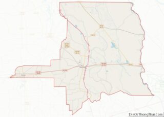
| County: | Acadia Parish, St. Landry Parish |
| Elevation: | 49 ft (15 m) |
| Total Area: | 5.14 sq mi (13.31 km²) |
| Land Area: | 5.14 sq mi (13.31 km²) |
| Water Area: | 0.00 sq mi (0.00 km²) |
| Total Population: | 9,422 |
| Population Density: | 1,833.79/sq mi (708.09/km²) |
| ZIP code: | 70535 |
| Area code: | 337 |
| FIPS code: | 2224565 |
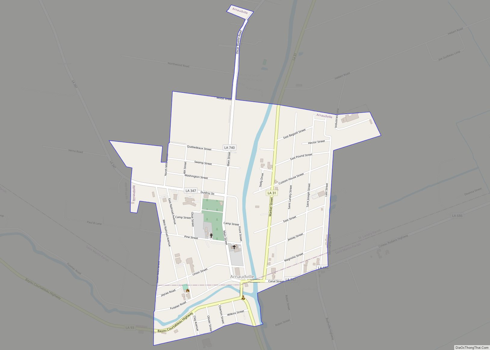
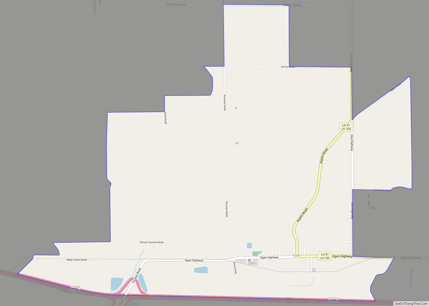
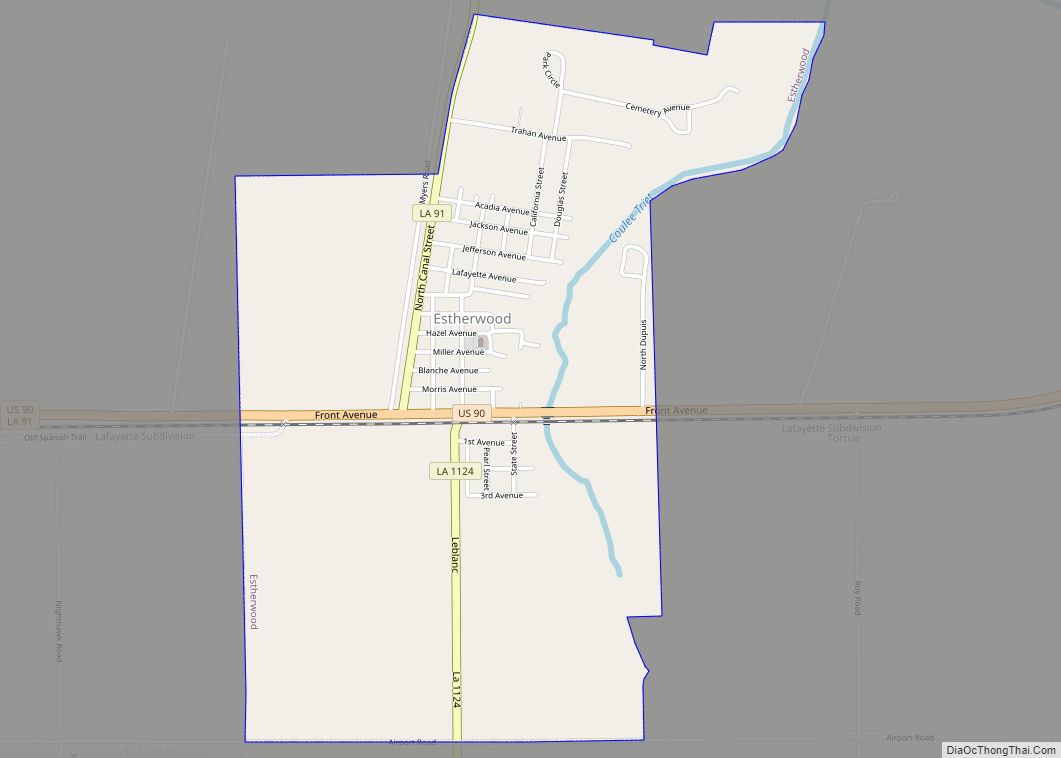
Online Interactive Map
Click on ![]() to view map in "full screen" mode.
to view map in "full screen" mode.
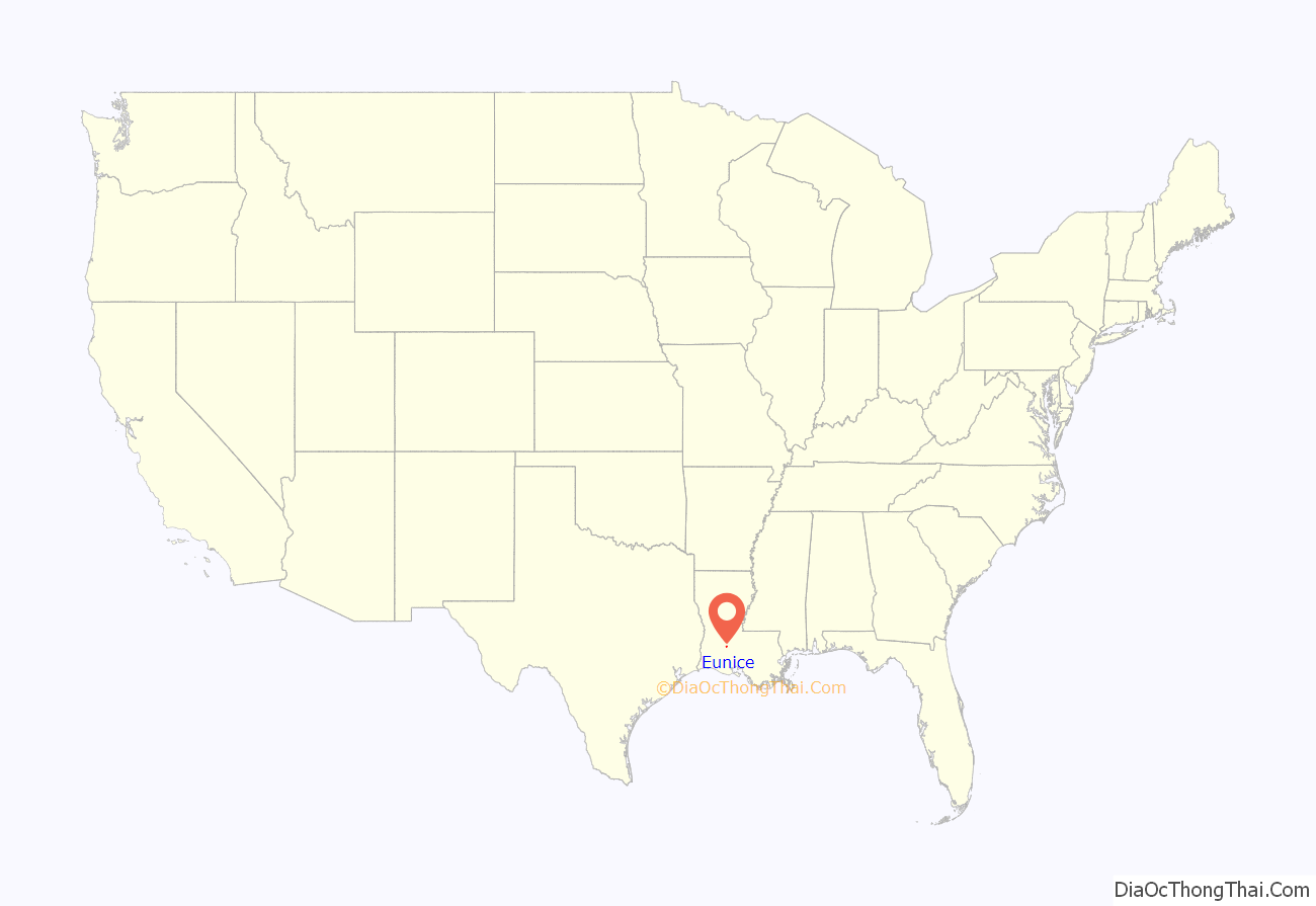
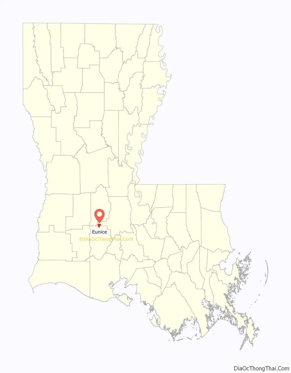
Eunice location map. Where is Eunice city?
History
One-time lawman and pioneer land developer C.C. Duson is credited with founding Eunice, which was named for his second wife, Eunice Pharr Duson. He and his brother, W.W. Duson, had already founded Crowley, Louisiana in 1887, and now he looked to the north of the parish for future development. Duson bought 160 acres (0.65 km) of land from Willie Humble of Prairie Faquetaïque and mapped out a town site, laid out in lots 50-by-140 feet, 12 lots to the block. Next, he persuaded the Southern Pacific Railroad to extend a branch line from Crowley to his new town. Then he began what he and his brother had learned how to do as well as anyone: promote land sales. It was chartered as a village on September 12, 1894, and incorporated as a town on June 4, 1895.
Evangeline Parish was created with the passage of a bill in June 1908. Eunice and Ville Platte were in competition for the parish seat, and Ville Platte was selected by voters on April 12, 1909. After the election, Eunice declared it would remain in St. Landry Parish.
In May 2000 a chemical freight train derailed in Eunice, spilling numerous hazardous chemicals and causing about 15 tank cars to explode and burn; approximately 3,500 residents of the town were evacuated for as many as five days. Over 10,000 residents settled in May 2004 for $65 million with the Union Pacific Corporation in a class action suit, claiming that the corporation had failed to repair a defective section of track.
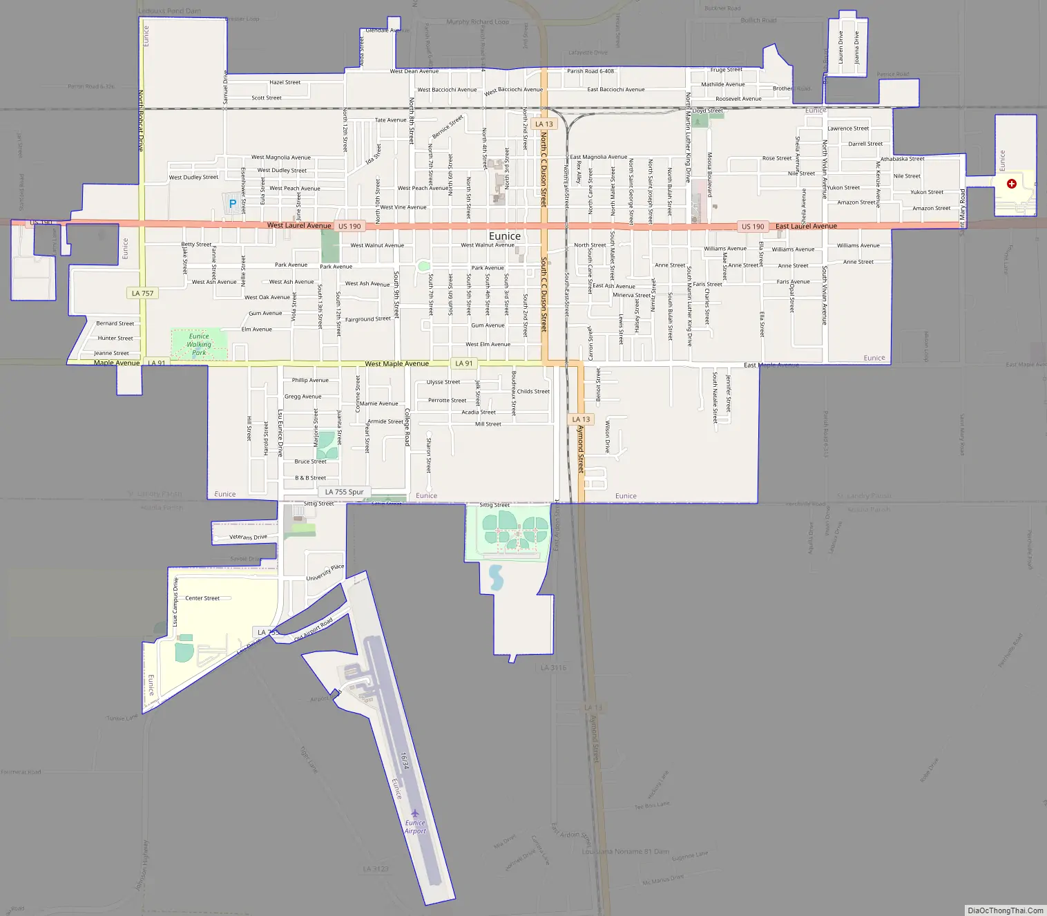
Eunice Road Map
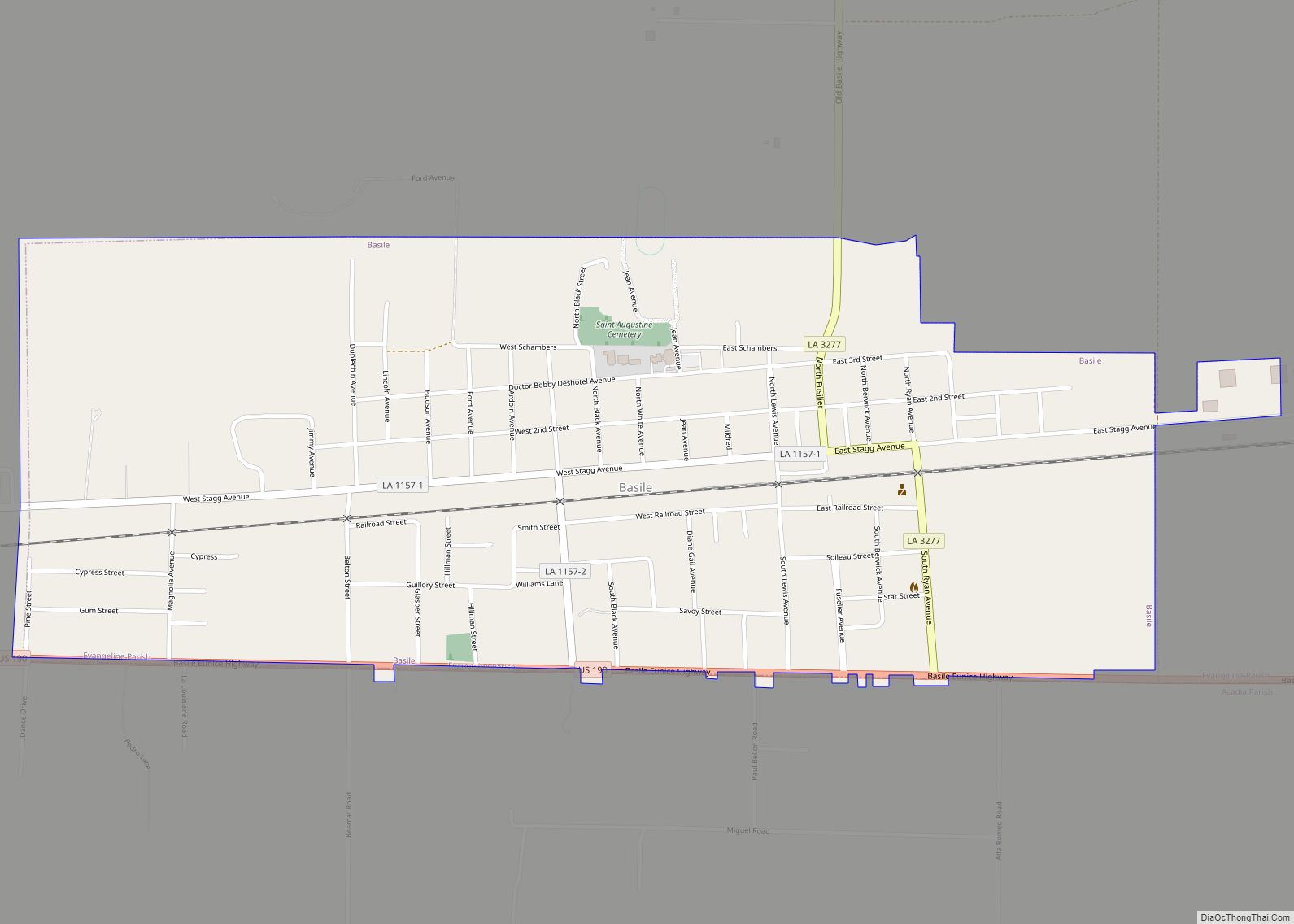
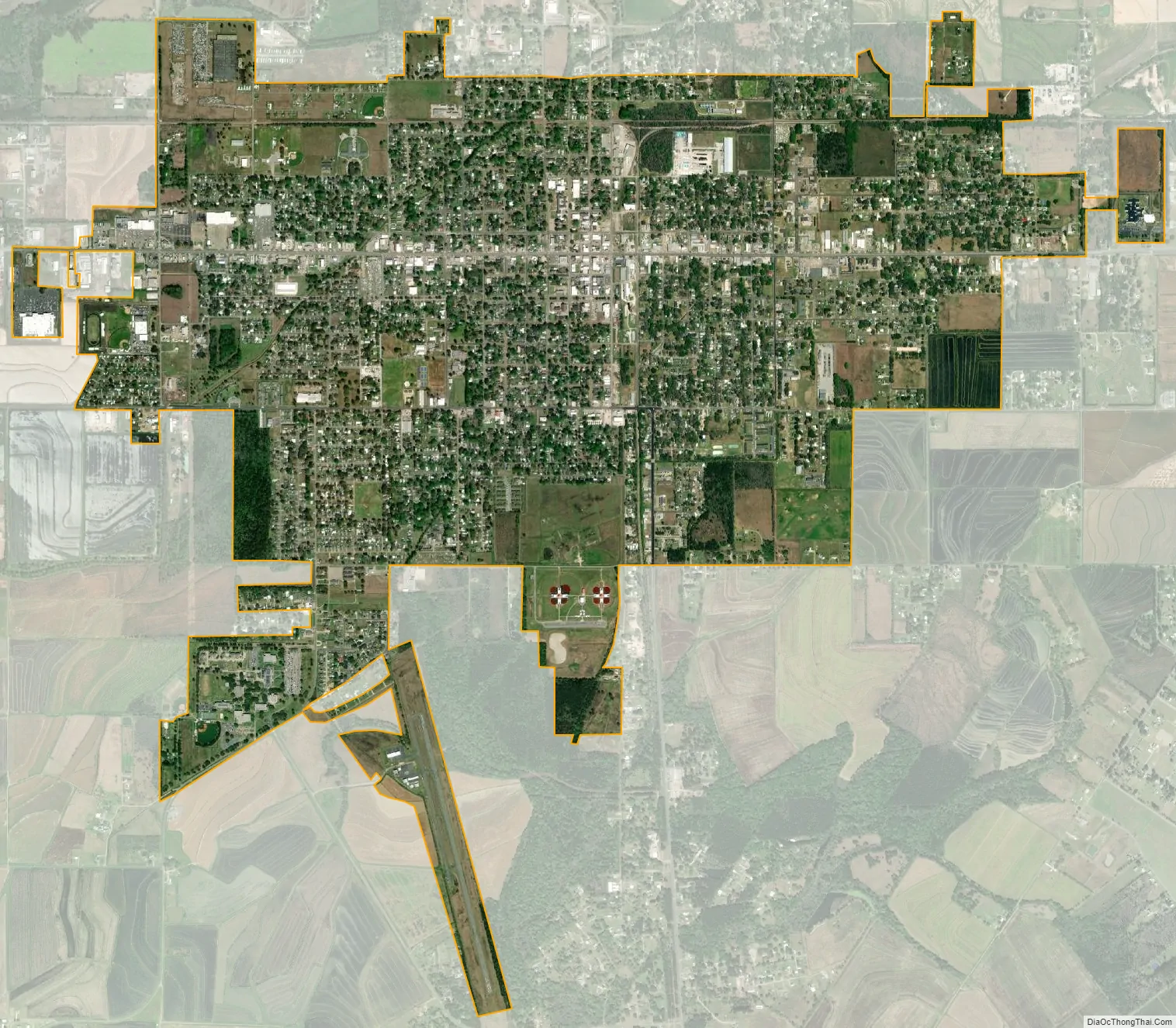
Eunice city Satellite Map
Geography
According to the United States Census Bureau, the city has a total area of 4.7 square miles (12.1 km), all land.
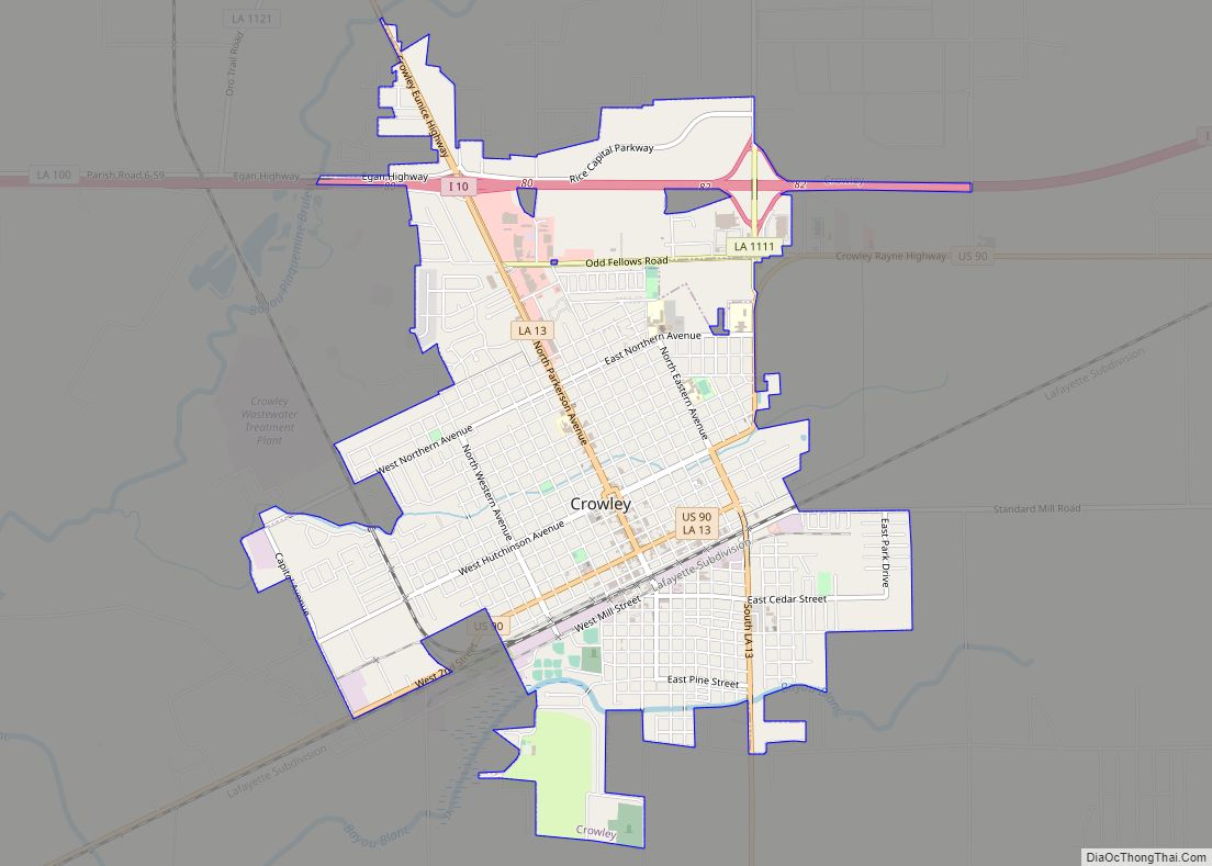
Louisiana Highway 13 and U.S. Highway 190 pass through the center of Eunice with U.S. 190 heading west 26 miles (42 km) to Kinder and east 21 miles (34 km) to Opelousas, the seat of St. Landry Parish. LA-13 heads north 11 miles (18 km) to Mamou and south 20 miles (32 km) to Crowley, the seat of Acadia Parish.
Climate
The climate in this area is characterized by hot, humid summers and generally mild to cool winters. According to the Köppen Climate Classification system, Eunice has a humid subtropical climate, abbreviated “Cfa” on climate maps.
Parish
Eunice is in parts of three parishes, St. Landry, Acadia and Evangeline. Thus the names of certain businesses in Eunice, such as Tri-Parish Bank. Most of the Evangeline Parish portion of Eunice is unincorporated.
St. Landry
Most of the city limits are located in St. Landry parish. This was one of the original parishes in Louisiana.
Acadia Parish
Acadia to the south actually borders most of the southern city limits, in a close west to east parallel line, with Sittig Street in the center, parish road 7-23 to the east, and both just inside the St. Landry Parish. On the west side the city limits drops south following highway 755 south and includes the airport, the Louisiana State University Eunice campus, as well as the streets around the campus. Acadia Parish also succeeded from the parish of St. Landry.
See also
Map of Louisiana State and its subdivision:- Acadia
- Allen
- Ascension
- Assumption
- Avoyelles
- Beauregard
- Bienville
- Bossier
- Caddo
- Calcasieu
- Caldwell
- Cameron
- Catahoula
- Claiborne
- Concordia
- De Soto
- East Baton Rouge
- East Carroll
- East Feliciana
- Evangeline
- Franklin
- Grant
- Iberia
- Iberville
- Jackson
- Jefferson
- Jefferson Davis
- La Salle
- Lafayette
- Lafourche
- Lincoln
- Livingston
- Madison
- Morehouse
- Natchitoches
- Orleans
- Ouachita
- Plaquemines
- Pointe Coupee
- Rapides
- Red River
- Richland
- Sabine
- Saint Bernard
- Saint Charles
- Saint Helena
- Saint James
- Saint John the Baptist
- Saint Landry
- Saint Martin
- Saint Mary
- Saint Tammany
- Tangipahoa
- Tensas
- Terrebonne
- Union
- Vermilion
- Vernon
- Washington
- Webster
- West Baton Rouge
- West Carroll
- West Feliciana
- Winn
- Alabama
- Alaska
- Arizona
- Arkansas
- California
- Colorado
- Connecticut
- Delaware
- District of Columbia
- Florida
- Georgia
- Hawaii
- Idaho
- Illinois
- Indiana
- Iowa
- Kansas
- Kentucky
- Louisiana
- Maine
- Maryland
- Massachusetts
- Michigan
- Minnesota
- Mississippi
- Missouri
- Montana
- Nebraska
- Nevada
- New Hampshire
- New Jersey
- New Mexico
- New York
- North Carolina
- North Dakota
- Ohio
- Oklahoma
- Oregon
- Pennsylvania
- Rhode Island
- South Carolina
- South Dakota
- Tennessee
- Texas
- Utah
- Vermont
- Virginia
- Washington
- West Virginia
- Wisconsin
- Wyoming