Fisher is a village in Sabine Parish, Louisiana, United States. The population was 230 at the 2010 census, down from 268 in 2000.
| Name: | Fisher village |
|---|---|
| LSAD Code: | 47 |
| LSAD Description: | village (suffix) |
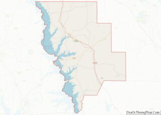
| State: | Louisiana |
| County: | Sabine Parish |
| Elevation: | 344 ft (105 m) |
| Total Area: | 0.62 sq mi (1.60 km²) |
| Land Area: | 0.62 sq mi (1.60 km²) |
| Water Area: | 0.00 sq mi (0.00 km²) |
| Total Population: | 197 |
| Population Density: | 319.81/sq mi (123.42/km²) |
| Area code: | 318 |
| FIPS code: | 2225615 |
| Website: | www.toledobendlakecountry.com |
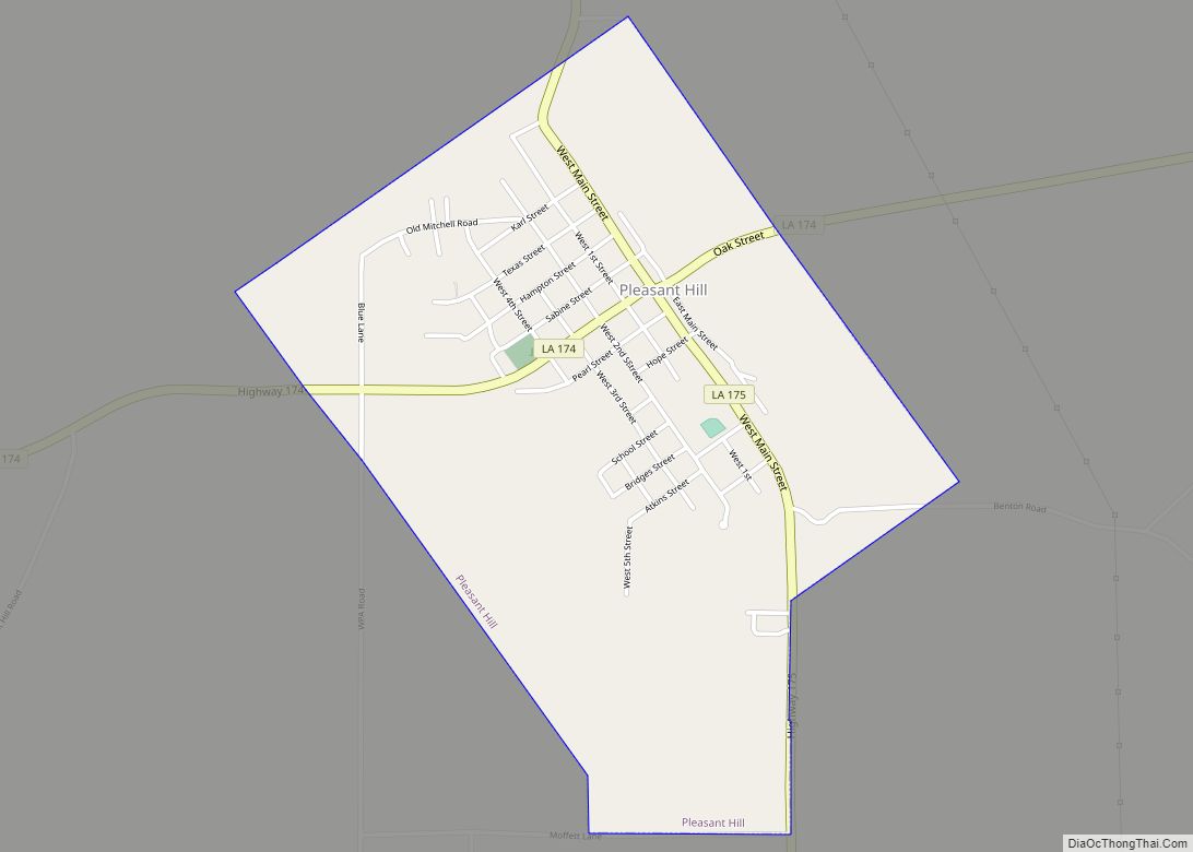
Online Interactive Map
Click on ![]() to view map in "full screen" mode.
to view map in "full screen" mode.
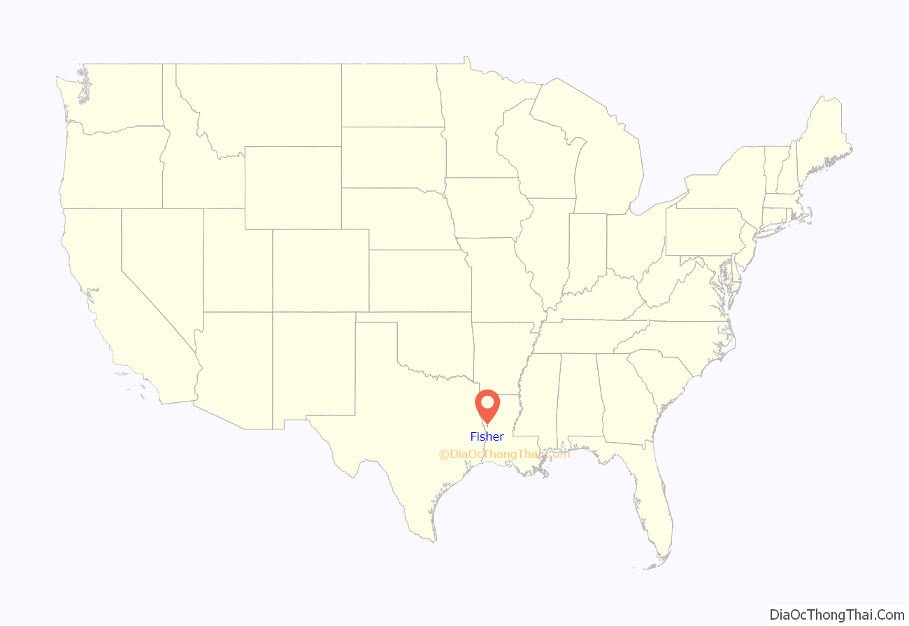
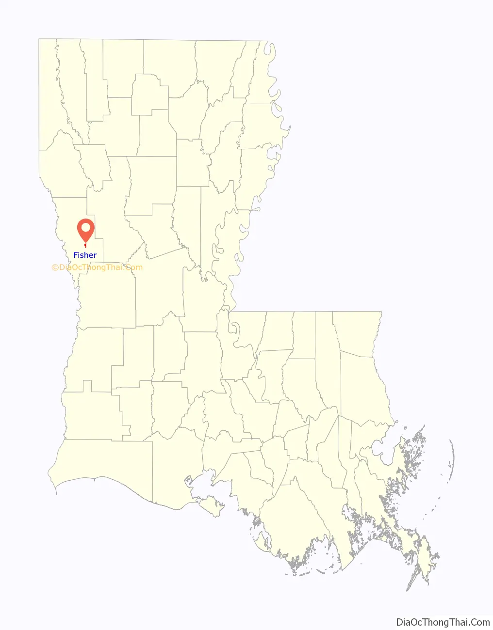
Fisher location map. Where is Fisher village?
History
Fisher was named for Oliver Williams Fisher and built between 1899 and 1901 by the Louisiana Long Leaf Lumber Company. It remained a company-owned sawmill town until it was sold to Boise Cascade Corporation in 1966.
Former Louisiana State Representative Cliff Ammons was the principal of Fisher High School in the late 1940s.
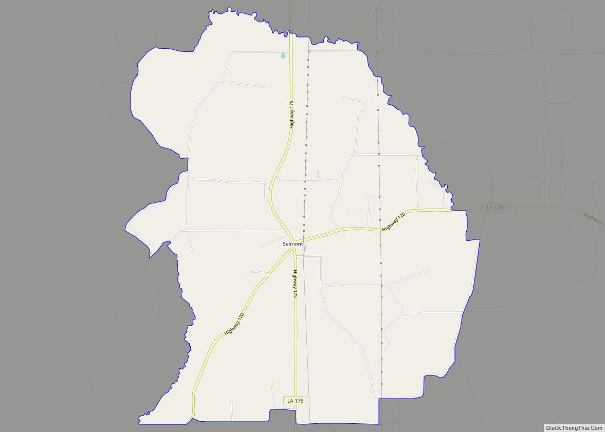
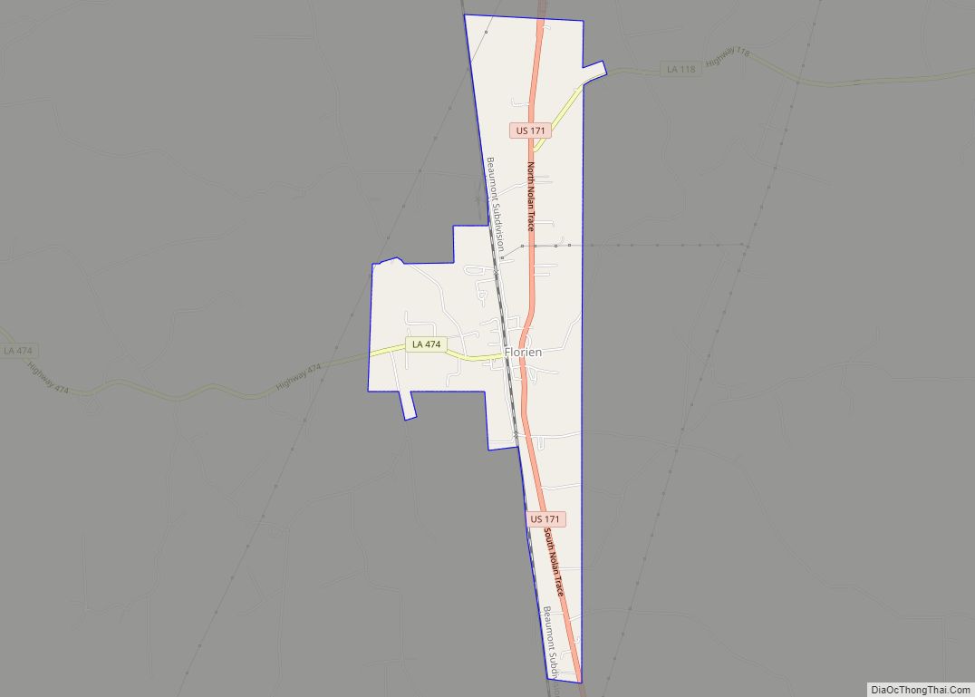
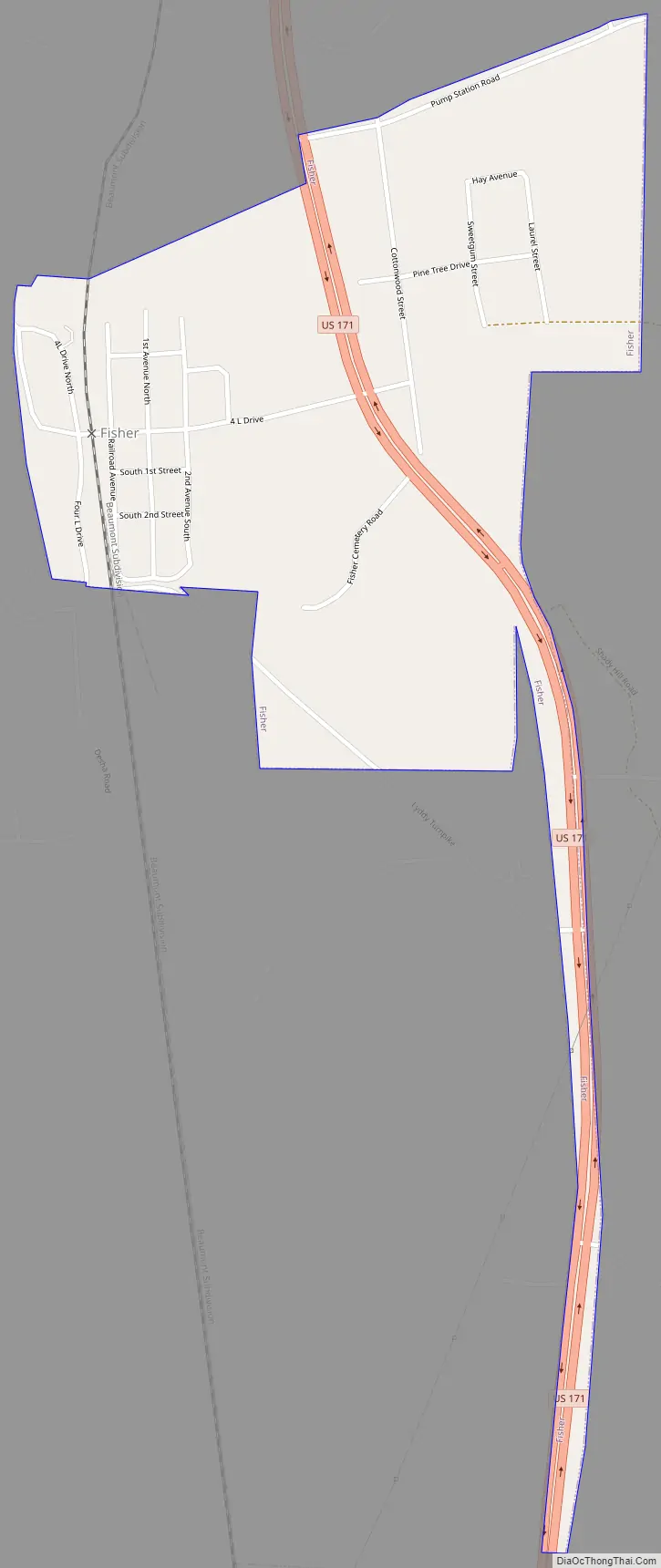
Fisher Road Map
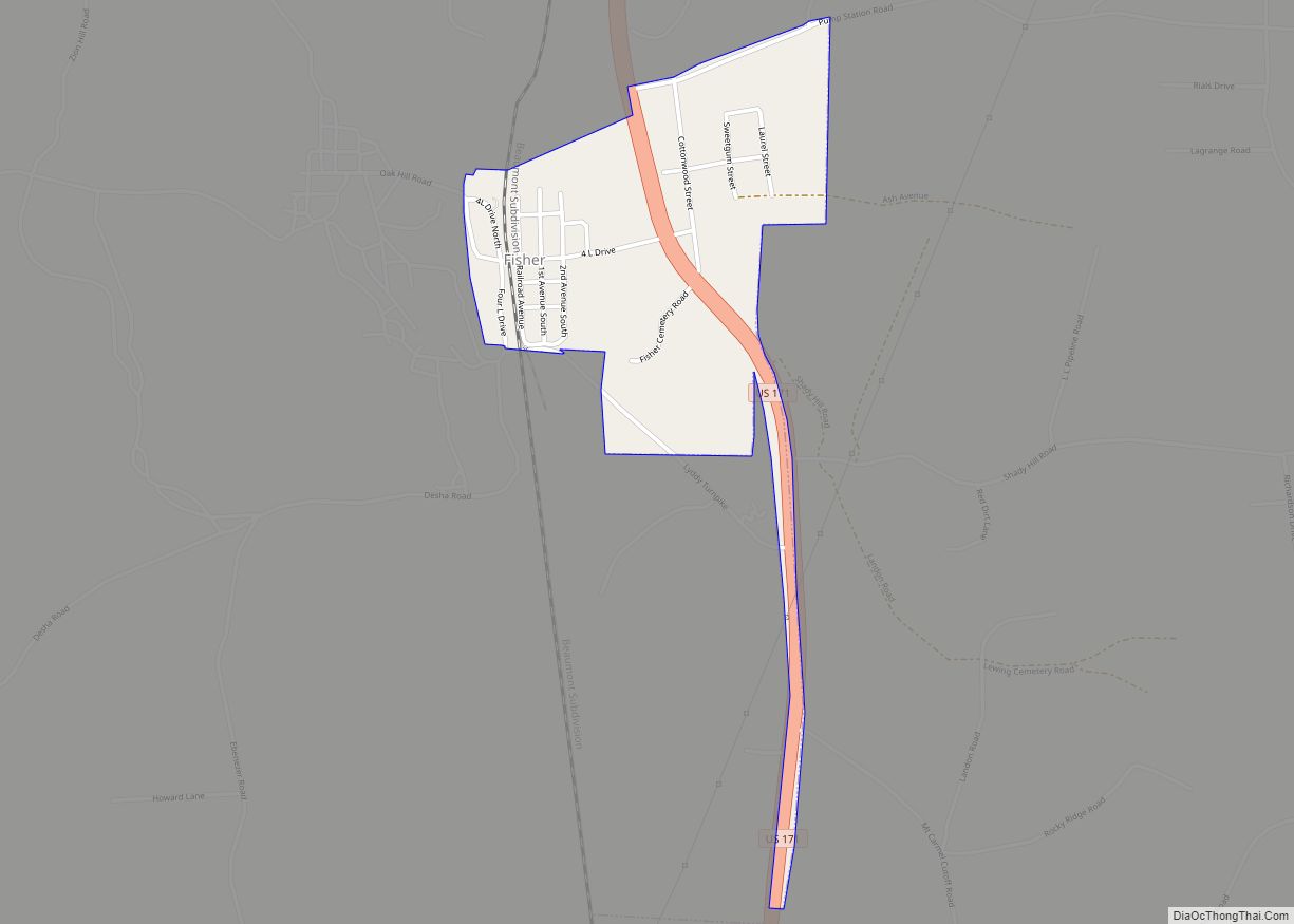
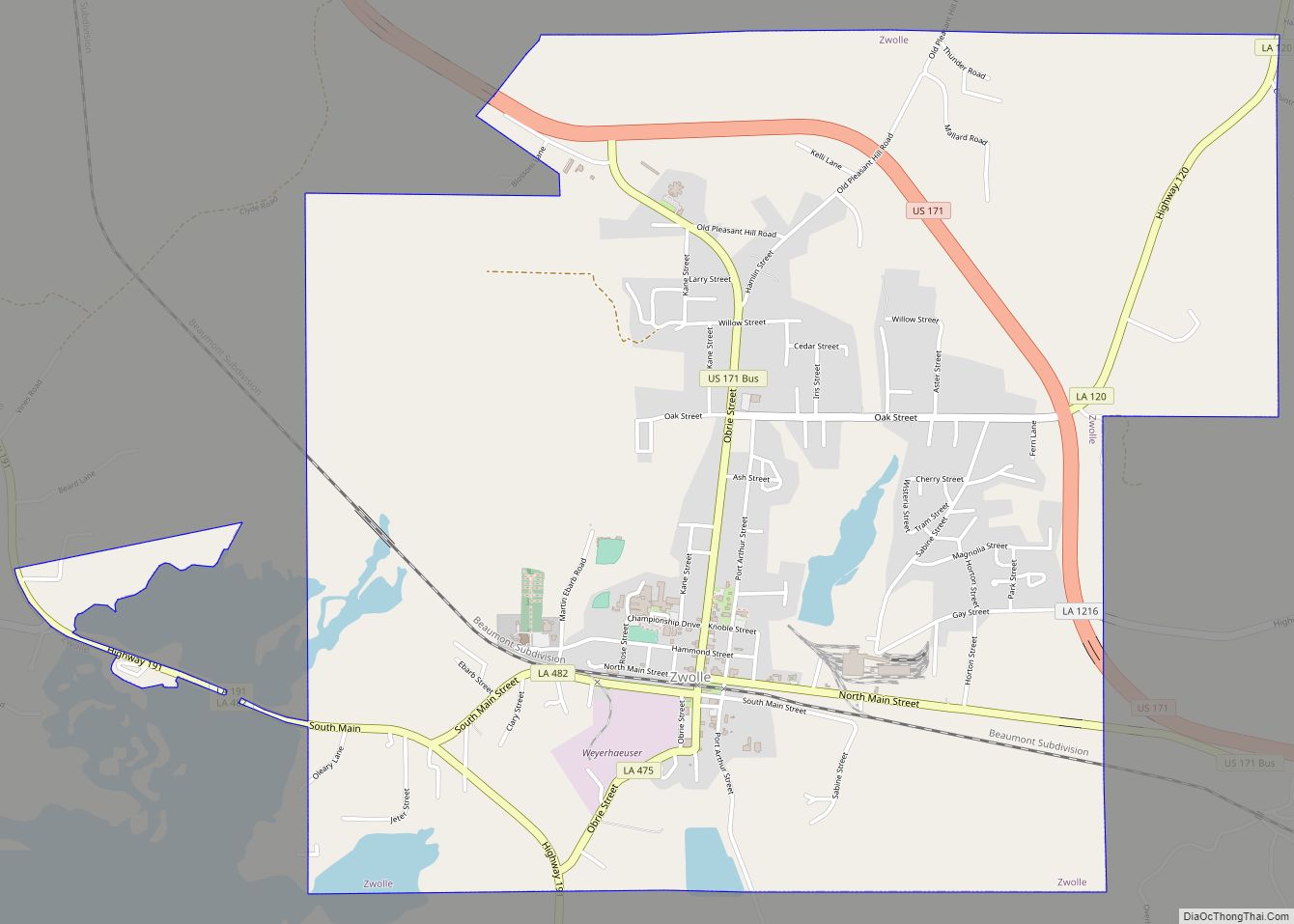
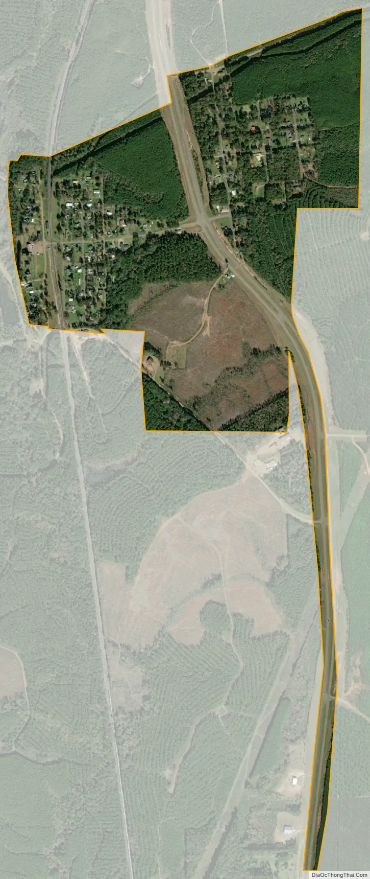
Fisher city Satellite Map
Geography
Fisher is located at 31°29′28″N 93°27′38″W / 31.49111°N 93.46056°W / 31.49111; -93.46056 (31.491157, -93.460599).
According to the United States Census Bureau, the village has a total area of 0.6 square miles (1.6 km), all land.
See also
Map of Louisiana State and its subdivision:- Acadia
- Allen
- Ascension
- Assumption
- Avoyelles
- Beauregard
- Bienville
- Bossier
- Caddo
- Calcasieu
- Caldwell
- Cameron
- Catahoula
- Claiborne
- Concordia
- De Soto
- East Baton Rouge
- East Carroll
- East Feliciana
- Evangeline
- Franklin
- Grant
- Iberia
- Iberville
- Jackson
- Jefferson
- Jefferson Davis
- La Salle
- Lafayette
- Lafourche
- Lincoln
- Livingston
- Madison
- Morehouse
- Natchitoches
- Orleans
- Ouachita
- Plaquemines
- Pointe Coupee
- Rapides
- Red River
- Richland
- Sabine
- Saint Bernard
- Saint Charles
- Saint Helena
- Saint James
- Saint John the Baptist
- Saint Landry
- Saint Martin
- Saint Mary
- Saint Tammany
- Tangipahoa
- Tensas
- Terrebonne
- Union
- Vermilion
- Vernon
- Washington
- Webster
- West Baton Rouge
- West Carroll
- West Feliciana
- Winn
- Alabama
- Alaska
- Arizona
- Arkansas
- California
- Colorado
- Connecticut
- Delaware
- District of Columbia
- Florida
- Georgia
- Hawaii
- Idaho
- Illinois
- Indiana
- Iowa
- Kansas
- Kentucky
- Louisiana
- Maine
- Maryland
- Massachusetts
- Michigan
- Minnesota
- Mississippi
- Missouri
- Montana
- Nebraska
- Nevada
- New Hampshire
- New Jersey
- New Mexico
- New York
- North Carolina
- North Dakota
- Ohio
- Oklahoma
- Oregon
- Pennsylvania
- Rhode Island
- South Carolina
- South Dakota
- Tennessee
- Texas
- Utah
- Vermont
- Virginia
- Washington
- West Virginia
- Wisconsin
- Wyoming