Loreauville is a village in Iberia Parish in the U.S. state of Louisiana. The population was 887 at the 2010 census, down from 938 at the 2000 census. It is part of the New Iberia micropolitan statistical area, and the Lafayette metropolitan statistical area.
| Name: | Loreauville village |
|---|---|
| LSAD Code: | 47 |
| LSAD Description: | village (suffix) |
| State: | Louisiana |
| County: | Iberia Parish |
| Elevation: | 20 ft (6 m) |
| Total Area: | 0.45 sq mi (1.17 km²) |
| Land Area: | 0.45 sq mi (1.15 km²) |
| Water Area: | 0.01 sq mi (0.02 km²) |
| Total Population: | 658 |
| Population Density: | 1,475.34/sq mi (570.03/km²) |
| ZIP code: | 70552 |
| Area code: | 337 |
| FIPS code: | 2245670 |
| Website: | www.loreauville.us |
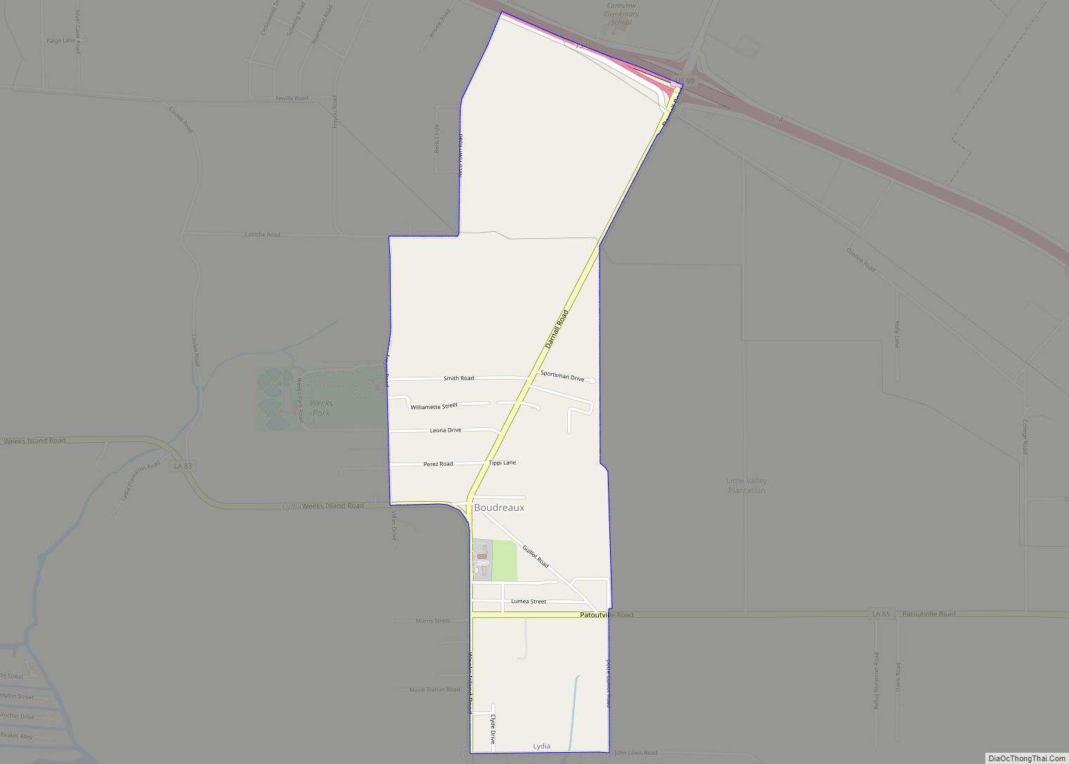
Online Interactive Map
Click on ![]() to view map in "full screen" mode.
to view map in "full screen" mode.
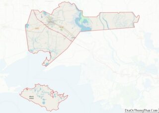
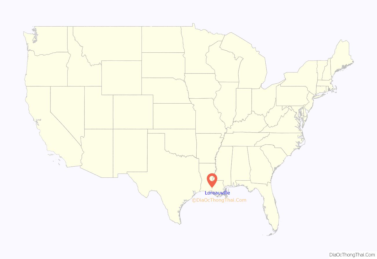
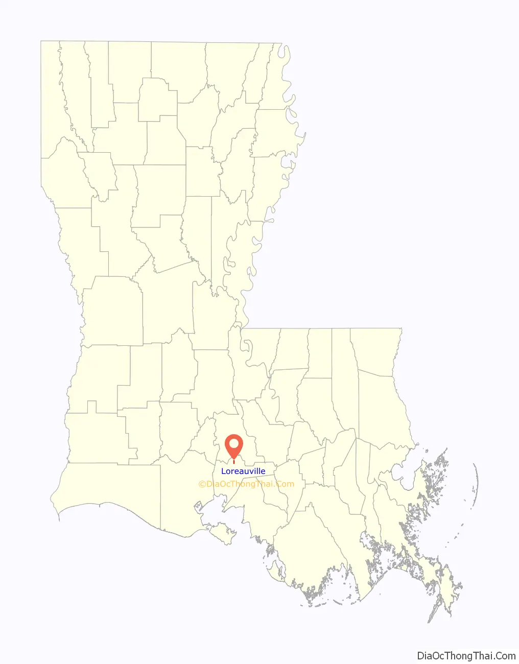
Loreauville location map. Where is Loreauville village?
History
Loreauville was initially called “Fausse Pointe”, then “Dugasville” after the Dugas family, who opened a trading post at the site. The name was changed to “Picouville” when a Picou family member donated land to build a chapel.
On April 15, 1871, the name was changed from Picouville to Loreauville for Ozaire Loreau, who had contributed the property for the old Catholic church and cemetery, and had also aided in the agricultural, industrial and political growth of the village.
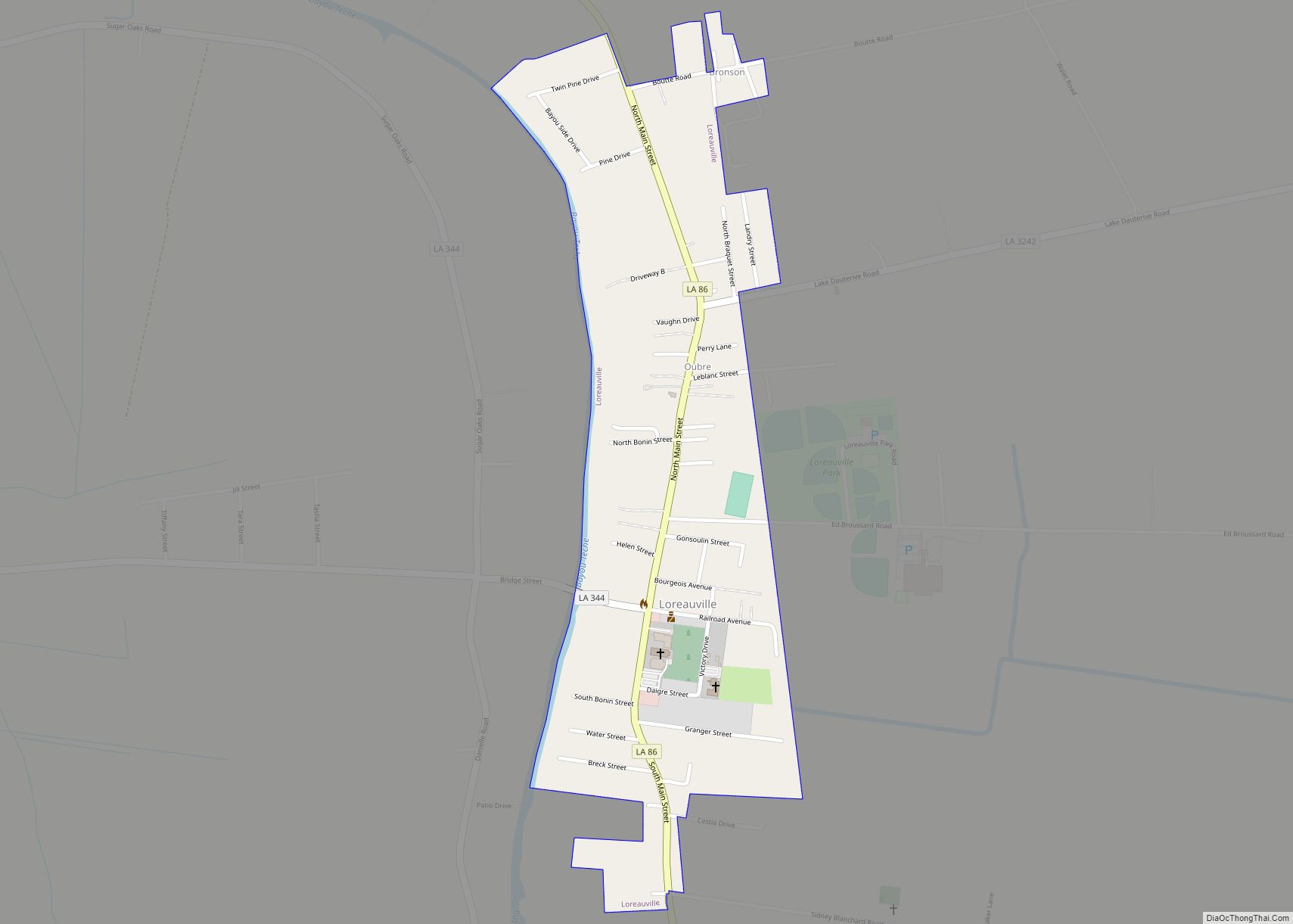
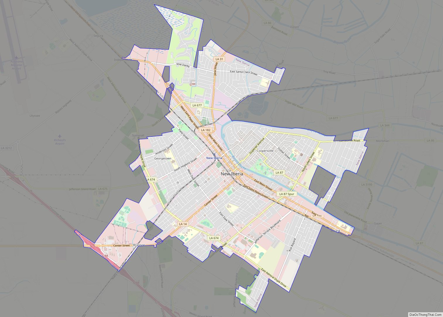
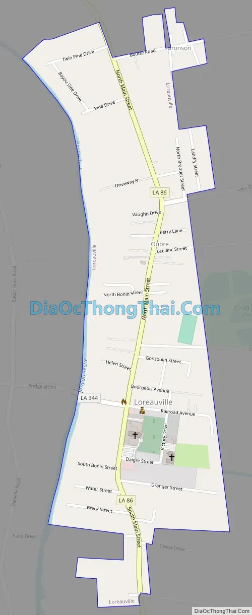
Loreauville Road Map
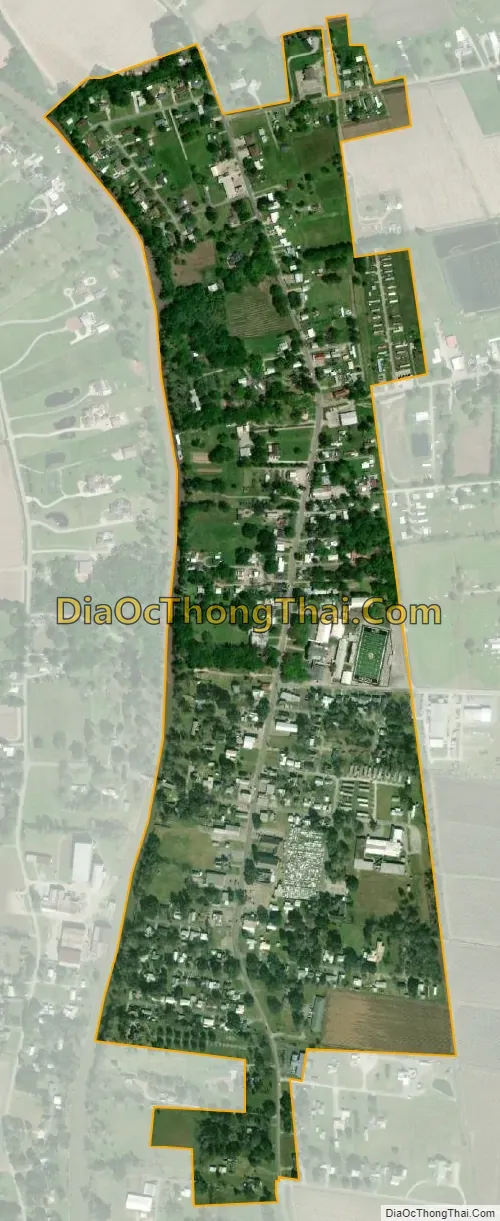
Loreauville city Satellite Map
Geography
Loreauville is located in northern Iberia Parish at 30°3′34″N 91°44′13″W / 30.05944°N 91.73694°W / 30.05944; -91.73694 (30.059388, -91.736830), on the east side of Bayou Teche. It is 8 miles (13 km) northeast of New Iberia, the parish seat of Iberia Parish and 9 miles (14 km) southeast of St. Martinville, the parish seat of St. Martin Parish.
According to the United States Census Bureau, the village has a total area of 0.45 square miles (1.2 km), of which 0.01 square miles (0.03 km), or 1.45% are water.
Hurricanes
The following hurricanes have impacted the village of Loreauville:
- 1974 – Hurricane Carmen
- 1992 – The eye of Hurricane Andrew passed directly over Loreauville. The passage of the hurricane caused severe damage to the local infrastructure, and residents were without electric service for over four weeks.
- 2002 – Hurricane Lili
- 2005 – Hurricane Rita
- 2008 – Hurricane Gustav
- 2019 – Hurricane Barry although a weaker hurricane, caused severe damage to electrical power lines and live oak trees
- 2020 – Hurricane Laura
See also
Map of Louisiana State and its subdivision:- Acadia
- Allen
- Ascension
- Assumption
- Avoyelles
- Beauregard
- Bienville
- Bossier
- Caddo
- Calcasieu
- Caldwell
- Cameron
- Catahoula
- Claiborne
- Concordia
- De Soto
- East Baton Rouge
- East Carroll
- East Feliciana
- Evangeline
- Franklin
- Grant
- Iberia
- Iberville
- Jackson
- Jefferson
- Jefferson Davis
- La Salle
- Lafayette
- Lafourche
- Lincoln
- Livingston
- Madison
- Morehouse
- Natchitoches
- Orleans
- Ouachita
- Plaquemines
- Pointe Coupee
- Rapides
- Red River
- Richland
- Sabine
- Saint Bernard
- Saint Charles
- Saint Helena
- Saint James
- Saint John the Baptist
- Saint Landry
- Saint Martin
- Saint Mary
- Saint Tammany
- Tangipahoa
- Tensas
- Terrebonne
- Union
- Vermilion
- Vernon
- Washington
- Webster
- West Baton Rouge
- West Carroll
- West Feliciana
- Winn
- Alabama
- Alaska
- Arizona
- Arkansas
- California
- Colorado
- Connecticut
- Delaware
- District of Columbia
- Florida
- Georgia
- Hawaii
- Idaho
- Illinois
- Indiana
- Iowa
- Kansas
- Kentucky
- Louisiana
- Maine
- Maryland
- Massachusetts
- Michigan
- Minnesota
- Mississippi
- Missouri
- Montana
- Nebraska
- Nevada
- New Hampshire
- New Jersey
- New Mexico
- New York
- North Carolina
- North Dakota
- Ohio
- Oklahoma
- Oregon
- Pennsylvania
- Rhode Island
- South Carolina
- South Dakota
- Tennessee
- Texas
- Utah
- Vermont
- Virginia
- Washington
- West Virginia
- Wisconsin
- Wyoming