St. Martinville (French: Saint-Martin) is a city in and the parish seat of St. Martin Parish, Louisiana, United States. It lies on Bayou Teche, 13 miles (21 km) south of Breaux Bridge, 16 miles (26 km) southeast of Lafayette, and 9 miles (14 km) north of New Iberia. The population was 6,114 at the 2010 U.S. census, and 5,379 at the 2020 United States census. It is part of the Lafayette metropolitan statistical area.
| Name: | St. Martinville city |
|---|---|
| LSAD Code: | 25 |
| LSAD Description: | city (suffix) |
| State: | Louisiana |
| County: | St. Martin Parish |
| Elevation: | 23 ft (7 m) |
| Total Area: | 3.16 sq mi (8.18 km²) |
| Land Area: | 3.05 sq mi (7.90 km²) |
| Water Area: | 0.11 sq mi (0.28 km²) |
| Total Population: | 5,379 |
| Population Density: | 1,762.45/sq mi (680.56/km²) |
| ZIP code: | 70582 |
| Area code: | 337 |
| FIPS code: | 2267600 |
| Website: | http://www.stmartinville.org/ |
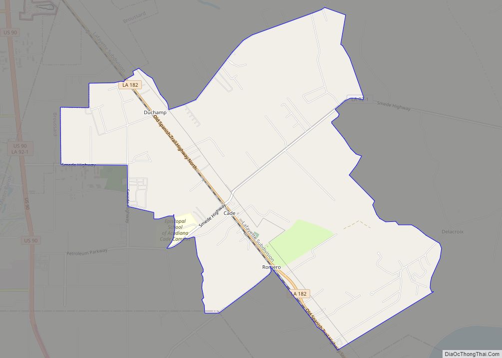
Online Interactive Map
Click on ![]() to view map in "full screen" mode.
to view map in "full screen" mode.
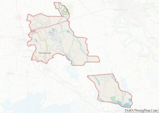
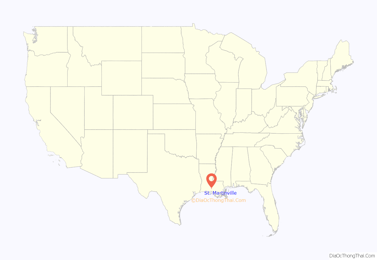
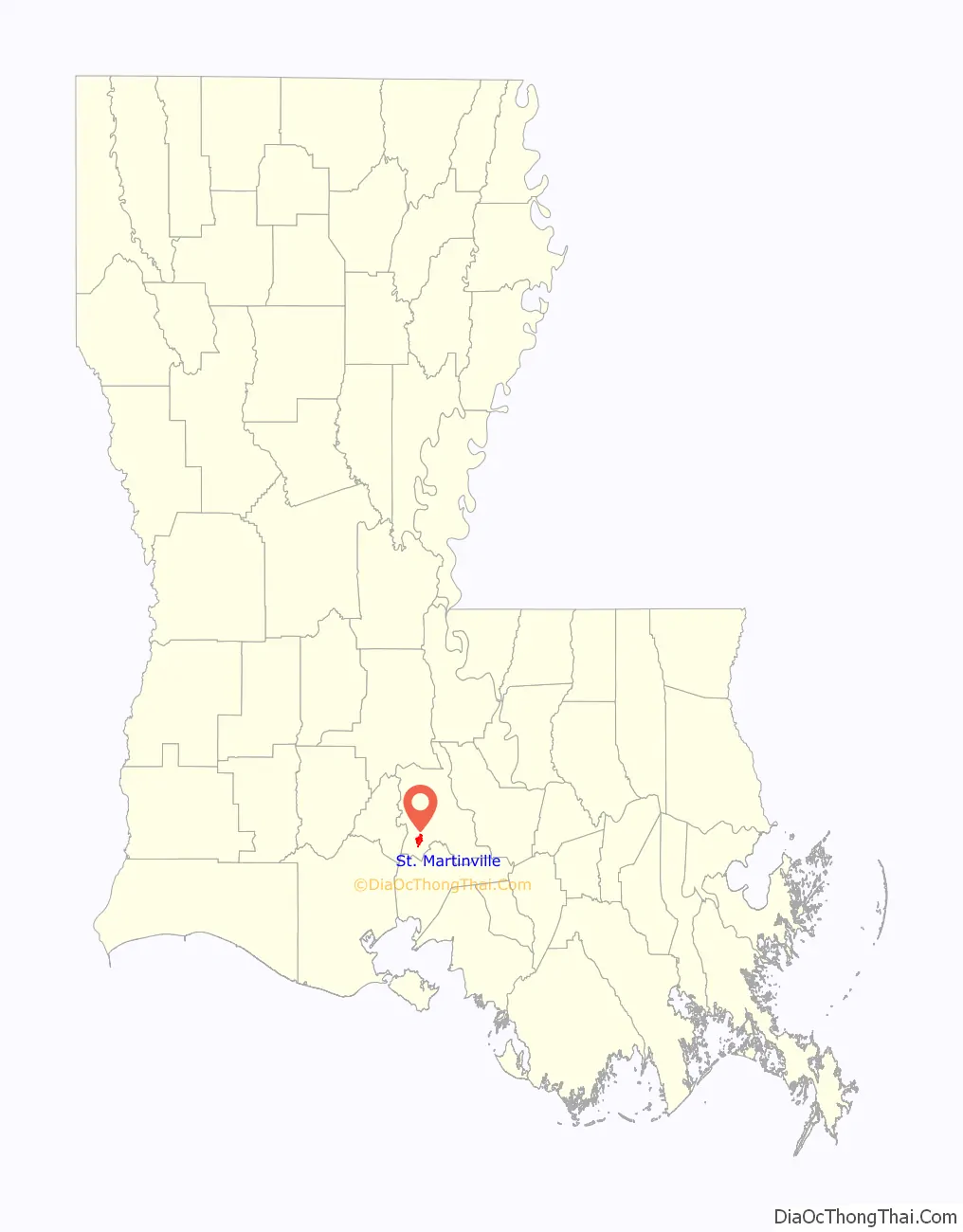
St. Martinville location map. Where is St. Martinville city?
History
In the 16th century, the area between the Atchafalaya River, in Louisiana, the Gulf of Mexico and Trinity River, in Texas, was occupied by numerous tribes or subdivisions of the Attakapan people. The territory was not closed to outsiders, and several traders roamed through it on business.
Europeans did not begin to settle there until French explorers claimed and founded the colony of Louisiana in 1699. They referred to the territory between the Atchafalaya River and Bayou Nezpique, where the Eastern Atakapa lived, as the Attakapas Territory, adopting the name from the Choctaw language term for this people. The French colonial government gave land away to French soldiers and settlers.
Poste des Atakapas (Attakapas Post) was founded as a trading post on the banks of the Bayou Teche, and settlers started to arrive. Some came separately from France, such as M. Masse, who came about 1754 from Grenoble. Gabriel Fuselier de la Claire, a Frenchman from Lyon, and some other Frenchmen from Mobile, in present-day Alabama, arrived in late 1763 or early 1764. Fuselier bought land between Vermilion River and Bayou Teche from the Eastern Attakapas chief Kinemo. Shortly after that, the rival Appalousa (Opelousas) invaded the area via the Atchafalaya and Sabine rivers, and exterminated much of the Eastern Atakapan. Gabriel Fuselier’s son Agricole Fuselier was prominent in settling what developed as New Iberia, Louisiana.
Gradually groups of more French speakers arrived, such as the first Acadians from Nova Scotia. They were assigned to this area in 1765 by Jean-Jacques Blaise d’Abbadie, the French official who was administering Louisiana for the Spanish. They had been expelled from Acadia by the British, who had defeated France in the Seven Years’ War and taken over its territories in North America east of the Mississippi River. Spain took over Louisiana and other territories west of the Mississippi but tended to rely on French colonists to administer La Louisiane.
The Acadians were led by Joseph Broussard. In 1768-1769, fifteen families arrived from Pointe Coupee, another French colonial community. Their members had migrated from Saint-Domingue (now Haïti) or from Paris via Fort de Chartres, in present-day Illinois. Between the arrivals of the two groups, the French captain Étienne de Vaugine came in 1764 and acquired a large domain east of Bayou Teche.
On April 25, 1766, after the arrival of the first Acadians, the census showed a population of 409 inhabitants for the Attakapas region. In 1767, the Attakapas Post had 150 inhabitants before the arrival of the 15 families from Pointe Coupee.
In 1803, after losing his effort to regain control over Saint-Domingue during its slave revolt, Napoleon sold Louisiana in 1803 to the United States through the Louisiana Purchase. The U.S. settlers and territorial government organized the Attakapas Territory between 1807 and 1868. After Louisiana became a state, Saint Martin Parish was created. Attakapas Post was renamed as Saint Martinville and designated as the parish seat.
In 1867, Governor Benjamin Flanders appointed Monroe Baker as mayor who was one of the earliest if not the first African-American mayor to serve in the United States.
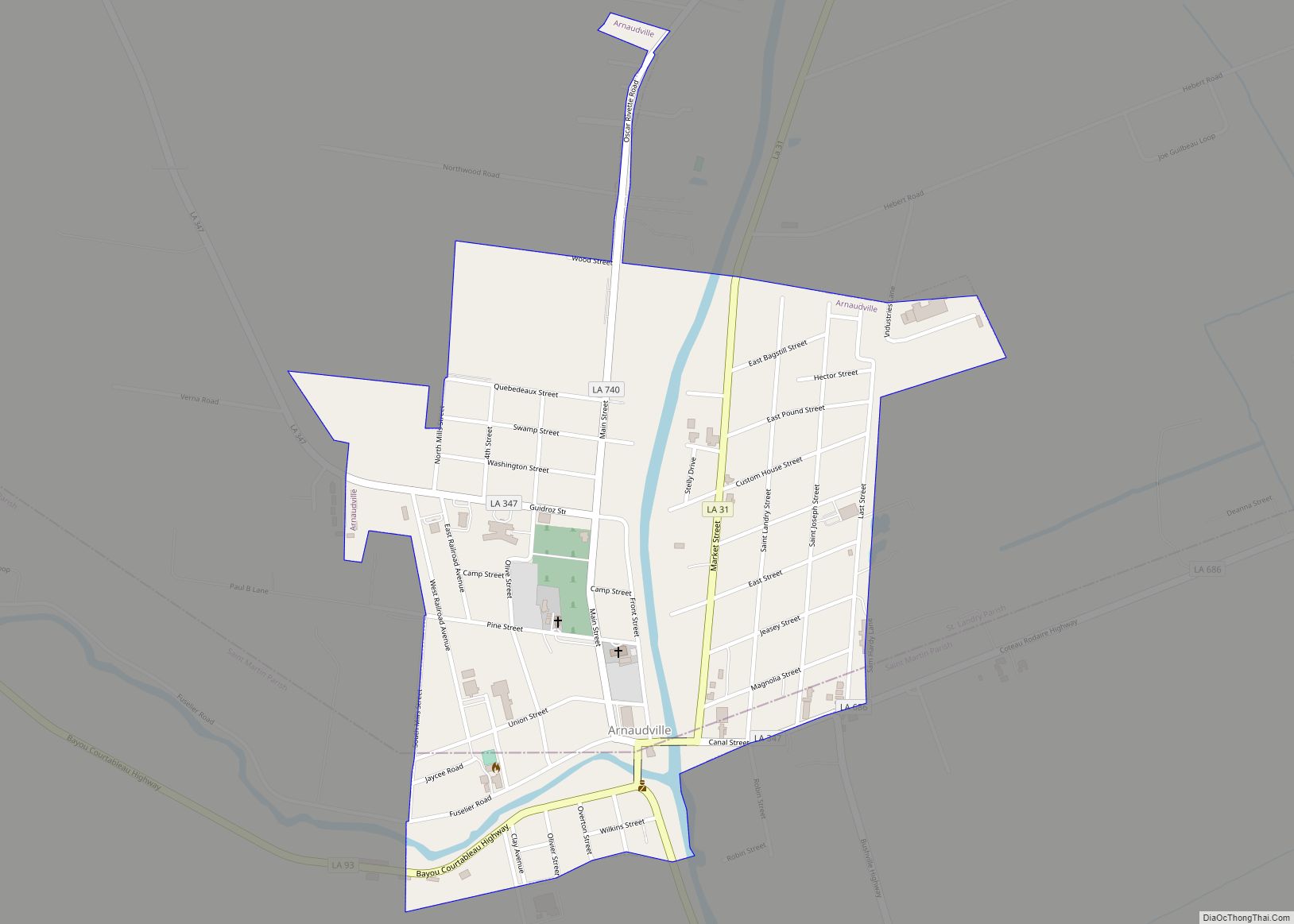
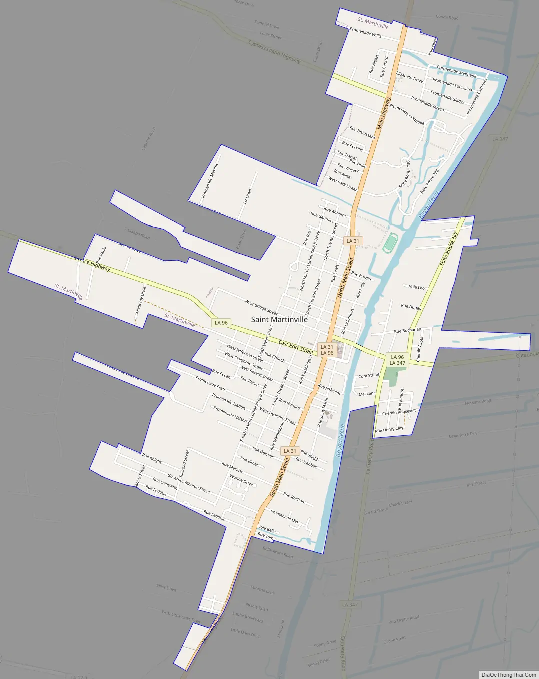
St. Martinville Road Map
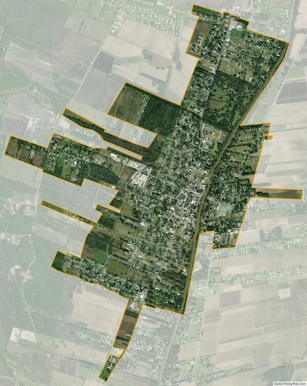
St. Martinville city Satellite Map
Geography
St. Martinville is located at 30°7′30″N 91°49′50″W / 30.12500°N 91.83056°W / 30.12500; -91.83056 (30.125053, -91.830593), in Acadiana. The city is part of the Lafayette metropolitan statistical area. According to the United States Census Bureau, the city has a total area of 3.0 square miles (7.8 km), of which 3.0 square miles (7.8 km) is land and 0.33% is water. Its terrain is mixture of swamp and prairie.
See also
Map of Louisiana State and its subdivision:- Acadia
- Allen
- Ascension
- Assumption
- Avoyelles
- Beauregard
- Bienville
- Bossier
- Caddo
- Calcasieu
- Caldwell
- Cameron
- Catahoula
- Claiborne
- Concordia
- De Soto
- East Baton Rouge
- East Carroll
- East Feliciana
- Evangeline
- Franklin
- Grant
- Iberia
- Iberville
- Jackson
- Jefferson
- Jefferson Davis
- La Salle
- Lafayette
- Lafourche
- Lincoln
- Livingston
- Madison
- Morehouse
- Natchitoches
- Orleans
- Ouachita
- Plaquemines
- Pointe Coupee
- Rapides
- Red River
- Richland
- Sabine
- Saint Bernard
- Saint Charles
- Saint Helena
- Saint James
- Saint John the Baptist
- Saint Landry
- Saint Martin
- Saint Mary
- Saint Tammany
- Tangipahoa
- Tensas
- Terrebonne
- Union
- Vermilion
- Vernon
- Washington
- Webster
- West Baton Rouge
- West Carroll
- West Feliciana
- Winn
- Alabama
- Alaska
- Arizona
- Arkansas
- California
- Colorado
- Connecticut
- Delaware
- District of Columbia
- Florida
- Georgia
- Hawaii
- Idaho
- Illinois
- Indiana
- Iowa
- Kansas
- Kentucky
- Louisiana
- Maine
- Maryland
- Massachusetts
- Michigan
- Minnesota
- Mississippi
- Missouri
- Montana
- Nebraska
- Nevada
- New Hampshire
- New Jersey
- New Mexico
- New York
- North Carolina
- North Dakota
- Ohio
- Oklahoma
- Oregon
- Pennsylvania
- Rhode Island
- South Carolina
- South Dakota
- Tennessee
- Texas
- Utah
- Vermont
- Virginia
- Washington
- West Virginia
- Wisconsin
- Wyoming