New Roads (historically French: Poste-de-Pointe-Coupée) is a city in and the parish seat of Pointe Coupee Parish, Louisiana, United States. The center of population of Louisiana was located in New Roads in 2000. The population was 4,831 at the 2010 census, down from 4,966 in 2000. The city’s ZIP code is 70760. It is part of the Baton Rouge Metropolitan Statistical Area.
| Name: | New Roads city |
|---|---|
| LSAD Code: | 25 |
| LSAD Description: | city (suffix) |
| State: | Louisiana |
| County: | Pointe Coupee Parish |
| Elevation: | 30 ft (9 m) |
| Total Area: | 4.58 sq mi (11.87 km²) |
| Land Area: | 4.58 sq mi (11.87 km²) |
| Water Area: | 0.00 sq mi (0.00 km²) |
| Total Population: | 4,549 |
| Population Density: | 992.80/sq mi (383.29/km²) |
| ZIP code: | 70760 |
| Area code: | 225 |
| FIPS code: | 2255105 |
| GNISfeature ID: | 2404366 |
| Website: | https://newroads.net |
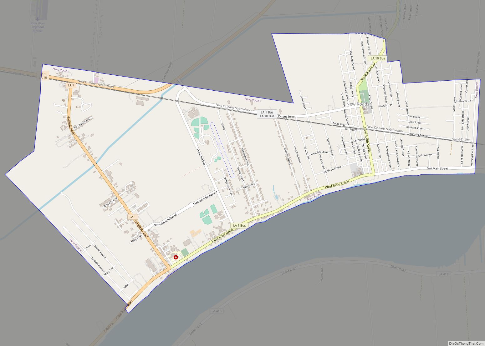
Online Interactive Map
Click on ![]() to view map in "full screen" mode.
to view map in "full screen" mode.
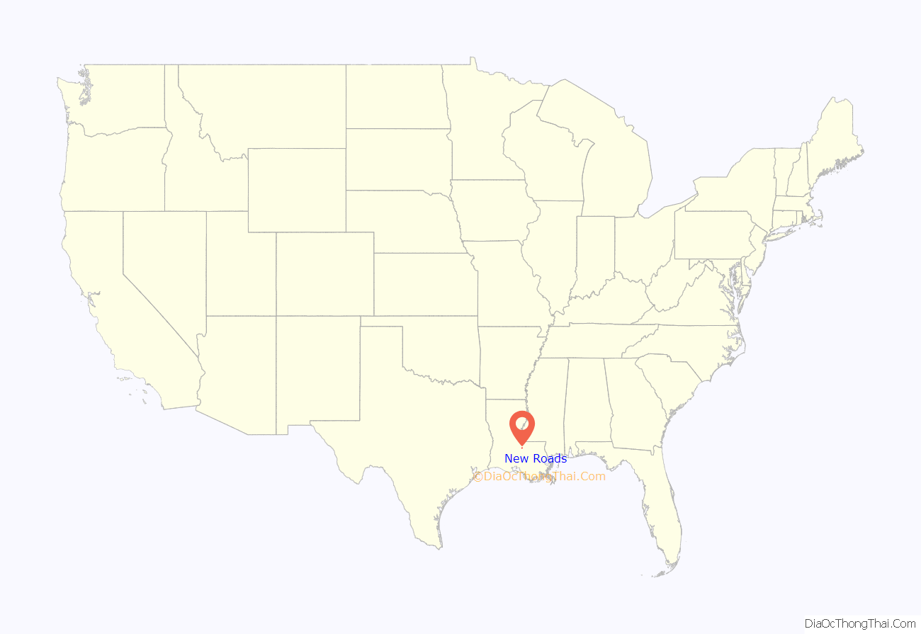
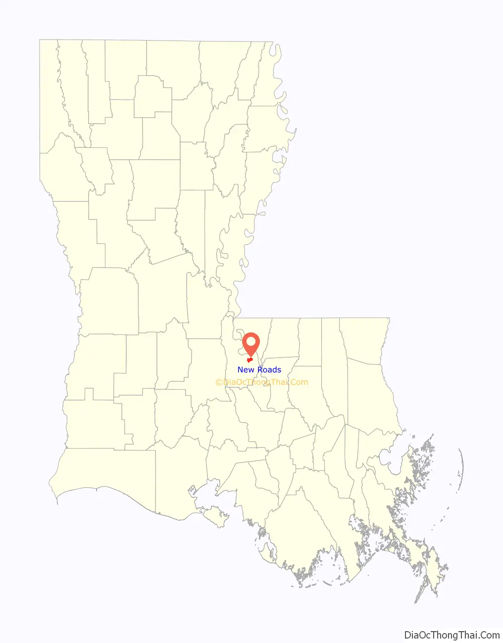
New Roads location map. Where is New Roads city?
History
Le Poste de Pointe Coupée (“the Pointe Coupée Post” or Cut Point Post) is one of the oldest communities in the Mississippi River Valley established by European colonists. The trading post was founded in the 1720s by settlers from France. It was located upstream from the point crossed by explorers, immediately above but not circled by False River. The name referred to the area along the Mississippi River northeast of what is now New Roads.
The post was initially settled by native French, as well as French-speaking Creoles born in the colony. Additional ethnically French settlers migrated down the Mississippi River from Fort de Chartres, Upper Louisiana. The colonists imported numerous African slaves from the French West Indies (Guadeloupe, Martinique, Saint-Domingue), and many directly from Africa, as workers for the plantations.
Historian Gwendolyn Midlo Hall discovered extensive French and Spanish documentation of the early slave trade, which provided more information than is usually available as to the ethnicity and names of individual slaves, all in the court house at New Roads. Using this and other research, she has produced “The Louisiana Slave Database and the Louisiana Free Database: 1719–1820,” which is searchable on line.
Commandants of Pointe Coupee (1729–1762)
- 1729: Chevalier Henri du Loubois
- 1731: Jean Baptiste François Tisserand de Moncharvaux
- 1734–38: Claude Joseph de Favrot
- 1738–1742: Jean Louis Richard de la Houssaye
- 1742–1744: Claude Joseph de Favrot
- 1744–1753: Jean Joseph Delfau de Pontalba, a relative by marriage of Micaela Almonester, Baroness de Pontalba, the New Orleans native who in the mid-19th century built the Pontalba Buildings and redesigned Jackson Square.
- 1753: Chevalier Morlière
- 1753–1756: Francois Artaud
- 1756–1759: Pierre Benoist, Sieur Payen de Noyan de Chavoy
- 1759–1762: Jean Louis Richard de la Houssaye
Spanish rule
After several floods, Governor Luis de Unzaga in 1772 moved the European settlement from Pointe Coupee to a new post, the so-called Post Unzaga. Recently, historians Frank Cazorla and J. David Polo, from the Louis de Unzaga Historical Society research team, using satellite remote sensing techniques and comparative plans from the General Archive of the Indies, have managed to locate the position of the Unzaga post, which included, along with it , a parish. Unfortunately after the slave rebellion of 1795 this settlement was left uninhabited.
After Great Britain defeated France in the Seven Years’ War (also known as the French and Indian War in North America), France ceded this territory to Spain. About 1776, the Spanish built a Chemin Neuf, French for “New Road,” connecting the Mississippi River with False River, a 22-mile (35 km) long oxbow lake and formerly the main channel of the Mississippi.
In 1791, the Mina (an African people) slave uprising, the Mina Conspiracy, started on the estate of Widow Robillard at New Roads. Three years later, there was another area slave revolt near Point Coupee, the Pointe Coupée Conspiracy.
Louisiana Purchase
In 1803 the United States made the Louisiana Purchase, and the territory became part of the United States. In-migration of American settlers increased, changing Louisiana culture.
In 1822, Catherine Dispau (a free woman of color called “La Fille Gougis”) made a four or six block subdivision out of her False River plantation. This was located at the terminus of a “new road” linking False River with the older Mississippi River settlement to the north. This is the area now bounded by West Main, New Roads, West Second and St. Mary Streets. The latter was named for St. Mary’s Catholic Church, founded in 1823. The community was referred to variously as the “village of St. Mary” or Chemin Neuf.
The founding of the church helped the community develop. In 1847, New Roads was named as the seat of Pointe Coupée Parish, and a courthouse was built. Between these “strong celestial poles,” the Main Street business district developed. After the abandonment of the competing parish port of Waterloo during 1882–84 due to flooding, New Roads became the major commercial port and city of Pointe Coupée Parish. The railroad reached the city in 1898–99, bringing much industrial development.
The official name of the community changed frequently during the years after Louisiana became part of the United States. The first post office was established in 1858 as “False River,” but it was discontinued in 1861. When the town was incorporated by the state legislature in 1875, it was named “New Roads.” But, in 1878, when the post office reopened, it was named “St. Mary’s.” In 1879, the city and post office name was changed to New Roads. The old incorporation fell into disuse. The city was reincorporated in 1892, and received its charter two years later. Several names were proposed, among them “St. Mary” and “Rose Lake.” But “New Roads” was finally chosen, although it was often misspelled “New Rhodes.”
Since its founding, New Roads has been the hub of an agricultural community that cultivated commodity crops of sugar cane, cotton, and pecans, among others. Today, the economy has grown to support large industries such as healthcare and social assistance, construction, and retail facilities.
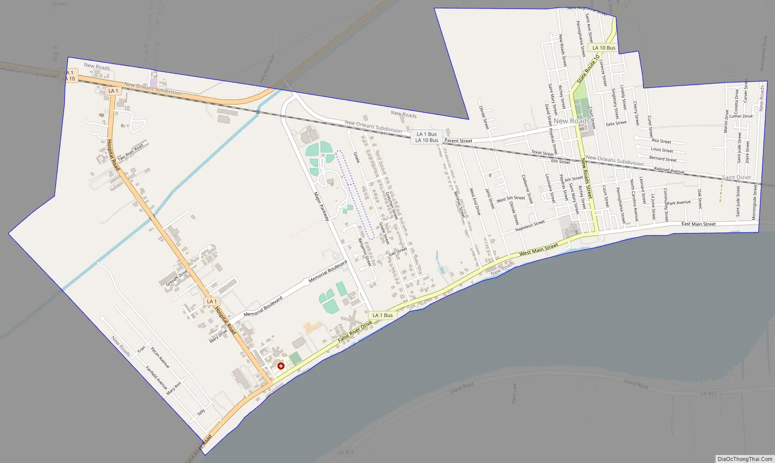
New Roads Road Map
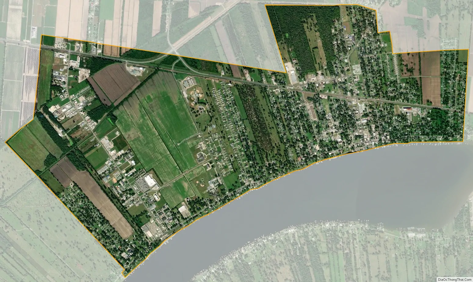
New Roads city Satellite Map
Geography
New Roads is located at 30°41′47″N 91°26′20″W / 30.69639°N 91.43889°W / 30.69639; -91.43889 (30.696305, -91.438980) and has an elevation of 30 feet (9.1 m).
According to the United States Census Bureau, the city has a total area of 4.6 square miles (12 km), all land.
Gradually sloping from a high of 36 feet (11 m) above sea level on Main Street immediately adjacent to False River to a low of 25 feet (7.6 m) along Portage Canal in the north, the city lies on a Mississippi River flood-plain but has never flooded to any great extent since 1912. Levee breaks or “crevasses” on the Mississippi River to the north and east overbanked False River and submerged all of New Roads in 1867, 1882 and 1884. The 1882 flood was the most severe, with four feet of water standing in Main Street during the height of the crisis. During the floods of 1912 and 1927, however, the southern portion of the town, including the main business district, remained dry, as the flood waters to the north and east were held back by the Texas & Pacific Railroad embankment. Mid-city flooding had periodically occurred during hurricanes and other heavy rainfall events due to the overbanking of the Portage Canal, the lowest part of the city.
See also
Map of Louisiana State and its subdivision:- Acadia
- Allen
- Ascension
- Assumption
- Avoyelles
- Beauregard
- Bienville
- Bossier
- Caddo
- Calcasieu
- Caldwell
- Cameron
- Catahoula
- Claiborne
- Concordia
- De Soto
- East Baton Rouge
- East Carroll
- East Feliciana
- Evangeline
- Franklin
- Grant
- Iberia
- Iberville
- Jackson
- Jefferson
- Jefferson Davis
- La Salle
- Lafayette
- Lafourche
- Lincoln
- Livingston
- Madison
- Morehouse
- Natchitoches
- Orleans
- Ouachita
- Plaquemines
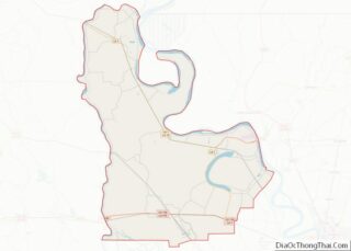
- Pointe Coupee
- Rapides
- Red River
- Richland
- Sabine
- Saint Bernard
- Saint Charles
- Saint Helena
- Saint James
- Saint John the Baptist
- Saint Landry
- Saint Martin
- Saint Mary
- Saint Tammany
- Tangipahoa
- Tensas
- Terrebonne
- Union
- Vermilion
- Vernon
- Washington
- Webster
- West Baton Rouge
- West Carroll
- West Feliciana
- Winn
- Alabama
- Alaska
- Arizona
- Arkansas
- California
- Colorado
- Connecticut
- Delaware
- District of Columbia
- Florida
- Georgia
- Hawaii
- Idaho
- Illinois
- Indiana
- Iowa
- Kansas
- Kentucky
- Louisiana
- Maine
- Maryland
- Massachusetts
- Michigan
- Minnesota
- Mississippi
- Missouri
- Montana
- Nebraska
- Nevada
- New Hampshire
- New Jersey
- New Mexico
- New York
- North Carolina
- North Dakota
- Ohio
- Oklahoma
- Oregon
- Pennsylvania
- Rhode Island
- South Carolina
- South Dakota
- Tennessee
- Texas
- Utah
- Vermont
- Virginia
- Washington
- West Virginia
- Wisconsin
- Wyoming