Oberlin is a town in and the parish seat of Allen Parish, Louisiana, United States. The population was 1,770 at the 2010 census. The town is named after Johann Friedrich Oberlin.
Oberlin was the home of Ernest S. Clements, a Democratic member of the Louisiana State Senate and, later, the Louisiana Public Service Commission. He ran unsuccessfully in 1944 for governor of Louisiana.
| Name: | Oberlin town |
|---|---|
| LSAD Code: | 43 |
| LSAD Description: | town (suffix) |
| State: | Louisiana |
| County: | Allen Parish |
| Elevation: | 69 ft (21 m) |
| Total Area: | 4.38 sq mi (11.35 km²) |
| Land Area: | 4.38 sq mi (11.35 km²) |
| Water Area: | 0.00 sq mi (0.01 km²) |
| Total Population: | 1,402 |
| Population Density: | 320.02/sq mi (123.55/km²) |
| ZIP code: | 70655 |
| Area code: | 337 |
| FIPS code: | 2257450 |
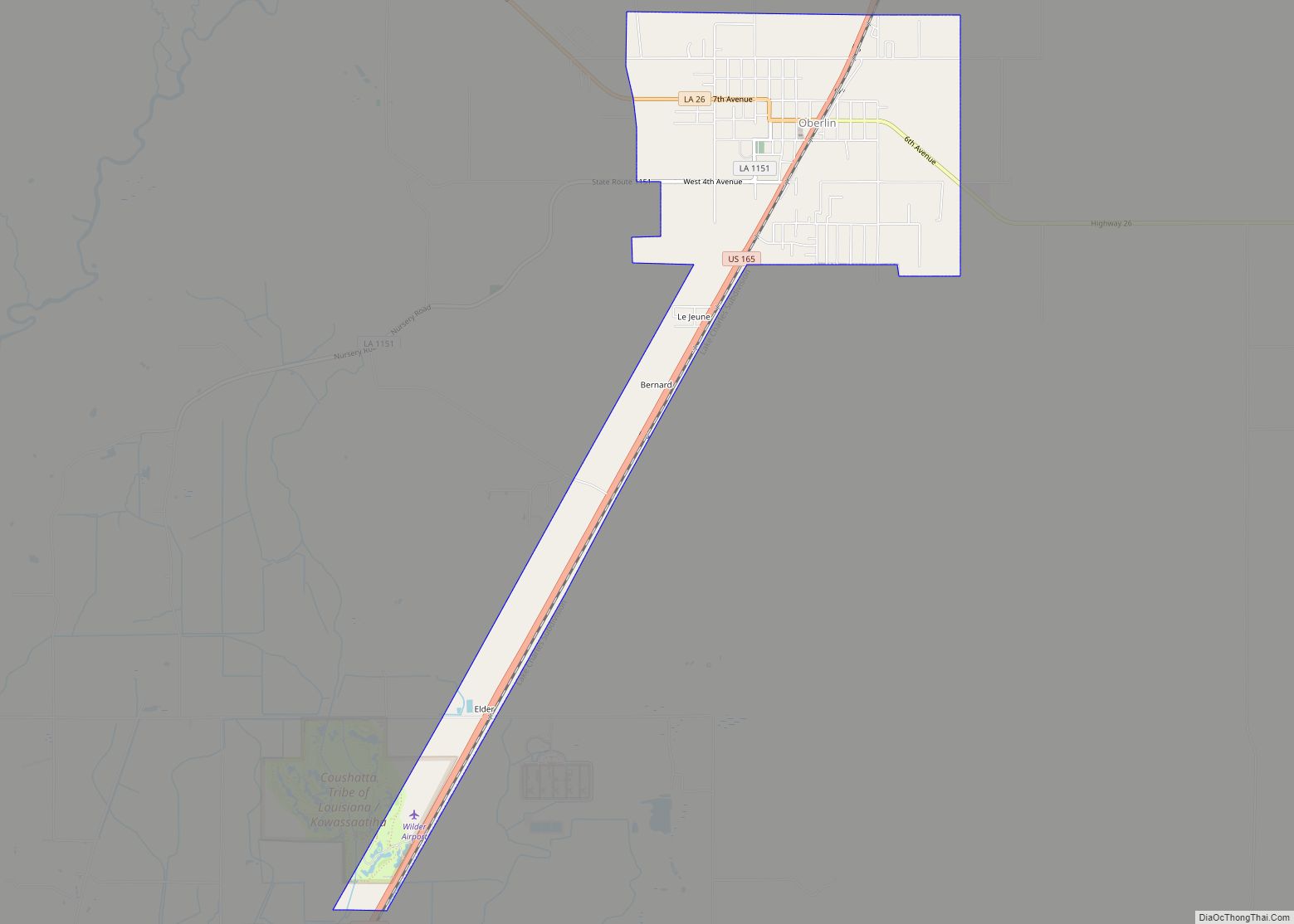
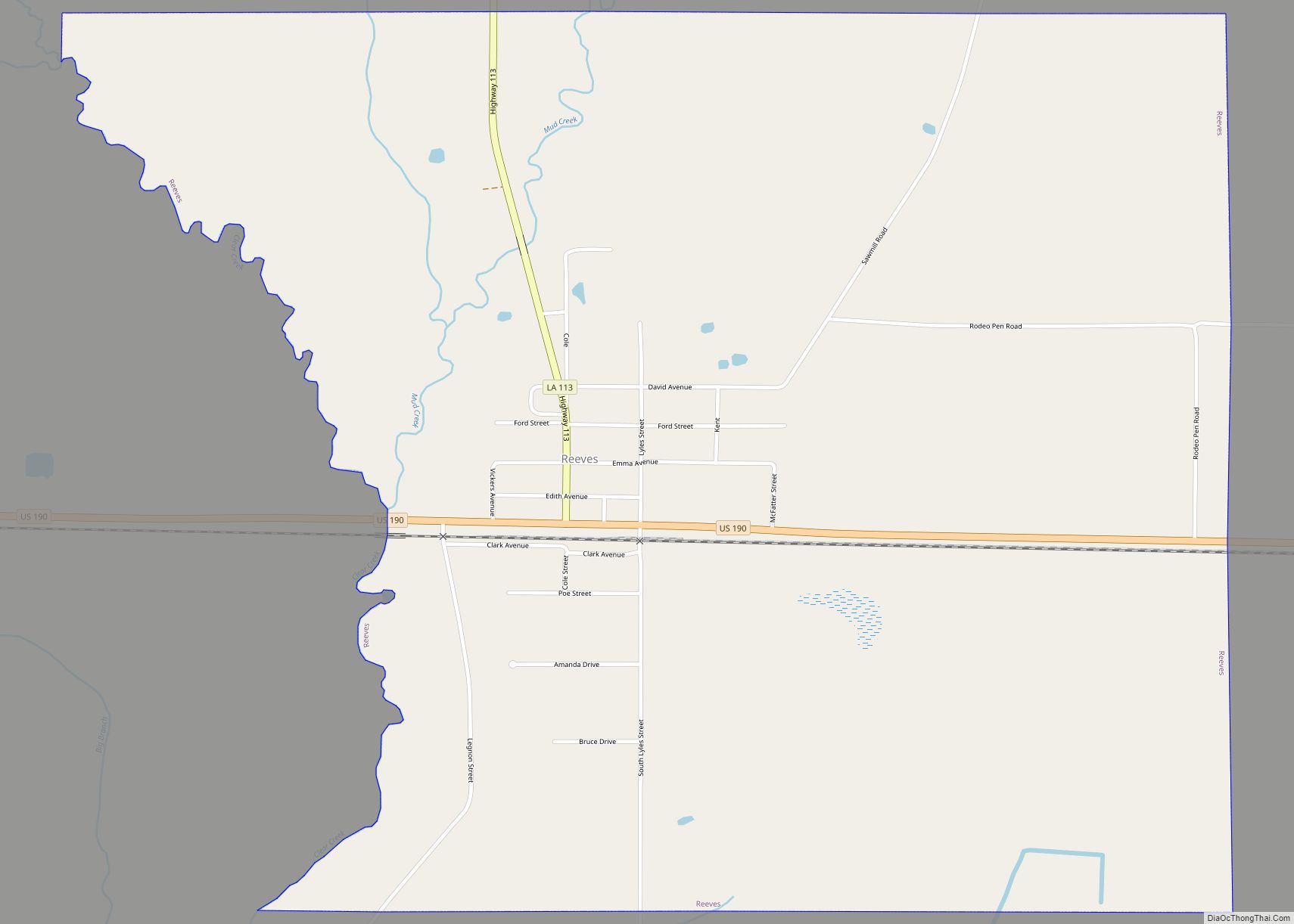
Online Interactive Map
Click on ![]() to view map in "full screen" mode.
to view map in "full screen" mode.
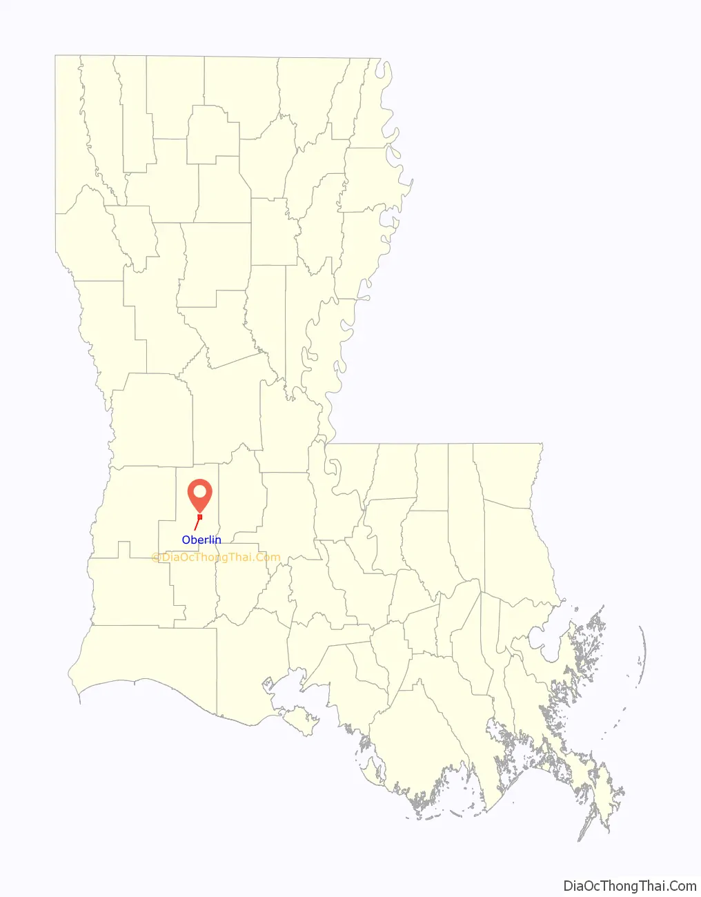
Oberlin location map. Where is Oberlin town?

Oberlin Road Map

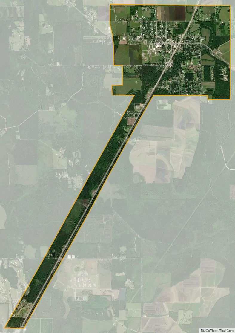
Oberlin city Satellite Map
Geography
Oberlin is located at 30°37′10″N 92°45′51″W / 30.61944°N 92.76417°W / 30.61944; -92.76417 (30.619560, -92.764058). According to the United States Census Bureau, the town has a total area of 4.4 square miles (11.4 km), all land. Oberlin is located on U.S. Route 165 at LA 26.
Climate
See also
Map of Louisiana State and its subdivision:- Acadia
- Allen
- Ascension
- Assumption
- Avoyelles
- Beauregard
- Bienville
- Bossier
- Caddo
- Calcasieu
- Caldwell
- Cameron
- Catahoula
- Claiborne
- Concordia
- De Soto
- East Baton Rouge
- East Carroll
- East Feliciana
- Evangeline
- Franklin
- Grant
- Iberia
- Iberville
- Jackson
- Jefferson
- Jefferson Davis
- La Salle
- Lafayette
- Lafourche
- Lincoln
- Livingston
- Madison
- Morehouse
- Natchitoches
- Orleans
- Ouachita
- Plaquemines
- Pointe Coupee
- Rapides
- Red River
- Richland
- Sabine
- Saint Bernard
- Saint Charles
- Saint Helena
- Saint James
- Saint John the Baptist
- Saint Landry
- Saint Martin
- Saint Mary
- Saint Tammany
- Tangipahoa
- Tensas
- Terrebonne
- Union
- Vermilion
- Vernon
- Washington
- Webster
- West Baton Rouge
- West Carroll
- West Feliciana
- Winn
- Alabama
- Alaska
- Arizona
- Arkansas
- California
- Colorado
- Connecticut
- Delaware
- District of Columbia
- Florida
- Georgia
- Hawaii
- Idaho
- Illinois
- Indiana
- Iowa
- Kansas
- Kentucky
- Louisiana
- Maine
- Maryland
- Massachusetts
- Michigan
- Minnesota
- Mississippi
- Missouri
- Montana
- Nebraska
- Nevada
- New Hampshire
- New Jersey
- New Mexico
- New York
- North Carolina
- North Dakota
- Ohio
- Oklahoma
- Oregon
- Pennsylvania
- Rhode Island
- South Carolina
- South Dakota
- Tennessee
- Texas
- Utah
- Vermont
- Virginia
- Washington
- West Virginia
- Wisconsin
- Wyoming