Saline is a village in southeastern Bienville Parish, Louisiana, United States. The population was 277 at the 2010 census. Saline is pronounced “Suh-LEEN”.
Jamie Fair, a member of the Louisiana House of Representatives from 1980–1984, resides between Saline and Castor off Louisiana Highway 9.
Former Second Judicial District Court Judge David T. Caldwell, based in Jonesboro, was born in Saline and graduated from Saline High School in 1942.
A branch of Sabine State Bank operates in Saline.
| Name: | Saline village |
|---|---|
| LSAD Code: | 47 |
| LSAD Description: | village (suffix) |
| State: | Louisiana |
| County: | Bienville Parish |
| Elevation: | 184 ft (56 m) |
| Total Area: | 1.19 sq mi (3.08 km²) |
| Land Area: | 1.19 sq mi (3.08 km²) |
| Water Area: | 0.00 sq mi (0.00 km²) |
| Total Population: | 265 |
| Population Density: | 222.69/sq mi (85.98/km²) |
| Area code: | 318 |
| FIPS code: | 2267880 |
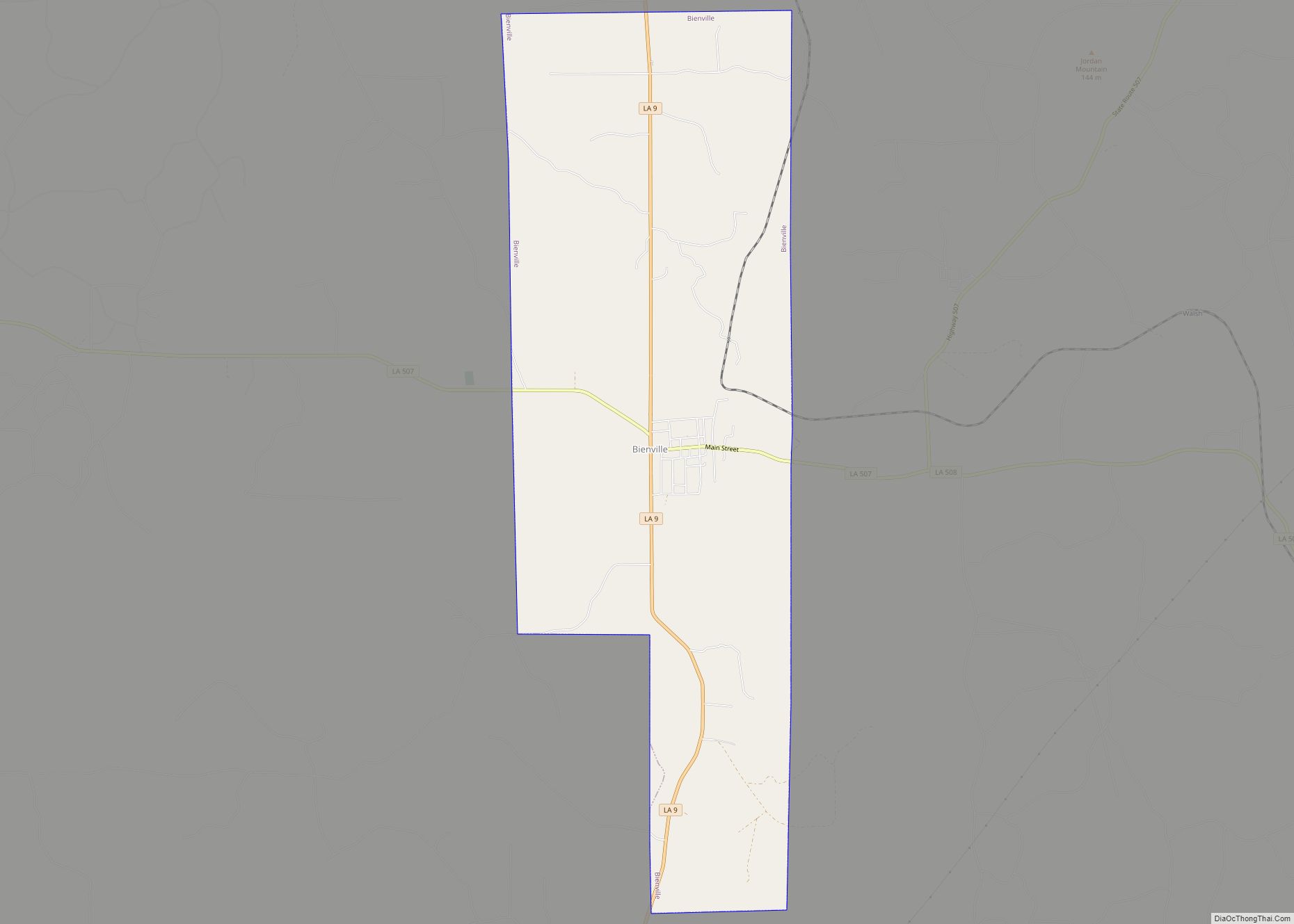
Online Interactive Map
Click on ![]() to view map in "full screen" mode.
to view map in "full screen" mode.
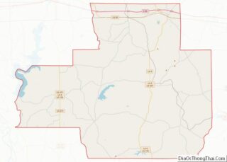
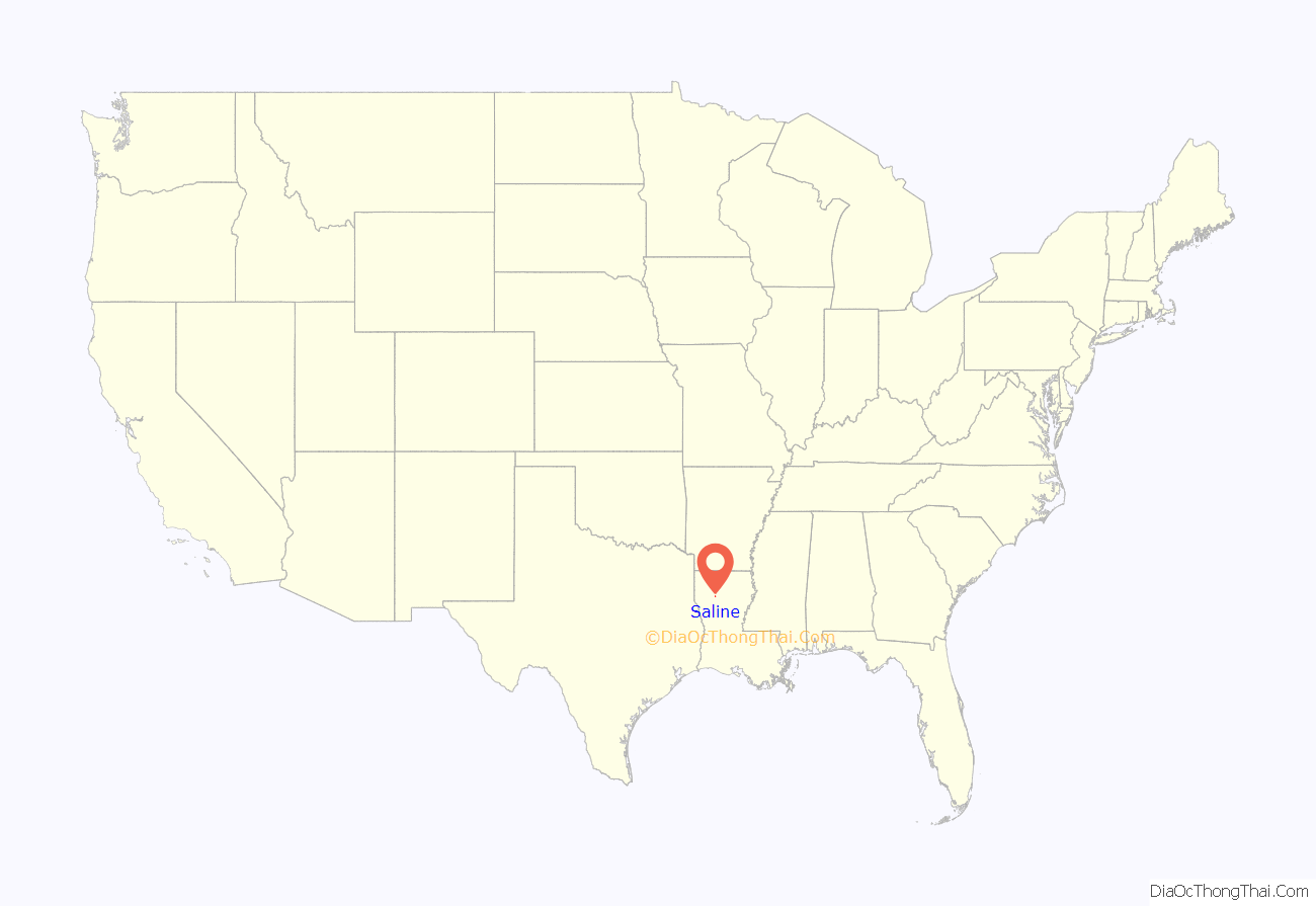
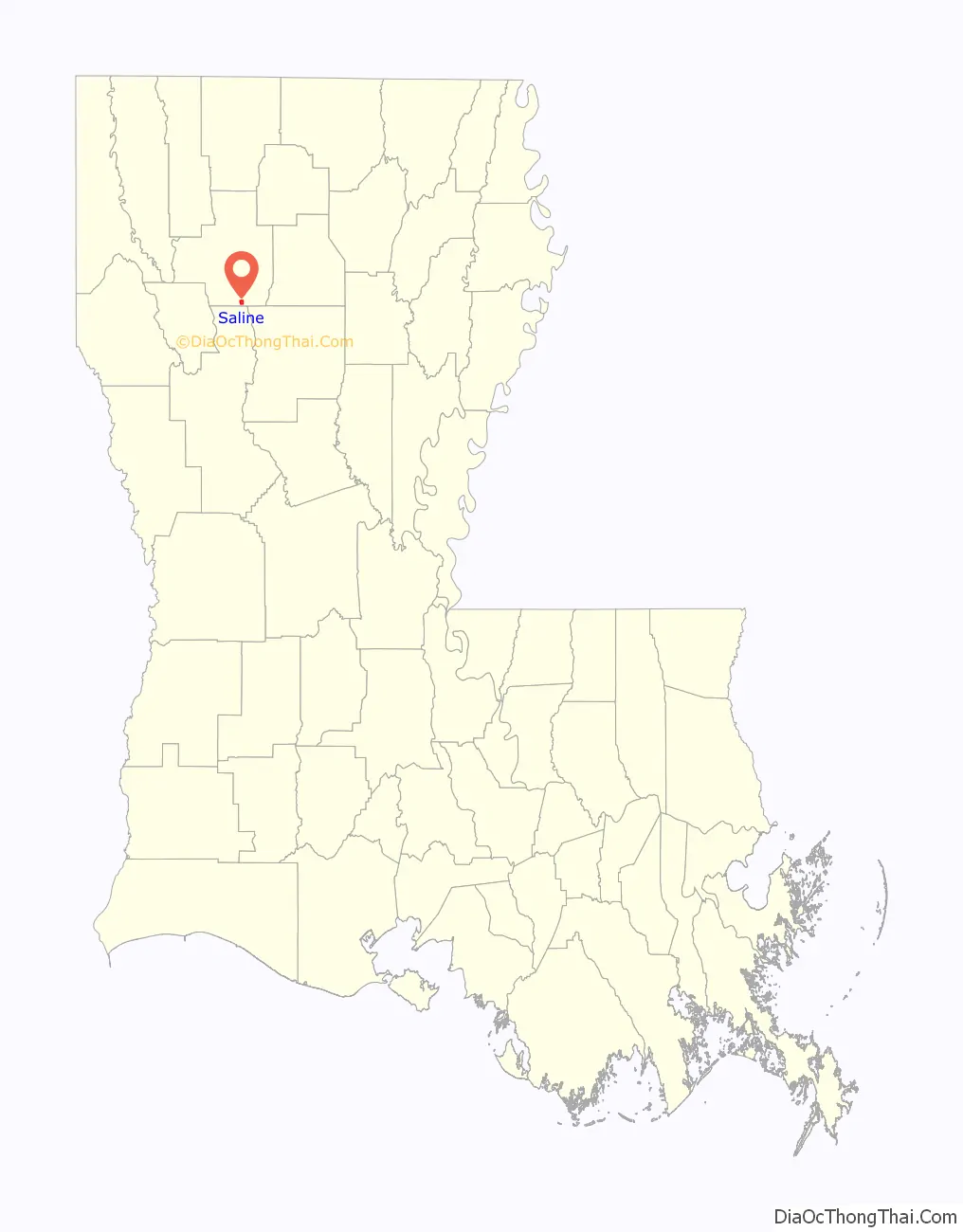
Saline location map. Where is Saline village?
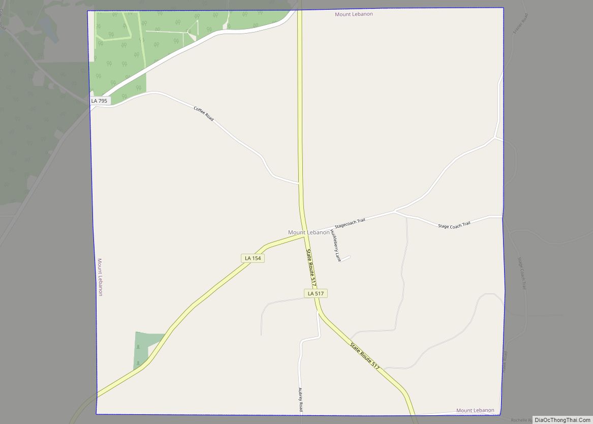
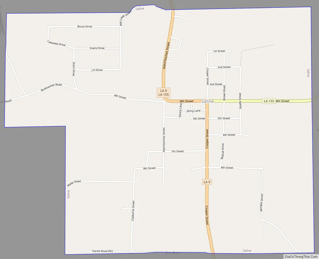
Saline Road Map
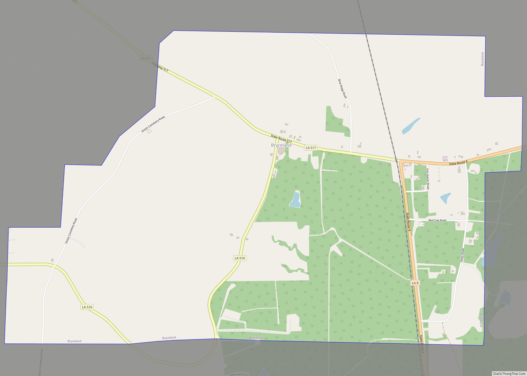
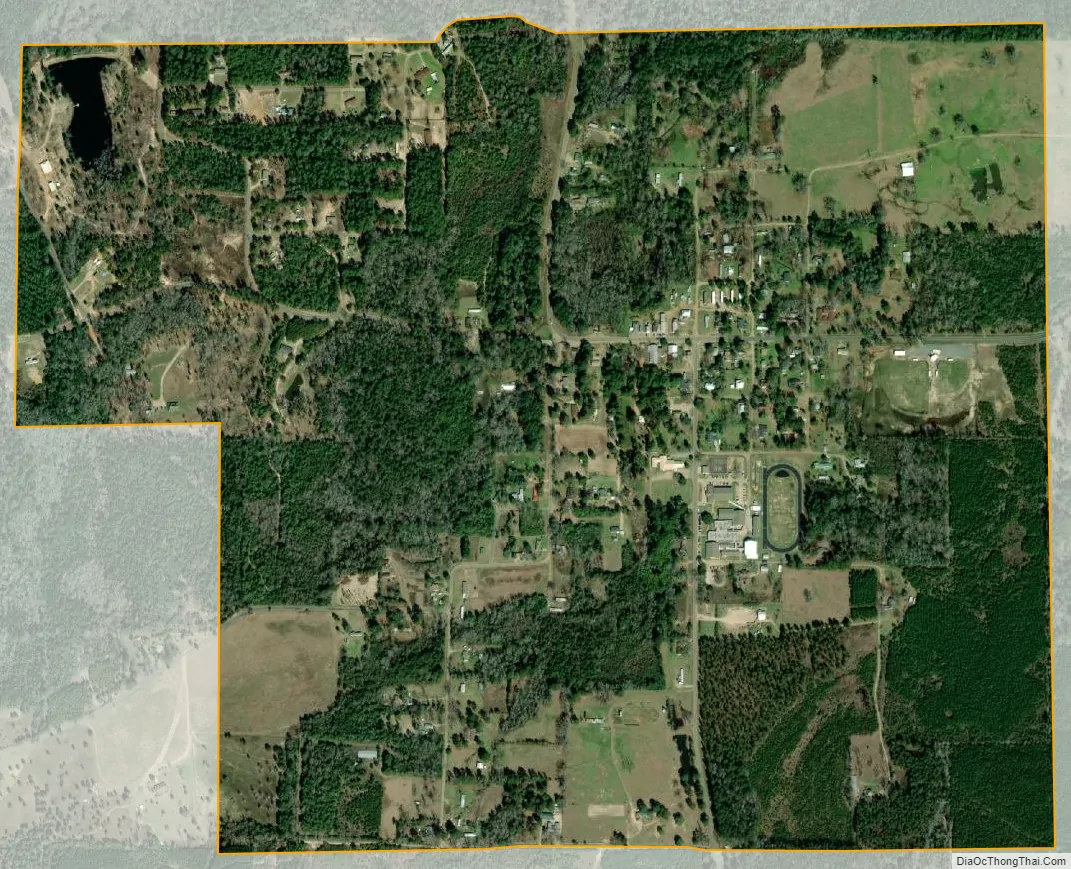
Saline city Satellite Map
Geography
Saline is located at 32°9′51″N 92°58′38″W / 32.16417°N 92.97722°W / 32.16417; -92.97722 (32.164170, -92.977127).
According to the United States Census Bureau, the village has a total area of 1.2 square miles (3.1 km), all land.
The biggest attraction to Saline is the Mill Creek Reservoir. Usually misnamed as Saline Lake, it is the biggest, easiest to access and safest body of water in Bienville Parish. The waters are fairly deep and were long ago cleared of trees and tree stumps, making it ideal for boating, skiing, knee-boarding and other water activities. The only danger in the area is the spillway which is a tower that rises about 50 feet (15 m) off the water. It has a ladder that goes to the top and some people climb it to jump off, but it is very unsafe and has claimed lives.
See also
Map of Louisiana State and its subdivision:- Acadia
- Allen
- Ascension
- Assumption
- Avoyelles
- Beauregard
- Bienville
- Bossier
- Caddo
- Calcasieu
- Caldwell
- Cameron
- Catahoula
- Claiborne
- Concordia
- De Soto
- East Baton Rouge
- East Carroll
- East Feliciana
- Evangeline
- Franklin
- Grant
- Iberia
- Iberville
- Jackson
- Jefferson
- Jefferson Davis
- La Salle
- Lafayette
- Lafourche
- Lincoln
- Livingston
- Madison
- Morehouse
- Natchitoches
- Orleans
- Ouachita
- Plaquemines
- Pointe Coupee
- Rapides
- Red River
- Richland
- Sabine
- Saint Bernard
- Saint Charles
- Saint Helena
- Saint James
- Saint John the Baptist
- Saint Landry
- Saint Martin
- Saint Mary
- Saint Tammany
- Tangipahoa
- Tensas
- Terrebonne
- Union
- Vermilion
- Vernon
- Washington
- Webster
- West Baton Rouge
- West Carroll
- West Feliciana
- Winn
- Alabama
- Alaska
- Arizona
- Arkansas
- California
- Colorado
- Connecticut
- Delaware
- District of Columbia
- Florida
- Georgia
- Hawaii
- Idaho
- Illinois
- Indiana
- Iowa
- Kansas
- Kentucky
- Louisiana
- Maine
- Maryland
- Massachusetts
- Michigan
- Minnesota
- Mississippi
- Missouri
- Montana
- Nebraska
- Nevada
- New Hampshire
- New Jersey
- New Mexico
- New York
- North Carolina
- North Dakota
- Ohio
- Oklahoma
- Oregon
- Pennsylvania
- Rhode Island
- South Carolina
- South Dakota
- Tennessee
- Texas
- Utah
- Vermont
- Virginia
- Washington
- West Virginia
- Wisconsin
- Wyoming