Eastview is a town in McNairy County, Tennessee. The population was 705 at the 2010 census.
| Name: | Eastview town |
|---|---|
| LSAD Code: | 43 |
| LSAD Description: | town (suffix) |
| State: | Tennessee |
| County: | McNairy County |
| Elevation: | 522 ft (159 m) |
| Total Area: | 5.12 sq mi (13.26 km²) |
| Land Area: | 5.12 sq mi (13.26 km²) |
| Water Area: | 0.00 sq mi (0.00 km²) |
| Total Population: | 763 |
| Population Density: | 149.08/sq mi (57.56/km²) |
| FIPS code: | 4722920 |
| GNISfeature ID: | 1283436 |
Online Interactive Map
Click on ![]() to view map in "full screen" mode.
to view map in "full screen" mode.
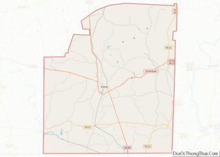
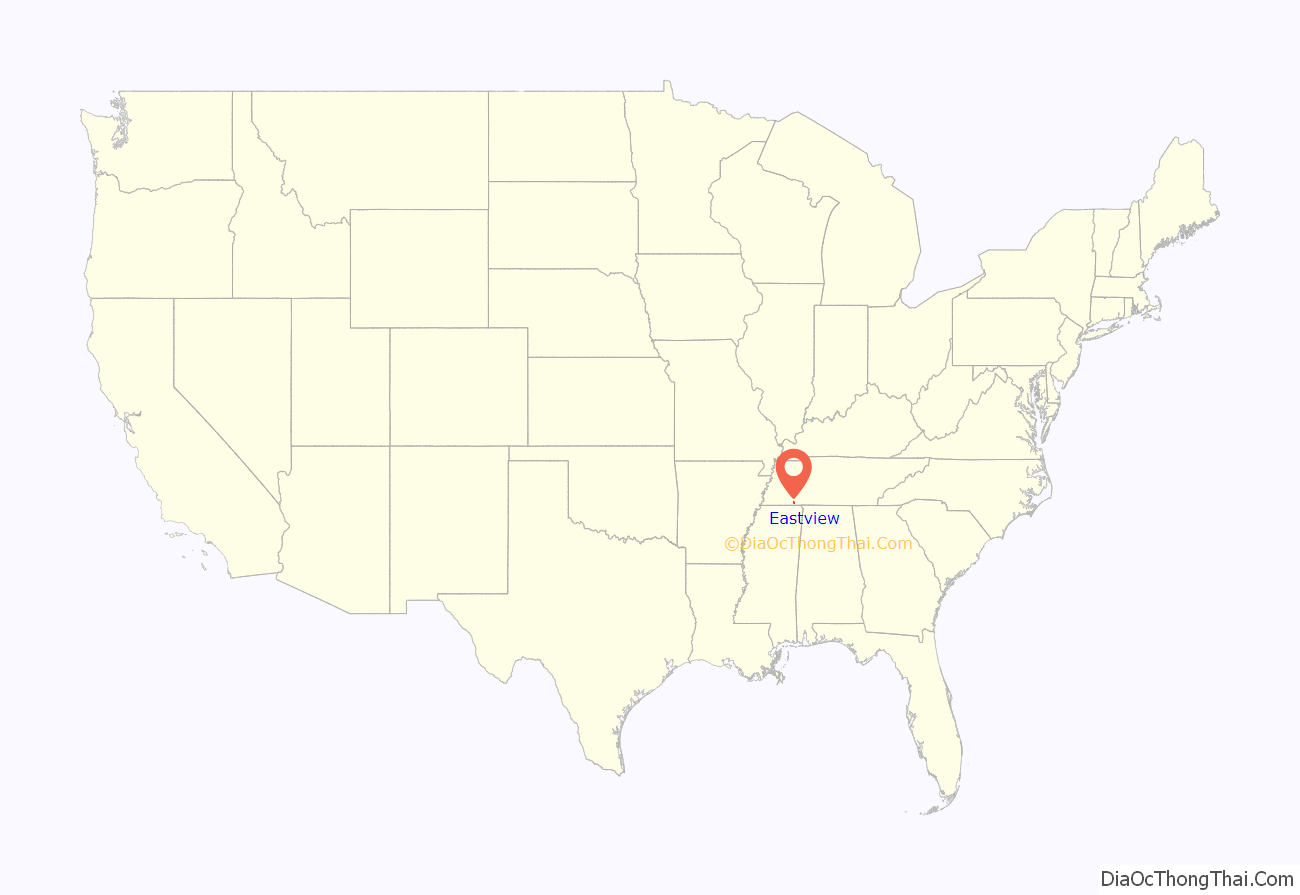
Eastview location map. Where is Eastview town?

History
Eastview is rooted in a three-room house and filling station established by the Littlejohn family in 1927. These buildings both faced east, giving the town its name. Eastview incorporated in the late 1960s.
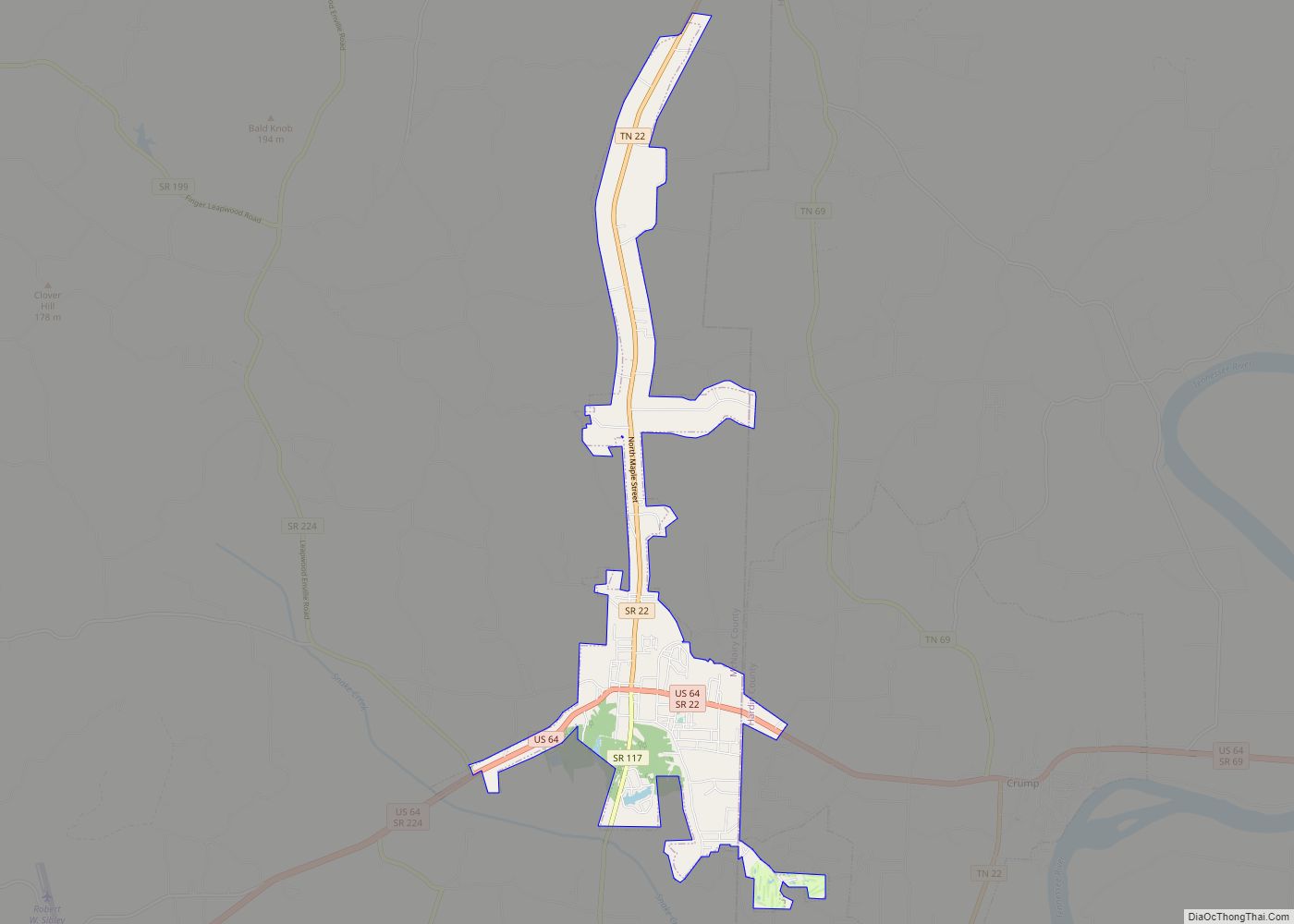
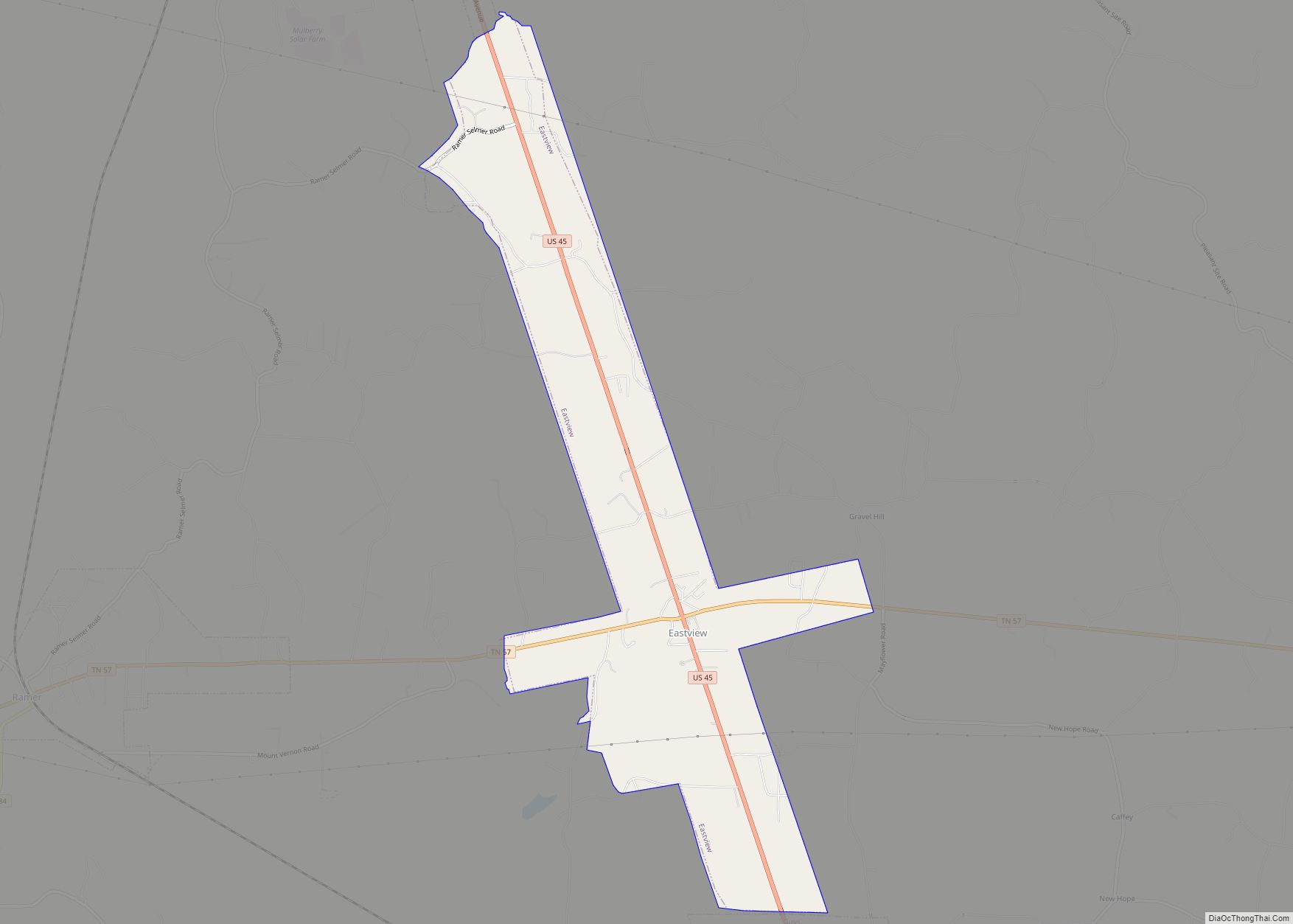
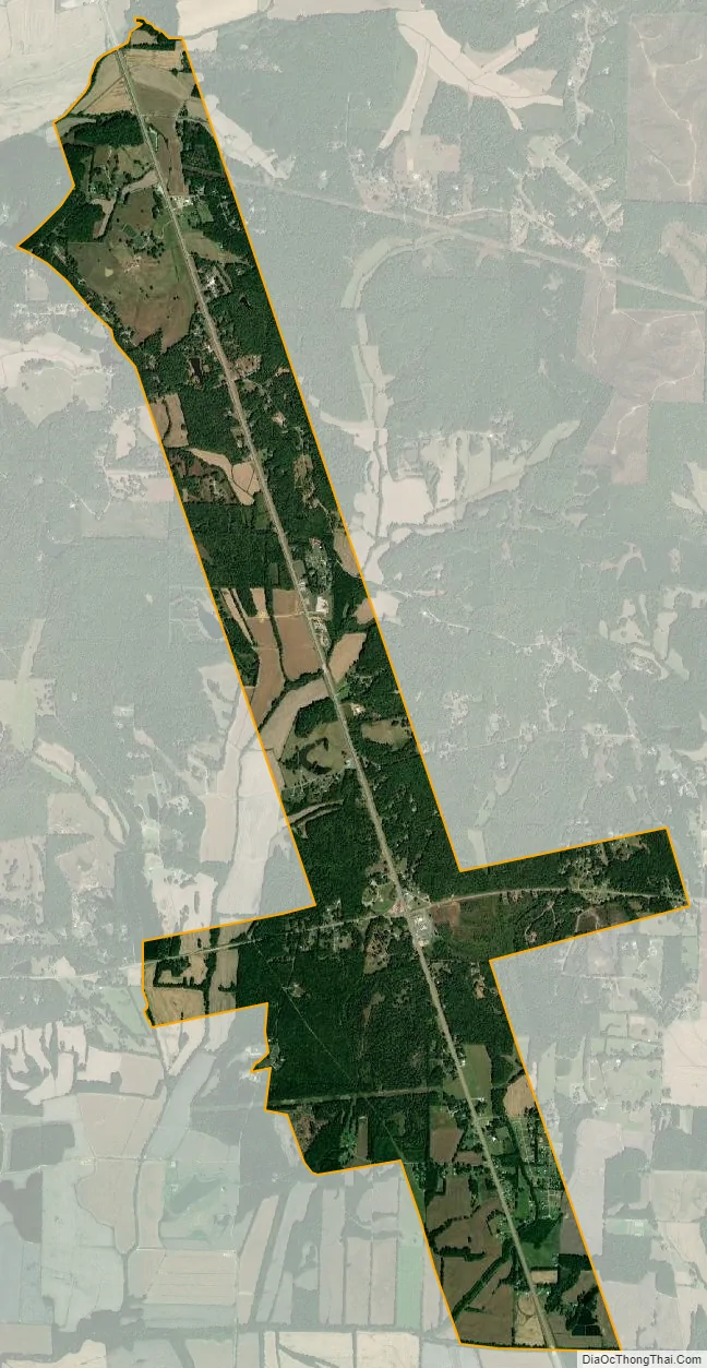
Eastview Road Map

Eastview city Satellite Map
Geography
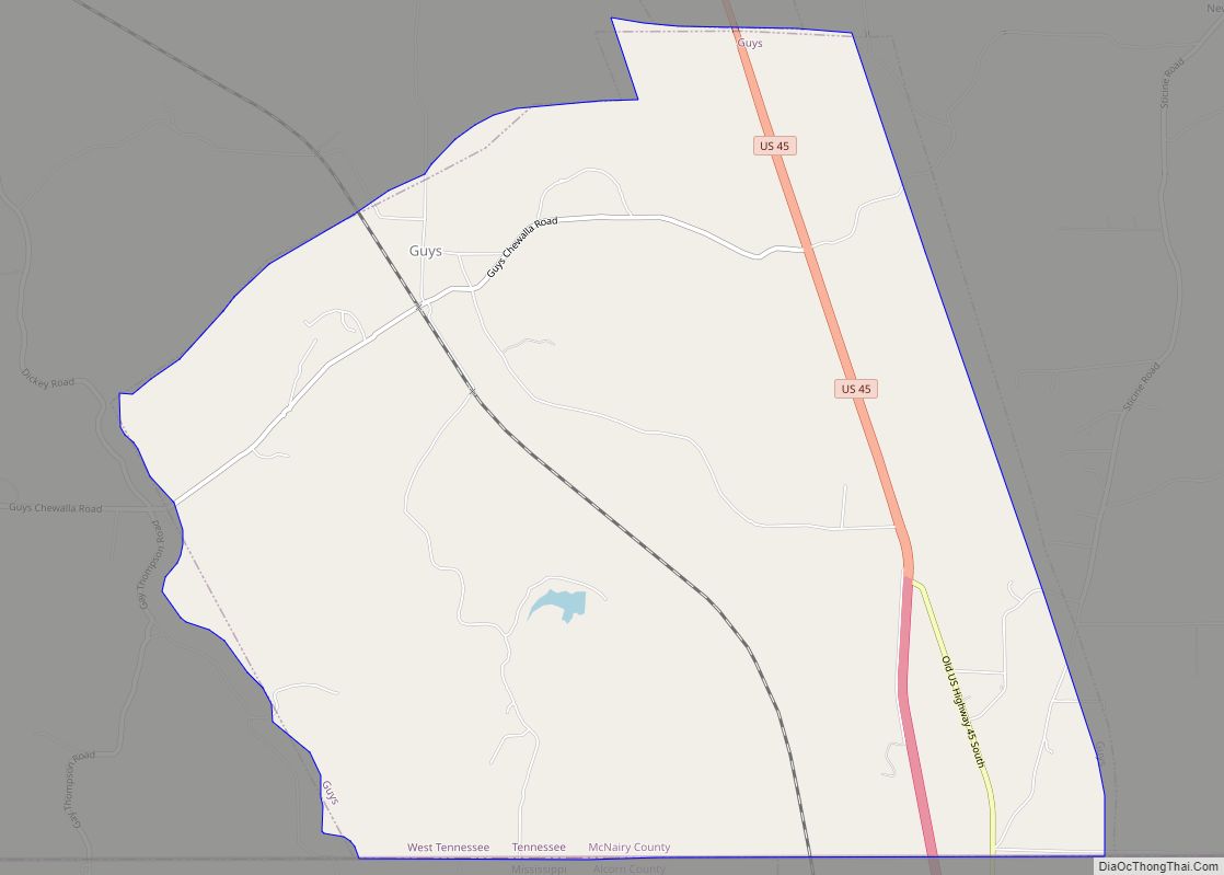
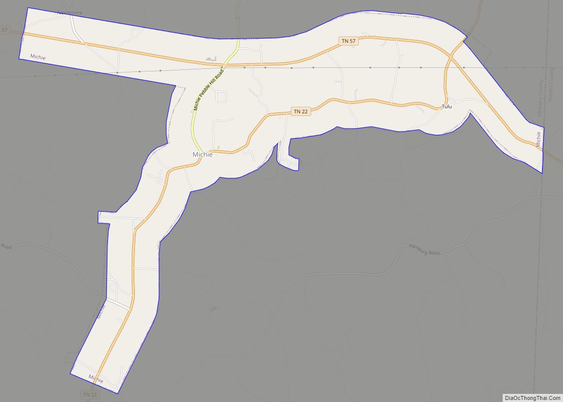
Eastview is located at 35°4′52″N 88°33′3″W / 35.08111°N 88.55083°W / 35.08111; -88.55083 (35.081209, -88.550886). The town is concentrated around the intersection of U.S. Route 45 and Tennessee State Route 57, a few miles north of the Tennessee-Mississippi state line. The town’s municipal boundaries stretch along US 45 to Selmer to the north and Guys to the south. Michie and Ramer lie along SR 57 to the east and west, respectively.
According to the United States Census Bureau, the town has a total area of 5.0 square miles (13 km), all land.
See also
Map of Tennessee State and its subdivision:- Anderson
- Bedford
- Benton
- Bledsoe
- Blount
- Bradley
- Campbell
- Cannon
- Carroll
- Carter
- Cheatham
- Chester
- Claiborne
- Clay
- Cocke
- Coffee
- Crockett
- Cumberland
- Davidson
- Decatur
- DeKalb
- Dickson
- Dyer
- Fayette
- Fentress
- Franklin
- Gibson
- Giles
- Grainger
- Greene
- Grundy
- Hamblen
- Hamilton
- Hancock
- Hardeman
- Hardin
- Hawkins
- Haywood
- Henderson
- Henry
- Hickman
- Houston
- Humphreys
- Jackson
- Jefferson
- Johnson
- Knox
- Lake
- Lauderdale
- Lawrence
- Lewis
- Lincoln
- Loudon
- Macon
- Madison
- Marion
- Marshall
- Maury
- McMinn
- McNairy
- Meigs
- Monroe
- Montgomery
- Moore
- Morgan
- Obion
- Overton
- Perry
- Pickett
- Polk
- Putnam
- Rhea
- Roane
- Robertson
- Rutherford
- Scott
- Sequatchie
- Sevier
- Shelby
- Smith
- Stewart
- Sullivan
- Sumner
- Tipton
- Trousdale
- Unicoi
- Union
- Van Buren
- Warren
- Washington
- Wayne
- Weakley
- White
- Williamson
- Wilson
- Alabama
- Alaska
- Arizona
- Arkansas
- California
- Colorado
- Connecticut
- Delaware
- District of Columbia
- Florida
- Georgia
- Hawaii
- Idaho
- Illinois
- Indiana
- Iowa
- Kansas
- Kentucky
- Louisiana
- Maine
- Maryland
- Massachusetts
- Michigan
- Minnesota
- Mississippi
- Missouri
- Montana
- Nebraska
- Nevada
- New Hampshire
- New Jersey
- New Mexico
- New York
- North Carolina
- North Dakota
- Ohio
- Oklahoma
- Oregon
- Pennsylvania
- Rhode Island
- South Carolina
- South Dakota
- Tennessee
- Texas
- Utah
- Vermont
- Virginia
- Washington
- West Virginia
- Wisconsin
- Wyoming