Greenport is a village in Suffolk County, on the North Fork of Long Island, in New York, United States. The population was 2,197 at the 2010 census.
The Incorporated Village of Greenport is located entirely within the Town of Southold and is the only incorporated community in the town.
Greenport was a major port for its area, having developed a strong fishing and whaling industry in the past, although currently there are only a handful of commercial fishing vessels operating out of the village. More recently the tourism industry has grown substantially too, especially in the summer.
| Name: | Greenport village |
|---|---|
| LSAD Code: | 47 |
| LSAD Description: | village (suffix) |
| State: | New York |
| County: | Suffolk County |
| Incorporated: | 1838 |
| Elevation: | 10 ft (3 m) |
| Total Area: | 1.20 sq mi (3.11 km²) |
| Land Area: | 0.95 sq mi (2.46 km²) |
| Water Area: | 0.25 sq mi (0.65 km²) |
| Total Population: | 2,583 |
| Population Density: | 2,718.95/sq mi (1,049.94/km²) |
| ZIP code: | 11944 |
| Area code: | 631, 934 |
| FIPS code: | 3630576 |
| GNISfeature ID: | 0951759 |
| Website: | www.villageofgreenport.org |
Online Interactive Map
Click on ![]() to view map in "full screen" mode.
to view map in "full screen" mode.
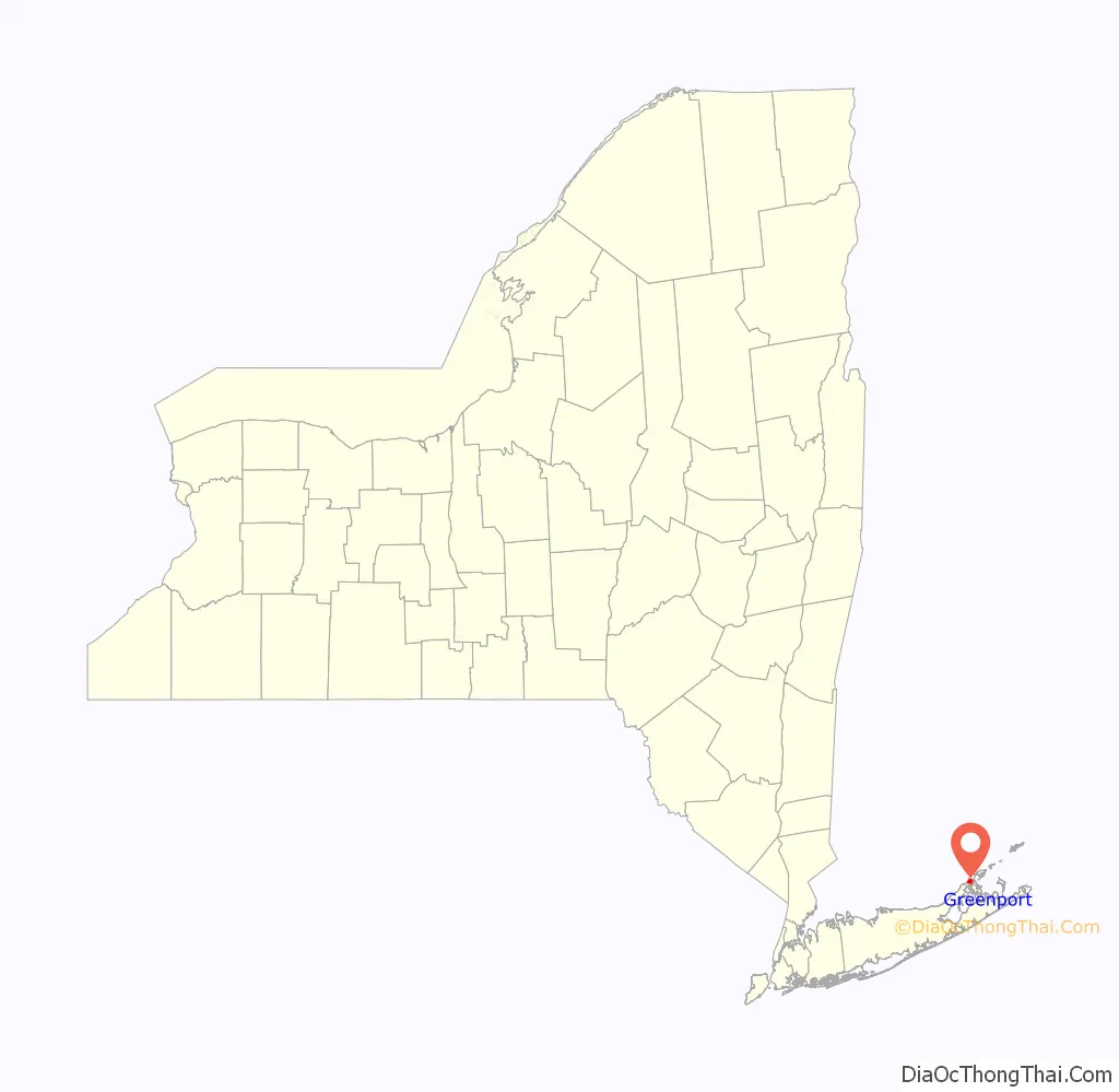
Greenport location map. Where is Greenport village?

History
Greenport was first settled in 1682. The village was called Winter Harbor, Stirling, and Green Hill and was incorporated in 1838. Greenport was once a whaling and ship building village, and since 1844, has been the eastern terminal station on the north fork for the Long Island Rail Road.
During Prohibition, rum running and speakeasies became a significant part of Greenport’s economy. Greenport’s residents knew the waters well and could outrun the coastguard. Restaurants on the east end, including Claudio’s in Greenport, served the illegal booze. Many of the village’s older structures are included in the Greenport Village Historic District, which was added to the National Register of Historic Places in 1986.
Police department disbanded
Village residents voted 617–339 in November 1994 to disband their nine-member police department. The department, which was established in 1947, was shut down after a grand jury investigation into a series of scandals. Since the shutdown, police services have been provided by the Southold Town Police Department. In 2005, trustees established a local chapter parapolice organization of volunteer vigilantes, Guardian Angels, to patrol the village.
Code Enforcement & Fire Prevention
In June 2016, the Village of Greenport began enforcing its own vehicle and traffic code, marking the first time since 1994 the Village enforced its traffic laws. The Village of Greenport Code Enforcement & Fire Prevention Department continue to enforce the Village Code, as well as a number of other Federal, State and Local rules & regulations.
Greenport Road Map
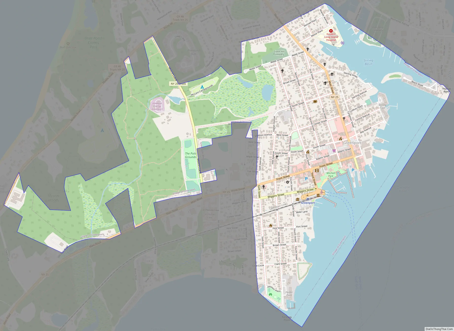
Greenport city Satellite Map

Geography
According to the United States Census Bureau, the village has a total area of 1.2 square miles (3.1 km), of which 1.0 square mile (2.6 km) is land and 0.2 square miles (0.52 km) (20.66%) is water.
See also
Map of New York State and its subdivision:- Albany
- Allegany
- Bronx
- Broome
- Cattaraugus
- Cayuga
- Chautauqua
- Chemung
- Chenango
- Clinton
- Columbia
- Cortland
- Delaware
- Dutchess
- Erie
- Essex
- Franklin
- Fulton
- Genesee
- Greene
- Hamilton
- Herkimer
- Jefferson
- Kings
- Lake Ontario
- Lewis
- Livingston
- Madison
- Monroe
- Montgomery
- Nassau
- New York
- Niagara
- Oneida
- Onondaga
- Ontario
- Orange
- Orleans
- Oswego
- Otsego
- Putnam
- Queens
- Rensselaer
- Richmond
- Rockland
- Saint Lawrence
- Saratoga
- Schenectady
- Schoharie
- Schuyler
- Seneca
- Steuben
- Suffolk
- Sullivan
- Tioga
- Tompkins
- Ulster
- Warren
- Washington
- Wayne
- Westchester
- Wyoming
- Yates
- Alabama
- Alaska
- Arizona
- Arkansas
- California
- Colorado
- Connecticut
- Delaware
- District of Columbia
- Florida
- Georgia
- Hawaii
- Idaho
- Illinois
- Indiana
- Iowa
- Kansas
- Kentucky
- Louisiana
- Maine
- Maryland
- Massachusetts
- Michigan
- Minnesota
- Mississippi
- Missouri
- Montana
- Nebraska
- Nevada
- New Hampshire
- New Jersey
- New Mexico
- New York
- North Carolina
- North Dakota
- Ohio
- Oklahoma
- Oregon
- Pennsylvania
- Rhode Island
- South Carolina
- South Dakota
- Tennessee
- Texas
- Utah
- Vermont
- Virginia
- Washington
- West Virginia
- Wisconsin
- Wyoming


