Lockport is both a city and the town that surrounds it in Niagara County, New York, United States. The city is the Niagara county seat, with a population of 21,165 according to 2010 census figures, and an estimated population of 20,305 as of 2019.
Its name derives from a set of Erie Canal locks (Lock Numbers 34 and 35) within the city that were built to allow canal barges to traverse the 60-foot natural drop of the Niagara Escarpment. It is part of the Buffalo–Niagara Falls metropolitan area.
| Name: | Lockport city |
|---|---|
| LSAD Code: | 25 |
| LSAD Description: | city (suffix) |
| State: | New York |
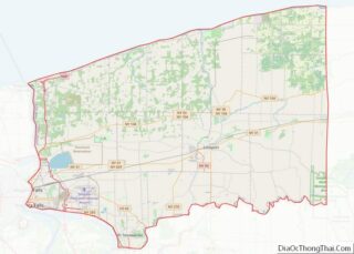
| County: | Niagara County |
| Elevation: | 614 ft (187 m) |
| Total Area: | 8.45 sq mi (21.87 km²) |
| Land Area: | 8.40 sq mi (21.76 km²) |
| Water Area: | 0.05 sq mi (0.12 km²) |
| Total Population: | 20,876 |
| Population Density: | 2,485.24/sq mi (959.58/km²) |
| Area code: | 716 |
| FIPS code: | 3643082 |
| GNISfeature ID: | 0955783 |
| Website: | lockportny.gov |
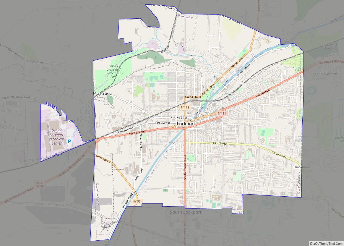
Online Interactive Map
Click on ![]() to view map in "full screen" mode.
to view map in "full screen" mode.
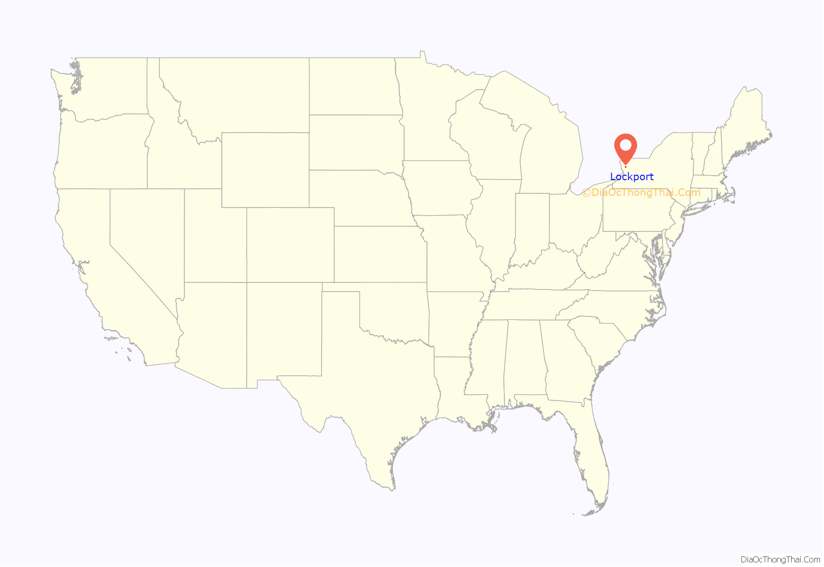
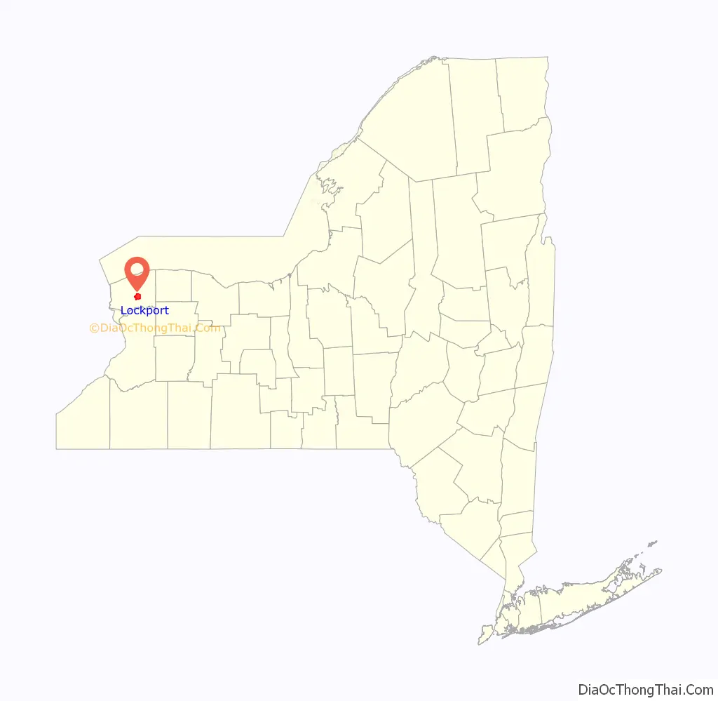
Lockport location map. Where is Lockport city?
History
The New York State Legislature authorized the Erie Canal’s construction in April 1816. The route proposed by surveyors was to traverse an area in central Niagara County, New York, which was then “uncivilized” and free of White settlers. At the time, the nearest settlers were in nearby Cold Springs, New York. Following the announcement, land speculators began to buy large plots along and near the proposed route of the canal. By December 1820, when the exact location of the step locks had been determined, the area that would become Lockport was owned by only fifteen men, many of whom were Quakers.
The canal reached Lockport in 1824, but the Flight of Five Locks were not completed until 1825. By 1829, Lockport was an established village. The community was centered on the locks, and consisted mainly of immigrant Scottish and Irish canal workers brought in as labor. The workers remained in Lockport after the completion of the locks, giving the city a heavy Celtic influence still discernible today, especially in the Lowertown and North Lockport neighborhoods.
The city of Lockport was incorporated in 1865. The Erie Canal was supplanted by the larger New York State Barge Canal in 1918, and the famous south “Flight of Five” locks was replaced by two much larger locks E34 and E35. The north “Flight of Five” lock chambers still remain as a spillway.
In recent years, public officials and private businesses have made an effort to promote Lockport history as a regional or national tourist attraction. This includes the completion of the Canal Discovery Center, the Lockport Cave and Underground Boat Ride tour, and the Lockport Locks and Erie Canal Cruises. Local officials are seeking state grants to reconstruct the historic “Flight of Five” and make it a living history site complete with boat rides and reenactors. Published reports state that such a living history site in Lockport, marketed as a day trip from Niagara Falls, could draw thousands of tourists to Lockport each year.
The city has a number of properties on the National Register of Historic Places. They include the Bacon-Merchant-Moss House, Col. William M. and Nancy Ralston Bond House, Chase-Crowley-Keep House, Chase-Hubbard-Williams House, Nathan Comstock Jr. House, Conkey House, Day Peckinpaugh, Dole House, Gibbs House, High and Locust Streets Historic District, Hopkins House, House at 8 Berkley Drive, Lockport Industrial District, Lowertown Historic District, Maloney House, Benjamin C. Moore Mill, Niagara County Courthouse and County Clerk’s Office, Thomas Oliver House, Pound–Hitchins House, Stickney House, Union Station, United States Post Office, Peter D. Walter House, Watson House, and White-Pound House.
Lockport’s largest employer is General Motors Components, the former Harrison Radiator Corporation, which was founded locally in 1912 and which became a division of General Motors Corporation in 1918. After 10 years of ownership by Delphi Corporation as Delphi Thermal Systems, it returned to General Motors in October 2009.
In 1948, the Lockport Chief of Police denied a permit for a Jehovah’s Witnesses minister to preach in a public park using a sound truck. In Saia v. New York, the U.S. Supreme Court struck down the city ordinance as a violation of the First Amendment.
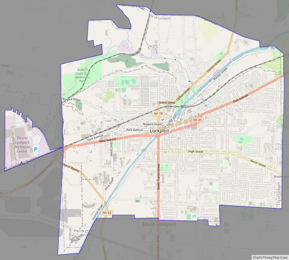
Lockport Road Map
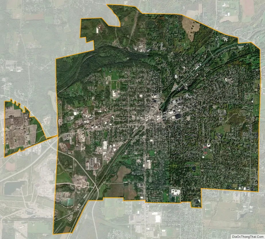
Lockport city Satellite Map
Geography
According to the U.S. Census Bureau, the city has a total area of 8.6 square miles (22.4 km), of which 8.5 square miles (22.1 km) is land and 0.1 square miles (0.3 km) (1.39%) is water. The Erie Canal passes through the center of the city, turning south toward Tonawanda Creek. It climbs the Niagara Escarpment through a series of two modern locks. Originally, a double set of five smaller combined locks were used.
Lockport is at the junction of several major truck routes, including NY Route 78 (Transit Road), NY Route 31, NY Route 77 and NY Route 93. It is 17 miles north of Interstate 90 via NY Route 78. The highest point is the bell tower at 452 High Street, with the street itself being the highest street as measured by frontage above the 650 feet elevation.
Lockport lies in area code 716.
See also
Map of New York State and its subdivision:- Albany
- Allegany
- Bronx
- Broome
- Cattaraugus
- Cayuga
- Chautauqua
- Chemung
- Chenango
- Clinton
- Columbia
- Cortland
- Delaware
- Dutchess
- Erie
- Essex
- Franklin
- Fulton
- Genesee
- Greene
- Hamilton
- Herkimer
- Jefferson
- Kings
- Lake Ontario
- Lewis
- Livingston
- Madison
- Monroe
- Montgomery
- Nassau
- New York
- Niagara
- Oneida
- Onondaga
- Ontario
- Orange
- Orleans
- Oswego
- Otsego
- Putnam
- Queens
- Rensselaer
- Richmond
- Rockland
- Saint Lawrence
- Saratoga
- Schenectady
- Schoharie
- Schuyler
- Seneca
- Steuben
- Suffolk
- Sullivan
- Tioga
- Tompkins
- Ulster
- Warren
- Washington
- Wayne
- Westchester
- Wyoming
- Yates
- Alabama
- Alaska
- Arizona
- Arkansas
- California
- Colorado
- Connecticut
- Delaware
- District of Columbia
- Florida
- Georgia
- Hawaii
- Idaho
- Illinois
- Indiana
- Iowa
- Kansas
- Kentucky
- Louisiana
- Maine
- Maryland
- Massachusetts
- Michigan
- Minnesota
- Mississippi
- Missouri
- Montana
- Nebraska
- Nevada
- New Hampshire
- New Jersey
- New Mexico
- New York
- North Carolina
- North Dakota
- Ohio
- Oklahoma
- Oregon
- Pennsylvania
- Rhode Island
- South Carolina
- South Dakota
- Tennessee
- Texas
- Utah
- Vermont
- Virginia
- Washington
- West Virginia
- Wisconsin
- Wyoming