Scarsdale is a town and village in Westchester County, New York, United States. The Town of Scarsdale is coextensive with the Village of Scarsdale, but the community has opted to operate solely with a village government, one of several villages in the state that have a similar governmental situation. As of the 2020 census, Scarsdale’s population was 18,253.
| Name: | Scarsdale village |
|---|---|
| LSAD Code: | 47 |
| LSAD Description: | village (suffix) |
| State: | New York |
| County: | Westchester County |
| Elevation: | 217 ft (66 m) |
| Total Area: | 6.68 sq mi (17.31 km²) |
| Land Area: | 6.67 sq mi (17.29 km²) |
| Water Area: | 0.01 sq mi (0.02 km²) |
| Total Population: | 18,253 |
| Population Density: | 2,734.53/sq mi (1,055.78/km²) |
| ZIP code: | 10583 |
| Area code: | 914 |
| FIPS code: | 3665431 |
| Website: | www.scarsdale.com |
Online Interactive Map
Click on ![]() to view map in "full screen" mode.
to view map in "full screen" mode.
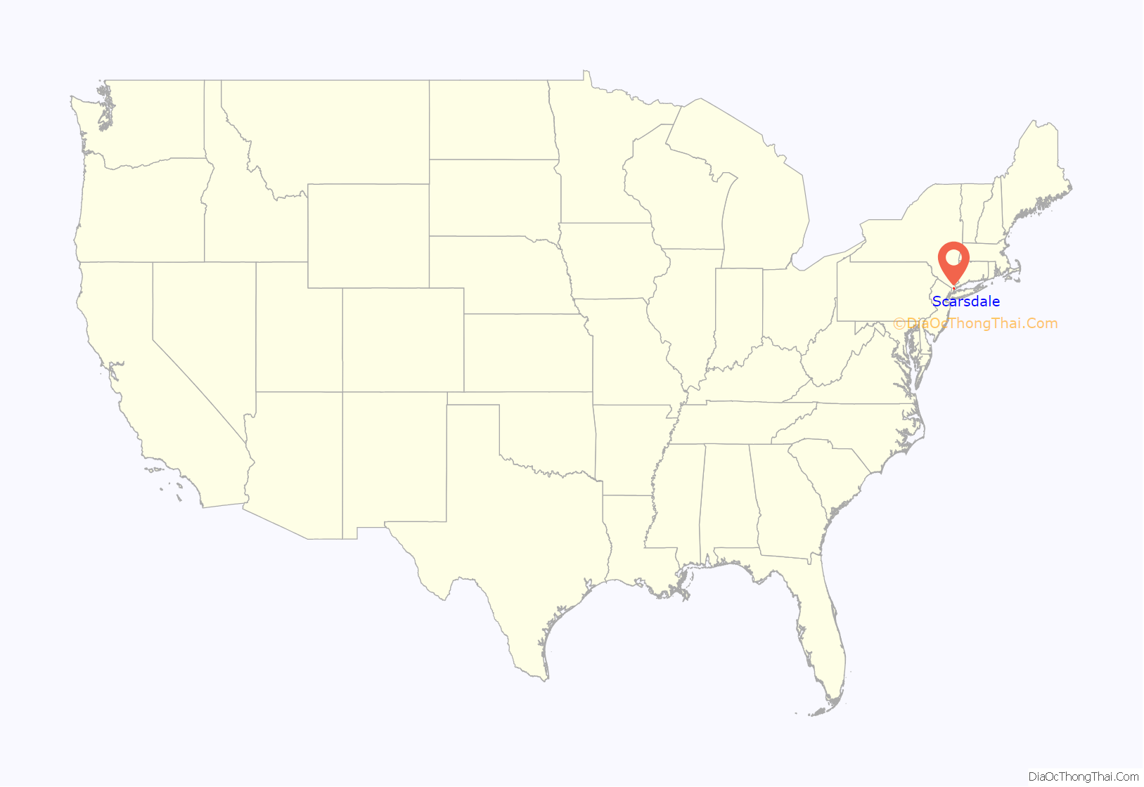
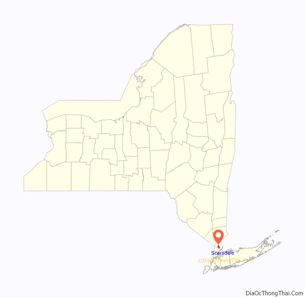
Scarsdale location map. Where is Scarsdale village?
History
Colonial era
Caleb Heathcote purchased land that would become Scarsdale at the end of the 17th century and, on March 21, 1701, had it elevated to a royal manor. He named the lands after his ancestral home in Derbyshire, England. The first local census of 1712 counted twelve inhabitants, including seven African slaves. When Caleb died in 1721, his daughters inherited the property. The estate was broken up in 1774, and the town was officially founded on March 7, 1788.
The town saw fighting during the American Revolution when the Continental and British armies clashed briefly at what is now the junction of Garden Road and Mamaroneck Road. The British commander, Sir William Howe, lodged at a farmhouse on Garden Road that remains standing. Scarsdale’s wartime history formed the basis for James Fenimore Cooper’s 1821 novel, The Spy: A Tale of the Neutral Ground, written while the author lived at the Angevine Farm in the present-day Heathcote section of town.
1790–1945
According to the first federal census in 1790, the town’s population was 281. By 1840, that number had declined to 255—the vast majority farmers and farm workers. In 1846, the New York and Harlem Railroad connected Scarsdale to New York City, leading to an influx of commuters.
The Arthur Suburban Home Company purchased a 150-acre (0.61 km) farm in 1891 and converted it into a subdevelopment of one-family dwellings, starting a transformation of the community from rural to suburban. Civil institutions soon appeared: the Heathcote Association (1904), the Town Club (1904), the Scarsdale Woman’s Club (1918) and the Scarsdale League of Women Voters (1921). Scarsdale High School and Greenacres Elementary School were built in 1912, and the Edgewood Elementary School opened in 1918. The first store in Scarsdale opened on the corner of Popham Road and Garth Road in 1912. By 1915, the population approached 3000. By 1930, that number approached 10,000.
In 1940, Nazi agent Gerhardt Alois Westrick secretly met with American business leaders at his Scarsdale home until public pressure—a reaction to articles in the New York Herald Tribune produced by British Security Coordination in New York—drove his family from the community. He was subsequently deported for pursuing activities unfriendly to the United States.
1945–present
Scarsdale became the subject of national controversy in the 1950s when a “Committee of Ten” led by Otto Dohrenwend alleged “Communist infiltration” in the public schools. A thorough investigation by the town rejected these claims. This same group, known as the Scarsdale Citizens Committee, sued to prevent a benefit for the Freedom Riders from taking place at the public high school in 1963 because some of the performers (Ossie Davis, Ruby Dee, Pete Seeger) were allegedly “communist sympathizers and subversives.”
Another controversy enveloped the town in 1961, when the Scarsdale Golf Club, headed by Charles S. McCallister, refused to allow a young man who had converted from Judaism into the Episcopal Church, Michael Cunningham Hernstadt, to escort a young woman, Pamela Nottage, to her debut at the club. At the time, it was the club’s policy to prohibit Jews from the premises. In response, the Rev. George French Kempsell of the Church of Saint James the Less announced that he would ban any supporters of the club’s decision from receiving Holy Communion. The event marked a turning point toward the decline of anti-Semitism in the town.
Scarsdale’s public library, which had been housed in historic Wayside Cottage since 1928, moved to its present structure on the White Plains Post Road in 1951. The driving force behind the library was New York City publisher S. Spencer Scott, who raised $100,000 for the project after the village rejected a bond issue to fund the building in 1938. The new library opened with 27,000 books and Sylvia C. Hilton serving as the first librarian.
The last of the town’s five elementary schools, Heathcote School, opened in September 1953. The $1,000,000 architectural landmark was designed by Perkins & Will of Chicago. Walter B. Cocking, the president of the New York State Committee for the Public Schools, delivered the dedication address.
In 1967, U.S. Secretary of State and former longtime resident Dean Rusk returned to Scarsdale at the height of the Vietnam War to receive the town’s Man of the Year Award and was greeted with a silent protest.
Scarsdale was the subject of a landmark United States Supreme Court decision, ACLU v. Scarsdale (1985), that established the so-called “reindeer rule” regarding public nativity scenes and upheld the right of local religious groups to place crèches on public property.
Scarsdale was involved in another United States Supreme Court case in 1985, Board of Trustees of Scarsdale v. McCreary, concerning the display of privately sponsored nativity scenes on public property.
On January 1, 2022, the village of Scarsdale banned the sale of all tobacco and cannabis products as well as smoking on public property for people of all ages. After the 60 day grace period, a 100 dollar fine will be imposed by law enforcement on violators.
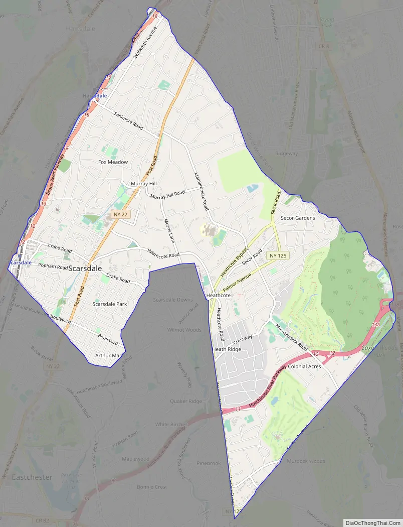
Scarsdale Road Map
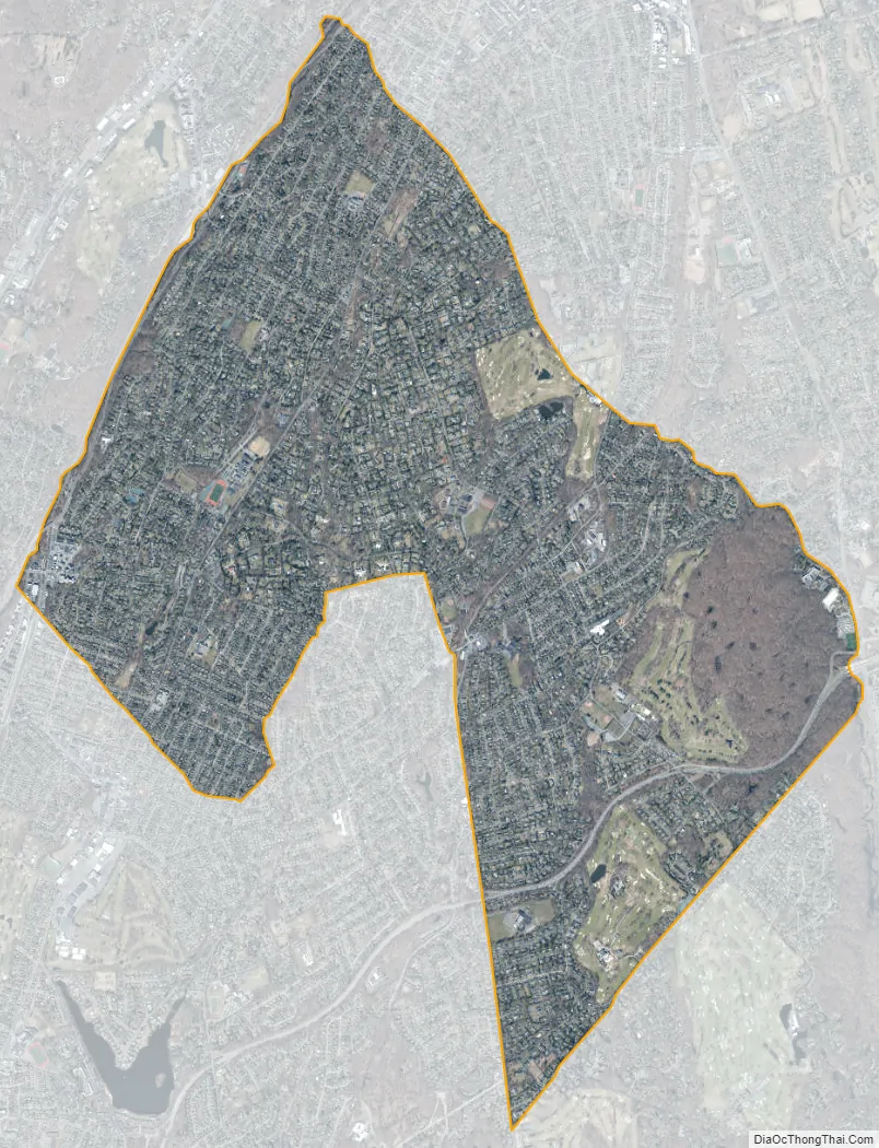
Scarsdale city Satellite Map
Geography
According to the United States Census Bureau, the village has a total area of 6.6 square miles (17 km), of which 0.15% is water. It is located approximately 7 miles to the border of New York City (in The Bronx), 11 miles from the northern tip of Manhattan, and 20 miles from Midtown Manhattan, which may be reached by Metro-North Railroad express train in approximately 30 minutes.
Climate
The town is in a humid continental climate zone (Köppen climate classification: Dfa), with cold, snowy winters and hot, humid summers and four distinct seasons. Scarsdale is just within the hardiness zone 7a, along with New York City and Long Island in New York state, with temperatures below 0 degrees Fahrenheit being rare.
Neighborhoods
Scarsdale is divided into five neighborhoods, which correspond to the public elementary schools: Greenacres, Fox Meadow, Heathcote, Quaker Ridge, and Edgewood.
See also
Map of New York State and its subdivision:- Albany
- Allegany
- Bronx
- Broome
- Cattaraugus
- Cayuga
- Chautauqua
- Chemung
- Chenango
- Clinton
- Columbia
- Cortland
- Delaware
- Dutchess
- Erie
- Essex
- Franklin
- Fulton
- Genesee
- Greene
- Hamilton
- Herkimer
- Jefferson
- Kings
- Lake Ontario
- Lewis
- Livingston
- Madison
- Monroe
- Montgomery
- Nassau
- New York
- Niagara
- Oneida
- Onondaga
- Ontario
- Orange
- Orleans
- Oswego
- Otsego
- Putnam
- Queens
- Rensselaer
- Richmond
- Rockland
- Saint Lawrence
- Saratoga
- Schenectady
- Schoharie
- Schuyler
- Seneca
- Steuben
- Suffolk
- Sullivan
- Tioga
- Tompkins
- Ulster
- Warren
- Washington
- Wayne
- Westchester
- Wyoming
- Yates
- Alabama
- Alaska
- Arizona
- Arkansas
- California
- Colorado
- Connecticut
- Delaware
- District of Columbia
- Florida
- Georgia
- Hawaii
- Idaho
- Illinois
- Indiana
- Iowa
- Kansas
- Kentucky
- Louisiana
- Maine
- Maryland
- Massachusetts
- Michigan
- Minnesota
- Mississippi
- Missouri
- Montana
- Nebraska
- Nevada
- New Hampshire
- New Jersey
- New Mexico
- New York
- North Carolina
- North Dakota
- Ohio
- Oklahoma
- Oregon
- Pennsylvania
- Rhode Island
- South Carolina
- South Dakota
- Tennessee
- Texas
- Utah
- Vermont
- Virginia
- Washington
- West Virginia
- Wisconsin
- Wyoming


