Aurora is a city in northwestern Portage County, Ohio, United States. A suburb in between Akron and Cleveland, the population was 17,239 at the 2020 census. It is part of the Akron metropolitan area.
Some say Aurora was the name of the daughter of Major Amos Spafford, while others believe the village was named after Aurora, the Roman goddess of dawn. The city is co-extensive with, and formed from, the former township of Aurora, which was formed from the Connecticut Western Reserve. Aurora was designated a Tree City USA by the National Arbor Day Foundation.
| Name: | Aurora city |
|---|---|
| LSAD Code: | 25 |
| LSAD Description: | city (suffix) |
| State: | Ohio |
| County: | Portage County |
| Incorporated: | 1929 (Village) |
| Elevation: | 1,132 ft (345 m) |
| Total Area: | 24.06 sq mi (62.31 km²) |
| Land Area: | 22.91 sq mi (59.35 km²) |
| Water Area: | 1.15 sq mi (2.97 km²) |
| Population Density: | 752.33/sq mi (290.48/km²) |
| ZIP code: | 44202 |
| Area code: | 330 |
| FIPS code: | 3903086 |
| GNISfeature ID: | 1064359 |
| Website: | www.auroraoh.com |
Online Interactive Map
Click on ![]() to view map in "full screen" mode.
to view map in "full screen" mode.
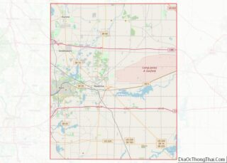
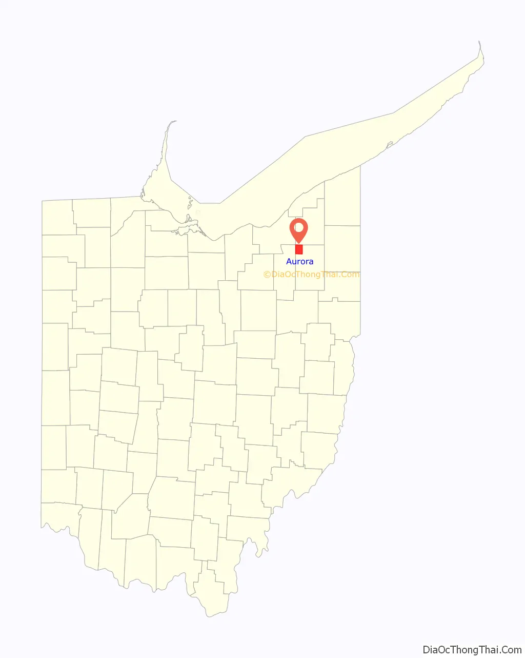
Aurora location map. Where is Aurora city?

History
In 1799, Ebenezer Sheldon, a former Revolutionary War soldier, settled in Aurora and built a cabin on east pioneer trail. Shortly after, he brought his family from Connecticut to live in the new settlement. In 1807 alone, 72 settlers came to Aurora, and two years later, the first frame house was built. Most people in Aurora at the time lived along the three main roads; The Cleveland-Warren road, the Chillicothe-Turnpike, and the Old Mill road. At the intersection of the three roads, inns and stores were built for settlers and travelers in Aurora. By the mid-1800s, the Chillicothe road was lined with shops, hotels, taverns, and a school. In 1862, one of the first cheese factories, the Silver Creek Cheese Factory, was built by Frank and Elisha Hurd. Ten years later, in 1872, the Aurora Station was constructed, and it became a major commercial area for the town. By the end of the 1800s, seven schools had been built, and the existing church in Aurora was also created.
In 1904, four million pounds of cheese was produced in Aurora cheese factories, making it the biggest cheese producer in the United States. One year later, Aurora’s stone sidewalk was completed, stretching from Aurora Station to Town Center. In 1913, a flood destroyed the Silver Creek Factory. One of its creators, Frank Hurd, stayed in the cheese industry until 1921. The Aurora cheese industry would be on decline from then on.
In 1929, Aurora would become a village, with its first mayor being Lee Gould. Later, the remaining areas of the Aurora township would be annexed into the village. By 1970, Aurora had reached a population of almost six and a half thousand residents, and its population would grow by about two thousand in the next decade. In 1971, Aurora would become a city.
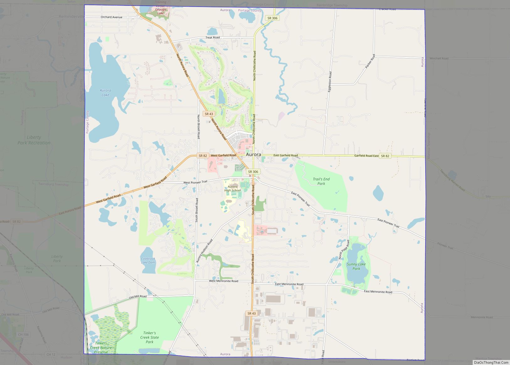
Aurora Road Map
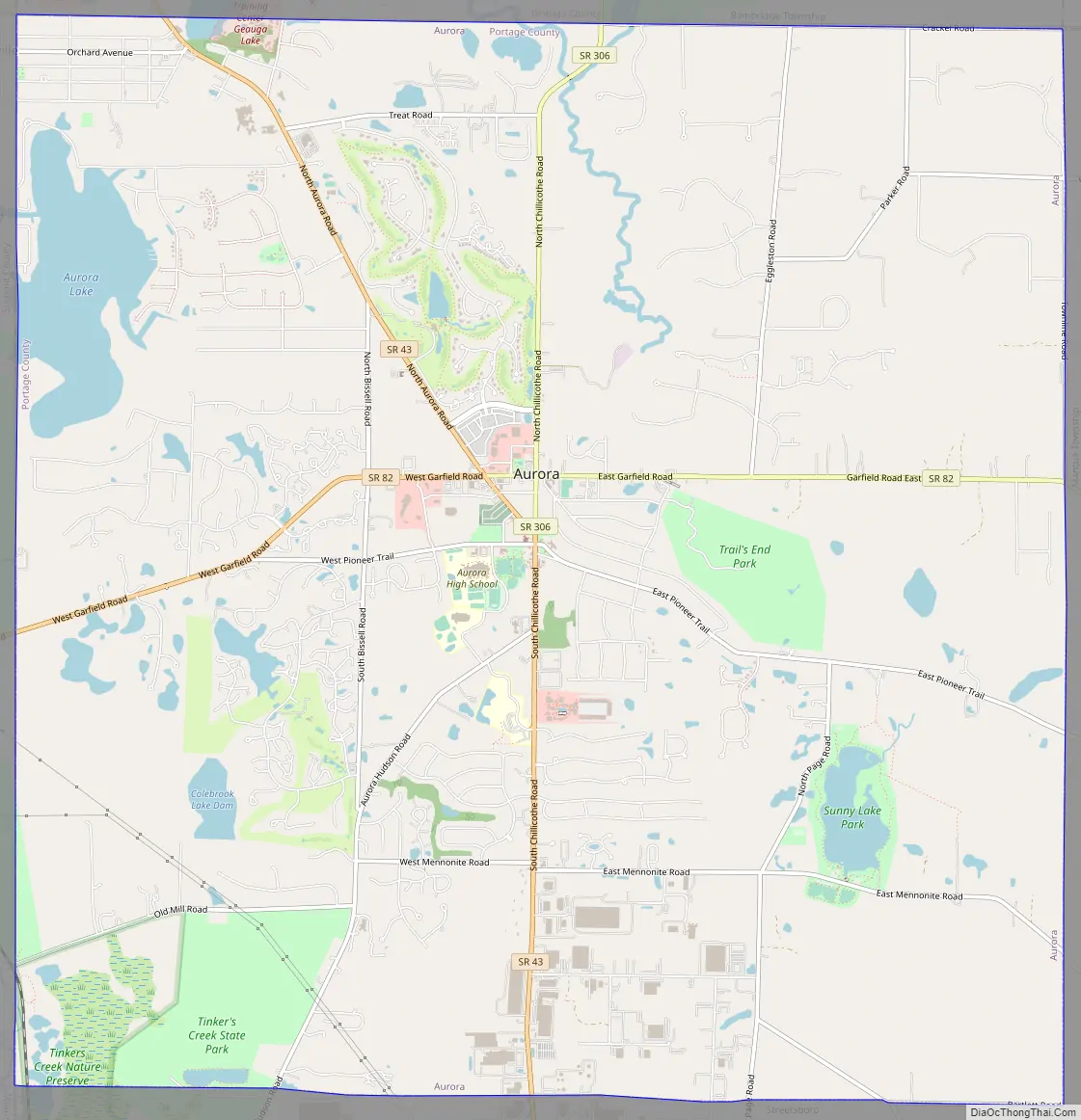
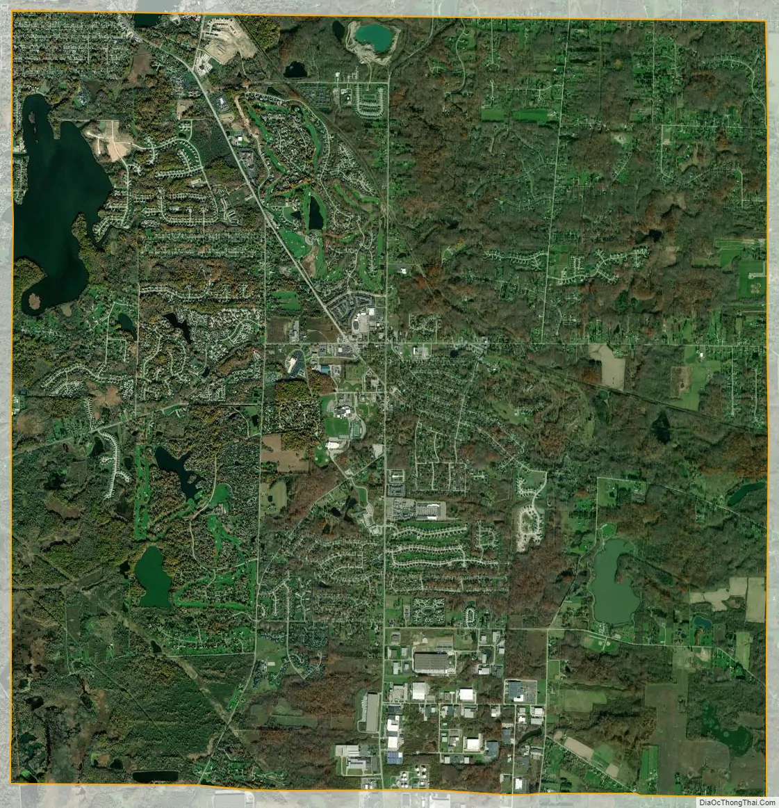
Aurora city Satellite Map
Geography
Aurora is located at 41°19′9″N 81°21′21″W / 41.31917°N 81.35583°W / 41.31917; -81.35583 (41.319254, -81.355859). It borders or touches the following other townships and municipalities:
- The city of Hudson, Summit County on the southwest (touches, but does not border)
- The city of Solon, Cuyahoga County on the northwest (touches, but does not border)
- Bainbridge Township, Geauga County, on the north
- Auburn Township, Geauga County, on the northeast (touches, but does not border)
- The city of Streetsboro, Portage County, on the south
- Twinsburg Township, Summit County, on the west
- The city of Reminderville, Summit County, on the west
According to the United States Census Bureau, the city has a total area of 24.07 square miles (62.34 km), of which 1.15 square miles (2.98 km) is covered by water.
See also
Map of Ohio State and its subdivision:- Adams
- Allen
- Ashland
- Ashtabula
- Athens
- Auglaize
- Belmont
- Brown
- Butler
- Carroll
- Champaign
- Clark
- Clermont
- Clinton
- Columbiana
- Coshocton
- Crawford
- Cuyahoga
- Darke
- Defiance
- Delaware
- Erie
- Fairfield
- Fayette
- Franklin
- Fulton
- Gallia
- Geauga
- Greene
- Guernsey
- Hamilton
- Hancock
- Hardin
- Harrison
- Henry
- Highland
- Hocking
- Holmes
- Huron
- Jackson
- Jefferson
- Knox
- Lake
- Lake Erie
- Lawrence
- Licking
- Logan
- Lorain
- Lucas
- Madison
- Mahoning
- Marion
- Medina
- Meigs
- Mercer
- Miami
- Monroe
- Montgomery
- Morgan
- Morrow
- Muskingum
- Noble
- Ottawa
- Paulding
- Perry
- Pickaway
- Pike
- Portage
- Preble
- Putnam
- Richland
- Ross
- Sandusky
- Scioto
- Seneca
- Shelby
- Stark
- Summit
- Trumbull
- Tuscarawas
- Union
- Van Wert
- Vinton
- Warren
- Washington
- Wayne
- Williams
- Wood
- Wyandot
- Alabama
- Alaska
- Arizona
- Arkansas
- California
- Colorado
- Connecticut
- Delaware
- District of Columbia
- Florida
- Georgia
- Hawaii
- Idaho
- Illinois
- Indiana
- Iowa
- Kansas
- Kentucky
- Louisiana
- Maine
- Maryland
- Massachusetts
- Michigan
- Minnesota
- Mississippi
- Missouri
- Montana
- Nebraska
- Nevada
- New Hampshire
- New Jersey
- New Mexico
- New York
- North Carolina
- North Dakota
- Ohio
- Oklahoma
- Oregon
- Pennsylvania
- Rhode Island
- South Carolina
- South Dakota
- Tennessee
- Texas
- Utah
- Vermont
- Virginia
- Washington
- West Virginia
- Wisconsin
- Wyoming