Hudson is a city in Summit County, Ohio, United States. The population was 23,110 at the 2020 census. It is a suburban community in the Akron metropolitan area. John Brown made his first public vow to destroy slavery here and it became part of the Underground Railroad. The Village of Hudson and Hudson Township were formerly two separate governing entities that merged in 1994.
| Name: | Hudson city |
|---|---|
| LSAD Code: | 25 |
| LSAD Description: | city (suffix) |
| State: | Ohio |
| County: | Summit County |
| Incorporated: | 1837 |
| Elevation: | 1,066 ft (325 m) |
| Total Area: | 25.88 sq mi (67.04 km²) |
| Land Area: | 25.63 sq mi (66.37 km²) |
| Water Area: | 0.26 sq mi (0.67 km²) |
| Total Population: | 23,110 |
| Population Density: | 901.85/sq mi (348.21/km²) |
| ZIP code: | 44236 |
| Area code: | 330, 234 |
| FIPS code: | 3936651 |
| GNISfeature ID: | 1048857 |
| Website: | www.hudson.oh.us |
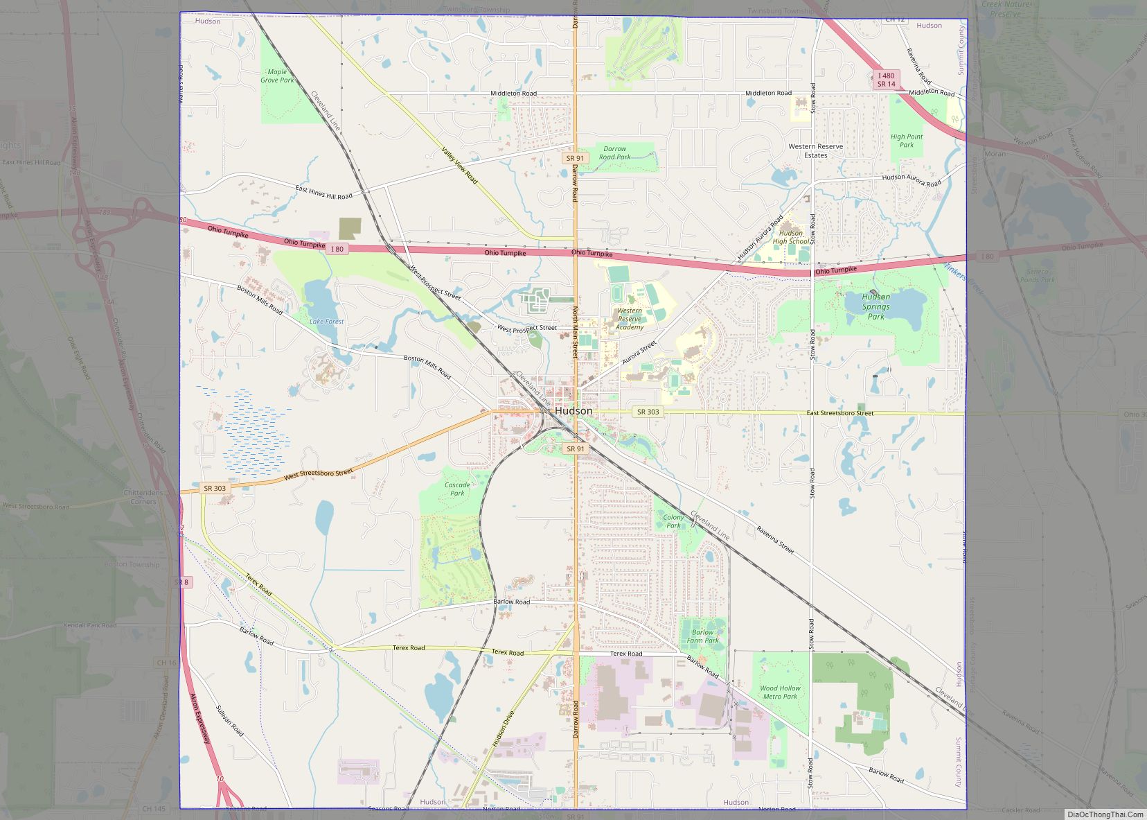
Online Interactive Map
Click on ![]() to view map in "full screen" mode.
to view map in "full screen" mode.
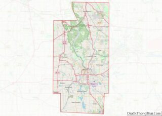
Hudson location map. Where is Hudson city?


History
The city is named after its founder, David Hudson, who settled there from Goshen, Connecticut, in 1799, when it was part of the Connecticut Western Reserve. The village of Hudson, located in the center of Hudson Township, was incorporated in 1837. In Hudson, David Hudson built the first Log House in Summit County, Ohio. There is a marker at the intersection of Baldwin Street and North Main Street (Ohio Route 91), on the right when traveling east on Baldwin Street. The marker is embedded in the west face of the boulder.
Hudson was the home of Western Reserve College and Preparatory School, founded in 1826 by David Hudson among others. It was spoken of as the “Yale of the West”. The College moved to Cleveland in 1882 and later, as Western Reserve University, merged with the Case Institute of Technology to form the modern Case Western Reserve University. The Yale-inspired red brick buildings are now the Western Reserve Academy. The Loomis Observatory was built in 1838 and is the oldest observatory in the U.S. still in its original location.
The Cleveland and Pittsburgh Railroad began service to Hudson in 1852. In 1861, President-elect Abraham Lincoln spoke to about 6,000 people for 2 to 3 minutes from the last train car at the old Hudson Depot, near the south end of College Street. The railroad ended passenger service at Hudson, Ohio in 1965. A former train station (built in the 1910s) that was located near the intersection of West Streetsboro and Library Streets was demolished in 2013.
There was a fire on the west side of Hudson’s Main street in 1892. The fire destroyed the buildings between Park Lane and Clinton Street. A. W. Lockhart’s saloon and the Mansion House [Hotel] burned. The Hudson-born Pennsylvania coal mine owner James Ellsworth assisted in the rebuilding of Main Street after the street had been destroyed by fire in 1903. Ellsworth also refinanced the bankrupt Western Reserve Academy, housed on the former campus of Western Reserve College, which had been closed from 1903 until 1916.
In 1882, Gustave H. Grimm established the G.H. Grimm Manufacturing Company to built and sell corrugated tin pan evaporators for use in maple syrup production. That area of now called “The Evaporator Works” is on the south of Ravenna and just east of Ohio Route 91.
The Hudson Clock Tower was built in 1912 by James Ellsworth who was born in Hudson in 1849. The original clock movement was supplied by the E. Howard Clock Company of Boston. The energy from 3000 pound gravity weights powered the movement of the clocks and Westminster chimes. The town marshall was responsible for entering the tower every few days and winding (lifting) the weights.
Lincoln Ellsworth was the son of James Ellsworth. Lincoln Ellsworth is the only Hudsonite on a U.S. postage stamp. The Ellsworth Mountains are named after Lincoln Ellsworth. Lincoln was born in Chicago and lived in Hudson when he was a child. Lincoln was awarded two Congressional Gold Medals.
From 1957 until the late 1980s, General Motors had a factory almost one thousand workers in Hudson, Ohio that built crawler tractor earth moving equipment. The factory was beside and east of Ohio Route 91 and it was south of Terex Road. The original 1958 factory had 660,000 square feet. In 1961, GM added 340,000 square feet for a total of 1 million square feet of factory. In 1970, GM renamed their earth moving equipment division as Terex. Currently Jo-Ann Stores uses most of the former GM factory. Hudson had an airport from mid-1920s until 1957, known as the Hudson Mid-City Airport, near the former General Motors Euclid Division.
On November 28, 1973, a large area of the village, “roughly bounded by College, Streetsboro, S. Main, and Baldwin” streets, was listed on the National Register of Historic Places as the Hudson Historic District. The historic district was expanded on October 10, 1989, to also include the area “roughly bounded by Hudson St., Old Orchard Dr., Aurora St., Oviatt St., Streetsboro St., and College St. to Aurora (street)”. In addition to the Hudson Historic District, there are several additional properties in Hudson listed on the Register. The City of Hudson came about in 1994 when voters approved the merger of Hudson Township and Hudson Village, which had previously been two separate governing entities.
In July 2003, Hudson received over 17 inches (430 mm) of rain from three storm events within 24 hours. Hudson had flood damage within all its three watersheds … Mud Brook, Brandywine Creek and Tinker’s Creek. The Brandywine Creek Watershed experienced the most flood damage in 2003. Two men drowned in an underground parking garage of a condominium complex on July 21, 2003. State Routes 91 and 303 flooded where the highways dip low to pass under the train tracks and the highways were closed by 7:40 PM on July 21.
An anti-slavery center
Ohio’s Western Reserve “was probably the most intensely antislavery section of the country”. Hudson, with the Reserve’s first college, was for a time its intellectual capital. The founders of Hudson were abolitionists, although founder David Hudson favored the soon-to-be-discarded strategy of “colonization”: sending free Blacks “back to Africa”. Another founder, Owen Brown, father of John Brown, was a fervent abolitionist. The latter, who arguably did more to end slavery in the United States than any other person, grew up and was educated in Hudson from 1805 to 1825. There is a marker at the site of his family’s home, at the intersection of Ravenna and South Main Streets.
There is also a historical marker at the location of the first meetinghouse of the First Congregational Church, at East Main and Church Streets, reading: “In August, 1835, church members unanimously adopted a resolution declaring that slavery is ‘a direct violation of the law of Almighty God.’ At a November 1837 prayer meeting, church member and anti-slavery leader John Brown made his first public vow to destroy slavery.”
Thousands of fugitive slaves, heading for freedom in Canada, passed through Hudson; it was a stop on the Underground Railroad. Owen Brown was very active in assisting the fugitives. As of 2019, 21 locations in and around Hudson associated with the Underground Railroad have been identified. and in 1992 there appeared a book by James Caccamo, Hudson and the Underground Railroad.
Hudson cheese manufacturer Seymour Straight was the primary funder of Straight University, founded in 1868, the first university in New Orleans for Black students.
Hudson’s period of anti-slavery leadership ended in the early 1830s. Beriah Green, the lone professor of theology at the college, was influenced by William Lloyd Garrison’s new newspaper, The Liberator, and his Thoughts on African Colonization. He preached four fiery anti-slavery sermons, which so inflamed the college that nothing else was being discussed, the president said, and the town was torn apart. Green, expecting to be fired, left to become president of the Oneida Institute, on condition Blacks be admitted on the same terms as whites. Oneida, near Utica, New York, replaced Hudson as the nation’s leading abolitionist center.
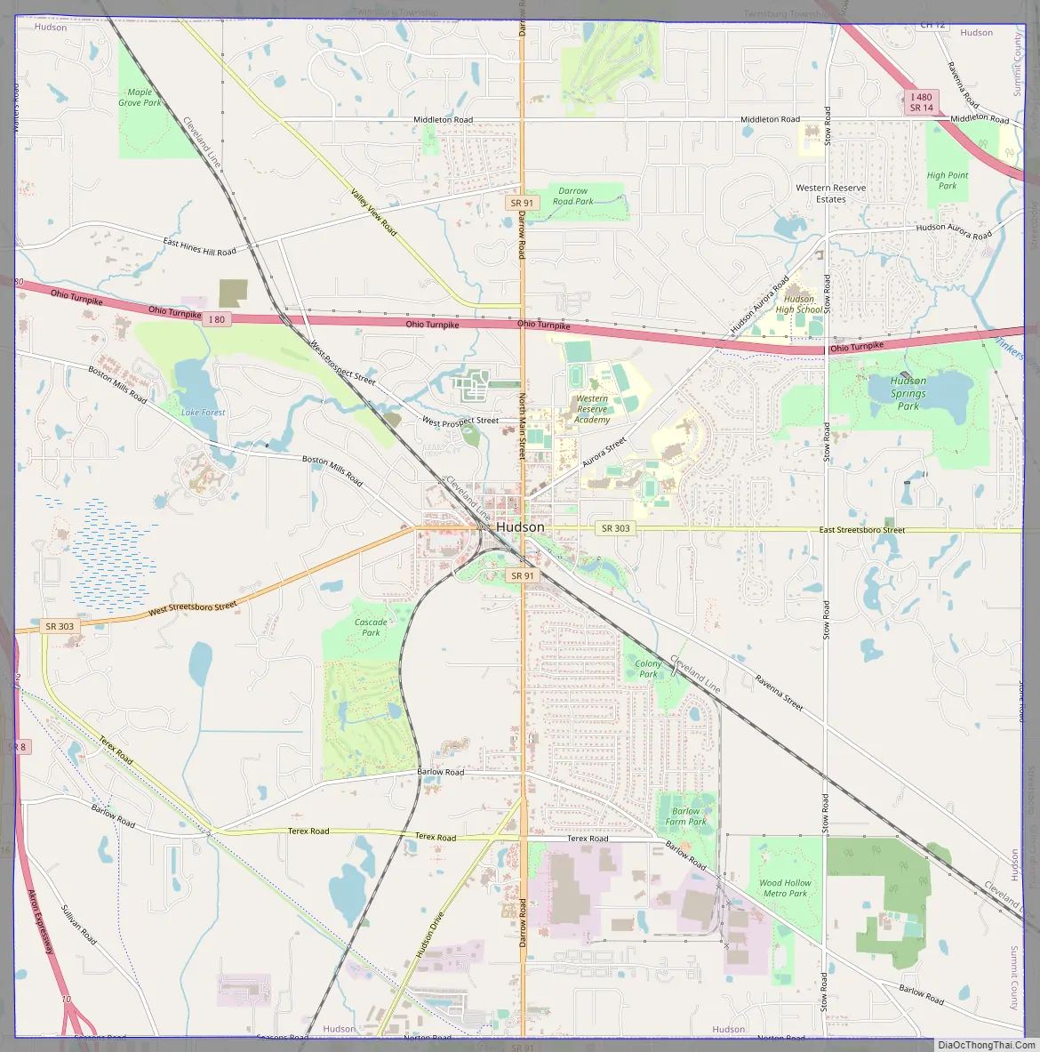
Hudson Road Map
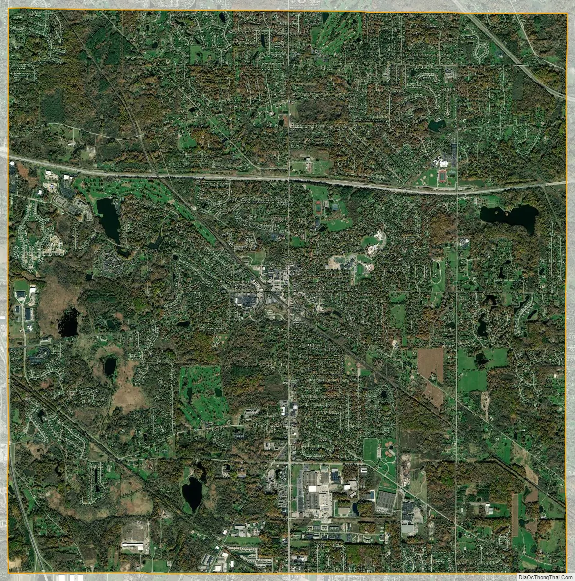
Hudson city Satellite Map
Geography
Hudson is located in northeastern Summit County. According to the United States Census Bureau, the city has a total area of 25.87 square miles (67.00 km), of which 25.60 square miles (66.30 km) is land and 0.27 square miles (0.70 km) is water.
Neighboring communities
Hudson’s neighbors are, starting at the northern corporate boundary and proceeding clockwise:
- Northfield Center Township (meets at Hudson’s northwest corner)
- Macedonia (western quarter of Hudson’s northern boundary)
- Twinsburg Township (remainder of Hudson’s northern boundary)
- Aurora (meets at northeast corner)
- Streetsboro (entire eastern boundary)
- Franklin Township (meets at southeast corner)
- Stow (entire southern boundary)
- Cuyahoga Falls (meets at southwest corner)
- Boston Township (southern third of Hudson’s western boundary)
- Boston Heights (remainder of western boundary)
Watersheds
Hudson’s surface water flows into five major watersheds. The three most prominent are Brandywine Creek, Mud Brook, and Tinkers Creek. A small part of the western edge of town drains into the Cuyahoga River, and the southeastern corner of the city drains into Fish Creek.
See also
Map of Ohio State and its subdivision:- Adams
- Allen
- Ashland
- Ashtabula
- Athens
- Auglaize
- Belmont
- Brown
- Butler
- Carroll
- Champaign
- Clark
- Clermont
- Clinton
- Columbiana
- Coshocton
- Crawford
- Cuyahoga
- Darke
- Defiance
- Delaware
- Erie
- Fairfield
- Fayette
- Franklin
- Fulton
- Gallia
- Geauga
- Greene
- Guernsey
- Hamilton
- Hancock
- Hardin
- Harrison
- Henry
- Highland
- Hocking
- Holmes
- Huron
- Jackson
- Jefferson
- Knox
- Lake
- Lake Erie
- Lawrence
- Licking
- Logan
- Lorain
- Lucas
- Madison
- Mahoning
- Marion
- Medina
- Meigs
- Mercer
- Miami
- Monroe
- Montgomery
- Morgan
- Morrow
- Muskingum
- Noble
- Ottawa
- Paulding
- Perry
- Pickaway
- Pike
- Portage
- Preble
- Putnam
- Richland
- Ross
- Sandusky
- Scioto
- Seneca
- Shelby
- Stark
- Summit
- Trumbull
- Tuscarawas
- Union
- Van Wert
- Vinton
- Warren
- Washington
- Wayne
- Williams
- Wood
- Wyandot
- Alabama
- Alaska
- Arizona
- Arkansas
- California
- Colorado
- Connecticut
- Delaware
- District of Columbia
- Florida
- Georgia
- Hawaii
- Idaho
- Illinois
- Indiana
- Iowa
- Kansas
- Kentucky
- Louisiana
- Maine
- Maryland
- Massachusetts
- Michigan
- Minnesota
- Mississippi
- Missouri
- Montana
- Nebraska
- Nevada
- New Hampshire
- New Jersey
- New Mexico
- New York
- North Carolina
- North Dakota
- Ohio
- Oklahoma
- Oregon
- Pennsylvania
- Rhode Island
- South Carolina
- South Dakota
- Tennessee
- Texas
- Utah
- Vermont
- Virginia
- Washington
- West Virginia
- Wisconsin
- Wyoming