Cornelius is a city in Washington County, Oregon, United States. Located in the Portland metropolitan area, the city’s population was 11,869 at the 2010 census. The city lies along Tualatin Valley Highway between Forest Grove to the west and Hillsboro to the east. Cornelius was incorporated in 1893 and is named for founder Thomas R. Cornelius.
| Name: | Cornelius city |
|---|---|
| LSAD Code: | 25 |
| LSAD Description: | city (suffix) |
| State: | Oregon |
| County: | Washington County |
| Incorporated: | 1893 |
| Elevation: | 179 ft (54 m) |
| Total Area: | 2.34 sq mi (6.06 km²) |
| Land Area: | 2.34 sq mi (6.06 km²) |
| Water Area: | 0.00 sq mi (0.00 km²) |
| Total Population: | 12,694 |
| Population Density: | 5,427.11/sq mi (2,095.42/km²) |
| ZIP code: | 97113 |
| Area code: | 503, 971 |
| FIPS code: | 4115550 |
| GNISfeature ID: | 1162918 |
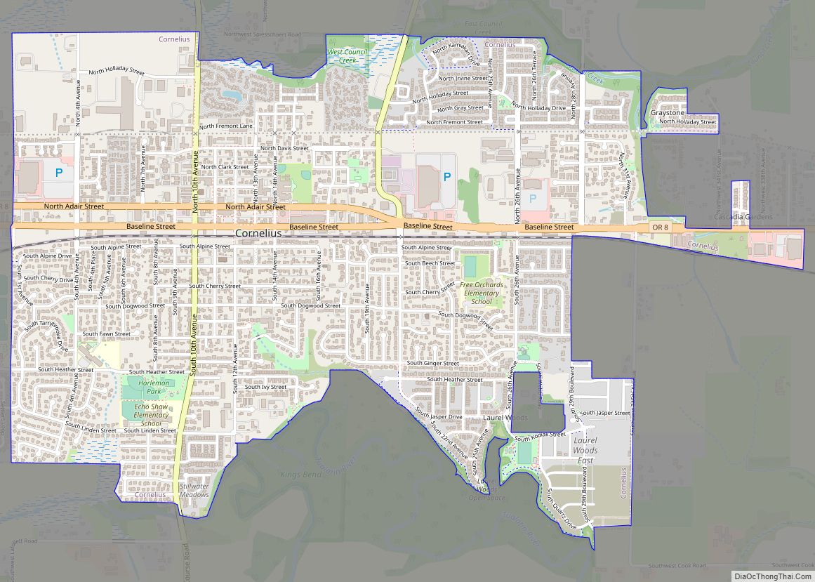
Online Interactive Map
Click on ![]() to view map in "full screen" mode.
to view map in "full screen" mode.
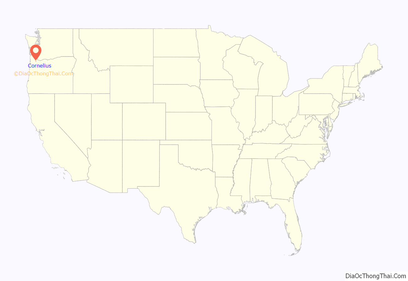
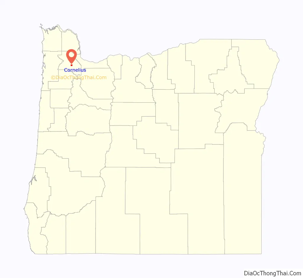
Cornelius location map. Where is Cornelius city?
History
In 1845, Benjamin Cornelius immigrated to Oregon with his family, traveling with Joseph Meek. The Cornelius family settled on the Tualatin Plains, near what is now North Plains. The same year, Benjamin Q. Tucker and Solomon Emerick staked land claims and established farms on the land that would eventually become Cornelius. At that time, the area was called Free Orchards; there was no actual community, but the name referred to the orchards on the 107 acres (0.43 km) of land.
In 1871, Benjamin Cornelius’s son Colonel Thomas R. Cornelius learned that Ben Holladay planned to extend the Oregon and California Railroad right through Free Orchards. Holladay had been told by Forest Grove and Hillsboro that they would not allow the railroad free right-of-way, so Holladay planned to bypass them, and build Free Orchards into a new city that would become the new county seat of Washington County.
The new railroad was approaching Free Orchards in 1871, and Cornelius saw an opportunity to benefit from the new railroad. He left his farm and built a new house, a warehouse, and a store in Free Orchards. The warehouse and store were located right next to the railroad, and so became natural places for local farmers to trade and store their goods. Cornelius also built a creamery to process milk, and two sawmills to supply lumber for the growing community. In addition, he helped to build the first frame schoolhouse and the Methodist Church.
In 1893, Free Orchards was incorporated and renamed “Cornelius”, to honor the man who spent many years helping build the community. Though Holladay’s plan to make Free Orchards into the county seat never materialized, Cornelius survives today as an agricultural town and, increasingly, as a suburb of Portland. The Cornelius Public Library was founded in 1912.
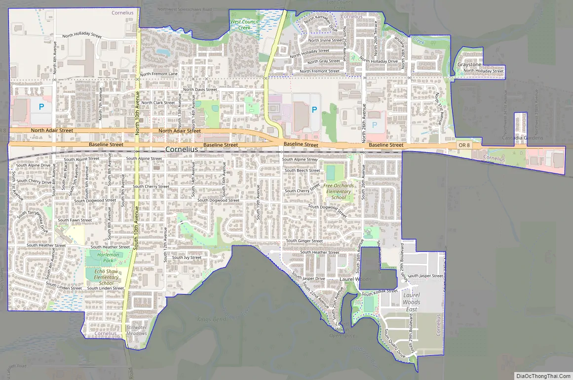
Cornelius Road Map
Cornelius city Satellite Map
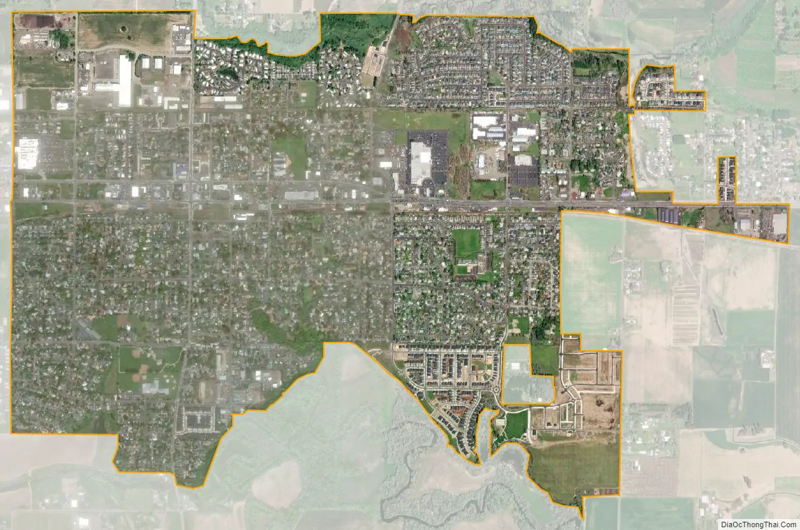
Geography
According to the United States Census Bureau, the city has a total area of 2.01 square miles (5.21 km), all land.
See also
Map of Oregon State and its subdivision: Map of other states:- Alabama
- Alaska
- Arizona
- Arkansas
- California
- Colorado
- Connecticut
- Delaware
- District of Columbia
- Florida
- Georgia
- Hawaii
- Idaho
- Illinois
- Indiana
- Iowa
- Kansas
- Kentucky
- Louisiana
- Maine
- Maryland
- Massachusetts
- Michigan
- Minnesota
- Mississippi
- Missouri
- Montana
- Nebraska
- Nevada
- New Hampshire
- New Jersey
- New Mexico
- New York
- North Carolina
- North Dakota
- Ohio
- Oklahoma
- Oregon
- Pennsylvania
- Rhode Island
- South Carolina
- South Dakota
- Tennessee
- Texas
- Utah
- Vermont
- Virginia
- Washington
- West Virginia
- Wisconsin
- Wyoming