Ontario is the largest city in Malheur County, Oregon, United States. It lies along the Snake River at the Idaho border. The population was 11,366 at the 2010 census. The city is the largest community in the region of far eastern Oregon, also known as the Western Treasure Valley.
Ontario is the principal city of the Ontario, OR-ID Micropolitan Statistical Area, which includes Malheur County in Oregon and Payette County in Idaho.
Ontario is approximately halfway between Portland and Salt Lake City. It is the closest city to the Idaho border along Interstate 84. The city’s slogan is “Where Oregon Begins”.
| Name: | Ontario city |
|---|---|
| LSAD Code: | 25 |
| LSAD Description: | city (suffix) |
| State: | Oregon |
| County: | Malheur County |
| Incorporated: | 1899 |
| Elevation: | 2,150 ft (655 m) |
| Total Area: | 5.17 sq mi (13.38 km²) |
| Land Area: | 5.17 sq mi (13.38 km²) |
| Water Area: | 0.00 sq mi (0.00 km²) |
| Total Population: | 11,645 |
| Population Density: | 2,254.60/sq mi (870.42/km²) |
| ZIP code: | 97914 |
| Area code: | 541 |
| FIPS code: | 4154900 |
| GNISfeature ID: | 1125001 |
| Website: | “City of Ontario, Oregon”. |
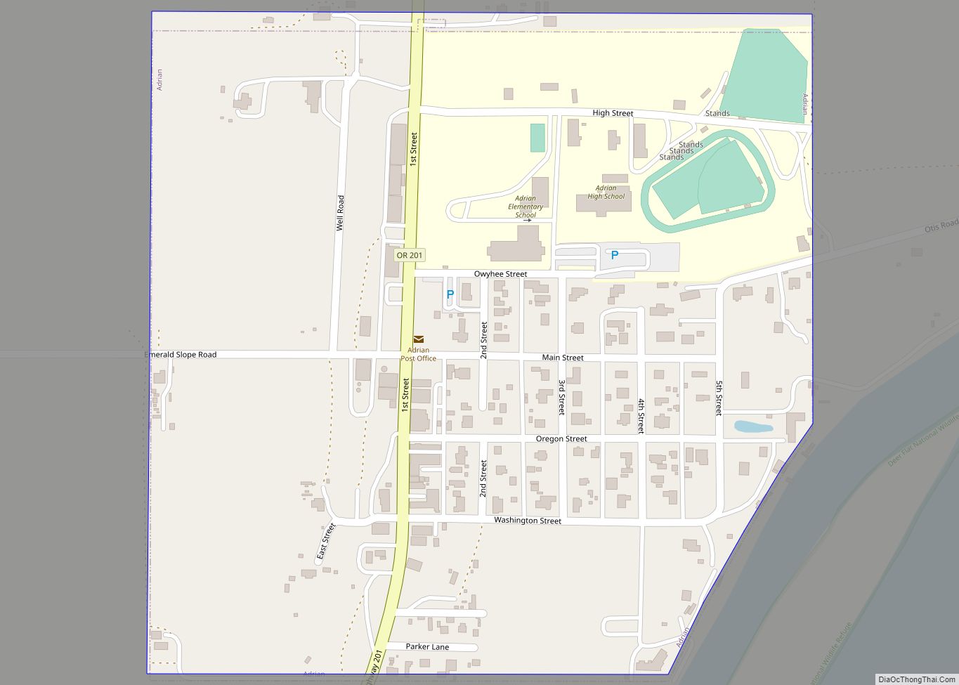
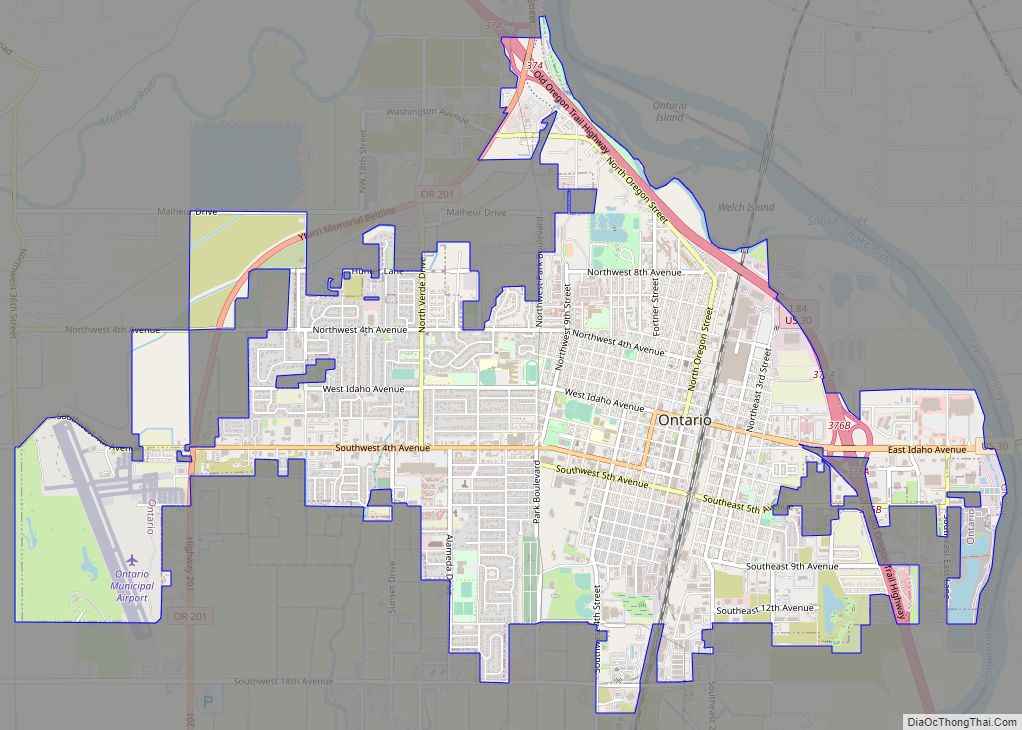
Online Interactive Map
Click on ![]() to view map in "full screen" mode.
to view map in "full screen" mode.
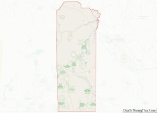
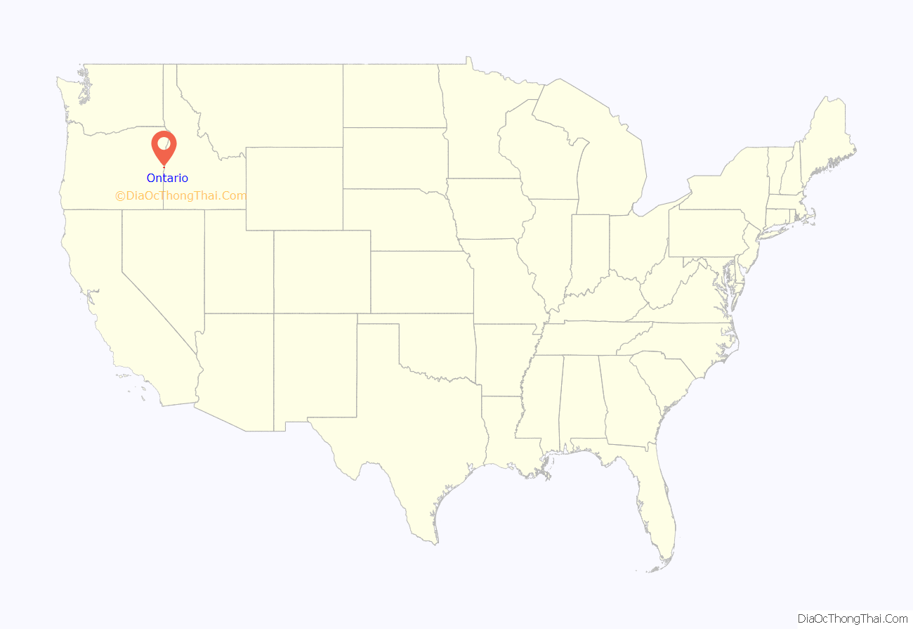
Ontario location map. Where is Ontario city?
History
Ontario was founded on 11 June 1883, by developers William Morfitt, Mary Richardson, Daniel Smith, and James Virtue. In March 1884, Richard Welch started a post office for the quarter of Ontario, so named by James Virtue after Ontario, Canada. Two months later Joseph Morton applied for a Morton post office at an island about one mile south of town, with Oscar Scott as postmaster. Unfortunately for Morton and Scott, merchants Morfitt and Richardson of Malheur City, gold miner Virtue, and lumberman Smith of Baker City acquired more land and were better financed. More importantly, Morfitt had negotiated a train depot for Ontario. All the settlers and speculators knew the railroad was coming and how important that would be to Ontario’s future so Scott closed his Morton post office and built a hotel at present-day Ontario. By December, Scott was Ontario’s postmaster.
The town continued to grow with the arrival of the Oregon Short Line Railroad in later 1884, and freight and passenger service were added to the town’s offerings. Soon after, stock began arriving from Eastern Oregon’s cattle ranches to Ontario’s stockyard for transshipment to markets throughout the Pacific Northwest. Ontario became one of the largest stockyards in the West. In addition, the construction of the Nevada Ditch and other canals aided the burgeoning agricultural industry, adding those products to Ontario’s exports.
Ontario was incorporated by the Oregon Legislative Assembly on 11 February 1899.
A city by the time of World War II, Ontario Mayor Elmo Smith allowed Japanese Americans to settle at a time when much of the West Coast supported their exclusion. Smith told the Associated Press “If the Japs, both alien and nationals, are a menace to the Pacific Coast safety unless they are moved inland, it appears downright cowardly to take any other stand than to put out the call, ‘Send them along; we’ll cooperate to the fullest possible extent in taking care of them.'” A population of about 134 in the city and surrounding county before the war ballooned to 1,000 as the county recruited farm workers during the war.
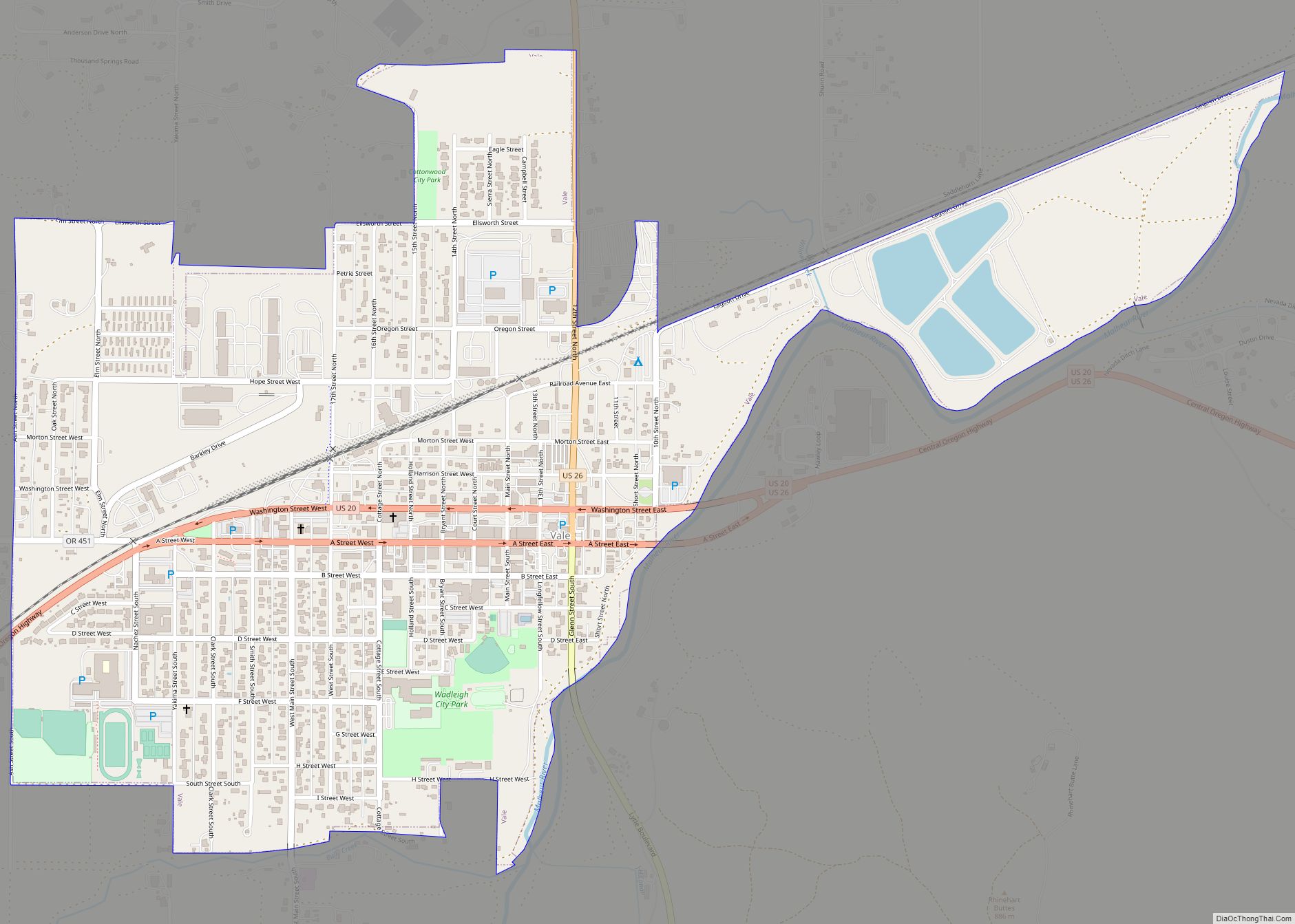
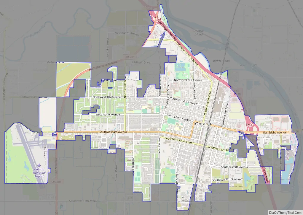
Ontario Road Map
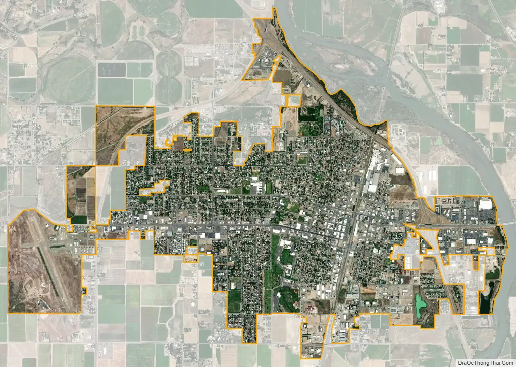
Ontario city Satellite Map
Geography
Ontario is located at an elevation of 2,150 feet (660 m) above sea level.
According to the United States Census Bureau, the city has a total area of 5.17 square miles (13.39 km), all land.
Climate
Ontario has a cold desert dry-summer continental climate, abbreviated “BSk” on climate maps. As is common with the high deserts of Oregon, winters are cold and snowy, while summers are hot, dry and sunny. The record high temperature of 114 °F (45.6 °C) was observed on July 12, 1967, while the record low of −25 °F (−31.7 °C) was observed on January 27, 1957, and January 22, 1962.
See also
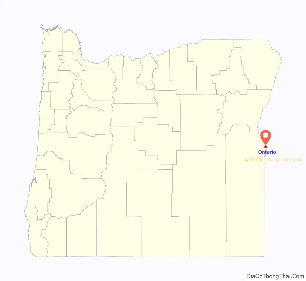
Map of Oregon State and its subdivision: Map of other states:- Alabama
- Alaska
- Arizona
- Arkansas
- California
- Colorado
- Connecticut
- Delaware
- District of Columbia
- Florida
- Georgia
- Hawaii
- Idaho
- Illinois
- Indiana
- Iowa
- Kansas
- Kentucky
- Louisiana
- Maine
- Maryland
- Massachusetts
- Michigan
- Minnesota
- Mississippi
- Missouri
- Montana
- Nebraska
- Nevada
- New Hampshire
- New Jersey
- New Mexico
- New York
- North Carolina
- North Dakota
- Ohio
- Oklahoma
- Oregon
- Pennsylvania
- Rhode Island
- South Carolina
- South Dakota
- Tennessee
- Texas
- Utah
- Vermont
- Virginia
- Washington
- West Virginia
- Wisconsin
- Wyoming