Eureka Mill is a census-designated place (CDP) in Chester County, South Carolina, United States. The population was 1,476 at the 2010 census, down from 1,737 at the 2000 census.
| Name: | Eureka Mill CDP |
|---|---|
| LSAD Code: | 57 |
| LSAD Description: | CDP (suffix) |
| State: | South Carolina |
| County: | Chester County |
| Elevation: | 518 ft (158 m) |
| Total Area: | 1.26 sq mi (3.26 km²) |
| Land Area: | 1.26 sq mi (3.26 km²) |
| Water Area: | 0.00 sq mi (0.00 km²) |
| Total Population: | 1,420 |
| Population Density: | 1,128.78/sq mi (435.77/km²) |
| ZIP code: | 29706 |
| Area code: | 803 |
| FIPS code: | 4524020 |
| GNISfeature ID: | 1867520 |
Online Interactive Map
Click on ![]() to view map in "full screen" mode.
to view map in "full screen" mode.
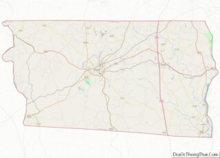
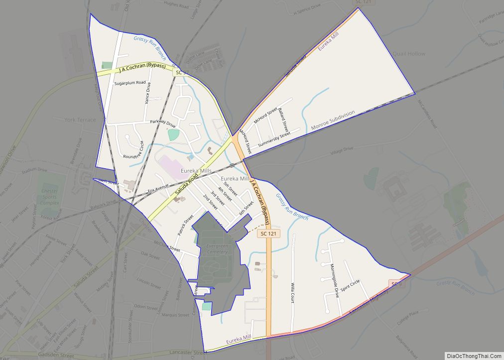
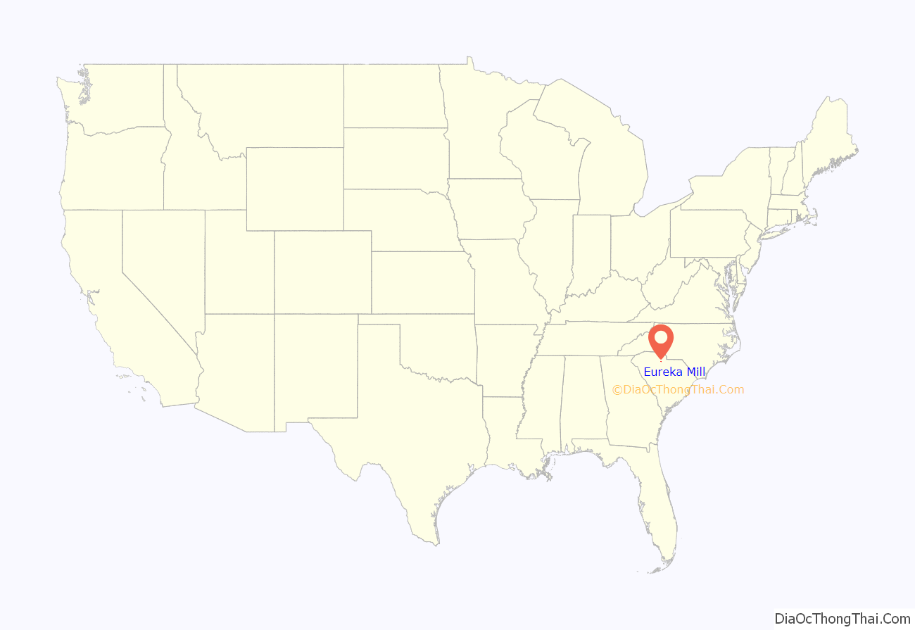
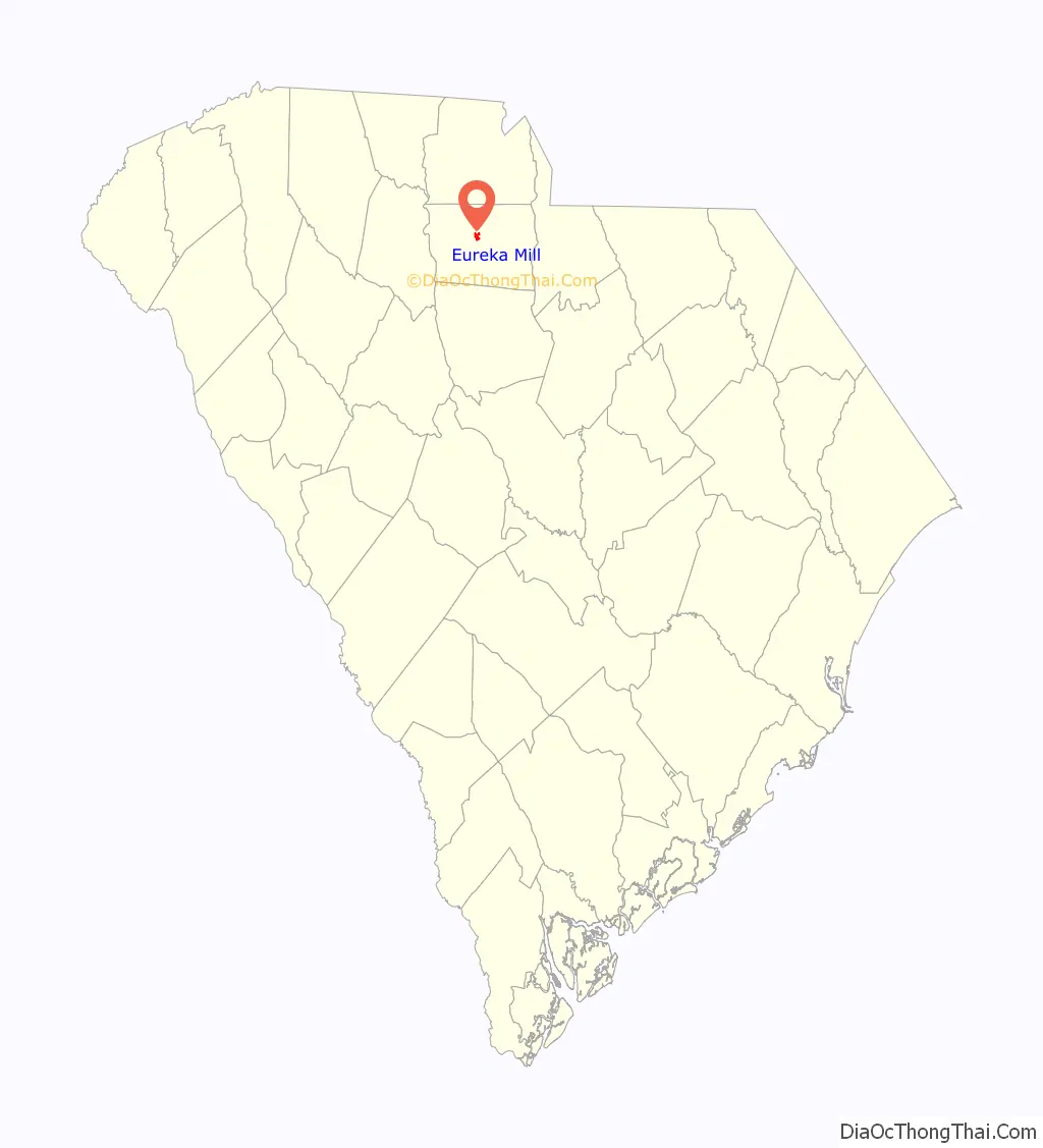
Eureka Mill location map. Where is Eureka Mill CDP?
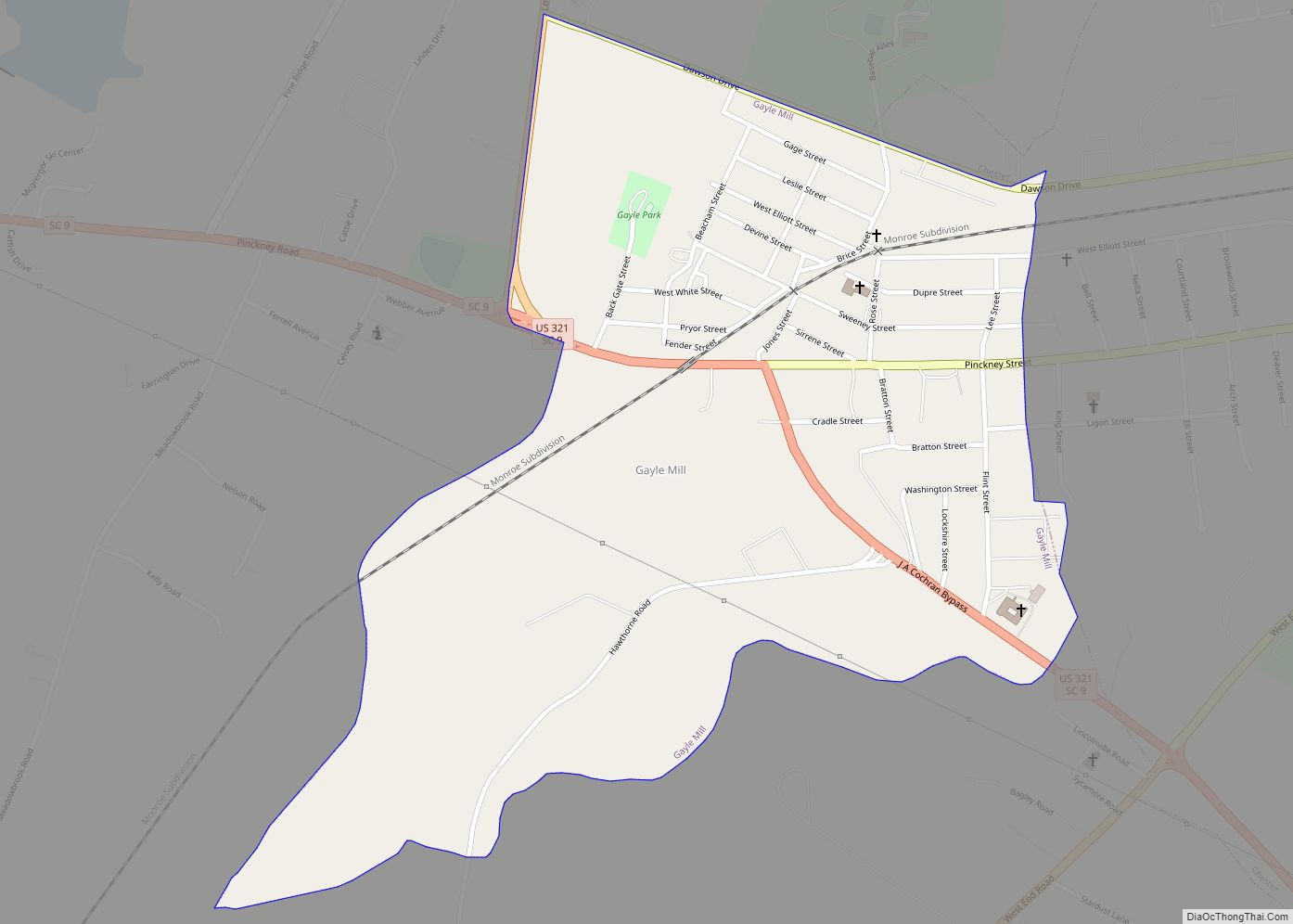
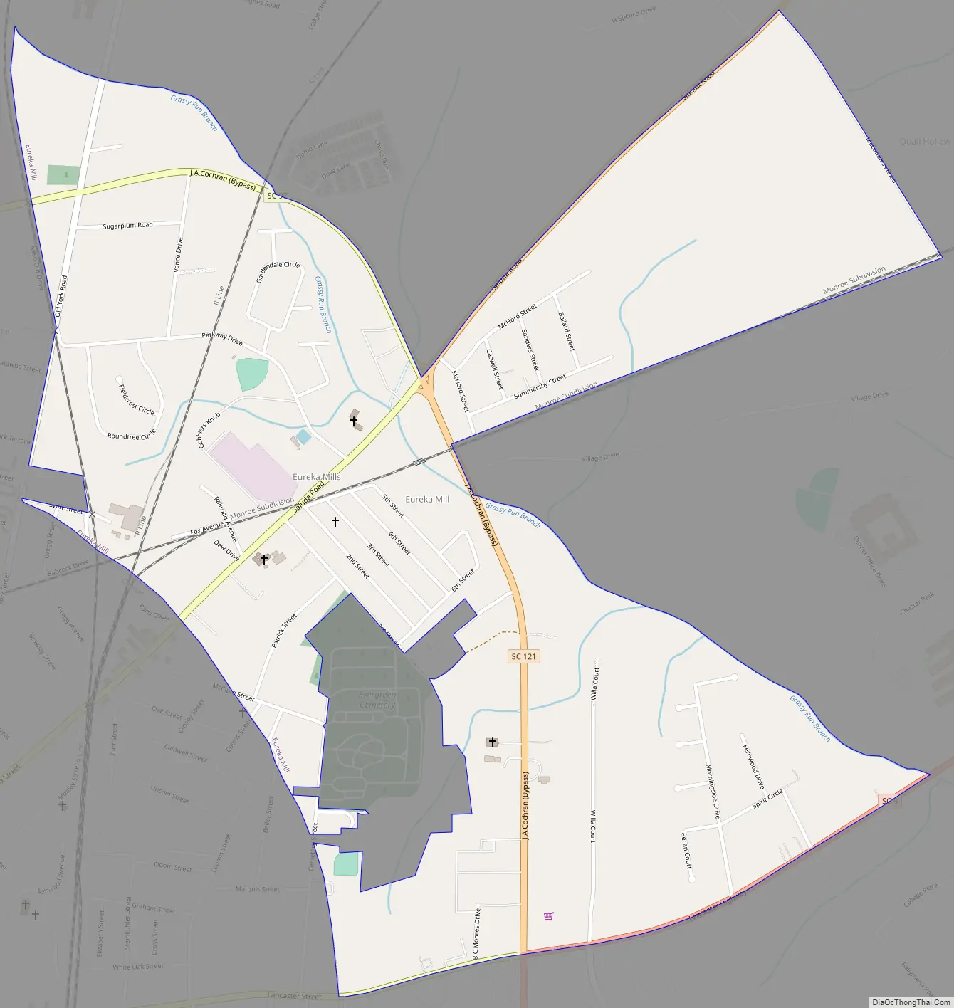
Eureka Mill Road Map
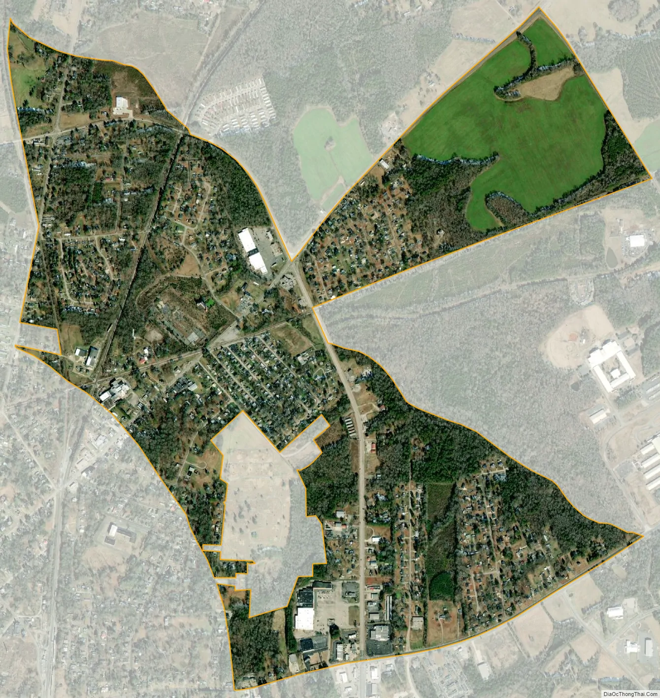
Eureka Mill city Satellite Map
Geography
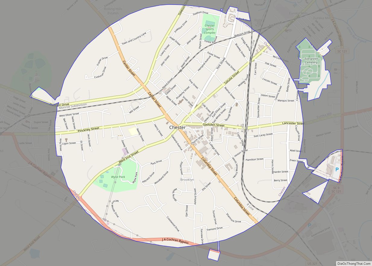
Eureka Mill is an unincorporated suburban area on the northeastern side of the city of Chester, the county seat. The CDP is located at 34°43′8″N 81°11′55″W / 34.71889°N 81.19861°W / 34.71889; -81.19861 (34.718868, -81.198698). South Carolina Highway 97, the J.A. Cochran Bypass, loops through the CDP, while Highway 72/121 is the main radial road leading out of Chester northeastward through the CDP. South Carolina Highway 9 forms the southern boundary of the CDP, leading eastward out from the center of Chester.
According to the United States Census Bureau, the Eureka Mill CDP has a total area of 1.29 square miles (3.34 km), all of it land.
See also
Map of South Carolina State and its subdivision:- Abbeville
- Aiken
- Allendale
- Anderson
- Bamberg
- Barnwell
- Beaufort
- Berkeley
- Calhoun
- Charleston
- Cherokee
- Chester
- Chesterfield
- Clarendon
- Colleton
- Darlington
- Dillon
- Dorchester
- Edgefield
- Fairfield
- Florence
- Georgetown
- Greenville
- Greenwood
- Hampton
- Horry
- Jasper
- Kershaw
- Lancaster
- Laurens
- Lee
- Lexington
- Marion
- Marlboro
- McCormick
- Newberry
- Oconee
- Orangeburg
- Pickens
- Richland
- Saluda
- Spartanburg
- Sumter
- Union
- Williamsburg
- York
- Alabama
- Alaska
- Arizona
- Arkansas
- California
- Colorado
- Connecticut
- Delaware
- District of Columbia
- Florida
- Georgia
- Hawaii
- Idaho
- Illinois
- Indiana
- Iowa
- Kansas
- Kentucky
- Louisiana
- Maine
- Maryland
- Massachusetts
- Michigan
- Minnesota
- Mississippi
- Missouri
- Montana
- Nebraska
- Nevada
- New Hampshire
- New Jersey
- New Mexico
- New York
- North Carolina
- North Dakota
- Ohio
- Oklahoma
- Oregon
- Pennsylvania
- Rhode Island
- South Carolina
- South Dakota
- Tennessee
- Texas
- Utah
- Vermont
- Virginia
- Washington
- West Virginia
- Wisconsin
- Wyoming