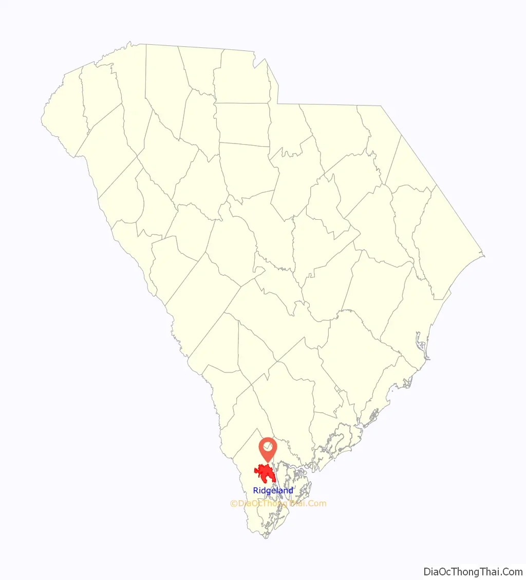
Ridgeland is a town in Jasper and Beaufort counties, South Carolina, United States. The population was 3,749 at the 2020 census, a 7.1% decrease from 2010. It has been the county seat of Jasper County since the county’s formation in 1912. As defined by the U.S. Census Bureau, Ridgeland is included within the Hilton Head Island–Bluffton metropolitan area.
Ridgeland is home to the Ridgeland Correctional Institution, a medium-security prison operated by the South Carolina Department of Corrections.
Ridgeland was originally known as “Gopher Hill” in 1894, derived from the gopher tortoise, which is indigenous to the area. The name was not considered good enough for a new railroad station, so it was changed to “Ridgeland” in 1902 by the station ticket master, Frederick Henry Ingram, for the fact that the town stands on a sandy ridge that is some of the highest land in Jasper County.
| Name: | Ridgeland town |
|---|---|
| LSAD Code: | 43 |
| LSAD Description: | town (suffix) |
| State: | South Carolina |
| County: | Jasper County |
| Elevation: | 56 ft (17 m) |
| Total Area: | 48.81 sq mi (126.41 km²) |
| Land Area: | 48.34 sq mi (125.20 km²) |
| Water Area: | 0.47 sq mi (1.21 km²) |
| Total Population: | 3,758 |
| Population Density: | 77.74/sq mi (30.02/km²) |
| ZIP code: | 29912, 29936 |
| Area code: | 843, 854 |
| FIPS code: | 4560280 |
| GNISfeature ID: | 1250384 |
| Website: | www.ridgelandsc.gov |
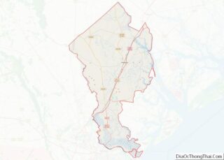
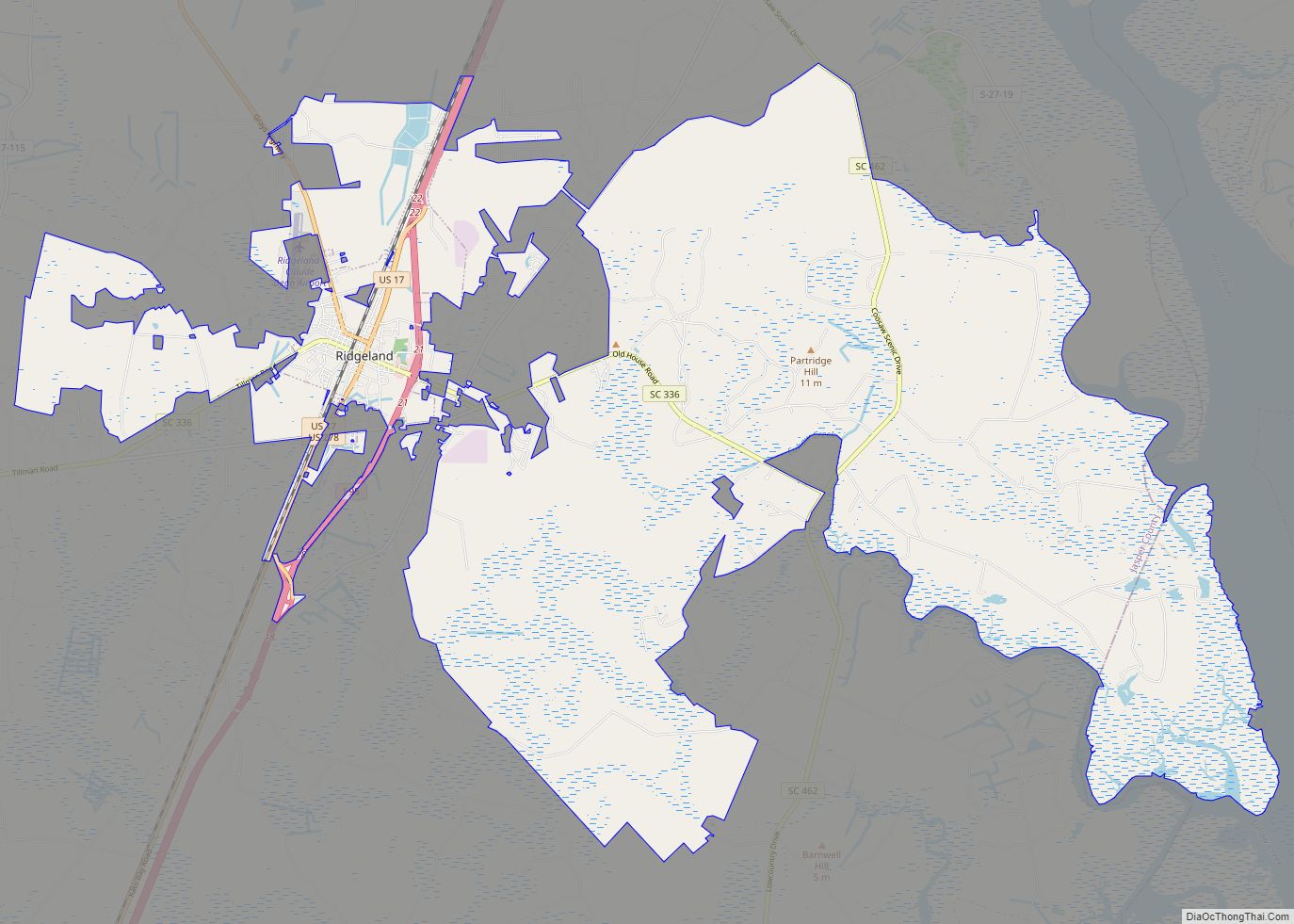
Online Interactive Map
Click on ![]() to view map in "full screen" mode.
to view map in "full screen" mode.
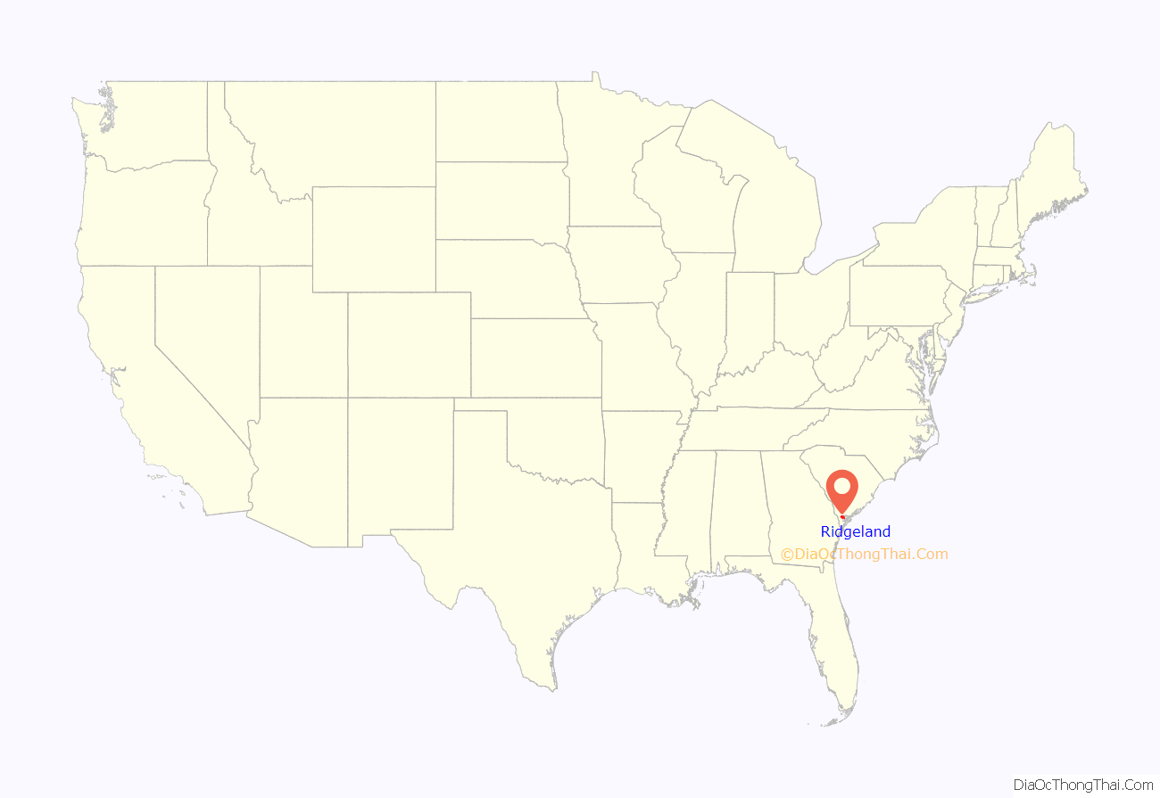
Ridgeland location map. Where is Ridgeland town?
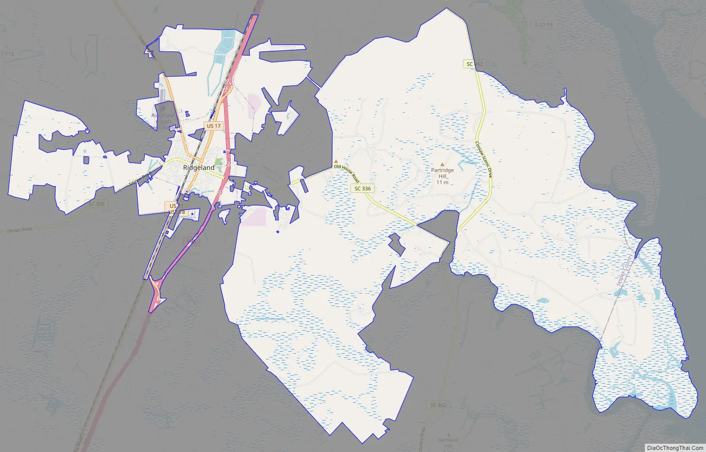
Ridgeland Road Map
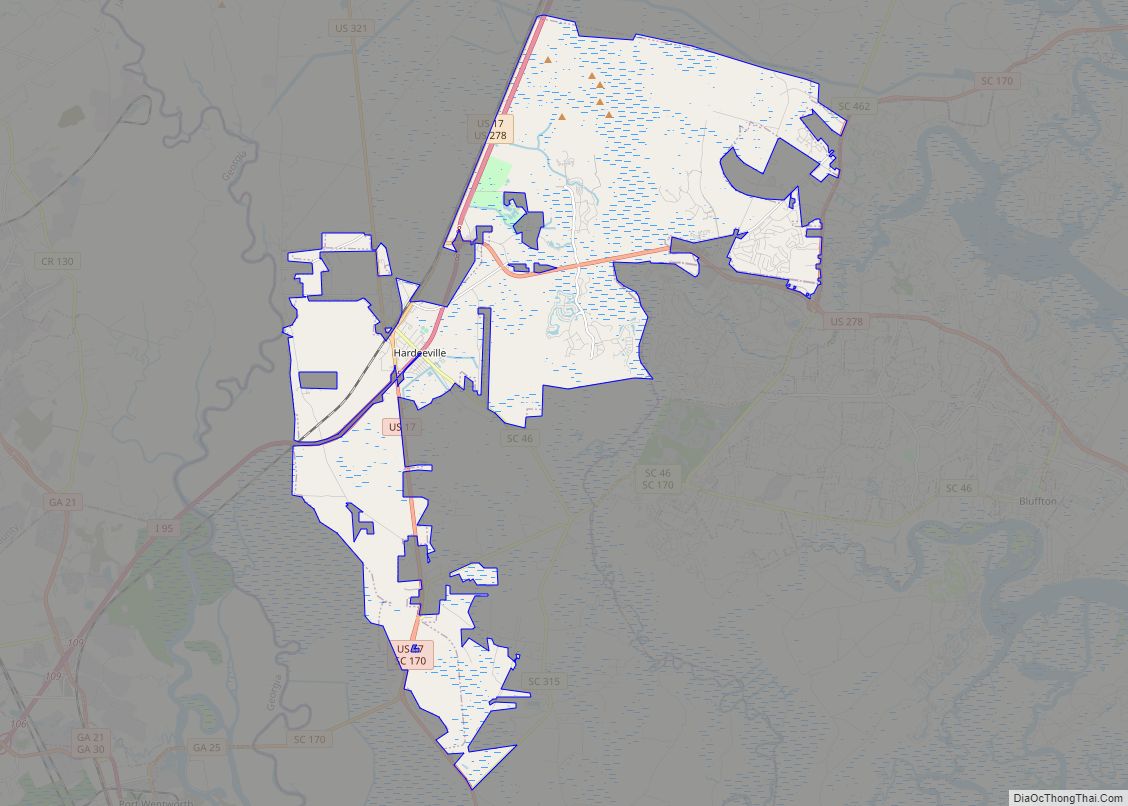
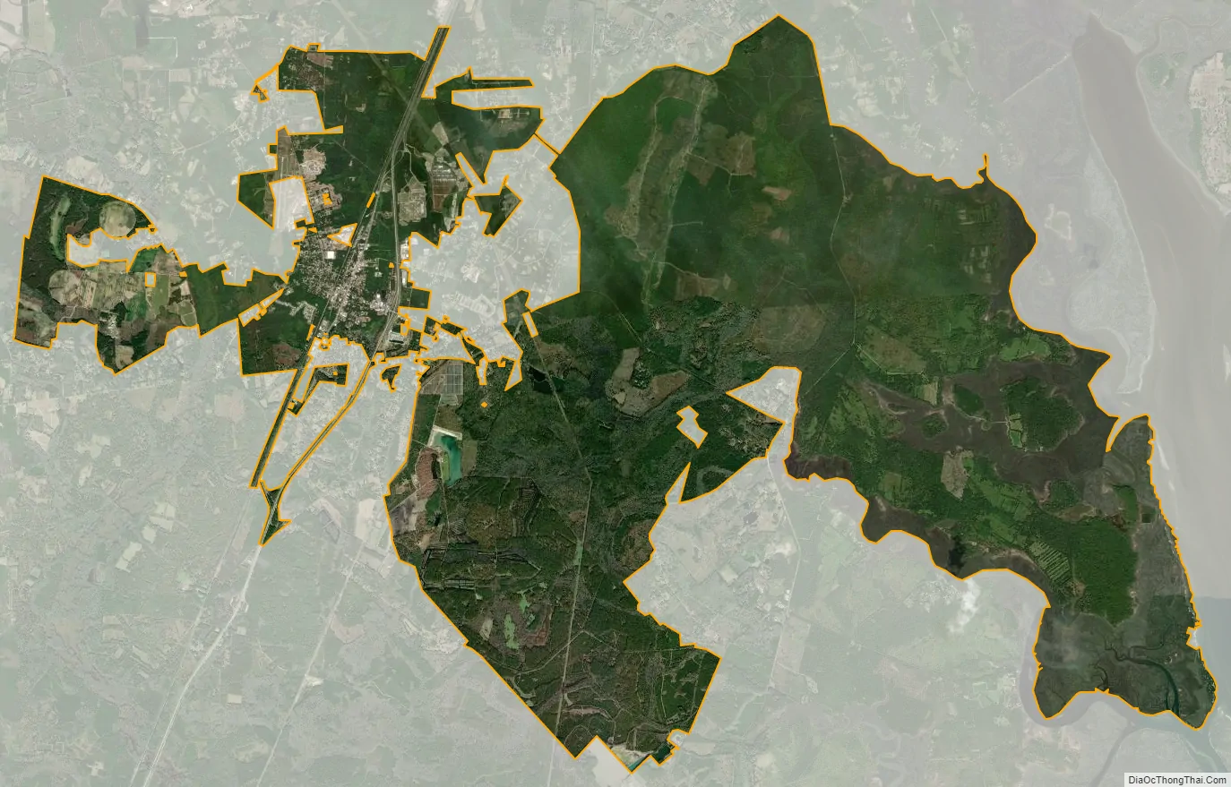
Ridgeland city Satellite Map
Geography
Ridgeland is in northeastern Jasper County, with the center of town sitting on a low ridge at an elevation of 62 feet (19 m) above sea level. According to the United States Census Bureau, the town has a total area of 44.7 square miles (115.8 km), of which 44.4 square miles (115.1 km) are land and 0.3 square miles (0.7 km), or 0.59%, are water. The town’s area as of 2010 was 18 times greater than its 2000 area of 2.4 square miles (6.3 km). The town limits now extend east into Beaufort County as far as the west bank of the Broad River.
Ridgeland is 36 miles (58 km) southwest of Walterboro, 32 miles (51 km) south of Hampton, 31 miles (50 km) north of Savannah, Georgia, 14 miles (23 km) north of Hardeeville, and 7 miles (11 km) east of Tillman.
See also
Map of South Carolina State and its subdivision:- Abbeville
- Aiken
- Allendale
- Anderson
- Bamberg
- Barnwell
- Beaufort
- Berkeley
- Calhoun
- Charleston
- Cherokee
- Chester
- Chesterfield
- Clarendon
- Colleton
- Darlington
- Dillon
- Dorchester
- Edgefield
- Fairfield
- Florence
- Georgetown
- Greenville
- Greenwood
- Hampton
- Horry
- Jasper
- Kershaw
- Lancaster
- Laurens
- Lee
- Lexington
- Marion
- Marlboro
- McCormick
- Newberry
- Oconee
- Orangeburg
- Pickens
- Richland
- Saluda
- Spartanburg
- Sumter
- Union
- Williamsburg
- York
- Alabama
- Alaska
- Arizona
- Arkansas
- California
- Colorado
- Connecticut
- Delaware
- District of Columbia
- Florida
- Georgia
- Hawaii
- Idaho
- Illinois
- Indiana
- Iowa
- Kansas
- Kentucky
- Louisiana
- Maine
- Maryland
- Massachusetts
- Michigan
- Minnesota
- Mississippi
- Missouri
- Montana
- Nebraska
- Nevada
- New Hampshire
- New Jersey
- New Mexico
- New York
- North Carolina
- North Dakota
- Ohio
- Oklahoma
- Oregon
- Pennsylvania
- Rhode Island
- South Carolina
- South Dakota
- Tennessee
- Texas
- Utah
- Vermont
- Virginia
- Washington
- West Virginia
- Wisconsin
- Wyoming