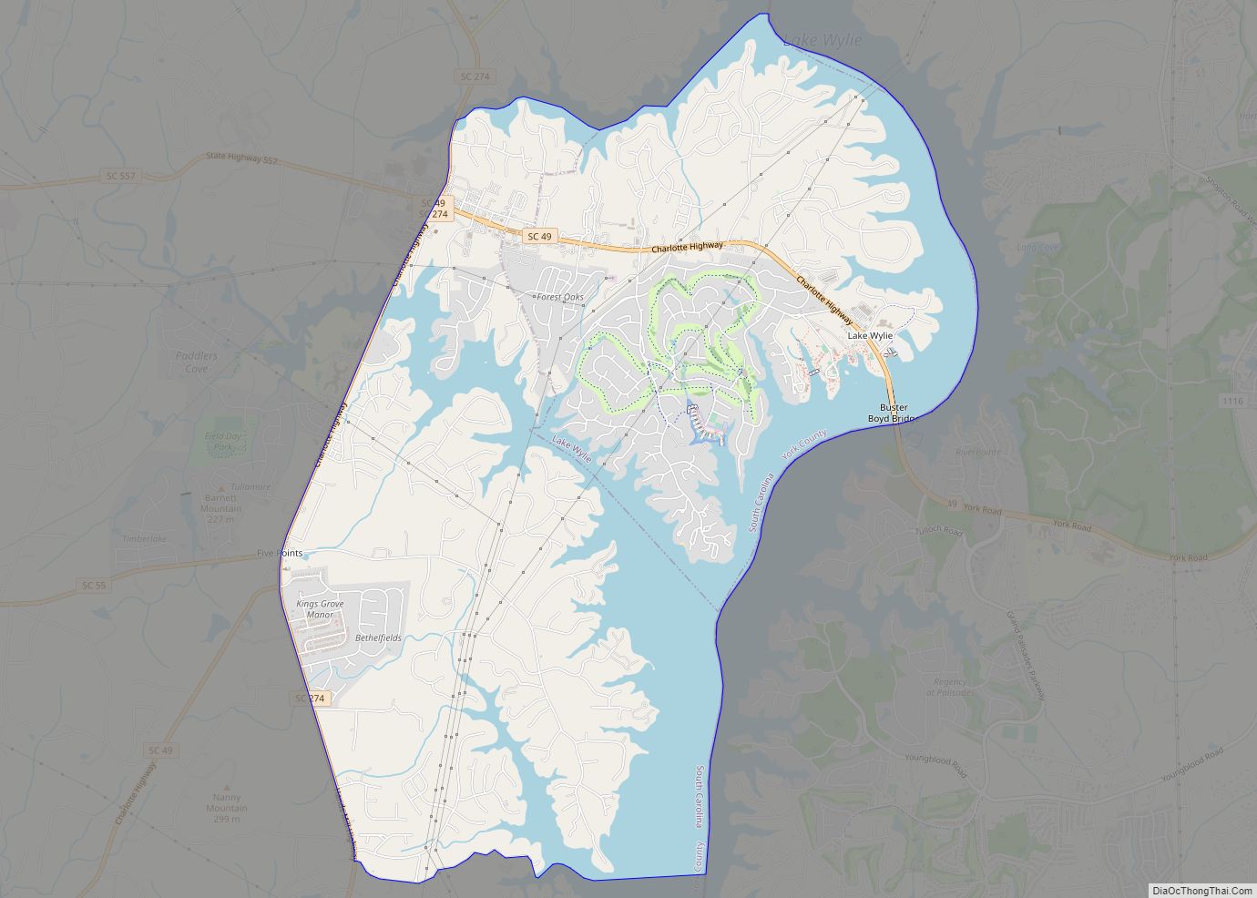
Lake Wylie is a census-designated place (CDP) in York County, South Carolina, United States. The population was 8,841 at the 2010 census. Lake Wylie is located on a peninsula along the shore of Lake Wylie, a reservoir that was named for Dr. W. Gil Wylie in 1960. It is a suburb of Charlotte, North Carolina.
| Name: | Lake Wylie CDP |
|---|---|
| LSAD Code: | 57 |
| LSAD Description: | CDP (suffix) |
| State: | South Carolina |
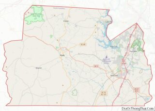
| County: | York County |
| Elevation: | 587 ft (179 m) |
| Total Area: | 10.65 sq mi (27.57 km²) |
| Land Area: | 7.89 sq mi (20.43 km²) |
| Water Area: | 2.76 sq mi (7.14 km²) |
| Total Population: | 13,655 |
| Population Density: | 1,730.89/sq mi (668.34/km²) |
| ZIP code: | 29710 |
| Area code: | 803, 839 |
| FIPS code: | 4539785 |
| GNISfeature ID: | 1233775 |
Online Interactive Map
Click on ![]() to view map in "full screen" mode.
to view map in "full screen" mode.
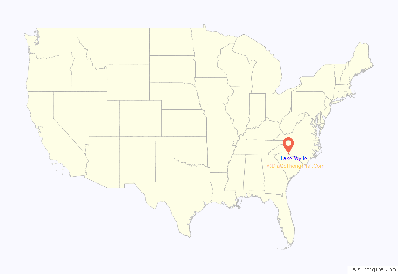
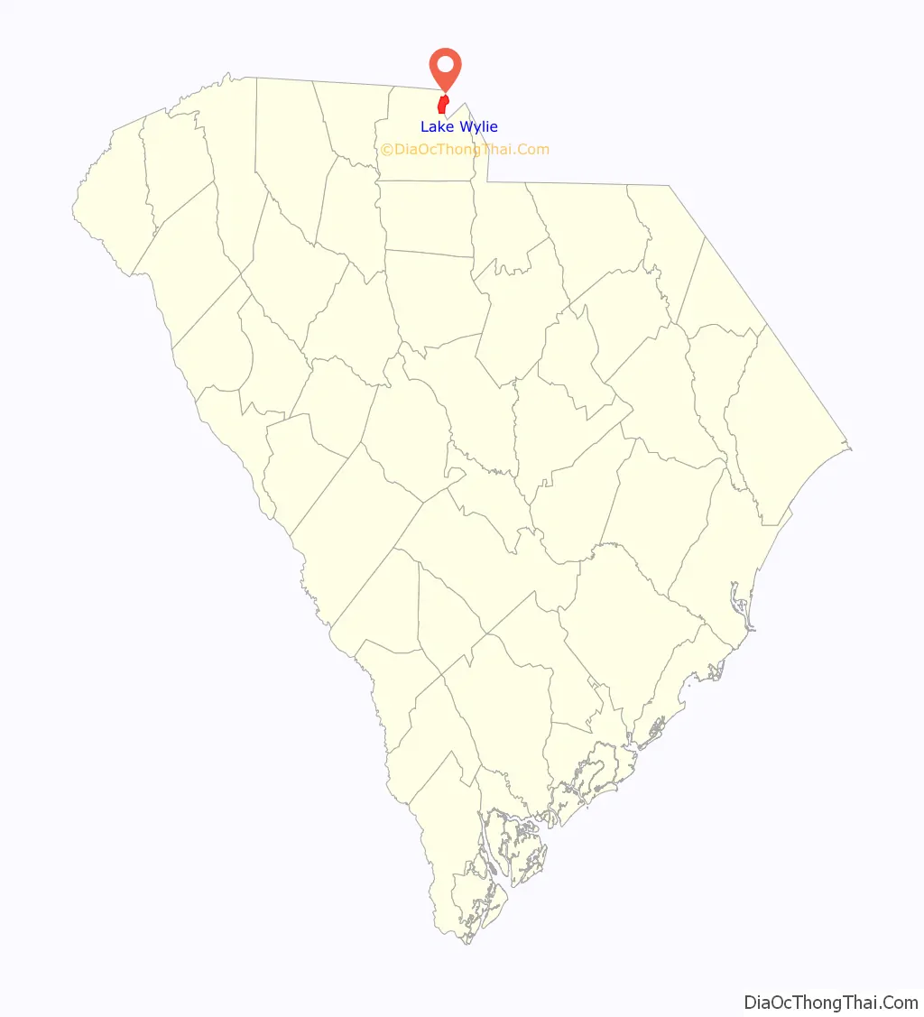
Lake Wylie location map. Where is Lake Wylie CDP?
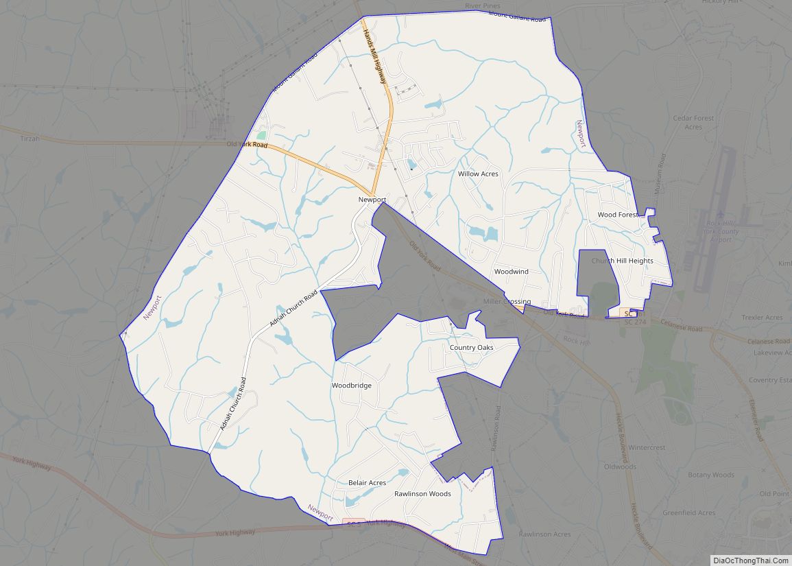
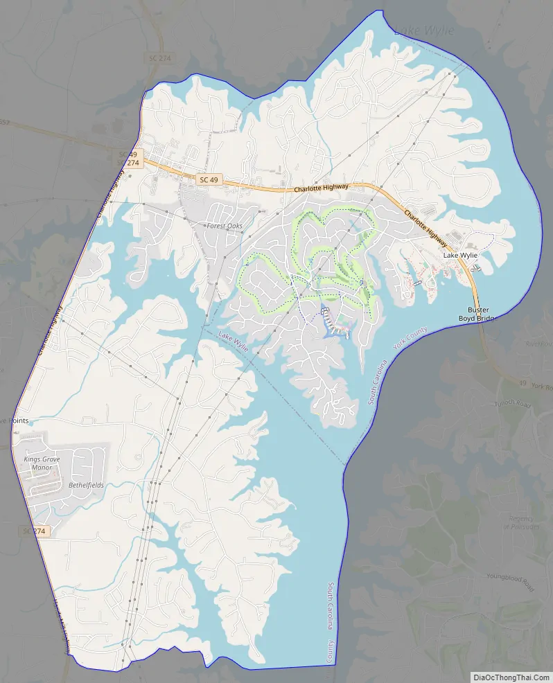
Lake Wylie Road Map
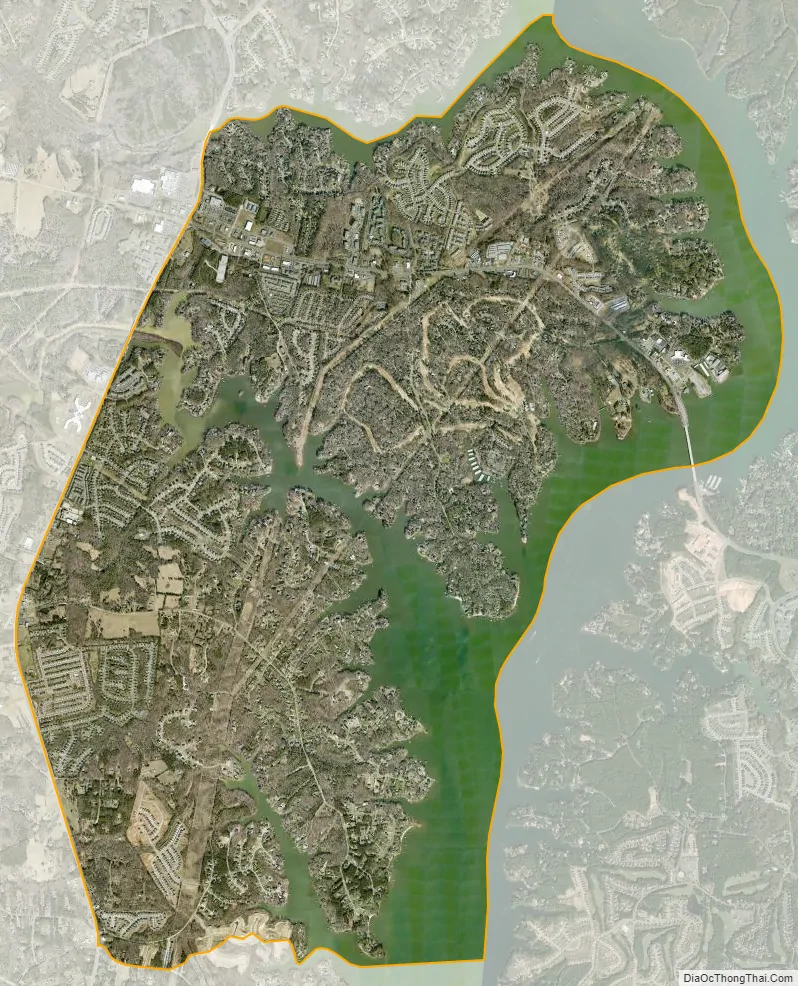
Lake Wylie city Satellite Map
Geography
Lake Wylie is located on a peninsula along the shore of Lake Wylie in the Piedmont of both North and South Carolina, at 35°6′22″N 81°3′25″W / 35.10611°N 81.05694°W / 35.10611; -81.05694 (35.105973, -81.056978). According to the United States Census Bureau, the CDP has a total area of 4.7 square miles (12 km), of which 3.5 square miles (9.1 km) is land and 1.3 square miles (3.4 km) (26.58%) is water. The average elevation of the town is 512 feet.
As a result of the community’s proximity to the state line between North and South Carolina, it has been significantly affected by recent efforts to resurvey the state line using modern global positioning system technology. The process moved the state line approximately 150 feet (46 m) southward in the Lake Wylie area, resulting in several properties in the community now being located in South Point Township in North Carolina — including one property where the new state line falls between the owner’s house and his back deck, and a gas station and convenience store whose owner has noted that differences in gas prices and retail regulations between the two states will probably force him out of business.
The Post Office considers much of the CDP to be unincorporated Clover.
See also
Map of South Carolina State and its subdivision:- Abbeville
- Aiken
- Allendale
- Anderson
- Bamberg
- Barnwell
- Beaufort
- Berkeley
- Calhoun
- Charleston
- Cherokee
- Chester
- Chesterfield
- Clarendon
- Colleton
- Darlington
- Dillon
- Dorchester
- Edgefield
- Fairfield
- Florence
- Georgetown
- Greenville
- Greenwood
- Hampton
- Horry
- Jasper
- Kershaw
- Lancaster
- Laurens
- Lee
- Lexington
- Marion
- Marlboro
- McCormick
- Newberry
- Oconee
- Orangeburg
- Pickens
- Richland
- Saluda
- Spartanburg
- Sumter
- Union
- Williamsburg
- York
- Alabama
- Alaska
- Arizona
- Arkansas
- California
- Colorado
- Connecticut
- Delaware
- District of Columbia
- Florida
- Georgia
- Hawaii
- Idaho
- Illinois
- Indiana
- Iowa
- Kansas
- Kentucky
- Louisiana
- Maine
- Maryland
- Massachusetts
- Michigan
- Minnesota
- Mississippi
- Missouri
- Montana
- Nebraska
- Nevada
- New Hampshire
- New Jersey
- New Mexico
- New York
- North Carolina
- North Dakota
- Ohio
- Oklahoma
- Oregon
- Pennsylvania
- Rhode Island
- South Carolina
- South Dakota
- Tennessee
- Texas
- Utah
- Vermont
- Virginia
- Washington
- West Virginia
- Wisconsin
- Wyoming