McColl is a town in Marlboro County, South Carolina, United States. It lies in the state’s Pee Dee region, 8 miles (13 km) from the North Carolina border. The population was 2,174 at the 2010 census.
McColl is the home of the Pee Dee Indian Tribe. They are a relatively small American Indian tribe that has occupied the Pee Dee region for several centuries. While they received state recognition from the Government of South Carolina just after the beginning of the 21st Century, they have been seeking federal acknowledgment since 1976. While today the tribe consists of just over 200 enrolled members, they were once a significant cultural and political power in the region. Their profound influence and continual presence in the area is why the region bears the Pee Dee name. Since 1976, the tribe’s official seat of government has operated on land awarded to the tribe in Marlboro County.
| Name: | McColl town |
|---|---|
| LSAD Code: | 43 |
| LSAD Description: | town (suffix) |
| State: | South Carolina |
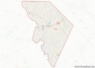
| County: | Marlboro County |
| Founded: | 1884 |
| Elevation: | 184 ft (56 m) |
| Total Area: | 1.05 sq mi (2.72 km²) |
| Land Area: | 1.05 sq mi (2.72 km²) |
| Water Area: | 0.00 sq mi (0.00 km²) |
| Total Population: | 2,070 |
| Population Density: | 1,971.43/sq mi (761.16/km²) |
| ZIP code: | 29570 |
| Area code: | 843, 854 |
| FIPS code: | 4543630 |
| GNISfeature ID: | 1253478 |
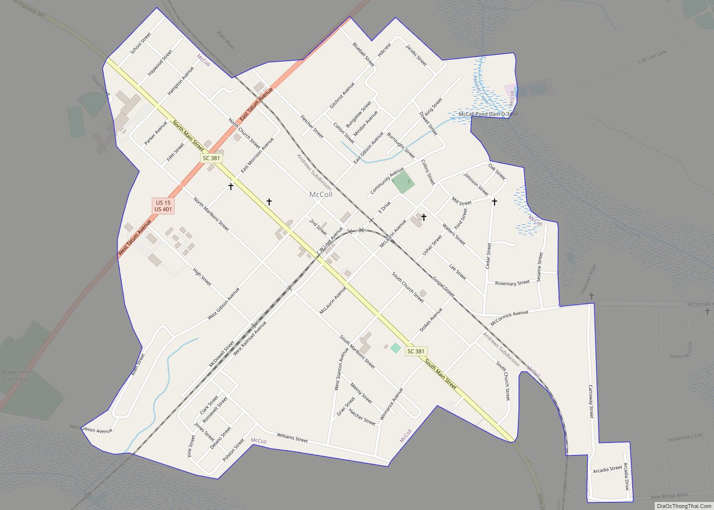
Online Interactive Map
Click on ![]() to view map in "full screen" mode.
to view map in "full screen" mode.
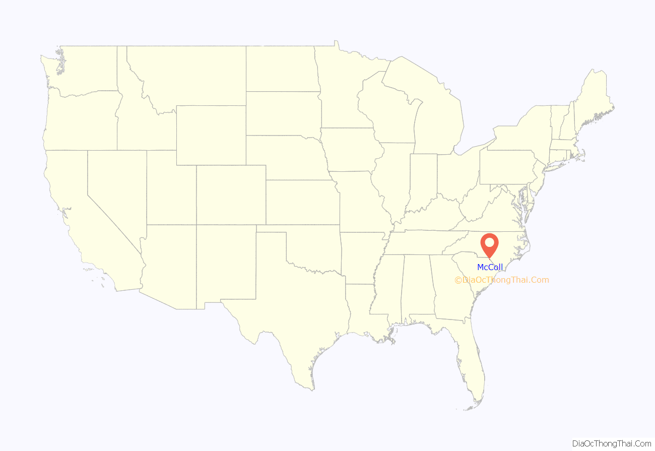
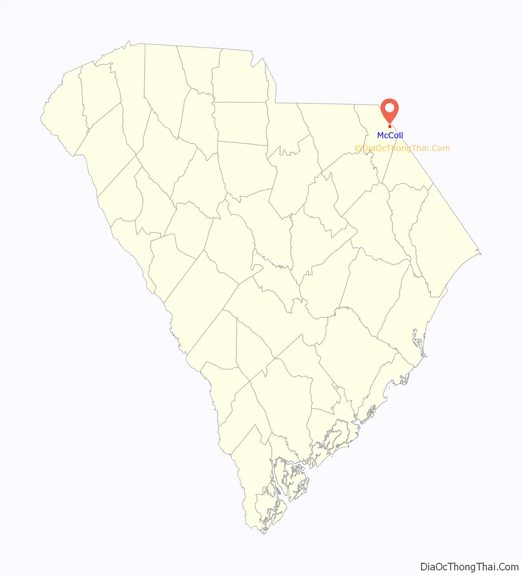
McColl location map. Where is McColl town?
History
This area is within territory occupied by the Pee Dee of the South Appalachian Mississippian culture for several hundred years. Among their earthwork monuments is Town Creek Indian Mound, an important regional ceremonial site that was occupied from about 1150 to 1400 CE in Montgomery County, North Carolina, before they abandoned it for unknown reasons. It was designated as a National Historic Landmark in 1966, the only American Indian site so honored in the state. In 2017, the Pee Dee Indian Tribe officially began work on the Pee Dee Tribal Mounds located on tribal land in McColl.
Some of this area was developed for the cultivation of short-staple cotton in the antebellum era after the invention of the cotton gin. The area was also a center of lumbering and turpentine production in the early 20th century.
The town was named for D. D. McColl, a businessperson.
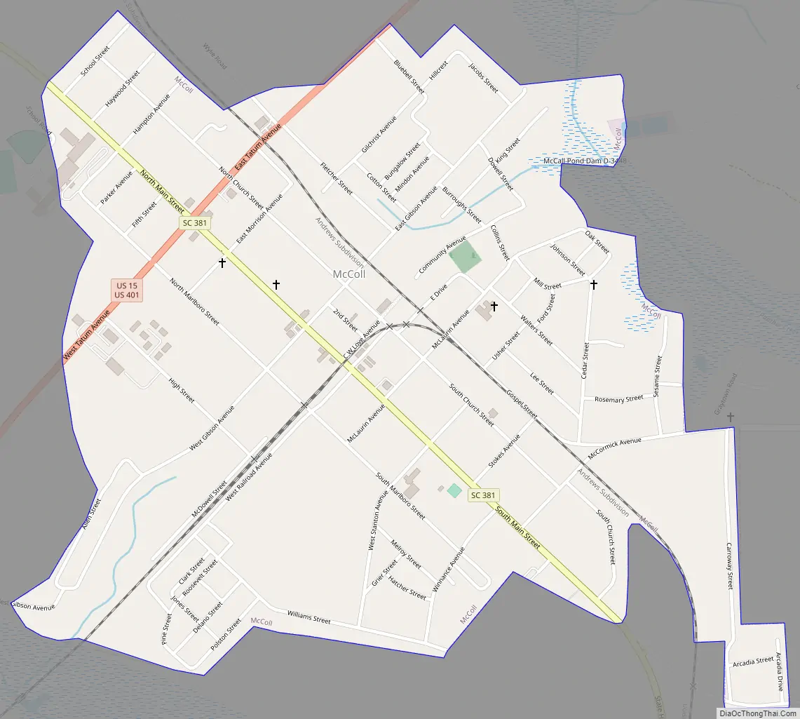
McColl Road Map
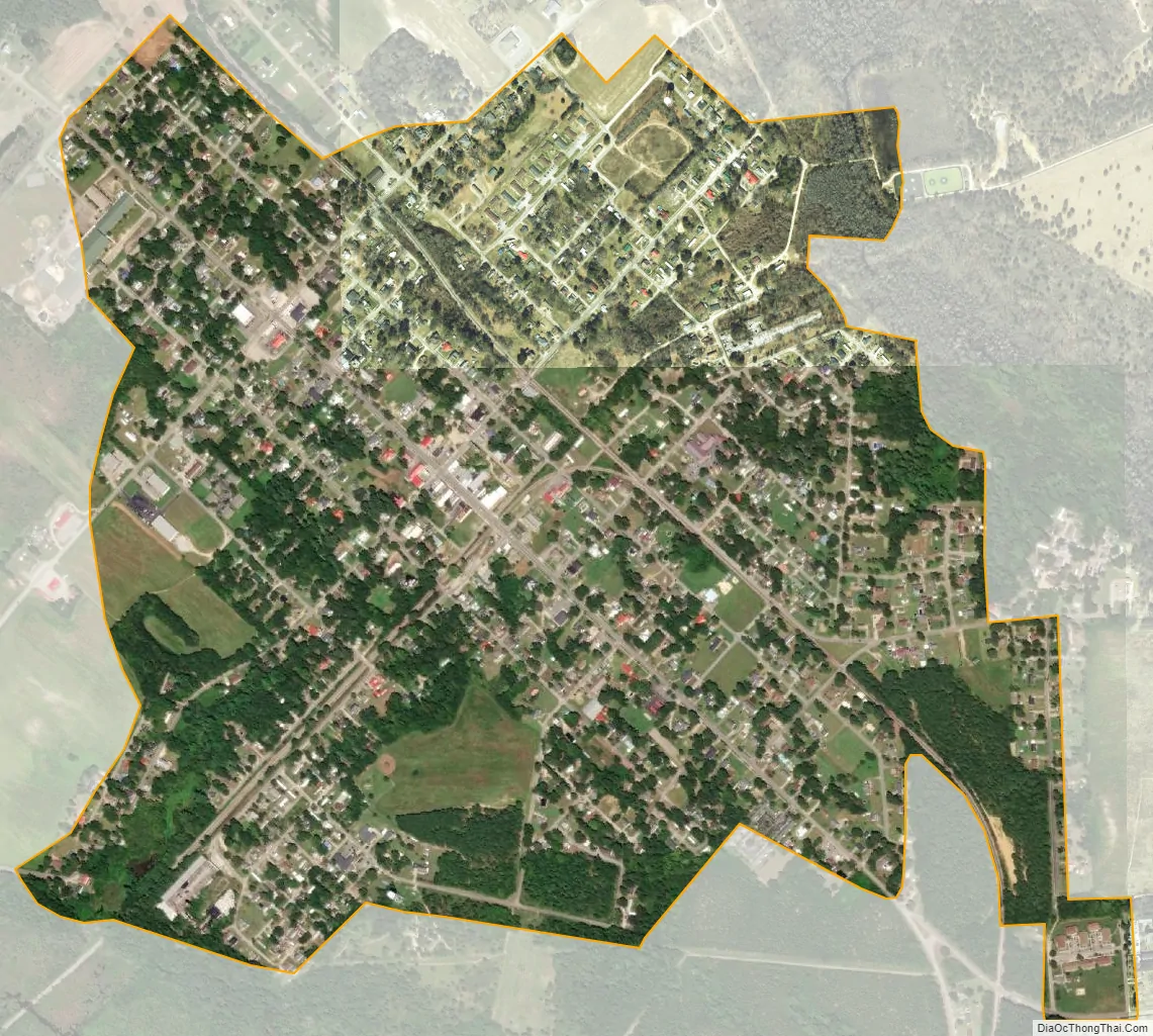
McColl city Satellite Map
Geography
According to the United States Census Bureau, the town has a total area of 1.1 square miles (2.8 km), all land.
See also
Map of South Carolina State and its subdivision:- Abbeville
- Aiken
- Allendale
- Anderson
- Bamberg
- Barnwell
- Beaufort
- Berkeley
- Calhoun
- Charleston
- Cherokee
- Chester
- Chesterfield
- Clarendon
- Colleton
- Darlington
- Dillon
- Dorchester
- Edgefield
- Fairfield
- Florence
- Georgetown
- Greenville
- Greenwood
- Hampton
- Horry
- Jasper
- Kershaw
- Lancaster
- Laurens
- Lee
- Lexington
- Marion
- Marlboro
- McCormick
- Newberry
- Oconee
- Orangeburg
- Pickens
- Richland
- Saluda
- Spartanburg
- Sumter
- Union
- Williamsburg
- York
- Alabama
- Alaska
- Arizona
- Arkansas
- California
- Colorado
- Connecticut
- Delaware
- District of Columbia
- Florida
- Georgia
- Hawaii
- Idaho
- Illinois
- Indiana
- Iowa
- Kansas
- Kentucky
- Louisiana
- Maine
- Maryland
- Massachusetts
- Michigan
- Minnesota
- Mississippi
- Missouri
- Montana
- Nebraska
- Nevada
- New Hampshire
- New Jersey
- New Mexico
- New York
- North Carolina
- North Dakota
- Ohio
- Oklahoma
- Oregon
- Pennsylvania
- Rhode Island
- South Carolina
- South Dakota
- Tennessee
- Texas
- Utah
- Vermont
- Virginia
- Washington
- West Virginia
- Wisconsin
- Wyoming