Sumter (/ˈsʌmtər/ SUM-tər) is a city in and the county seat of Sumter County, South Carolina, United States. Known as the Sumter Metropolitan Statistical Area, the namesake county adjoins Clarendon and Lee to form the core of Sumter-Lee-Clarendon Tri-county (or East Midlands) area of South Carolina that includes three counties straddling the border of the Sandhills (or Midlands), Pee Dee, and Lowcountry regions. The population was 43,463 at the 2020 census.
| Name: | Sumter city |
|---|---|
| LSAD Code: | 25 |
| LSAD Description: | city (suffix) |
| State: | South Carolina |
| County: | Sumter County |
| Incorporated: | 1845 |
| Elevation: | 171 ft (52 m) |
| Land Area: | 32.86 sq mi (85.11 km²) |
| Water Area: | 0.20 sq mi (0.51 km²) |
| Population Density: | 1,322.59/sq mi (510.66/km²) |
| ZIP code: | 29150, 29151, 29153, 29154 |
| Area code: | 803, 839 |
| FIPS code: | 4570405 |
| GNISfeature ID: | 1251074 |
| Website: | www.sumtersc.gov |
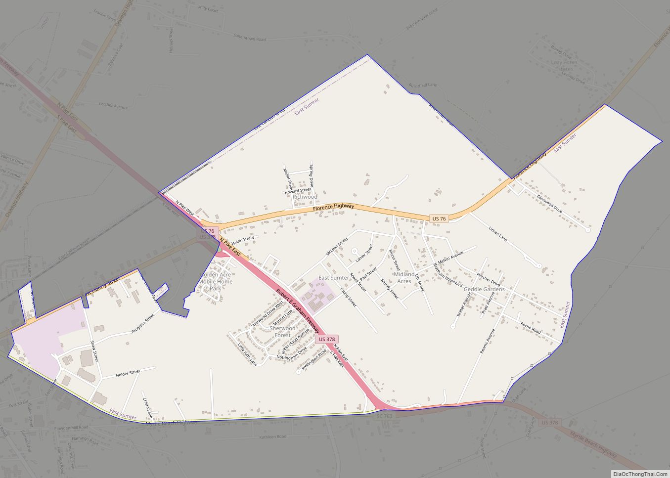
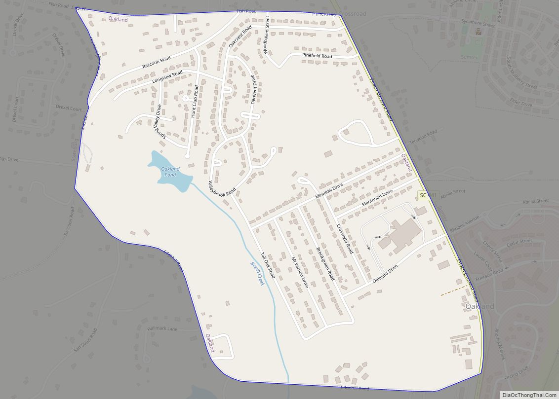
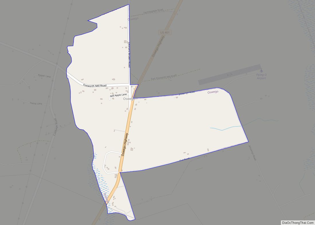
Online Interactive Map
Click on ![]() to view map in "full screen" mode.
to view map in "full screen" mode.
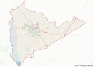
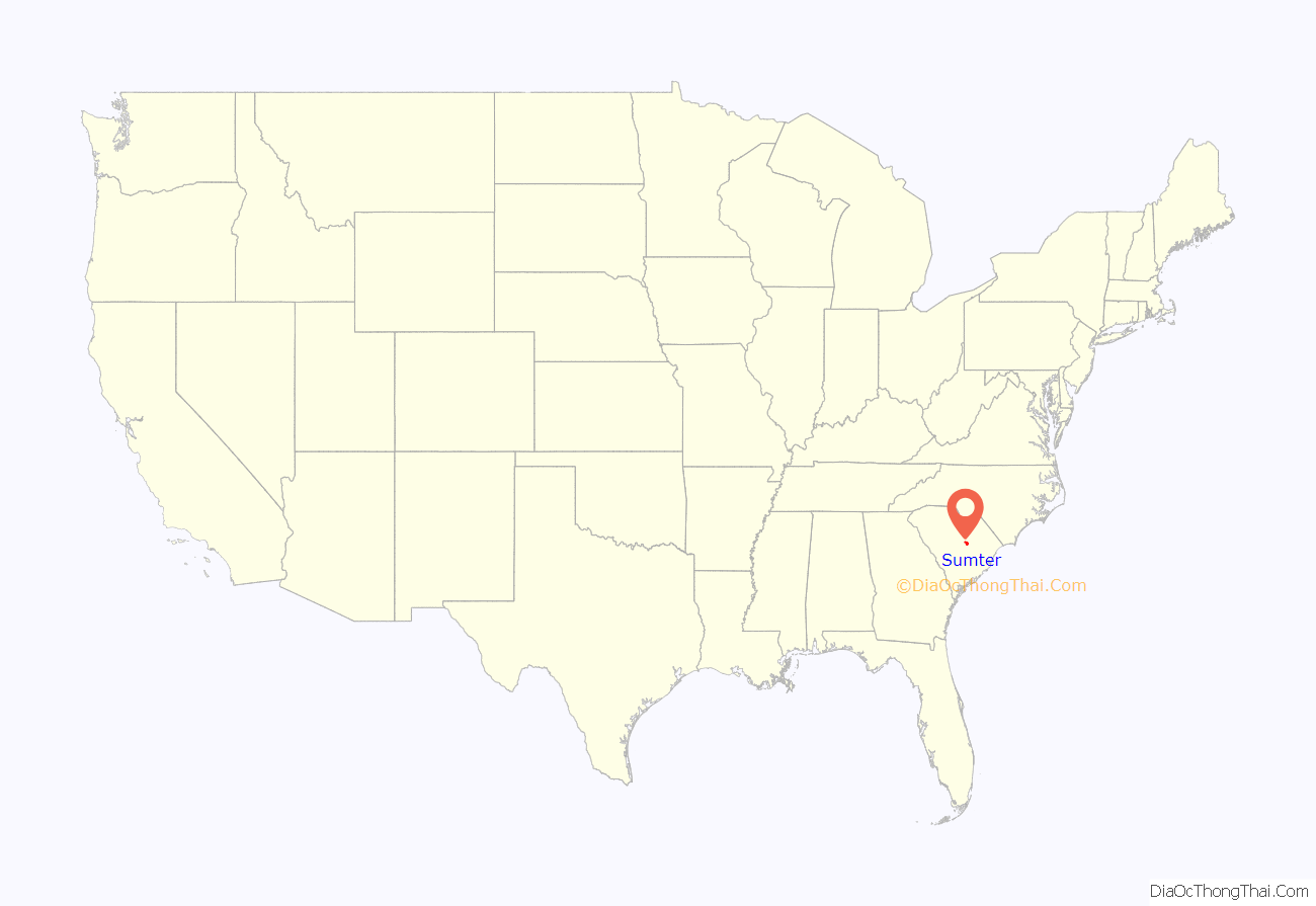
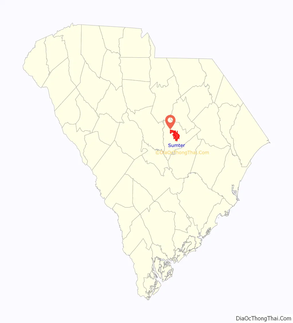
Sumter location map. Where is Sumter city?
History
Incorporated as Sumterville in 1845, the city’s name was shortened to Sumter in 1855. It has grown and prospered from its early beginnings as a plantation settlement. The city and county of Sumter bear the name of General Thomas Sumter, the “Fighting Gamecock” of the American Revolutionary War.
During the Civil War, the town was an important supply and railroad repair center for the Confederacy. After the war, Sumter grew and prospered, using its large railroad network to supply cotton, timber, and by the start of the 20th century, tobacco to the region.
During the 20th century, Sumter grew into a major industrial center. Still a unique business founded in 1923, Palmetto Pigeon Plant has grown into one of the largest producers of squab, poussin (chicken), cornish game hen, and silkie chickens in the world. Starting with the opening of Shaw Air Force Base (now home to the 9th Air Force, 20th Fighter Wing, and United States Army Central) in 1941, industry grew, especially after World War II. Sumter became increasingly known for textiles, manufacturing, biotech industries, a thriving retail environment, and medical center of its region in addition to agricultural products, which makes it a hub for business in the east-central portion of South Carolina.
Local sites listed on the National Register of Historic Places include:
- J. Clinton Brogdon House
- Carnegie Public Library
- Heriot-Moise House
- Charles T. Mason House
- Myrtle Moor
- O’Donnell House
- Rip Raps Plantation
- Salem Black River Presbyterian Church
- Henry Lee Scarborough House
- Stateburg Historic District
- Sumter County Courthouse
- Sumter Historic District
- Sumter Town Hall-Opera House
- Temple Sinai
- Elizabeth White House
- Lincoln High School
- Singleton’s Graveyard
- Goodwill Parochial School, Gable, SC (Sumter County)
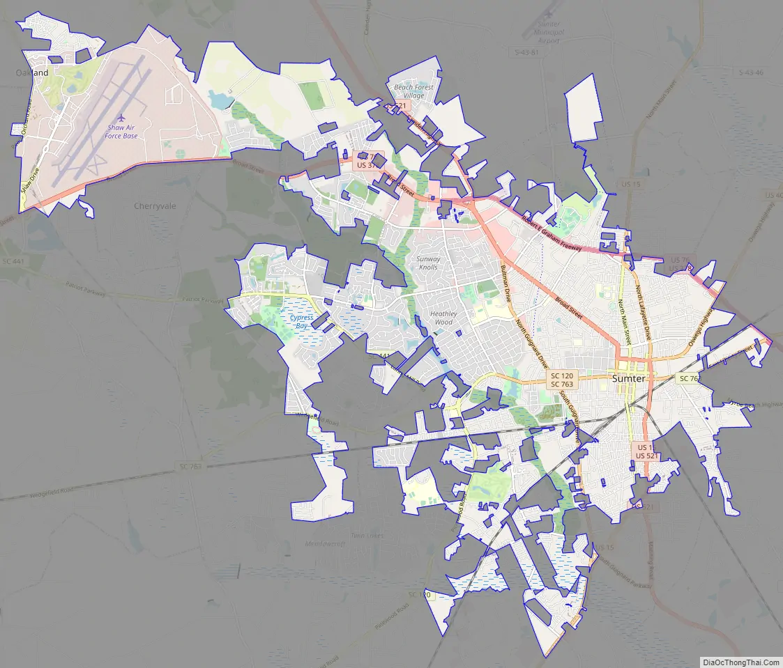
Sumter Road Map
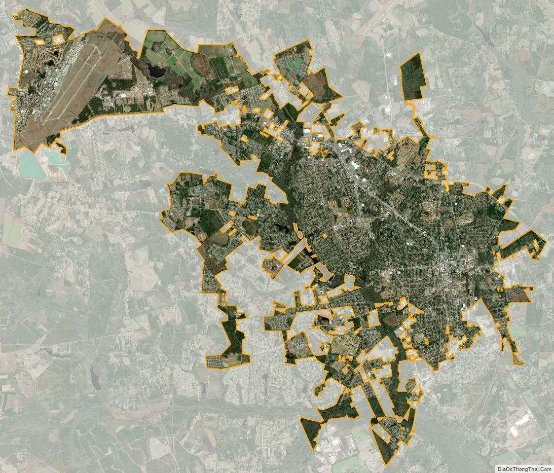
Sumter city Satellite Map
Geography
Known as the Gamecock City, Sumter lies near the geographic center of the state of South Carolina at 33°55′37″N 80°21′49″W / 33.92694°N 80.36361°W / 33.92694; -80.36361 (33.926942, -80.363541). Sumter is 100 miles west of Myrtle Beach’s Grand Strand and 175 miles east of the Blue Ridge Mountains. Columbia, the state capital, is about 45 miles to the west, and Charleston is around 100 miles to the south. According to the United States Census Bureau, the city has a total area of 26.8 square miles (69.3 km), of which 26.6 square miles (68.9 km) are land and 0.2 square mile (0.4 km) (0.60%) is covered by water.
See also
Map of South Carolina State and its subdivision:- Abbeville
- Aiken
- Allendale
- Anderson
- Bamberg
- Barnwell
- Beaufort
- Berkeley
- Calhoun
- Charleston
- Cherokee
- Chester
- Chesterfield
- Clarendon
- Colleton
- Darlington
- Dillon
- Dorchester
- Edgefield
- Fairfield
- Florence
- Georgetown
- Greenville
- Greenwood
- Hampton
- Horry
- Jasper
- Kershaw
- Lancaster
- Laurens
- Lee
- Lexington
- Marion
- Marlboro
- McCormick
- Newberry
- Oconee
- Orangeburg
- Pickens
- Richland
- Saluda
- Spartanburg
- Sumter
- Union
- Williamsburg
- York
- Alabama
- Alaska
- Arizona
- Arkansas
- California
- Colorado
- Connecticut
- Delaware
- District of Columbia
- Florida
- Georgia
- Hawaii
- Idaho
- Illinois
- Indiana
- Iowa
- Kansas
- Kentucky
- Louisiana
- Maine
- Maryland
- Massachusetts
- Michigan
- Minnesota
- Mississippi
- Missouri
- Montana
- Nebraska
- Nevada
- New Hampshire
- New Jersey
- New Mexico
- New York
- North Carolina
- North Dakota
- Ohio
- Oklahoma
- Oregon
- Pennsylvania
- Rhode Island
- South Carolina
- South Dakota
- Tennessee
- Texas
- Utah
- Vermont
- Virginia
- Washington
- West Virginia
- Wisconsin
- Wyoming