McIntosh (Lakota: Maktáža) is a city in and the county seat of Corson County, South Dakota, United States. The population was 173 at the 2010 census and 111 at the 2020 United States Census.
| Name: | McIntosh city |
|---|---|
| LSAD Code: | 25 |
| LSAD Description: | city (suffix) |
| State: | South Dakota |
| County: | Corson County |
| Elevation: | 2,316 ft (706 m) |
| Total Area: | 0.77 sq mi (1.99 km²) |
| Land Area: | 0.73 sq mi (1.89 km²) |
| Water Area: | 0.04 sq mi (0.10 km²) |
| Total Population: | 111 |
| Population Density: | 152.05/sq mi (58.74/km²) |
| ZIP code: | 57641 |
| Area code: | 605 |
| FIPS code: | 4639940 |
Online Interactive Map
Click on ![]() to view map in "full screen" mode.
to view map in "full screen" mode.
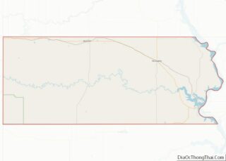
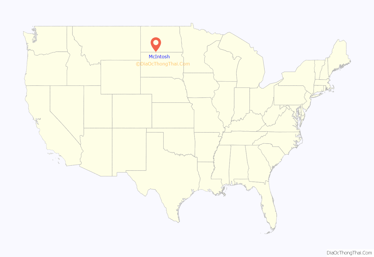
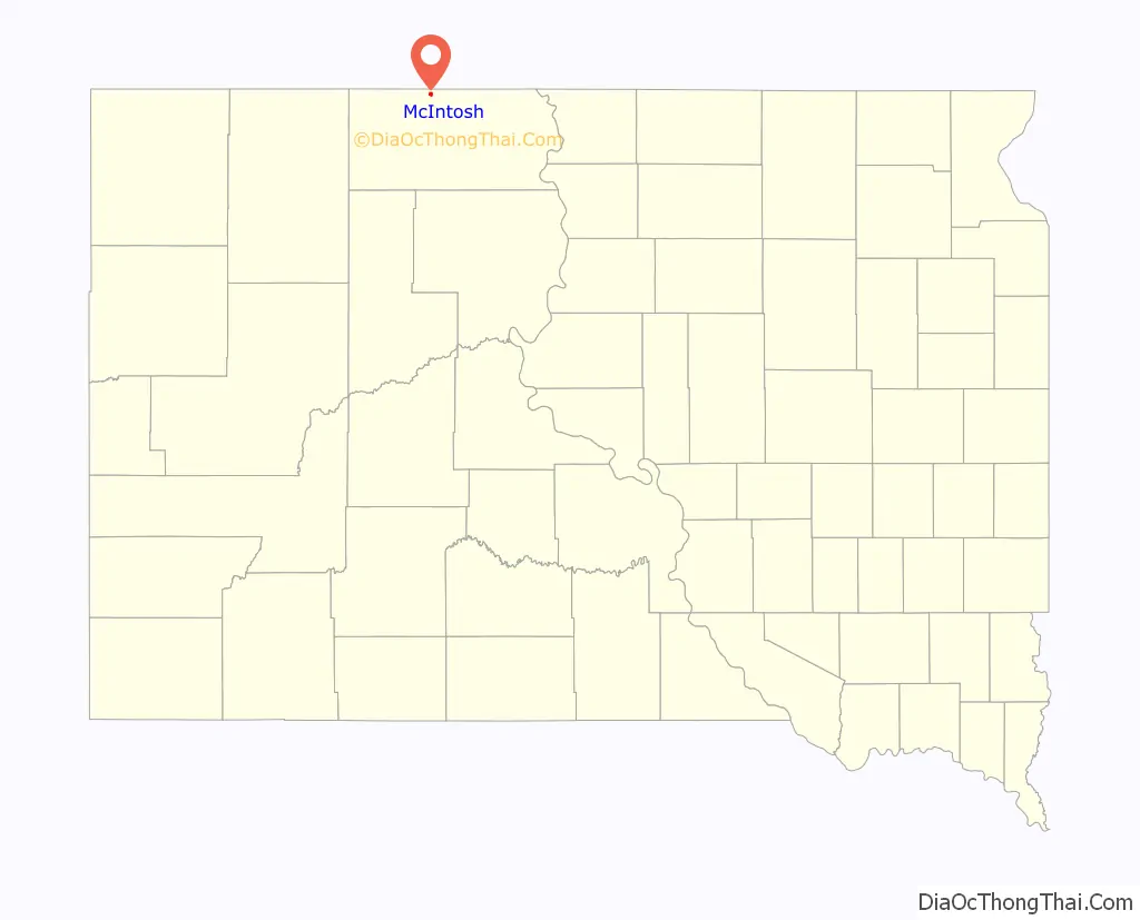
McIntosh location map. Where is McIntosh city?
History
McIntosh was named for a sibling duo who worked for the railroad. The town was established in 1909.
McIntosh was the site of a Cold War era radar station. On April 1, 2006, the wood-frame courthouse burned to the ground. Twenty-five year old Dwight Crigger, an employee of the local weed and pest board, was arrested for the setting the fire. It was the last wood courthouse in use in South Dakota.
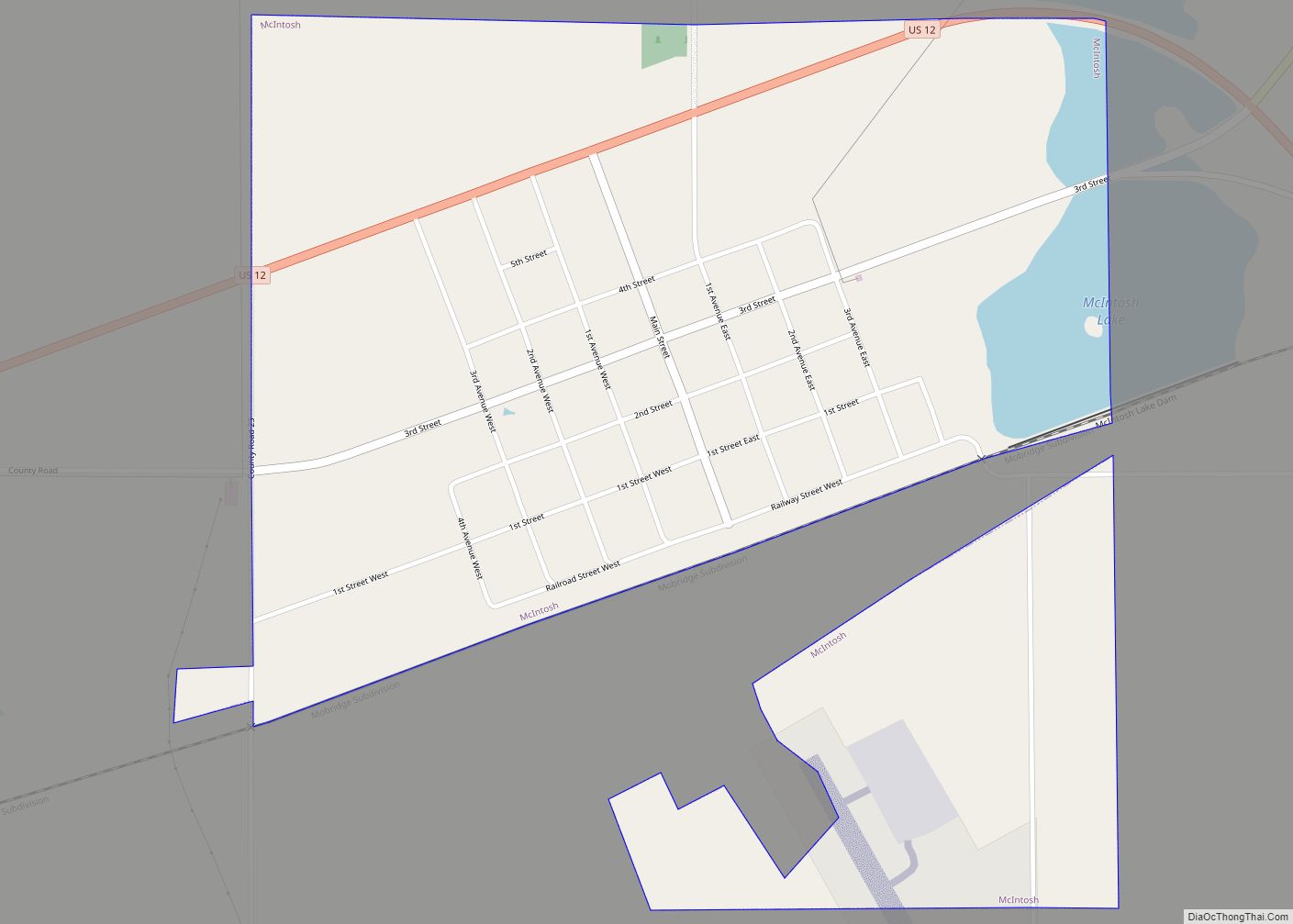
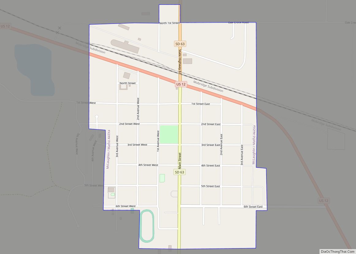
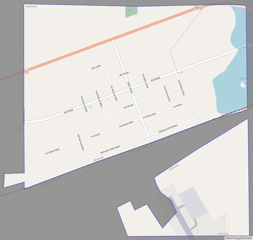
McIntosh Road Map
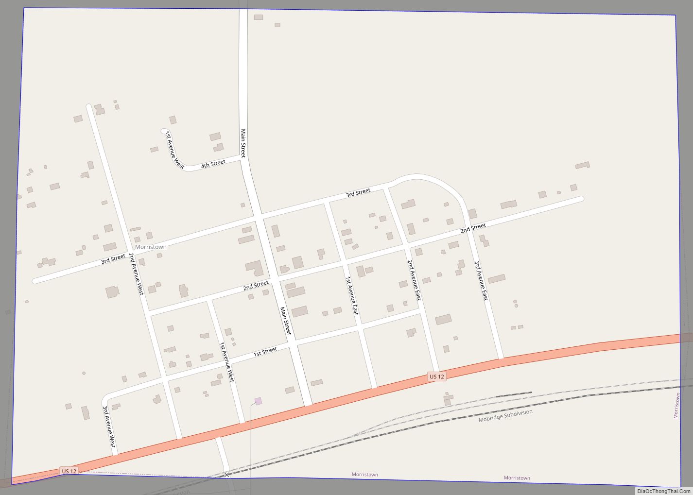
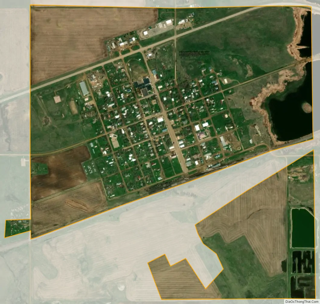
McIntosh city Satellite Map
Geography
McIntosh is located at 45°55′18″N 101°21′1″W / 45.92167°N 101.35028°W / 45.92167; -101.35028 (45.921649, -101.350171). According to the United States Census Bureau, the city has a total area of 0.77 square miles (1.99 km), of which 0.73 square miles (1.89 km) is land and 0.04 square miles (0.10 km) is water. McIntosh has been assigned the ZIP code 57641 and the FIPS place code 39940.
McIntosh is located on US Route 12 and a mile west of the junction with South Dakota Highway 65. It is also a mile west of East (McIntosh) Lake, a lake created by the railroad bed.
Climate
McIntosh holds the record for the coldest record temperature in South Dakota (−58 °F or −50 °C), set February 17, 1936.
That same year, McIntosh set its own record for highest temperature (114 °F or 45.6 °C) that stands to this day.
See also
Map of South Dakota State and its subdivision:- Aurora
- Beadle
- Bennett
- Bon Homme
- Brookings
- Brown
- Brule
- Buffalo
- Butte
- Campbell
- Charles Mix
- Clark
- Clay
- Codington
- Corson
- Custer
- Davison
- Day
- Deuel
- Dewey
- Douglas
- Edmunds
- Fall River
- Faulk
- Grant
- Gregory
- Haakon
- Hamlin
- Hand
- Hanson
- Harding
- Hughes
- Hutchinson
- Hyde
- Jackson
- Jerauld
- Jones
- Kingsbury
- Lake
- Lawrence
- Lincoln
- Lyman
- Marshall
- McCook
- McPherson
- Meade
- Mellette
- Miner
- Minnehaha
- Moody
- Pennington
- Perkins
- Potter
- Roberts
- Sanborn
- Shannon
- Spink
- Stanley
- Sully
- Todd
- Tripp
- Turner
- Union
- Walworth
- Yankton
- Ziebach
- Alabama
- Alaska
- Arizona
- Arkansas
- California
- Colorado
- Connecticut
- Delaware
- District of Columbia
- Florida
- Georgia
- Hawaii
- Idaho
- Illinois
- Indiana
- Iowa
- Kansas
- Kentucky
- Louisiana
- Maine
- Maryland
- Massachusetts
- Michigan
- Minnesota
- Mississippi
- Missouri
- Montana
- Nebraska
- Nevada
- New Hampshire
- New Jersey
- New Mexico
- New York
- North Carolina
- North Dakota
- Ohio
- Oklahoma
- Oregon
- Pennsylvania
- Rhode Island
- South Carolina
- South Dakota
- Tennessee
- Texas
- Utah
- Vermont
- Virginia
- Washington
- West Virginia
- Wisconsin
- Wyoming