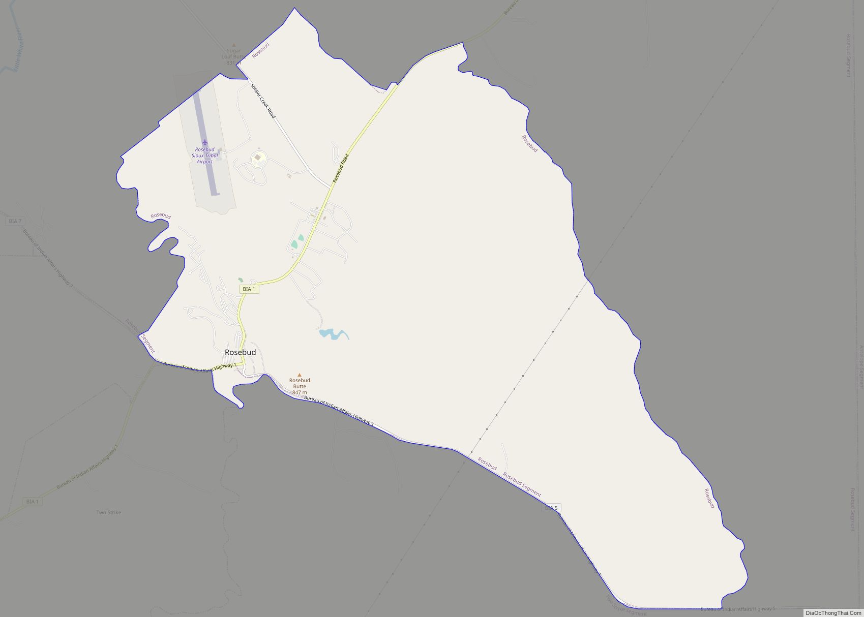
Rosebud also Sicanġu (Lakhota Sicanġu; “Scorched Thigh”) is a census-designated place (CDP) in Todd County, South Dakota, United States. The population was 1,455 at the 2020 census.
Rosebud is located on the Rosebud Indian Reservation. It is home to the Rosebud Sioux tribe. Rosebud also has many tribal agencies such as the Indian Health Service, Bureau of Indian Affairs, Tribal Land Enterprise, Tribal BIA Police, and the Division of Forestry and Wildland Fire Management.
| Name: | Rosebud CDP |
|---|---|
| LSAD Code: | 57 |
| LSAD Description: | CDP (suffix) |
| State: | South Dakota |
| County: | Todd County |
| Total Area: | 13.1 sq mi (34 km²) |
| Land Area: | 13.1 sq mi (33.9 km²) |
| Water Area: | 0 sq mi (0.1 km²) |
| Total Population: | 1,455 |
| Population Density: | 121.1/sq mi (46.8/km²) |
| FIPS code: | 4655940 |
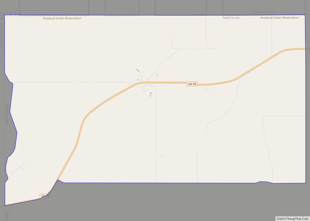
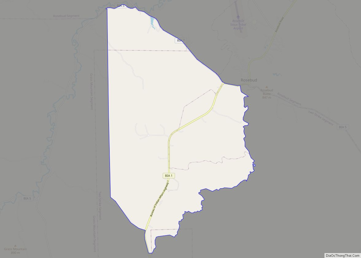
Online Interactive Map
Click on ![]() to view map in "full screen" mode.
to view map in "full screen" mode.
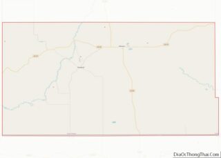
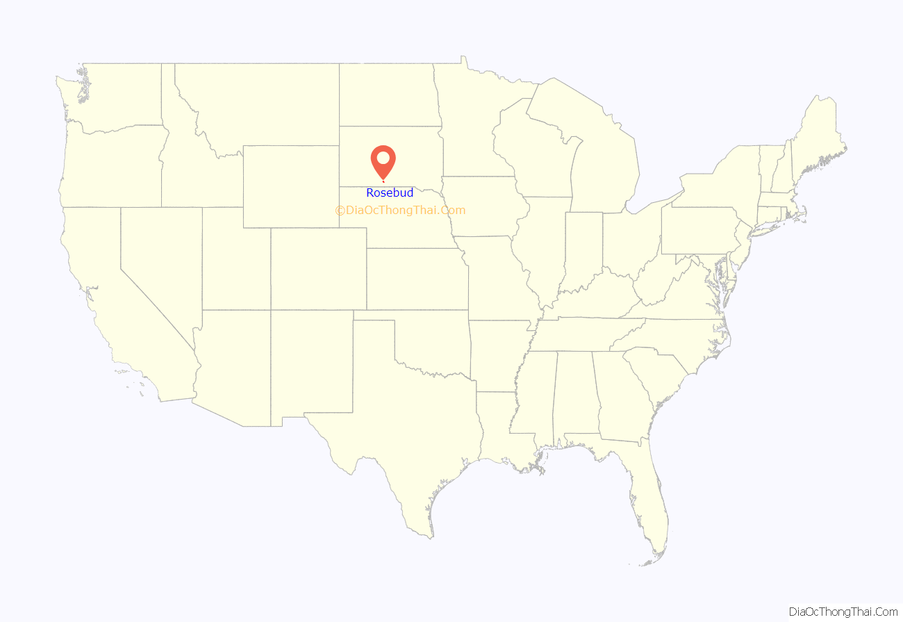
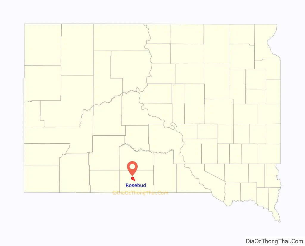
Rosebud location map. Where is Rosebud CDP?
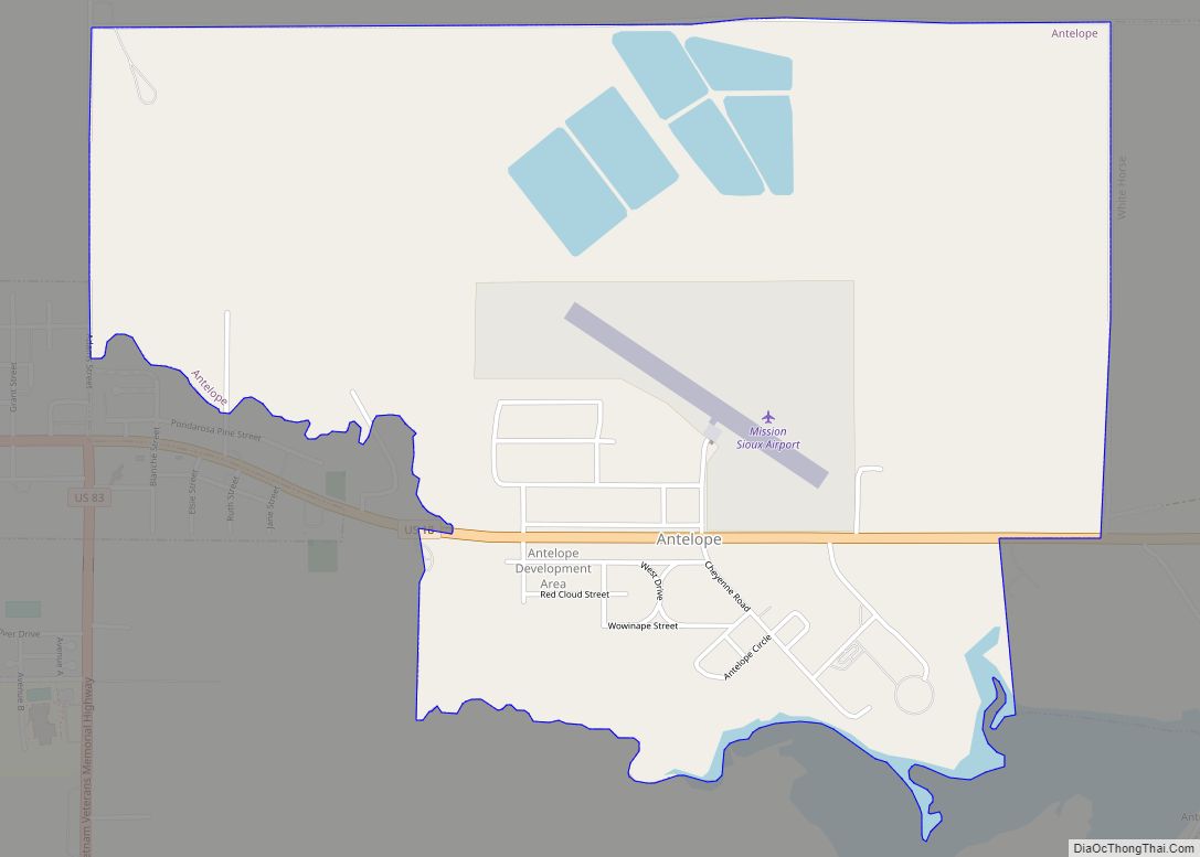
Rosebud Road Map

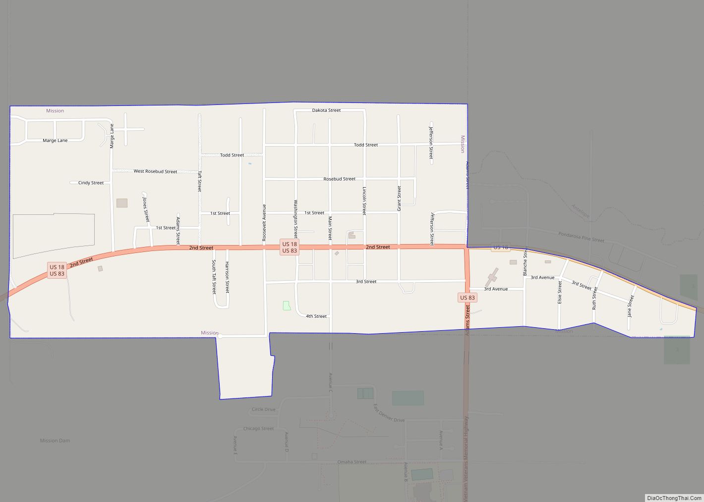
Rosebud city Satellite Map

Geography
According to the United States Census Bureau, the CDP has a total area of 13.1 square miles (34 km), of which 13.1 square miles (34 km) is land and 0.04 square miles (0.10 km) (0.30%) is water.
Rosebud has been assigned the ZIP code 57570.
See also
Map of South Dakota State and its subdivision:- Aurora
- Beadle
- Bennett
- Bon Homme
- Brookings
- Brown
- Brule
- Buffalo
- Butte
- Campbell
- Charles Mix
- Clark
- Clay
- Codington
- Corson
- Custer
- Davison
- Day
- Deuel
- Dewey
- Douglas
- Edmunds
- Fall River
- Faulk
- Grant
- Gregory
- Haakon
- Hamlin
- Hand
- Hanson
- Harding
- Hughes
- Hutchinson
- Hyde
- Jackson
- Jerauld
- Jones
- Kingsbury
- Lake
- Lawrence
- Lincoln
- Lyman
- Marshall
- McCook
- McPherson
- Meade
- Mellette
- Miner
- Minnehaha
- Moody
- Pennington
- Perkins
- Potter
- Roberts
- Sanborn
- Shannon
- Spink
- Stanley
- Sully
- Todd
- Tripp
- Turner
- Union
- Walworth
- Yankton
- Ziebach
- Alabama
- Alaska
- Arizona
- Arkansas
- California
- Colorado
- Connecticut
- Delaware
- District of Columbia
- Florida
- Georgia
- Hawaii
- Idaho
- Illinois
- Indiana
- Iowa
- Kansas
- Kentucky
- Louisiana
- Maine
- Maryland
- Massachusetts
- Michigan
- Minnesota
- Mississippi
- Missouri
- Montana
- Nebraska
- Nevada
- New Hampshire
- New Jersey
- New Mexico
- New York
- North Carolina
- North Dakota
- Ohio
- Oklahoma
- Oregon
- Pennsylvania
- Rhode Island
- South Carolina
- South Dakota
- Tennessee
- Texas
- Utah
- Vermont
- Virginia
- Washington
- West Virginia
- Wisconsin
- Wyoming