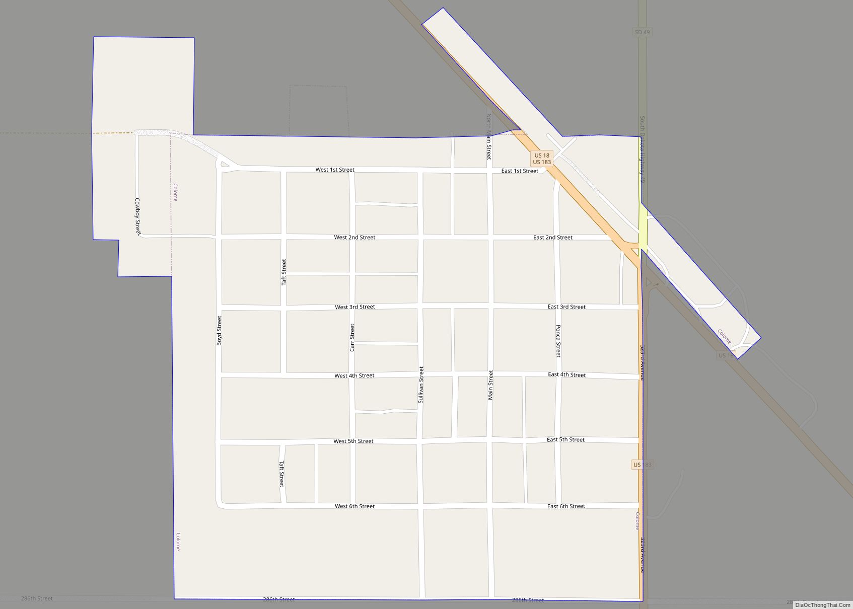
Winner is a city in central Tripp County, South Dakota, United States. The population was 2,921 at the 2020 census. It is the county seat of Tripp County. Winner also serves as the administrative center of neighboring Todd County, which does not have its own county seat. The nearest airport is Winner Regional Airport.
Winner was laid out in 1909, and named for the fact the town had emerged the “winner” as the county’s most successful trading point.
| Name: | Winner city |
|---|---|
| LSAD Code: | 25 |
| LSAD Description: | city (suffix) |
| State: | South Dakota |
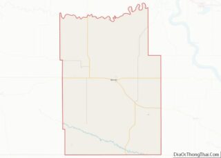
| County: | Tripp County |
| Incorporated: | 1911 |
| Elevation: | 1,969 ft (600 m) |
| Total Area: | 2.29 sq mi (5.94 km²) |
| Land Area: | 2.29 sq mi (5.94 km²) |
| Water Area: | 0.00 sq mi (0.00 km²) |
| Total Population: | 2,921 |
| Population Density: | 1,274.43/sq mi (492.05/km²) |
| ZIP code: | 57580 |
| Area code: | 605 |
| FIPS code: | 4672180 |
| GNISfeature ID: | 1266939 |
| Website: | www.winnersd.org |
Online Interactive Map
Click on ![]() to view map in "full screen" mode.
to view map in "full screen" mode.
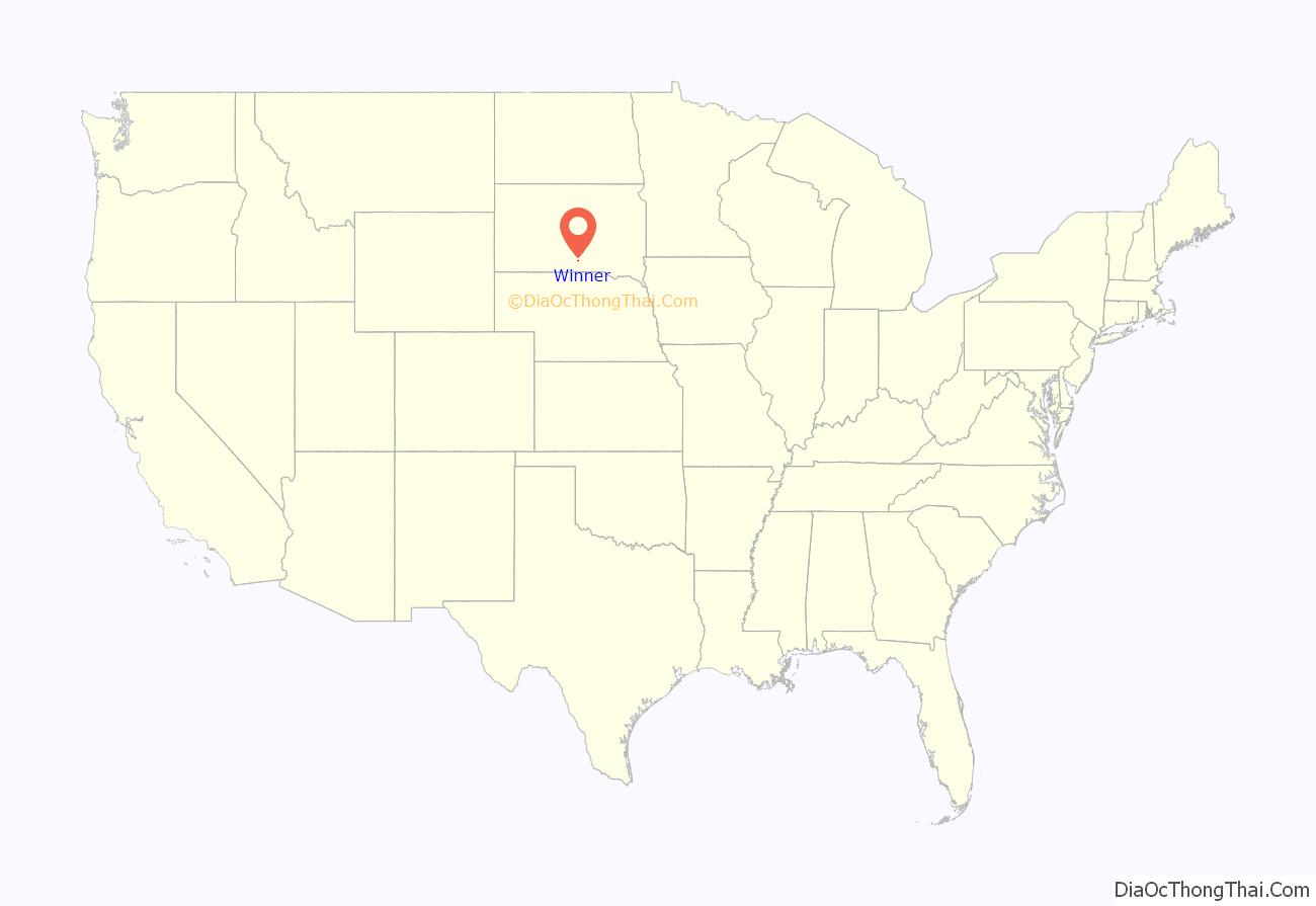
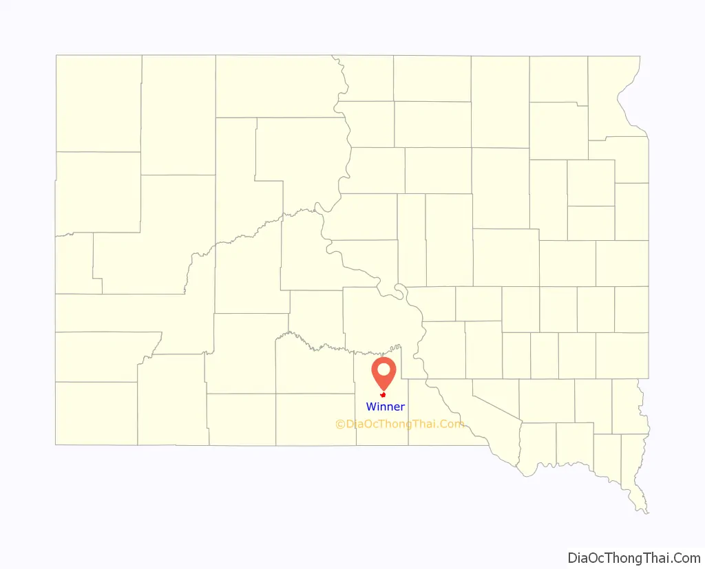
Winner location map. Where is Winner city?
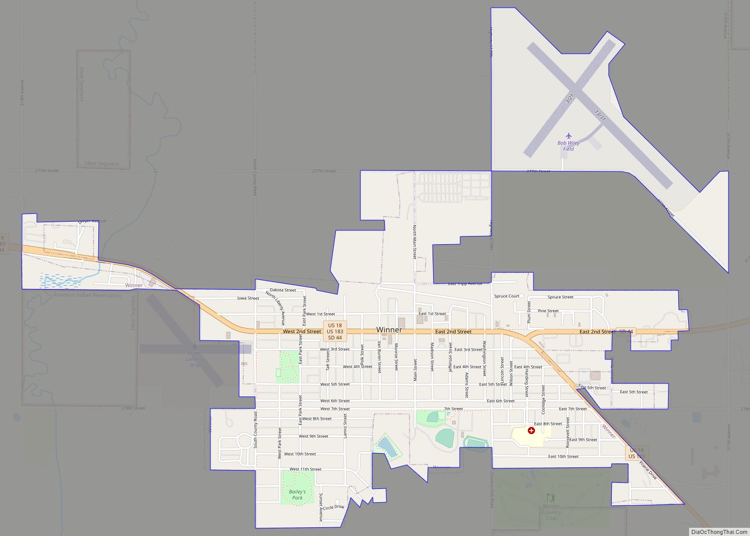
Winner Road Map
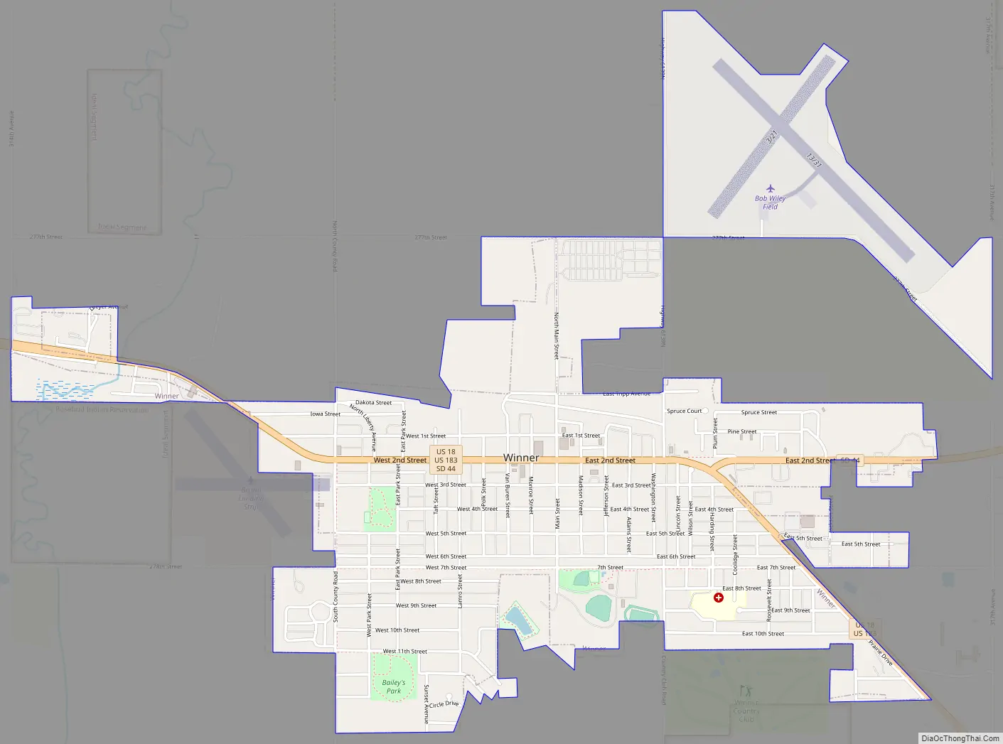
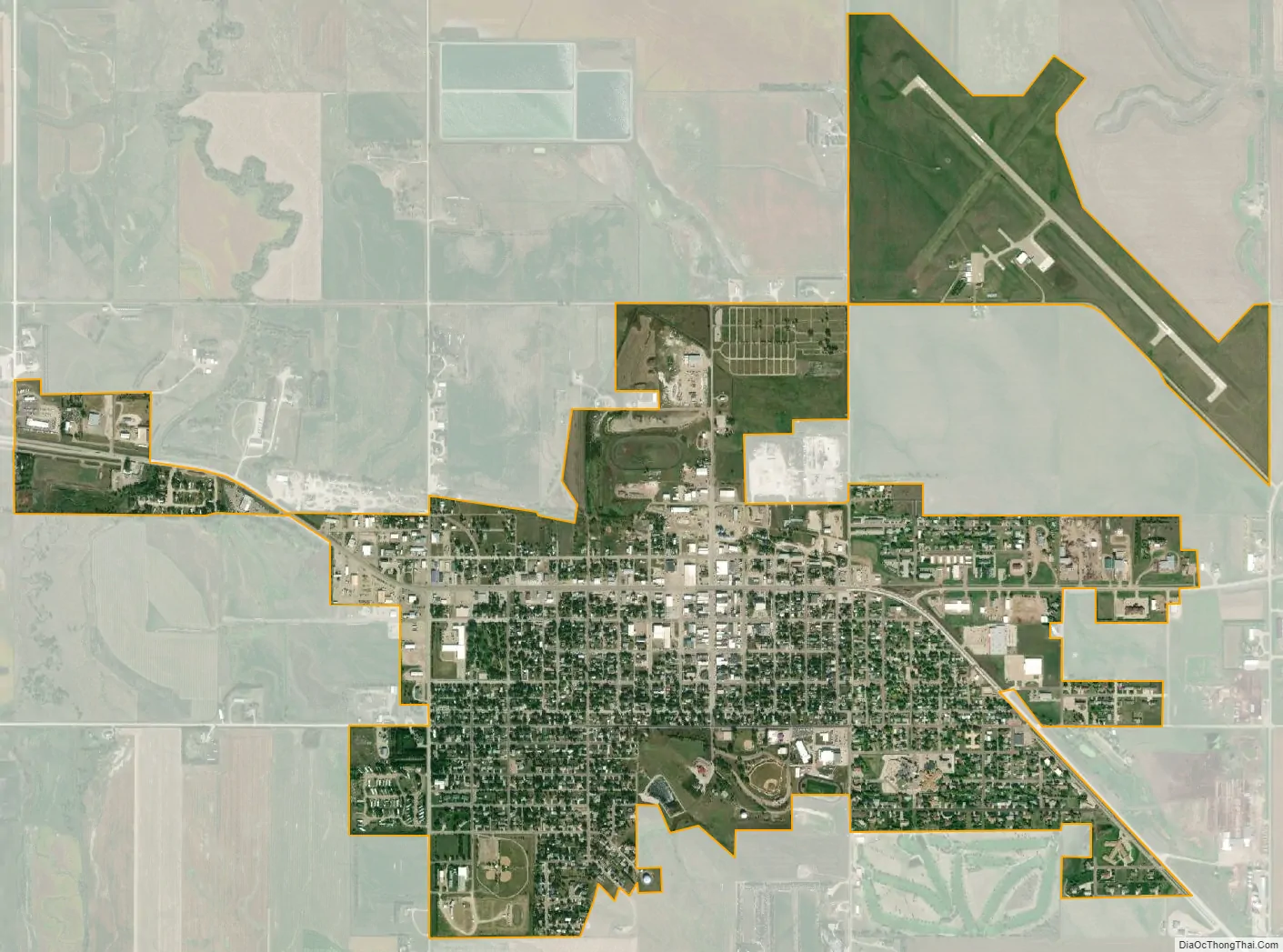
Winner city Satellite Map
Geography
According to the United States Census Bureau, the city has a total area of 2.20 square miles (5.70 km), all land.
Climate
Winner, located in the south central part of the state, features a climate type (Köppen Dfa) often described as a hot summer humid continental climate. Winters average below the −3 °C (26.6 °F) persistent snow line isotherm, and summers average above the 22 °C (72 °F) Köppen hot summer isotherm. The climate features nearly even four seasons, typical of its classification. The all-time high temperature is 115 °F (46 °C), set in 1934, and the all-time low temperature is −38 °F (−39 °C), set in 1936.
See also
Map of South Dakota State and its subdivision:- Aurora
- Beadle
- Bennett
- Bon Homme
- Brookings
- Brown
- Brule
- Buffalo
- Butte
- Campbell
- Charles Mix
- Clark
- Clay
- Codington
- Corson
- Custer
- Davison
- Day
- Deuel
- Dewey
- Douglas
- Edmunds
- Fall River
- Faulk
- Grant
- Gregory
- Haakon
- Hamlin
- Hand
- Hanson
- Harding
- Hughes
- Hutchinson
- Hyde
- Jackson
- Jerauld
- Jones
- Kingsbury
- Lake
- Lawrence
- Lincoln
- Lyman
- Marshall
- McCook
- McPherson
- Meade
- Mellette
- Miner
- Minnehaha
- Moody
- Pennington
- Perkins
- Potter
- Roberts
- Sanborn
- Shannon
- Spink
- Stanley
- Sully
- Todd
- Tripp
- Turner
- Union
- Walworth
- Yankton
- Ziebach
- Alabama
- Alaska
- Arizona
- Arkansas
- California
- Colorado
- Connecticut
- Delaware
- District of Columbia
- Florida
- Georgia
- Hawaii
- Idaho
- Illinois
- Indiana
- Iowa
- Kansas
- Kentucky
- Louisiana
- Maine
- Maryland
- Massachusetts
- Michigan
- Minnesota
- Mississippi
- Missouri
- Montana
- Nebraska
- Nevada
- New Hampshire
- New Jersey
- New Mexico
- New York
- North Carolina
- North Dakota
- Ohio
- Oklahoma
- Oregon
- Pennsylvania
- Rhode Island
- South Carolina
- South Dakota
- Tennessee
- Texas
- Utah
- Vermont
- Virginia
- Washington
- West Virginia
- Wisconsin
- Wyoming