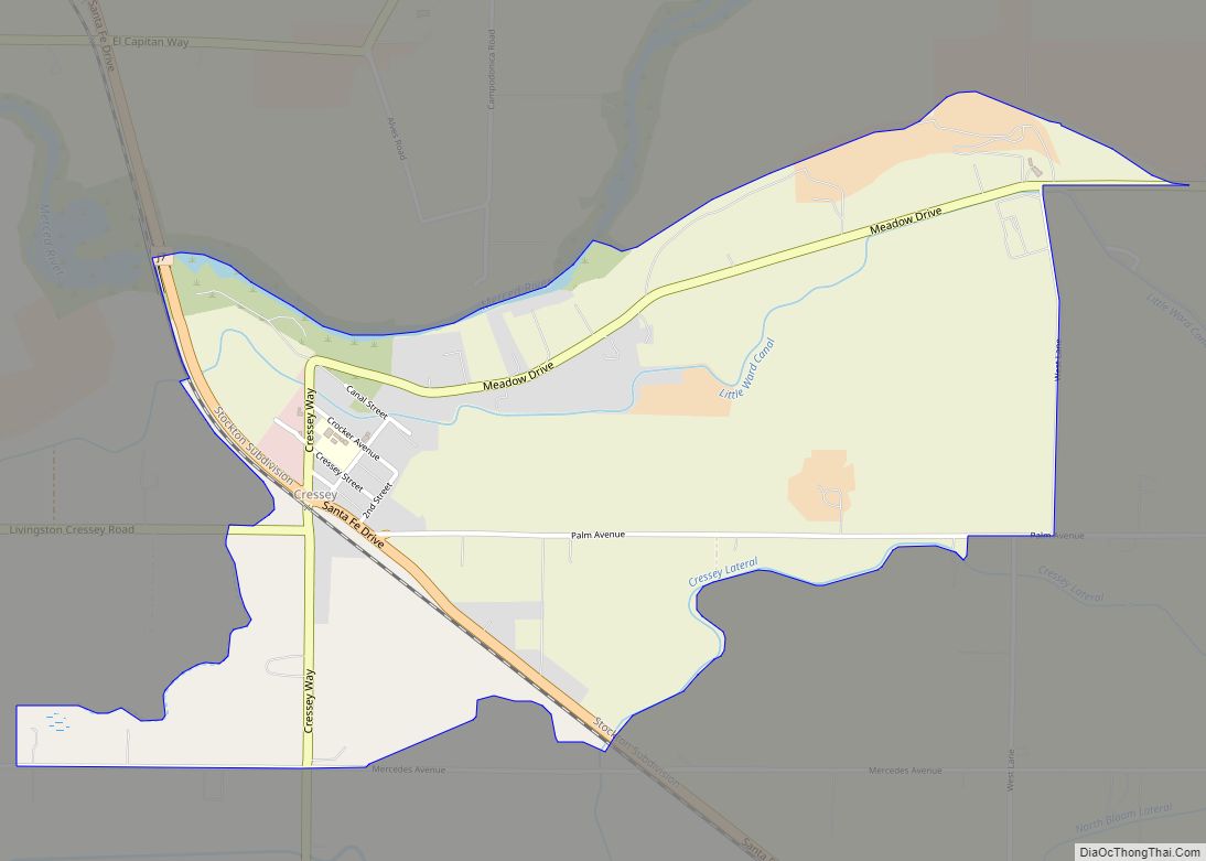
Cressey (formerly, Cressy) is a census-designated place in Merced County, California. It is located 6 miles (9.7 km) north-northwest of Atwater, at an elevation of 167 feet (51 m). The population was 366 at the 2020 United States census, down from 393 in 2010.
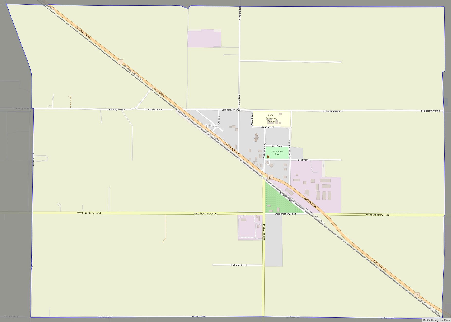
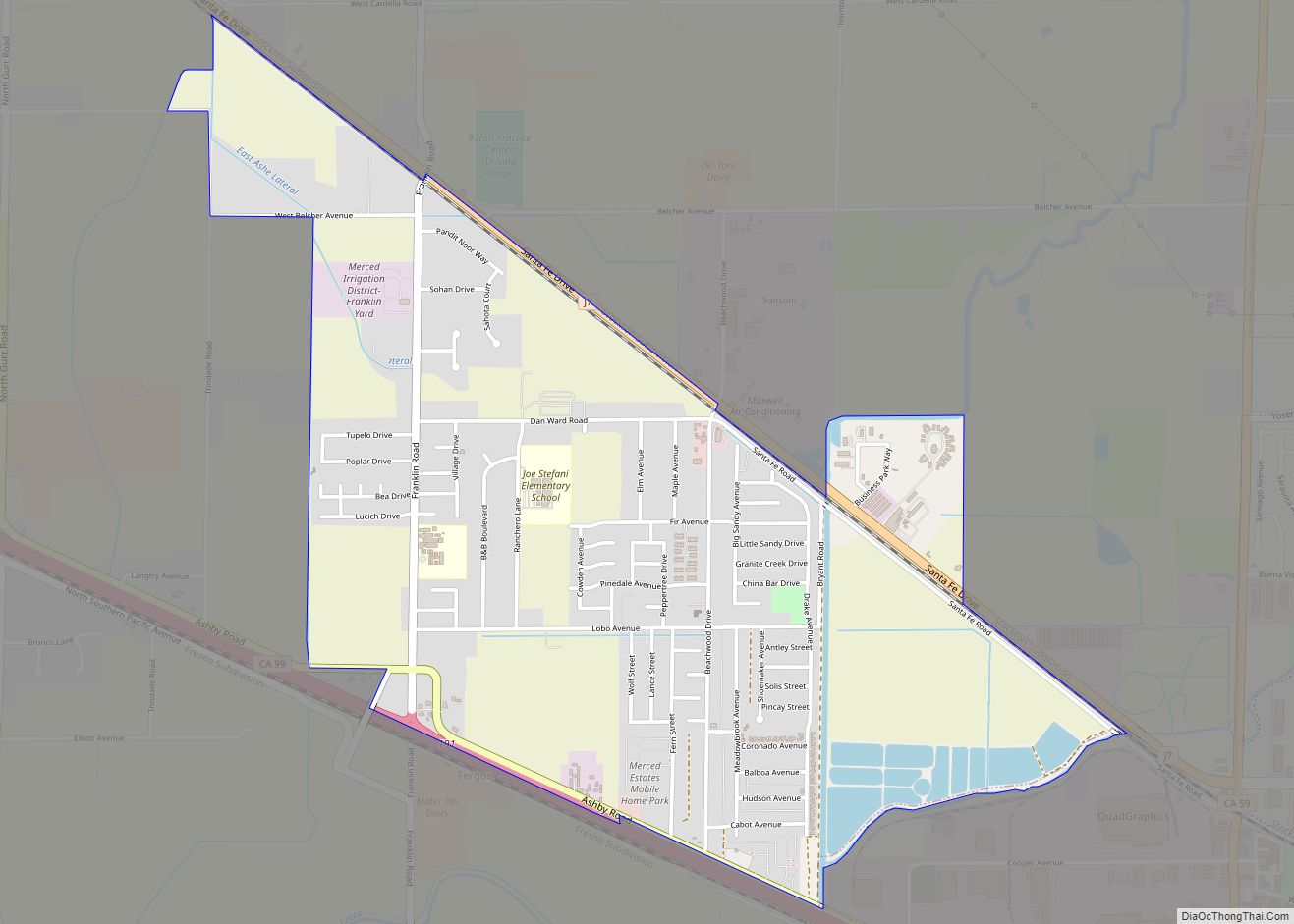
Cressey is located in the northern part of Merced County. It is just east of where the Santa Fe railroad (original line of the San Francisco and San Joaquin Valley Railroad) crosses the Merced River. Ballico is across the river to the northwest. Livingston is to the southwest, and Winton is southeast of Cressey. The ZIP Code is 95312. The area is inside area code 209.
| Name: | Cressey CDP |
|---|---|
| LSAD Code: | 57 |
| LSAD Description: | CDP (suffix) |
| State: | California |
| County: | Merced County |
| Elevation: | 167 ft (51 m) |
| Total Area: | 1.76 sq mi (4.55 km²) |
| Land Area: | 1.76 sq mi (4.55 km²) |
| Water Area: | 0.00 sq mi (0.00 km²) 0% |
| Total Population: | 366 |
| Population Density: | 208.19/sq mi (80.36/km²) |
| ZIP code: | 95312 |
| Area code: | 209 |
| FIPS code: | 0617078 |
Online Interactive Map
Click on ![]() to view map in "full screen" mode.
to view map in "full screen" mode.
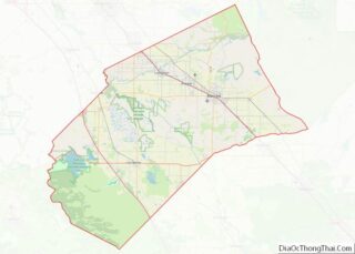
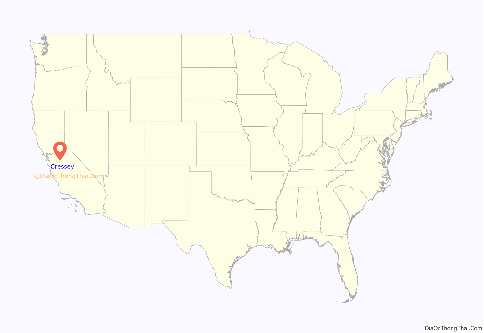
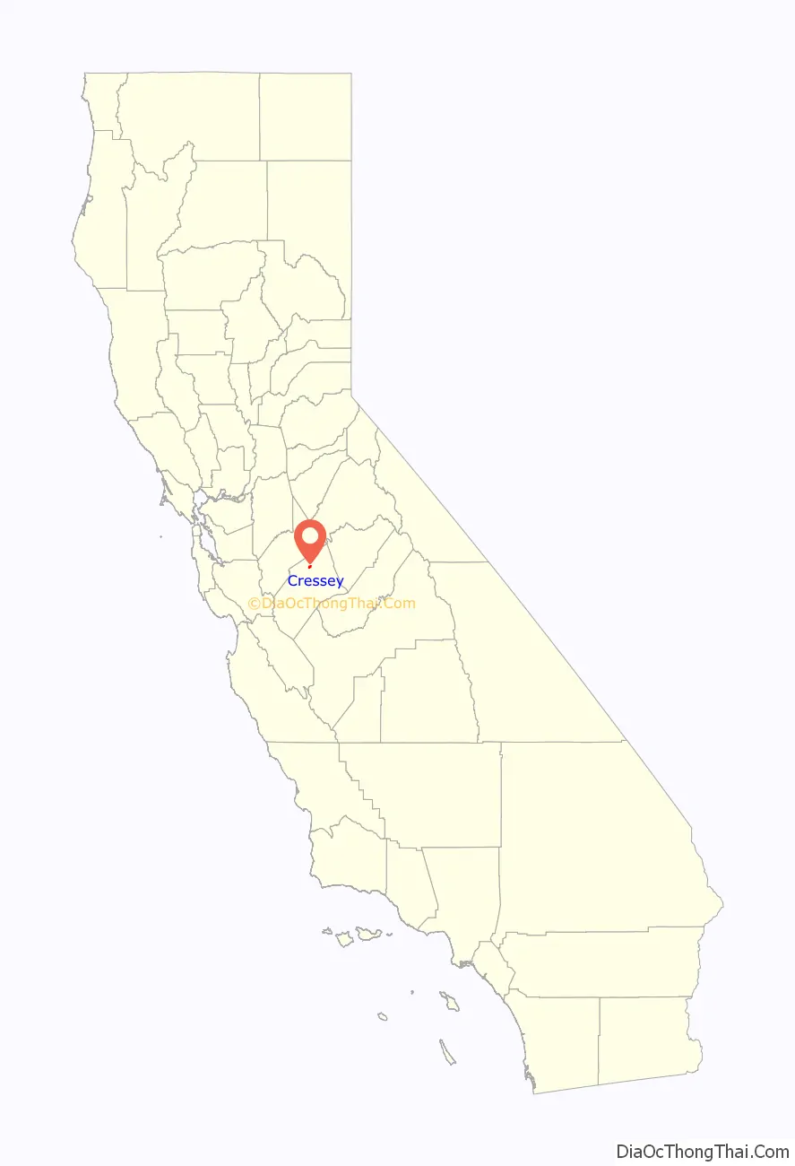
Cressey location map. Where is Cressey CDP?
History
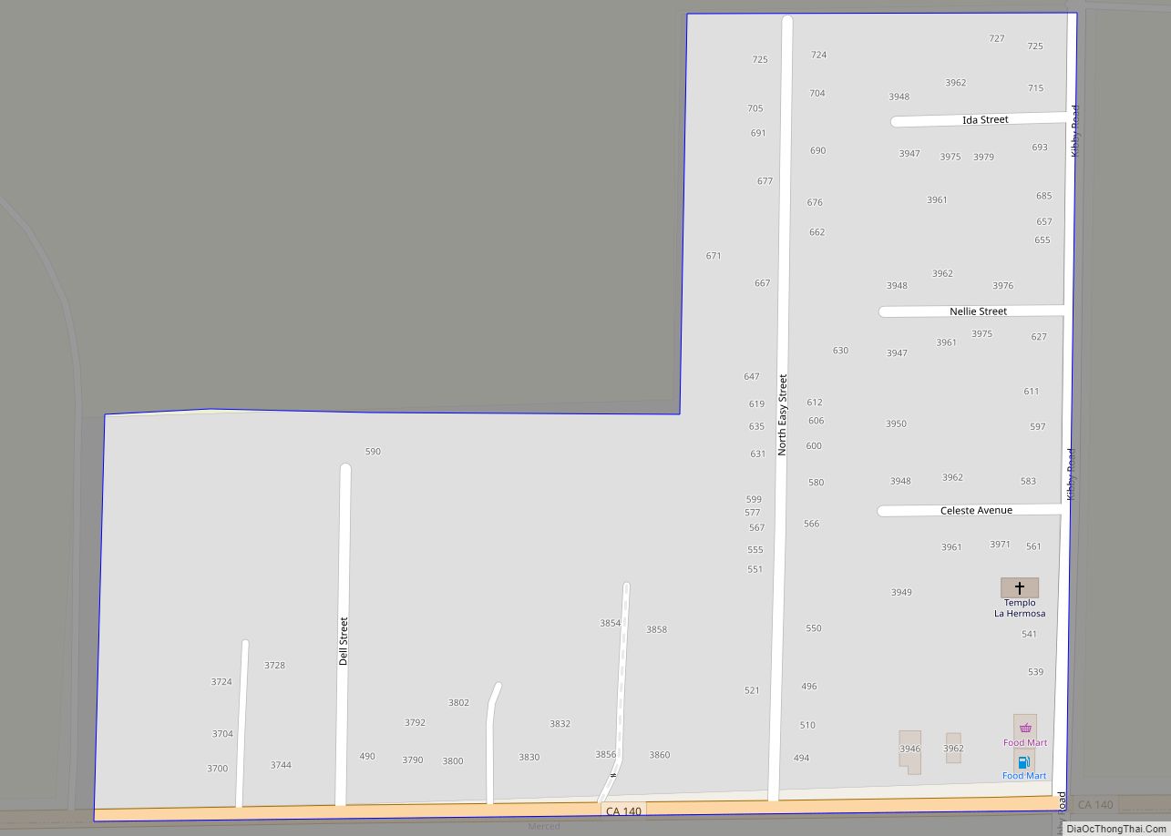
The Cressy post office opened in 1882, closed in 1883, re-opened in 1909, and changed its name to Cressey in 1912. The town was named by the Atchison, Topeka and Santa Fe Railway for Calvin J. Cressey, local landowner. Cressey has one Postal Office, located on Cressey Way. The Old Post Office was located behind the Cressey General Store, on Third St. Cressey has one active General Store, located on the corner of Santa Fe Dr. and Third St. In the past, the Cressey Store had two Gasoline Pumps; then was reduced to one. Then after, all were taken out of service and removed. Cressey has one county-owned Park, located on Cressey Way, just west of the Ward Canal, but it’s said to be maintained by a few citizens and the Cal-Fire Firefighter Volunteers. Cressey was also said to have one church (but later turned into a private home) on the corner of Crocker Ave and Third St. It was also said that Cressey had a Hotel near the RailRoad (Santa Fe) but has not been confirmed. Cressey had an Old “one-lane” iron suspension bridge (similar to the Historic Shaffer Bridge), that was off of Meadow Dr, that went over the Merced River. That bridge was a “cut-off” or an alternate way to Ballico, CA; that went onto Alves Rd. The bridge was later demolished after multiple injuries sustained by kids jumping off into the water. Cressey is patrolled by the Merced County Sheriffs Office. Cressey has one Elementary School (Ballico-Cressey School District, K-2).
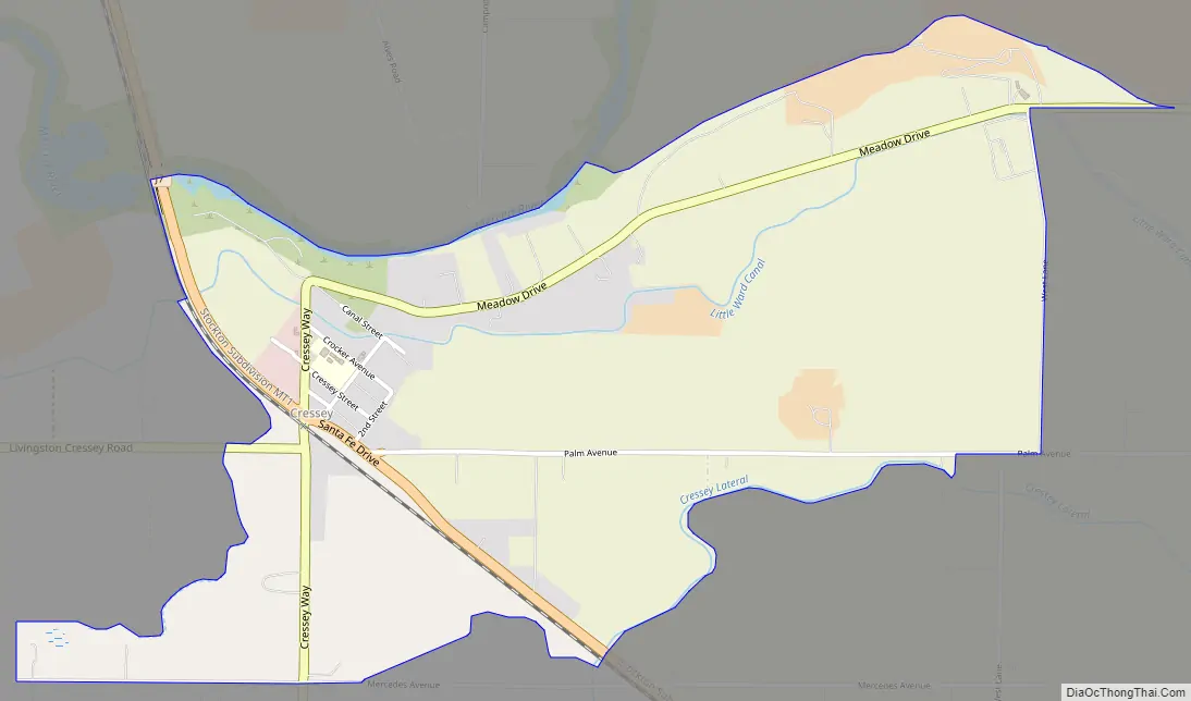
Cressey Road Map
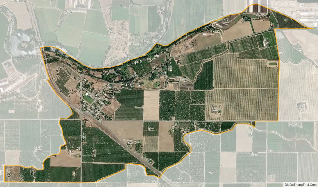
Cressey city Satellite Map
Geography
According to the United States Census Bureau, the CDP covers an area of 1.8 square miles (4.6 km), all of it land. To the North of Cressey, beyond the Merced River, it is considered Ballico, Ca. To the South of Cressey, Palm Ave and Beyond, it is considered Winton, Ca. To the West of Cressey, over the Santa Fe Rail Road and beyond, it is considered Livingston, Ca. To the East of Cressey, off of Cressey Way onto Meadow Dr and beyond, it is considered Winton, Ca as well.
See also
Map of California State and its subdivision:- Alameda
- Alpine
- Amador
- Butte
- Calaveras
- Colusa
- Contra Costa
- Del Norte
- El Dorado
- Fresno
- Glenn
- Humboldt
- Imperial
- Inyo
- Kern
- Kings
- Lake
- Lassen
- Los Angeles
- Madera
- Marin
- Mariposa
- Mendocino
- Merced
- Modoc
- Mono
- Monterey
- Napa
- Nevada
- Orange
- Placer
- Plumas
- Riverside
- Sacramento
- San Benito
- San Bernardino
- San Diego
- San Francisco
- San Joaquin
- San Luis Obispo
- San Mateo
- Santa Barbara
- Santa Clara
- Santa Cruz
- Shasta
- Sierra
- Siskiyou
- Solano
- Sonoma
- Stanislaus
- Sutter
- Tehama
- Trinity
- Tulare
- Tuolumne
- Ventura
- Yolo
- Yuba
- Alabama
- Alaska
- Arizona
- Arkansas
- California
- Colorado
- Connecticut
- Delaware
- District of Columbia
- Florida
- Georgia
- Hawaii
- Idaho
- Illinois
- Indiana
- Iowa
- Kansas
- Kentucky
- Louisiana
- Maine
- Maryland
- Massachusetts
- Michigan
- Minnesota
- Mississippi
- Missouri
- Montana
- Nebraska
- Nevada
- New Hampshire
- New Jersey
- New Mexico
- New York
- North Carolina
- North Dakota
- Ohio
- Oklahoma
- Oregon
- Pennsylvania
- Rhode Island
- South Carolina
- South Dakota
- Tennessee
- Texas
- Utah
- Vermont
- Virginia
- Washington
- West Virginia
- Wisconsin
- Wyoming