Emerald Lake Hills or Emerald Hills is a census-designated place and neighborhood in unincorporated San Mateo County, in the state of California, United States. Situated among oak-studded hills between Woodside, Redwood City, and San Carlos roughly bounded by Edgewood Road, Alameda de las Pulgas, Farm Hill Boulevard, and Interstate 280. The population was 4,406 at the 2020 census and the per-capita income was $68,966, making it the 22nd wealthiest place in California and the 82nd highest income places in the United States
Emerald Lake Hills was originally conceived as a resort community for city-weary San Franciscans during World War I. Emerald Lake Hills actually consists of two large subdivisions created around 1920: Emerald Lake (even though there are two lakes) and Emerald Hills. Residents refer to the area by either Emerald Hills or by Emerald Lake Hills. The name Emerald Hills is now more commonly adopted due to mailing designation rules, as the U.S. Post Office would allow only a two-word name.
According to an interview with Yuji Naka, Emerald Hills is the namesake for the famous Emerald Hill Zone, the first level of Sonic the Hedgehog 2.
| Name: | Emerald Lake Hills CDP |
|---|---|
| LSAD Code: | 57 |
| LSAD Description: | CDP (suffix) |
| State: | California |
| County: | San Mateo County |
| Elevation: | 518 ft (158 m) |
| Total Area: | 1.203 sq mi (3.115 km²) |
| Land Area: | 1.196 sq mi (3.097 km²) |
| Water Area: | 0.007 sq mi (0.017 km²) 0.55% |
| Total Population: | 4,406 |
| Population Density: | 3,700/sq mi (1,400/km²) |
| ZIP code: | 94062 |
| Area code: | 650 |
| FIPS code: | 0622587 |
| GNISfeature ID: | 1867022 |
Online Interactive Map
Click on ![]() to view map in "full screen" mode.
to view map in "full screen" mode.
Emerald Lake Hills location map. Where is Emerald Lake Hills CDP?


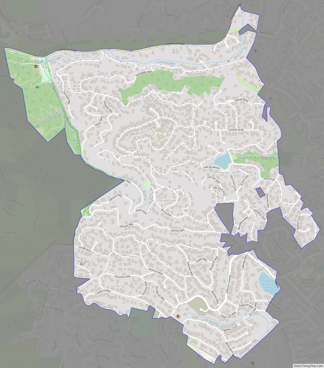
Emerald Lake Hills Road Map
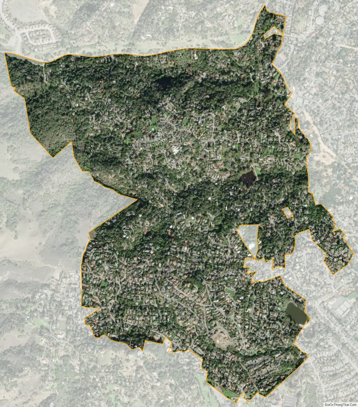
Emerald Lake Hills city Satellite Map
Geography
Emerald Lake Hills is located at 37°27′52″N 122°15′59″W / 37.46444°N 122.26639°W / 37.46444; -122.26639 (37.464388, -122.266389).
According to the United States Census Bureau, the neighborhood has a total area of 1.2 square miles (3.1 km), of which, 1.2 square miles (3.1 km) of it is land and 0.55% is water.
See also
Map of California State and its subdivision:- Alameda
- Alpine
- Amador
- Butte
- Calaveras
- Colusa
- Contra Costa
- Del Norte
- El Dorado
- Fresno
- Glenn
- Humboldt
- Imperial
- Inyo
- Kern
- Kings
- Lake
- Lassen
- Los Angeles
- Madera
- Marin
- Mariposa
- Mendocino
- Merced
- Modoc
- Mono
- Monterey
- Napa
- Nevada
- Orange
- Placer
- Plumas
- Riverside
- Sacramento
- San Benito
- San Bernardino
- San Diego
- San Francisco
- San Joaquin
- San Luis Obispo
- San Mateo
- Santa Barbara
- Santa Clara
- Santa Cruz
- Shasta
- Sierra
- Siskiyou
- Solano
- Sonoma
- Stanislaus
- Sutter
- Tehama
- Trinity
- Tulare
- Tuolumne
- Ventura
- Yolo
- Yuba
- Alabama
- Alaska
- Arizona
- Arkansas
- California
- Colorado
- Connecticut
- Delaware
- District of Columbia
- Florida
- Georgia
- Hawaii
- Idaho
- Illinois
- Indiana
- Iowa
- Kansas
- Kentucky
- Louisiana
- Maine
- Maryland
- Massachusetts
- Michigan
- Minnesota
- Mississippi
- Missouri
- Montana
- Nebraska
- Nevada
- New Hampshire
- New Jersey
- New Mexico
- New York
- North Carolina
- North Dakota
- Ohio
- Oklahoma
- Oregon
- Pennsylvania
- Rhode Island
- South Carolina
- South Dakota
- Tennessee
- Texas
- Utah
- Vermont
- Virginia
- Washington
- West Virginia
- Wisconsin
- Wyoming


