Woodside is a small incorporated town in San Mateo County, California, United States, on the San Francisco Peninsula. Woodside is among the wealthiest communities in the United States, home to many technology billionaires and investment managers, with average home prices exceeding 10 million dollars. It has a council–manager system of government. The population of the town was 5,309 at the 2020 census.
Woodside has a median household income of $375,561, median family income of $401,591 and median home price exceeding $4.5 million.
| Name: | Woodside town |
|---|---|
| LSAD Code: | 43 |
| LSAD Description: | town (suffix) |
| State: | California |
| County: | San Mateo County |
| Incorporated: | November 16, 1956 |
| Elevation: | 387 ft (118 m) |
| Total Area: | 11.47 sq mi (29.70 km²) |
| Land Area: | 11.47 sq mi (29.70 km²) |
| Water Area: | 0.00 sq mi (0.00 km²) 0% |
| Total Population: | 5,309 |
| Population Density: | 460/sq mi (180/km²) |
| ZIP code: | 94061–94062 |
| Area code: | 650 |
| FIPS code: | 0686440 |
| Website: | www.woodsidetown.org |
Online Interactive Map
Click on ![]() to view map in "full screen" mode.
to view map in "full screen" mode.
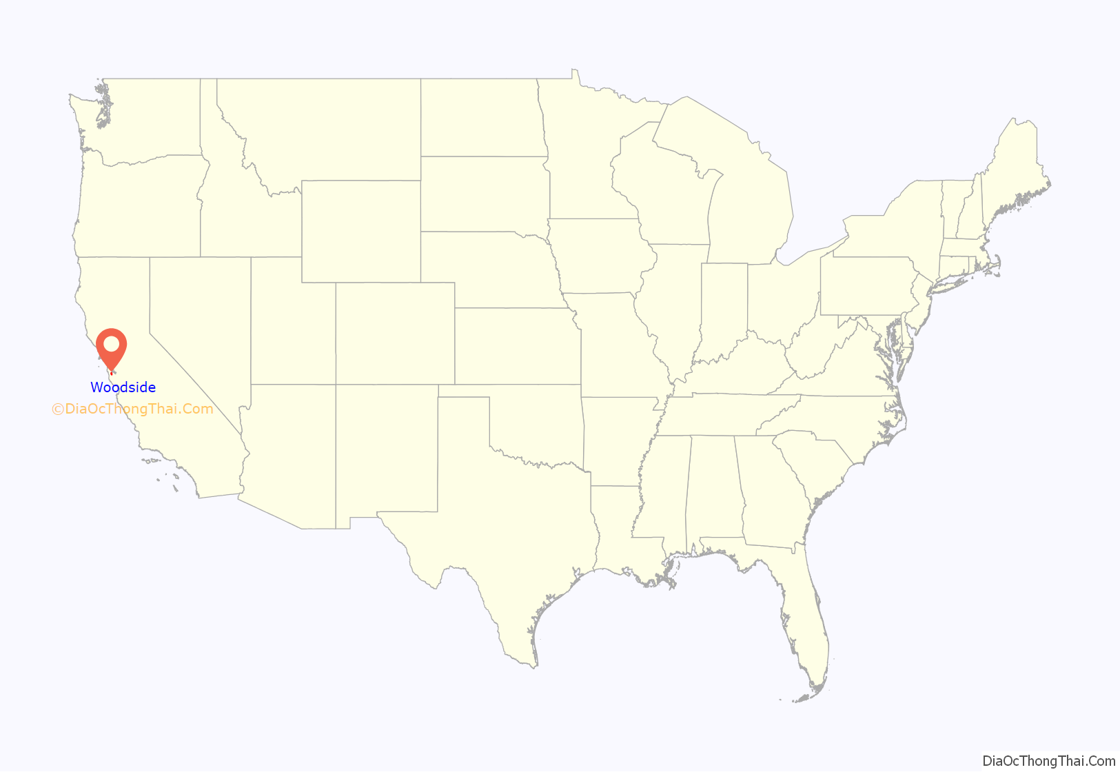
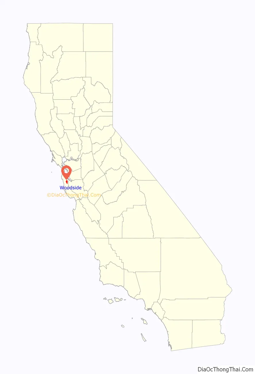
Woodside location map. Where is Woodside town?
History
The Woodside area was originally home to indigenous people belonging to the Ohlone tribe. In 1769, led by Gaspar de Portolá, Spanish explorers searching for San Francisco Bay camped at a site near Woodside.
Woodside is said to be the oldest English-speaking settlement in the southern part of the San Francisco Peninsula. The first English-speaking settlers arrived in the early 19th century to log the rich stands of redwoods. Charles Brown constructed the first sawmill in Woodside on his Mountain Home Ranch around 1838. Brown’s adobe house, built in 1839, still stands today. By mid-century, the Woodside area had a dozen mills producing building materials for a booming San Francisco.
In 1849, during the California Gold Rush, 20-year-old Mathias Alfred Parkhurst purchased 127 acres (0.5 km) of timberland and named it “Woodside”; of course, this name was kept. By the late 19th century, Woodside was home to country estates. The Sequoia Redwood trees in Woodside are currently 3rd generation growth. The first generation of the Redwood trees were used to build San Francisco’s original homes. After the 1906 San Francisco earthquake, the loggers returned to Woodside to cut the second growth of redwood so they could be used for the rebuilding of San Francisco.
In 1909, the Family, a private club, set up camp facilities and rustic buildings in Woodside at the Family Farm, a rural retreat used by club members for recreation. Gatherings at the Family Farm include an annual Farm Play, written and performed by members. In 1912, the Family pooled funds to build Our Lady of the Wayside Church in Portola Valley, designed by 19-year-old Timothy L. Pflueger, his first commission. The historic building was repaired at a cost of US$600,000 after the 1989 Loma Prieta earthquake.
Woodside was incorporated in 1956 and it retains a rural residential character even though it is only a short commute to Silicon Valley and Stanford University.
In early 2022, the town drew widespread derision for declaring itself a mountain lion habitat to avoid state affordable housing requirements. It backed down on that attempt after California Attorney General Rob Bonta denied this claim. Bonta wrote: “There is no valid basis to claim that the entire town of Woodside is a habitat for mountain lions. Land that is already developed — with, for example a single-family home — is not, by definition, habitat. (…) Our message to local governments is simple: act in good faith, follow the law, and do your part to increase the housing supply.”
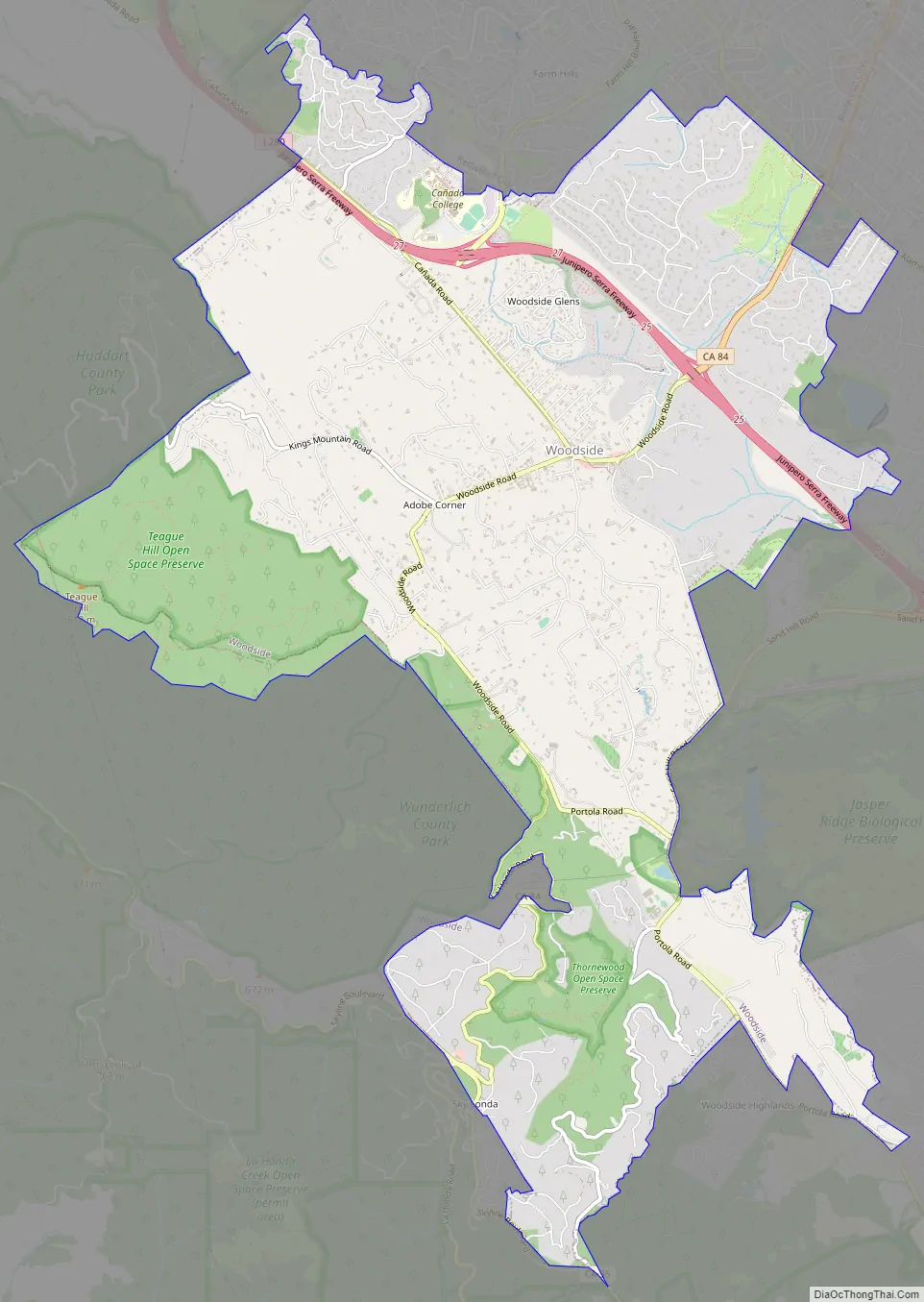
Woodside Road Map
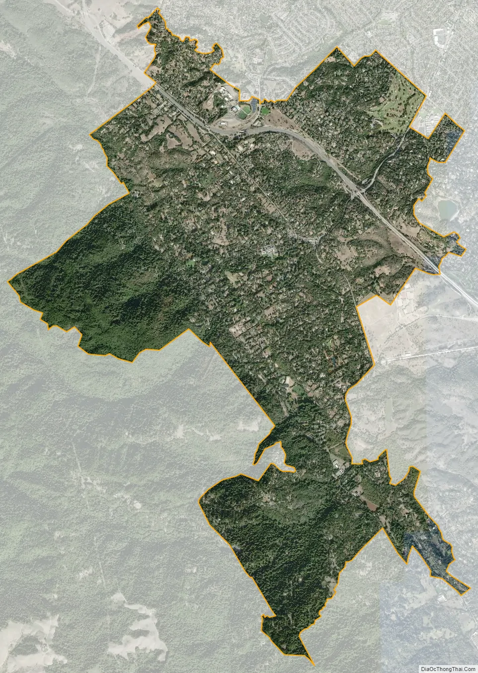
Woodside city Satellite Map
Geography
Woodside is located on the San Francisco Peninsula, midway between San Jose and San Francisco, just north of Silicon Valley, in San Mateo County. The San Andreas fault runs through portions of Woodside. Much of Woodside is wooded, with redwoods and Douglas fir dominating in the western hills and more oaks and eucalyptus in the lower areas. San Francisco Bay lies to the east, while Pacific Ocean beaches lie to the west. The Santa Cruz mountains separate Woodside from the ocean and extend down to Monterey Bay about forty miles south.
The nearest cities and towns are Redwood City, Menlo Park, Portola Valley, Atherton, San Carlos, Belmont, and Palo Alto.
Climate
As is true of most of the California coastal areas, weather in Woodside is usually mild during most of the year. Summers are dry and can be hot; winter temperatures rarely dip much below freezing. Average January temperatures are a maximum of 60 °F (16 °C) and a minimum of 36 °F (2 °C). Average July temperatures are a maximum of 88 °F (31 °C) and a minimum of 51 °F (11 °C). Snowfall is extremely rare except in the nearby Santa Cruz Mountains, where several inches falls every several years. Annual precipitation averages 30.9 inches (785.4 millimeters) and falls on an average of 61 days annually.
The record maximum temperature was 114 °F (46 °C) on July 22, 2006, and the record minimum temperature was 17 °F (−8 °C) on February 6, 1989. Temperatures reach 90 °F (32 °C) or higher on an average of 48.4 days annually. Temperatures drop to freezing on an average of 10.0 days annually. The maximum rainfall in one year was 59.86 inches (1,520 mm) in 1983. The maximum rainfall in one month was 20.50 inches (521 mm) in December 2002 and the maximum in 24 hours was 4.64 inches (118 mm) on December 1, 2002. On February 5, 1976, 3.0 inches of snow fell at the fire station.
Hills and mountains between Woodside and the Pacific coast make fog much less prevalent than in nearby San Francisco. As well, during the summer, Woodside’s climate is remarkably hotter than that of San Francisco.
See also
Map of California State and its subdivision:- Alameda
- Alpine
- Amador
- Butte
- Calaveras
- Colusa
- Contra Costa
- Del Norte
- El Dorado
- Fresno
- Glenn
- Humboldt
- Imperial
- Inyo
- Kern
- Kings
- Lake
- Lassen
- Los Angeles
- Madera
- Marin
- Mariposa
- Mendocino
- Merced
- Modoc
- Mono
- Monterey
- Napa
- Nevada
- Orange
- Placer
- Plumas
- Riverside
- Sacramento
- San Benito
- San Bernardino
- San Diego
- San Francisco
- San Joaquin
- San Luis Obispo
- San Mateo
- Santa Barbara
- Santa Clara
- Santa Cruz
- Shasta
- Sierra
- Siskiyou
- Solano
- Sonoma
- Stanislaus
- Sutter
- Tehama
- Trinity
- Tulare
- Tuolumne
- Ventura
- Yolo
- Yuba
- Alabama
- Alaska
- Arizona
- Arkansas
- California
- Colorado
- Connecticut
- Delaware
- District of Columbia
- Florida
- Georgia
- Hawaii
- Idaho
- Illinois
- Indiana
- Iowa
- Kansas
- Kentucky
- Louisiana
- Maine
- Maryland
- Massachusetts
- Michigan
- Minnesota
- Mississippi
- Missouri
- Montana
- Nebraska
- Nevada
- New Hampshire
- New Jersey
- New Mexico
- New York
- North Carolina
- North Dakota
- Ohio
- Oklahoma
- Oregon
- Pennsylvania
- Rhode Island
- South Carolina
- South Dakota
- Tennessee
- Texas
- Utah
- Vermont
- Virginia
- Washington
- West Virginia
- Wisconsin
- Wyoming


