Redwood City is a city on the San Francisco Peninsula in Northern California‘s Bay Area, approximately 27 miles (43 km) south of San Francisco, and 24 miles (39 km) northwest of San Jose. Redwood City’s history spans its earliest inhabitation by the Ohlone people to being a port for lumber and other goods. The county seat of San Mateo County in the heart of Silicon Valley, Redwood City is home to several global technology companies including Oracle, Electronic Arts, Evernote, Box, and Informatica. The city’s population was 84,292 according to the 2020 census. The Port of Redwood City is the only deepwater port on San Francisco Bay south of San Francisco.
According to the United States Census Bureau, the city has an area of 34.7 square miles (90 km), of which 19.4 square miles (50 km) is land and 15.2 square miles (39 km) (44.34%) is water. A major watercourse draining much of Redwood City is Redwood Creek, to which several significant river deltas connect, the largest of which is Westpoint Slough.
| Name: | Redwood City city |
|---|---|
| LSAD Code: | 25 |
| LSAD Description: | city (suffix) |
| State: | California |
| County: | San Mateo County |
| Incorporated: | May 11, 1867 |
| Elevation: | 20 ft (6 m) |
| Total Area: | 34.74 sq mi (90.0 km²) |
| Land Area: | 19.34 sq mi (50.1 km²) |
| Water Area: | 15.41 sq mi (39.9 km²) 44.34% |
| Total Population: | 84,292 |
| Population Density: | 2,400/sq mi (940/km²) |
| ZIP code: | 94059, 94061–94065 |
| Area code: | 650 |
| FIPS code: | 0660102 |
| Website: | www.redwoodcity.org |
Online Interactive Map
Click on ![]() to view map in "full screen" mode.
to view map in "full screen" mode.
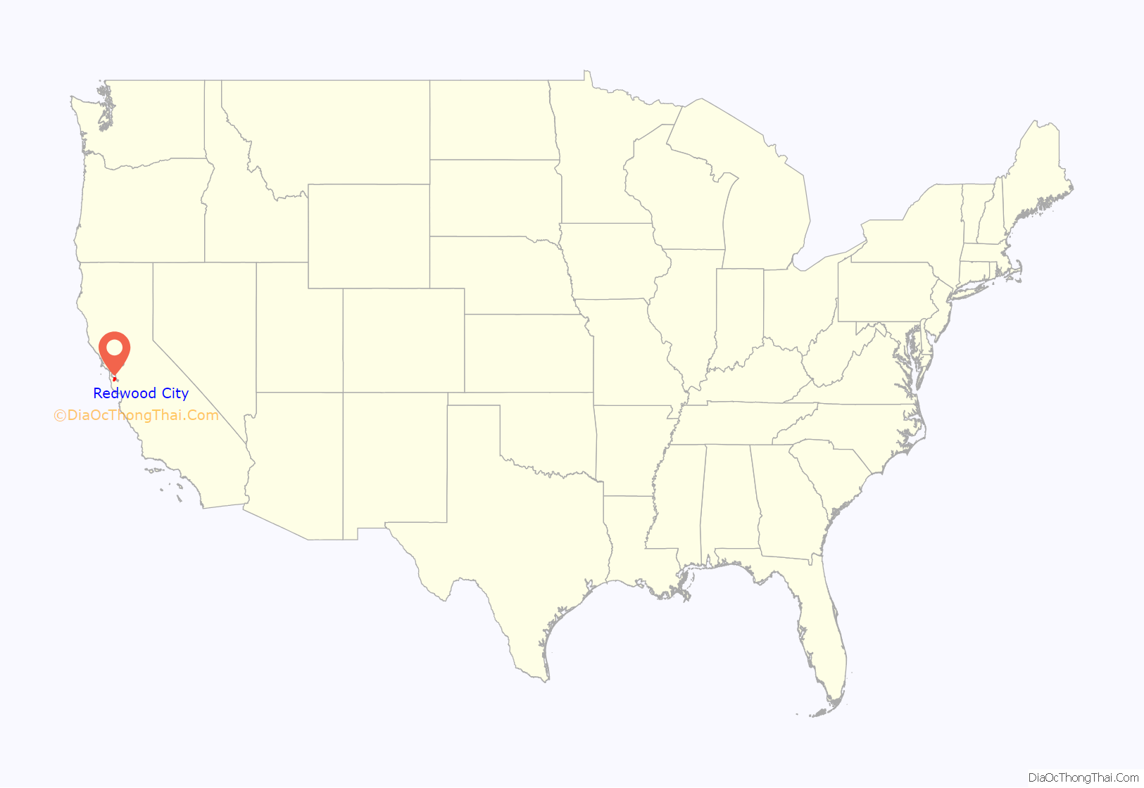
Redwood City location map. Where is Redwood City city?
History
The earliest known inhabitants of the area which was to become Redwood City were the Ohlone who were present when the Spanish claimed the land and established missions.
Redwood City incorporated in 1867, being the first city in San Mateo County to do so; it has remained the county seat since the county’s formation in 1856. The land had been part of the Rancho de las Pulgas granted to the Argüello family in 1835 by the Mexican government. Their control was challenged after the Mexican–American War when California became part of the United States. The family lawyer, Simon M. Mezes, in 1854 defended the claim somewhat successfully and was allowed to buy the part of the estate that is now Redwood City. Mezes sold some of the land to people already squatting on it along the banks of Redwood Creek and named the settlement “Mezesville.” Though the city did not keep that name, Mezes Park still exists on land that Mezes had given for open space.
In 1907, Eikichi and Sadakusi Enomoto, Japanese immigrant brothers, grew what may perhaps have been the first commercially grown chrysanthemums in the United States in Redwood City. In 1926, the chamber of commerce proclaimed the city the “Chrysanthemum Center of the World” though the internment of Japanese Americans in 1941 and other factors would contribute to the end of flower growing as a major industry in the city.
Redwood City Road Map
Redwood City city Satellite Map
Geography
Redwood City stretches from the San Francisco Bay towards the Santa Cruz Mountains between San Carlos to the northwest and Atherton to the southeast with Woodside to the southwest. It is divided by Highway 101 and further inland El Camino Real on the northwest–southeast axis and Woodside Road on the north-northeast/south-southwest axis. Locally, the former two are regarded as north–south and the latter east/west, as 101 and El Camino connects Redwood City to San Francisco and San Jose and Woodside Road runs from San Francisco Bay to the Santa Cruz Mountains.
Neighborhoods include Bair Island to the northeast of Highway 101. The northern planned community of Redwood Shores, also to the northeast of Highway 101, is part of Redwood City, although it is not possible to travel by road from one to the other without passing through the neighboring city of San Carlos, or through Belmont via San Mateo County. Stretching along Highway 101 to the southeast of Woodside Road is Friendly Acres, further inland and still to the southeast of Woodside Road are Redwood Village and then Redwood Oaks. Most neighborhoods are to the northwest of Woodside Road and southwest of Highway 101. Centennial, Downtown, and Stambaugh Heller are adjacent to 101. Next inland are Edgewood, Mt. Carmel, Central and Palm then Canyon, Eagle Hill, Roosevelt, and Woodside Plaza. Furthest inland is Farm Hills (or Farm Hill).
Neighborhoods associated with Redwood City but not part of the incorporated city include Emerald Lake Hills and Kensington Square inland and to the north and North Fair Oaks to the southeast. Palomar Park, just north of Emerald Hills and east of San Carlos’ Crestview area, is another Redwood City neighborhood that is formally part of unincorporated San Mateo County. Although Redwood City has a large middle class, the southeastern section of Redwood City strongly resembles working-class North Fair Oaks in both demographic makeup and income level.
Downtown
In an attempt to revitalize Redwood City’s downtown, city officials decided to consider development. In February 1999, the San Mateo County History Museum opened inside the old San Mateo County Courthouse in downtown Redwood City. The courthouse had been built in 1910 and in the late ’30s an addition was built in front of the original structure, obscuring the view. As part of the revitalization, this addition was torn down and replaced with a large courtyard flanked by water fountains on either side, leading to the main steps of the courthouse. The courthouse’s glass dome is lit at night and changes colors every 11 seconds.
In August 2006, a 20-screen theater and various shops opened in a prime downtown location. The theater complex boasts restaurant and retail space at street level and a two-level underground parking structure.
Climate
Redwood City, along with most of the Bay Area, enjoys a mild Mediterranean climate (Köppen climate classification Csb), with warm, dry summers and cool, relatively wet winters. The National Weather Service, which maintains both a forecast center and a cooperative office in Redwood City, reports that December is the coolest month and July is the warmest month. The record highest temperature of 110 °F (43 °C) was recorded on three occasions, July 14 and 15, 1972, and September 6, 2022. The record lowest temperature of 16 °F (−9 °C) was recorded on January 11, 1949. Annually, there are an average of 21.6 days with highs of 90 °F (32 °C) or higher and 2.8 days with highs of 100 °F (38 °C) or higher; there are an average of 1.8 days with lows of 32 °F (0 °C) or lower.
The normal annual precipitation is 20.56 inches (52.2 cm). The most rainfall in one month was 12.42 inches (31.5 cm) in February 1998. The record 24-hour rainfall of 4.88 inches (12.4 cm) was on October 13, 1962. There are an average of 62.1 days with measurable precipitation. Snow flurries have been observed on rare occasions; there was some minor snow accumulation in May 1935, January 1962, and February 1976.
See also
Map of California State and its subdivision:- Alameda
- Alpine
- Amador
- Butte
- Calaveras
- Colusa
- Contra Costa
- Del Norte
- El Dorado
- Fresno
- Glenn
- Humboldt
- Imperial
- Inyo
- Kern
- Kings
- Lake
- Lassen
- Los Angeles
- Madera
- Marin
- Mariposa
- Mendocino
- Merced
- Modoc
- Mono
- Monterey
- Napa
- Nevada
- Orange
- Placer
- Plumas
- Riverside
- Sacramento
- San Benito
- San Bernardino
- San Diego
- San Francisco
- San Joaquin
- San Luis Obispo
- San Mateo
- Santa Barbara
- Santa Clara
- Santa Cruz
- Shasta
- Sierra
- Siskiyou
- Solano
- Sonoma
- Stanislaus
- Sutter
- Tehama
- Trinity
- Tulare
- Tuolumne
- Ventura
- Yolo
- Yuba
- Alabama
- Alaska
- Arizona
- Arkansas
- California
- Colorado
- Connecticut
- Delaware
- District of Columbia
- Florida
- Georgia
- Hawaii
- Idaho
- Illinois
- Indiana
- Iowa
- Kansas
- Kentucky
- Louisiana
- Maine
- Maryland
- Massachusetts
- Michigan
- Minnesota
- Mississippi
- Missouri
- Montana
- Nebraska
- Nevada
- New Hampshire
- New Jersey
- New Mexico
- New York
- North Carolina
- North Dakota
- Ohio
- Oklahoma
- Oregon
- Pennsylvania
- Rhode Island
- South Carolina
- South Dakota
- Tennessee
- Texas
- Utah
- Vermont
- Virginia
- Washington
- West Virginia
- Wisconsin
- Wyoming
