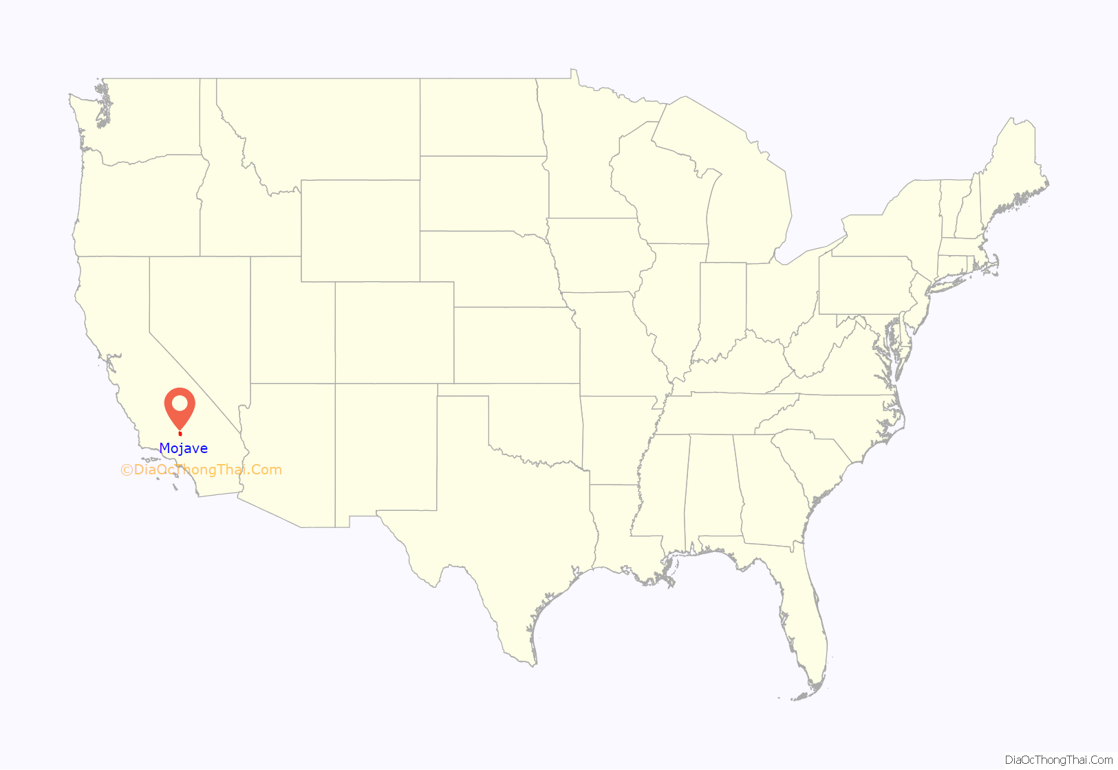
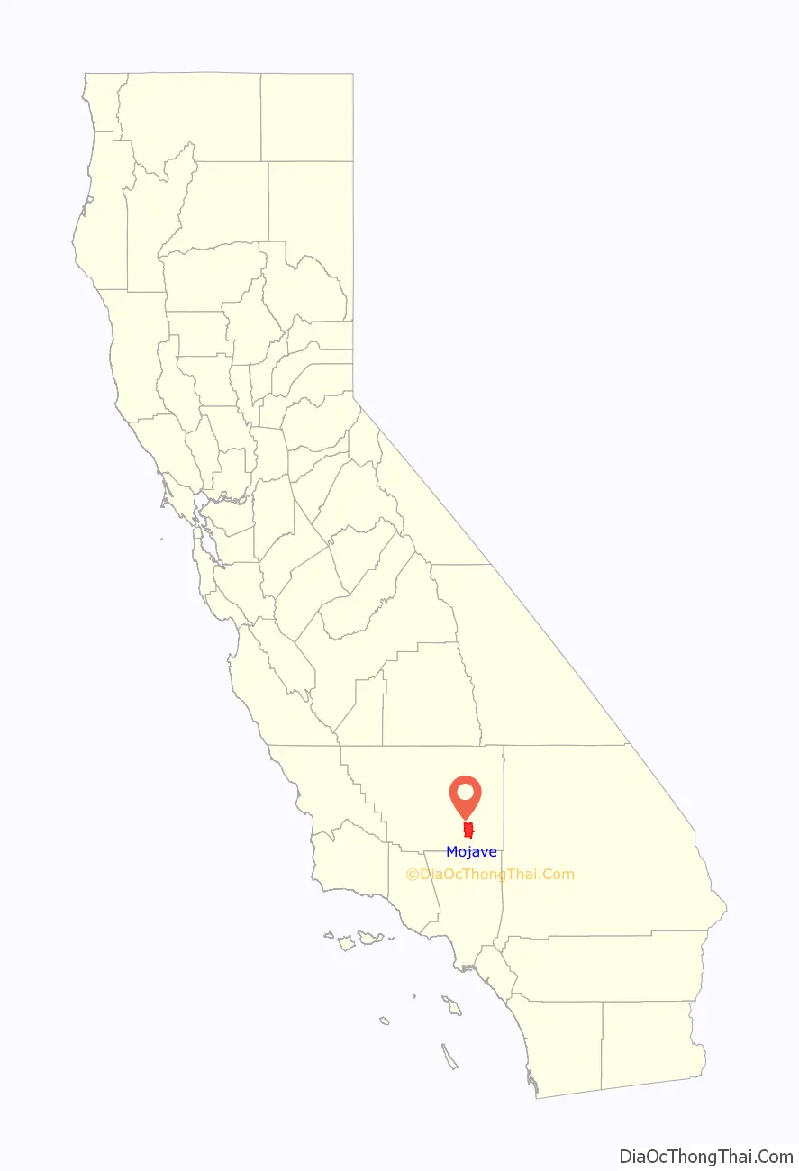
Mojave (formerly Mohave) is an unincorporated community in Kern County, California, United States. Mojave is located 50 miles (80 km) east of Bakersfield, and 100 miles (161 km) north of Los Angeles, at an elevation of 2,762 feet (842 m). The town is located in the western region of the Mojave Desert, below and east of Oak Creek Pass and the Tehachapi Mountains. Mojave is on the Pacific Crest Trail.
The population was 4,238 at the 2010 census, up from 3,836 at the 2000 census. Telephone numbers in Mojave follow the format (661) 824-xxxx and the area includes three postal ZIP Codes.
| Name: | Mojave CDP |
|---|---|
| LSAD Code: | 57 |
| LSAD Description: | CDP (suffix) |
| State: | California |
| County: | Kern County |
| Elevation: | 2,762 ft (842 m) |
| Total Area: | 58.375 sq mi (151.191 km²) |
| Land Area: | 58.29 sq mi (150.970 km²) |
| Water Area: | 0.085 sq mi (0.220 km²) 0.146% |
| Total Population: | 4,238 |
| Population Density: | 73/sq mi (28/km²) |
| ZIP code: | 93501, 93502, 93519 |
| Area code: | 661 |
| FIPS code: | 0648452 |
| GNISfeature ID: | 1652752 |
| Website: | visitmojave.com |
Online Interactive Map
Click on ![]() to view map in "full screen" mode.
to view map in "full screen" mode.
Mojave location map. Where is Mojave CDP?
History
The town of Mojave began in 1876 as a construction camp on the Southern Pacific Railroad. From 1884 to 1889, the town was the western terminus of the 165-mile (266 km), twenty-mule team at Harmony Borax Works in Death Valley. It later served as headquarters for construction of the Los Angeles Aqueduct.
Mojave Airport: aviation and military use
Located near Edwards Air Force Base, Naval Air Weapons Station China Lake, and Palmdale Regional Airport, Mojave has a rich aerospace history. Besides being a general-use public airport, Mojave has three main areas of activity: flight testing, space industry development, and aircraft heavy maintenance and storage. The closest airfield to the city, formerly known as the Mojave Airport, is now part of the Mojave Air and Space Port.
In 1935, Kern County established the Mojave Airport 0.5 miles (0.8 km) east of town to serve the gold and silver mining industry in the area. The airport consisted of two dirt runways, one of which was oiled, but it lacked any fueling or servicing facilities. In 1941, the Civil Aeronautics Board began improvements to the airport for national defense purposes that included two 4,500 by 150 foot (1,372 by 46 m) asphalt runways and adjacent taxiway. Kern County agreed the airport could be taken over by the military in the event of war.
Following the Japanese attack on Pearl Harbor in December 1941, the U.S. Marine Corps took over the airport and expanded it into Marine Corps Auxiliary Air Station (MCAAS) Mojave. The two existing runways were extended and a third one added. Barracks were constructed to house 2,734 male and 376 female military personnel. Civilian employment at the base would peak at 176. The Marines would eventually spend more than $7 million on the base, which totaled 2,312 acres (936 ha).
Many of the Corps’ World War II aces received their gunnery training at Mojave. During World War II, Mojave hosted 29 aircraft squadrons, four Carrier Aircraft Service Detachments, and three Air Warning Squadrons. At its peak, the air station had 145 training and other aircraft. Mojave also had a 75 by 156 foot (23 by 48 m) swimming pool that was used to train aviators in emergency water egress and for recreation. The base’s 900-seat auditorium hosted several USO shows that featured Bob Hope, Frances Langford and Marilyn Maxwell.
With the end of WWII, MCAAS was dis-established on February 7, 1946; a U.S. Navy Air Station was established the same day. The Navy used the airport for drone operations for less than a year, closing it on January 1, 1947. The base remained closed for four years until the outbreak of the Korean War. Mojave was reactivated as an auxiliary landing field to MCAS El Toro. The airport was recommissioned as a MCAAS on December 31, 1953. Squadrons used Mojave for ordnance training when El Toro had bad weather. Marine Corps reserve units were temporarily deployed to Mojave for two week periods. MCAAS Mojave personnel peaked at 400 military and 200 civilians during this period.
In 1961, after the USMC transferred operations to MCAS El Centro, Kern County obtained title to the airport. In February 1972, the East Kern Airport District (EKAD) was formed to administer the airport; EKAD maintains the airport to this day. To a great extent EKAD was the brainchild of Dan Sabovich who heavily lobbied the state for the airport district’s creation and ran EKAD until 2002.
During the 1970s, Mojave Airport was served by commuter air carrier Golden West Airlines with scheduled passenger flights operated with de Havilland Canada DHC-6 Twin Otter turboprops direct to Los Angeles (LAX).
Mojave Air and Space Port
On November 20, 2012, the EKAD Board of Directors voted to change the name of the district to the Mojave Air and Space Port. Officials said that the spaceport name is well known around the world, but EKAD is not. The change took effect on January 1, 2013.
The airport is now the home of various aerospace companies and institutions such as Scaled Composites and the civilian National Test Pilot School. The town was home to the Rutan Voyager, the first aircraft to fly around the world nonstop and unrefueled. The airport is also the first inland spaceport in the United States, and was the location of the first private spaceflight, the launch of SpaceShipOne on June 21, 2004.
Mojave also has a Mojave Transportation Museum.
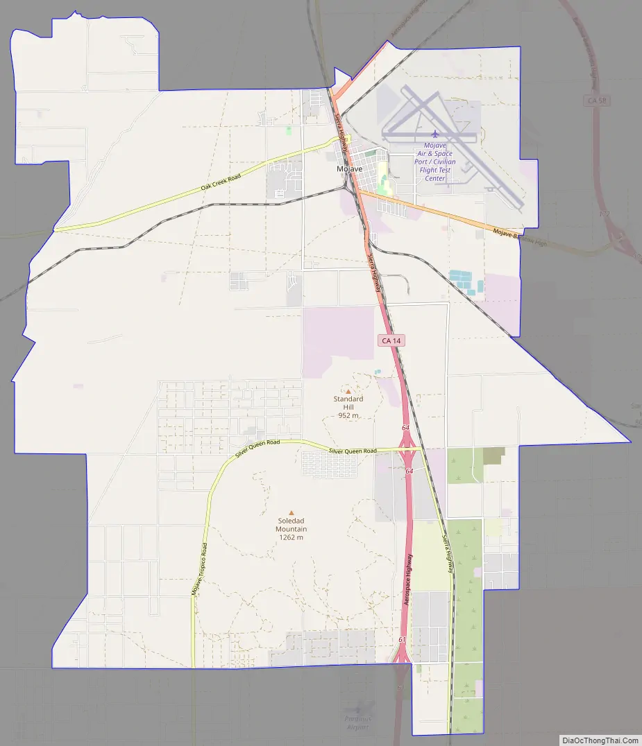
Mojave Road Map
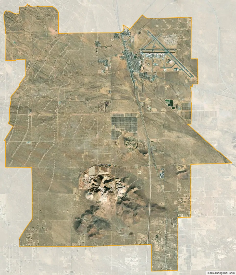
Mojave city Satellite Map
Geography
Mojave is located at 35°03′09″N 118°10′26″W / 35.05250°N 118.17389°W / 35.05250; -118.17389. According to the United States Census Bureau, the town has a total area of 58.4 square miles (151 km), over 99% of it land.
Climate
Mojave has a desert climate (Köppen: BWk), cold desert for using an isotherm of mean annual temperature of less than 18 °C (64 °F) or hot desert (BWh) for using an isotherm of less than 0 °C (32 °F) for the mean temperature of the coldest month. It has hot summers and cool winters. Average January temperatures are a maximum of 57.8 °F (14.3 °C) and a minimum of 34.3 °F (1.3 °C). Average July temperatures are a maximum of 97.7 °F (36.5 °C) and a minimum of 69.8 °F (21 °C). There are an average of 98 days with highs of 90 °F (32 °C) and an average of 45.7 days with lows of 32 °F (0 °C). The record high temperature was 118 °F (48 °C) on August 5, 1914. The record low temperature was 8 °F (−13 °C) on December 23, 1990.
Average annual rainfall is 5.96 inches (15.1 cm). There are an average of 22 days with measurable precipitation. The wettest year was 1983 with 15.51 inches (39.4 cm) and the driest year was 1942 with 0.85 inches (2.2 cm). The most rainfall in one month was 6.85 inches (17.4 cm) in February 1998. The most rainfall in 24 hours was 3 inches (7.6 cm) on January 30, 1915. Snow is relatively rare in Mojave, averaging 1.7 inches (4.3 cm). The most snowfall in one month was 11 inches (28 cm) in February 1911.
See also
Map of California State and its subdivision:- Alameda
- Alpine
- Amador
- Butte
- Calaveras
- Colusa
- Contra Costa
- Del Norte
- El Dorado
- Fresno
- Glenn
- Humboldt
- Imperial
- Inyo
- Kern
- Kings
- Lake
- Lassen
- Los Angeles
- Madera
- Marin
- Mariposa
- Mendocino
- Merced
- Modoc
- Mono
- Monterey
- Napa
- Nevada
- Orange
- Placer
- Plumas
- Riverside
- Sacramento
- San Benito
- San Bernardino
- San Diego
- San Francisco
- San Joaquin
- San Luis Obispo
- San Mateo
- Santa Barbara
- Santa Clara
- Santa Cruz
- Shasta
- Sierra
- Siskiyou
- Solano
- Sonoma
- Stanislaus
- Sutter
- Tehama
- Trinity
- Tulare
- Tuolumne
- Ventura
- Yolo
- Yuba
- Alabama
- Alaska
- Arizona
- Arkansas
- California
- Colorado
- Connecticut
- Delaware
- District of Columbia
- Florida
- Georgia
- Hawaii
- Idaho
- Illinois
- Indiana
- Iowa
- Kansas
- Kentucky
- Louisiana
- Maine
- Maryland
- Massachusetts
- Michigan
- Minnesota
- Mississippi
- Missouri
- Montana
- Nebraska
- Nevada
- New Hampshire
- New Jersey
- New Mexico
- New York
- North Carolina
- North Dakota
- Ohio
- Oklahoma
- Oregon
- Pennsylvania
- Rhode Island
- South Carolina
- South Dakota
- Tennessee
- Texas
- Utah
- Vermont
- Virginia
- Washington
- West Virginia
- Wisconsin
- Wyoming


