Amite City (/eɪˈmiːt/ ay-MEET or /eɪˈmɪt/ ay-MIT; commonly just Amite) is a town in and the seat of Tangipahoa Parish in southeastern Louisiana, United States. The population was 4,141 at the 2010 census. It is part of the Hammond Micropolitan Statistical Area.
| Name: | Amite City town |
|---|---|
| LSAD Code: | 43 |
| LSAD Description: | town (suffix) |
| State: | Louisiana |
| County: | Tangipahoa Parish |
| Incorporated: | March 7, 1861 |
| Elevation: | 115 ft (35 m) |
| Total Area: | 3.89 sq mi (10.08 km²) |
| Land Area: | 3.88 sq mi (10.04 km²) |
| Water Area: | 0.01 sq mi (0.04 km²) |
| Total Population: | 4,005 |
| Population Density: | 1,033.02/sq mi (398.83/km²) |
| ZIP code: | 70422 |
| Area code: | 985 |
| FIPS code: | 2201885 |
| Website: | www.townofamitecity.com |
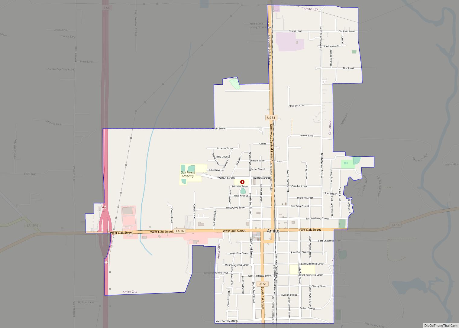
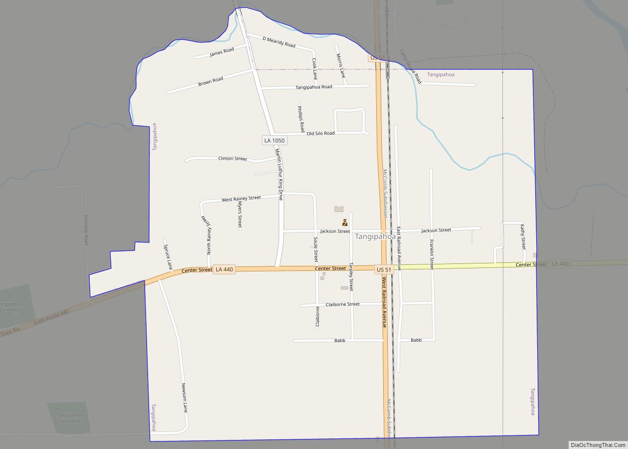
Online Interactive Map
Click on ![]() to view map in "full screen" mode.
to view map in "full screen" mode.
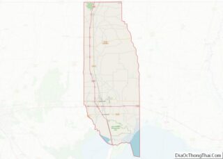
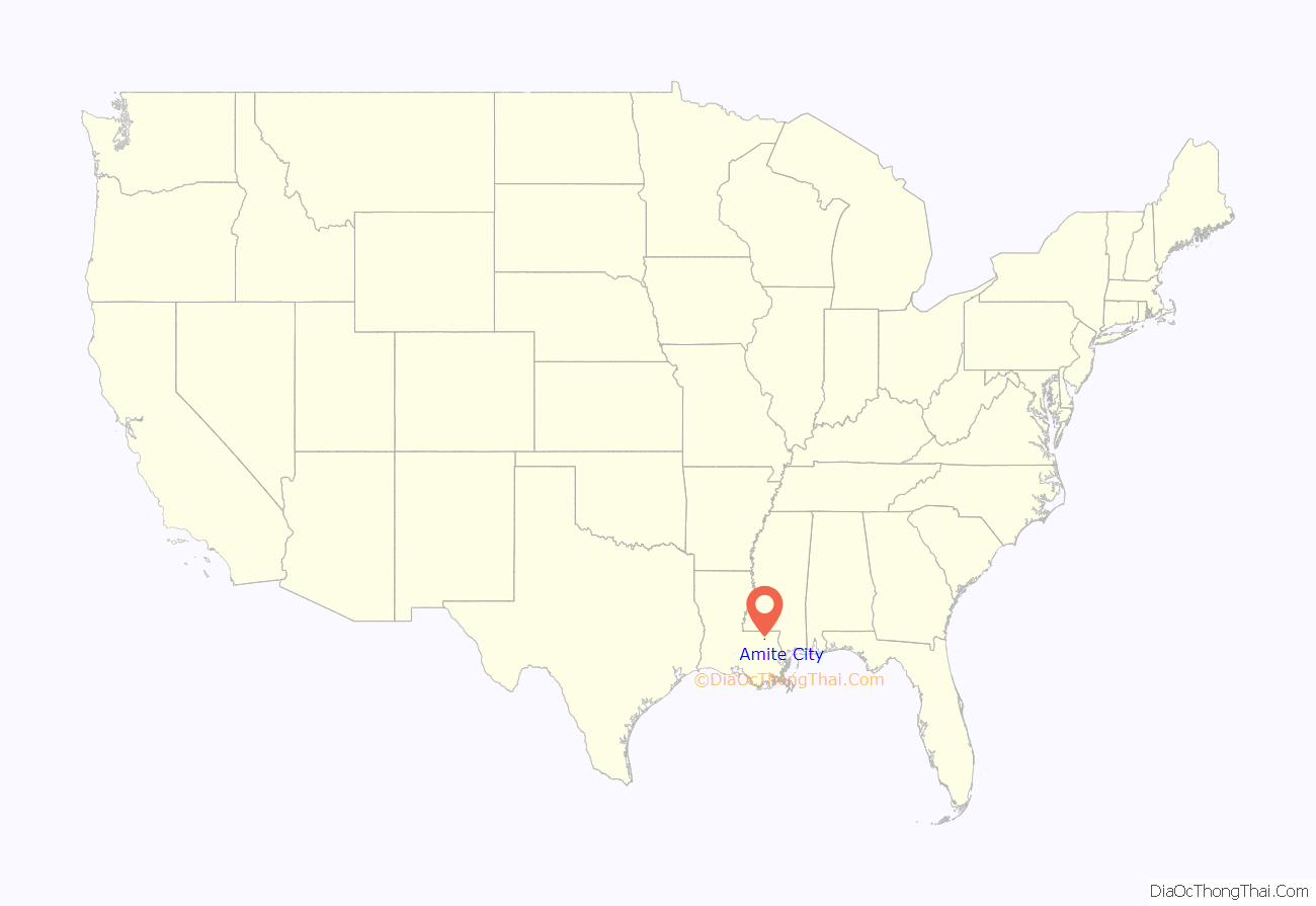
Amite City location map. Where is Amite City town?
History
The first European settlement, by French traders and colonists, developed on the banks of the Tangipahoa River, adjacent to a Choctaw village. Legend has it that the site was chosen when Choctaw Chief Baptiste welcomed the earliest settlers. Baptiste was the last Choctaw chief in the region. “Amite” has been said to be a Choctaw word for “red ant”, signifying “thrift”. It may also be derived from French, where amitié means “friendship.”
The United States acquired what were known as the Florida Parishes in 1812. Anglo-American travelers are documented as entering Amite City as early as 1813.
In 1852 the New Orleans, Jackson, and Great Northern Railroad was chartered in both Louisiana and Mississippi. Two years later, the railroad was opened from New Orleans to the state line. Amite City was chosen as the practical stopping point, as it was halfway between Lake Pontchartrain to the south and the Mississippi state line that formed the northern border of the parish.
Amite City was chartered in 1855. The town was laid out, lots were sold and the community quickly began to grow. The Hotel Ponder at the “Amite Station” became a popular spot among travelers for dining and relaxing. In addition to becoming a major commercial center for a large region, Amite Station became a popular resort in the late 1850s. Many prosperous New Orleans residents established country retreats in the region to enjoy the natural beauty and escape unhealthy conditions in the low-lying city along the Mississippi. This trend intensified as seasonal epidemics of yellow fever continued to plague New Orleans in the mid-19th century.
On March 7, 1861, Amite City was incorporated as a town two months after the secession of Louisiana from the Union. During the war, Amite City served as an important gathering spot for Confederate officials involved in the supply and support of Camp Moore, the largest Confederate training base in Louisiana, located 10 miles to the north. Amite endured at least two visits by Union cavalry. In 1864 a brigade of Union infantry burned the railroad depot and destroyed the track from the depot to Camp Moore.
After the war, Amite City served as the base for Union troops occupying the region during Reconstruction. After the legislature established a new parish in 1869, soon to be named Tangipahoa, Amite City was selected as the parish seat. Five different buildings have served as the courthouse since 1870.
From the early 1870s through the first decade of the 20th century, Amite City played a central role in the violence that gained the parish the name “Bloody Tangipahoa.” The turbulent political and economic conditions of the Reconstruction period and its aftermath sparked a number of vicious family feuds. Numerous duels and “bushwhacking” between whites occurred in the streets of Amite City and the countryside. In addition, white mobs lynched numerous blacks during this period. By the early 20th century, improved law enforcement brought some peace and better harmony to the area for some families, but blacks were excluded from political life.
Amite City continued to grow as a trading center for cotton planters and others. In 1869, the Gullet Gin Company opened in Amite City. The company was the largest producer of cotton gins in the south, employing more than 250 people by the early 20th century.
During World War II, the plant converted to war industry production, manufacturing 150 mm shells. The plant closed in 1963.
In the mid-20th century, family dairy farms began to replace cotton farms. Today, Tangipahoa Parish is the heart of Louisiana’s dairy industry. It is also the primary producer of strawberries in the state. Amite City is a major oyster processing center and home of the Oyster Festival.
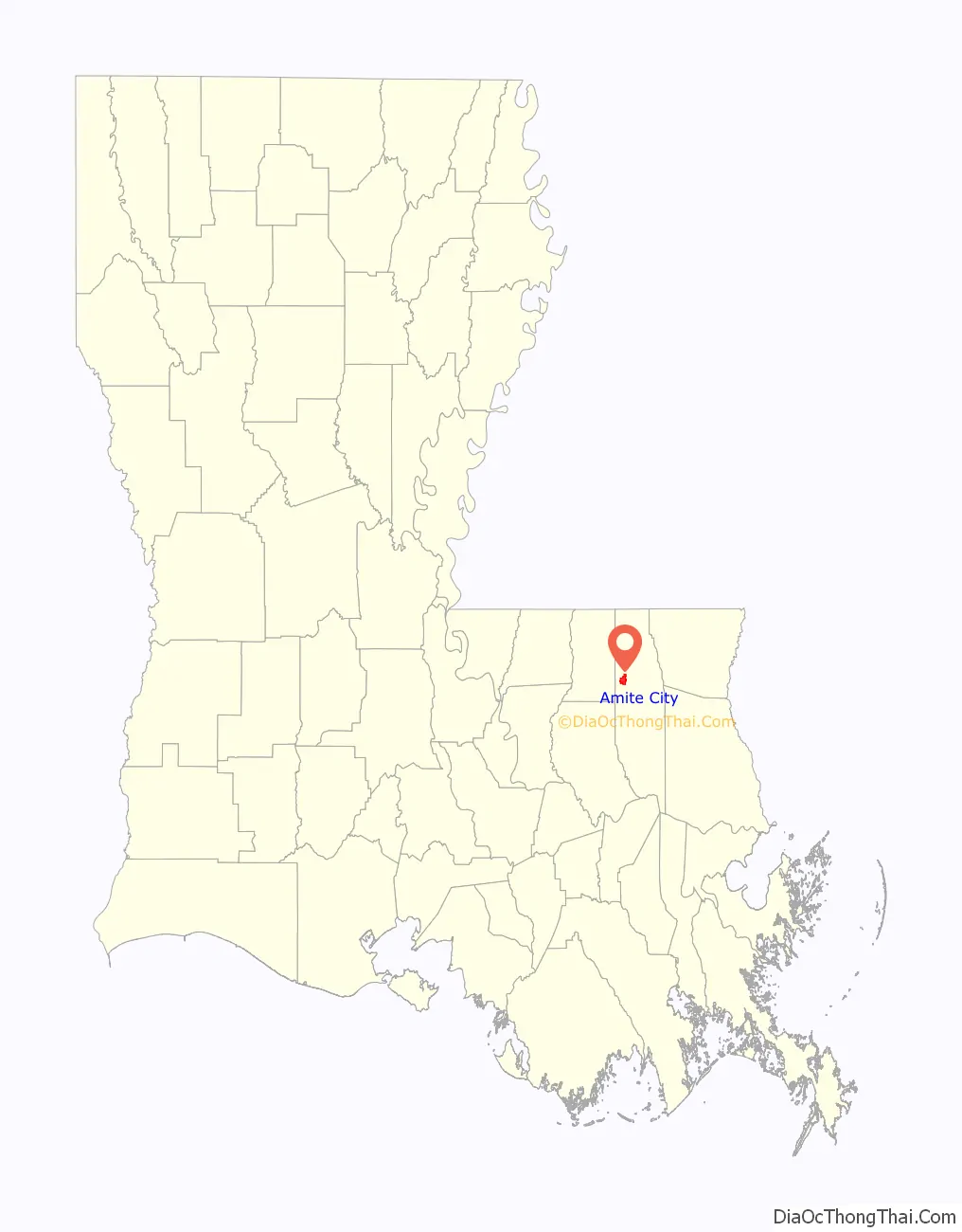
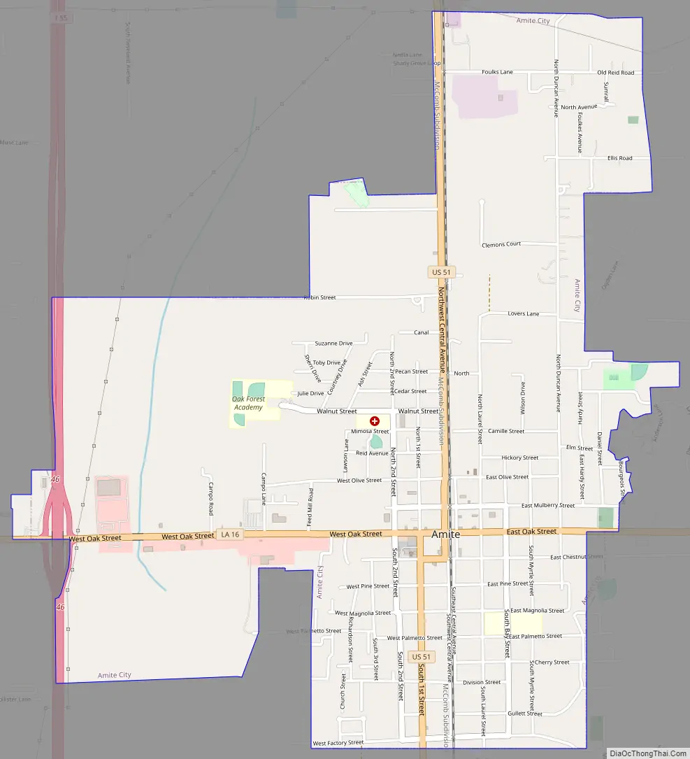
Amite City Road Map
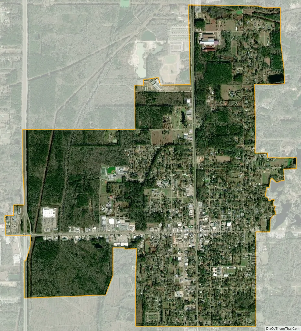
Amite City city Satellite Map
Geography
Amite City is located at 30°43′43″N 90°30′31″W / 30.72861°N 90.50861°W / 30.72861; -90.50861 (30.728718, -90.508519).
According to the United States Census Bureau, the town has a total area of 3.9 square miles (10 km), of which 3.8 square miles (9.8 km) is land and 0.04 square miles (0.10 km) (0.52%) is water.
See also
Map of Louisiana State and its subdivision:- Acadia
- Allen
- Ascension
- Assumption
- Avoyelles
- Beauregard
- Bienville
- Bossier
- Caddo
- Calcasieu
- Caldwell
- Cameron
- Catahoula
- Claiborne
- Concordia
- De Soto
- East Baton Rouge
- East Carroll
- East Feliciana
- Evangeline
- Franklin
- Grant
- Iberia
- Iberville
- Jackson
- Jefferson
- Jefferson Davis
- La Salle
- Lafayette
- Lafourche
- Lincoln
- Livingston
- Madison
- Morehouse
- Natchitoches
- Orleans
- Ouachita
- Plaquemines
- Pointe Coupee
- Rapides
- Red River
- Richland
- Sabine
- Saint Bernard
- Saint Charles
- Saint Helena
- Saint James
- Saint John the Baptist
- Saint Landry
- Saint Martin
- Saint Mary
- Saint Tammany
- Tangipahoa
- Tensas
- Terrebonne
- Union
- Vermilion
- Vernon
- Washington
- Webster
- West Baton Rouge
- West Carroll
- West Feliciana
- Winn
- Alabama
- Alaska
- Arizona
- Arkansas
- California
- Colorado
- Connecticut
- Delaware
- District of Columbia
- Florida
- Georgia
- Hawaii
- Idaho
- Illinois
- Indiana
- Iowa
- Kansas
- Kentucky
- Louisiana
- Maine
- Maryland
- Massachusetts
- Michigan
- Minnesota
- Mississippi
- Missouri
- Montana
- Nebraska
- Nevada
- New Hampshire
- New Jersey
- New Mexico
- New York
- North Carolina
- North Dakota
- Ohio
- Oklahoma
- Oregon
- Pennsylvania
- Rhode Island
- South Carolina
- South Dakota
- Tennessee
- Texas
- Utah
- Vermont
- Virginia
- Washington
- West Virginia
- Wisconsin
- Wyoming