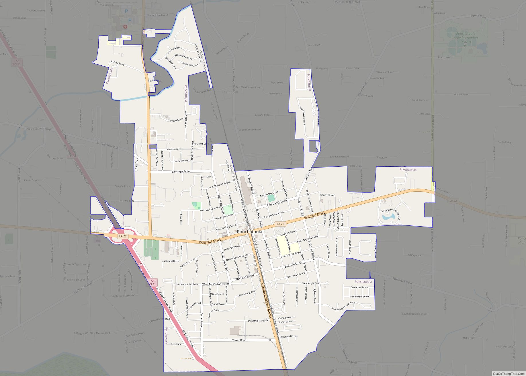
Ponchatoula is the second-largest city in Tangipahoa Parish, Louisiana. The population was 6,559 at the 2010 census and 7,545 at the time of the 2020 population estimates program.
| Name: | Ponchatoula city |
|---|---|
| LSAD Code: | 25 |
| LSAD Description: | city (suffix) |
| State: | Louisiana |
| County: | Tangipahoa Parish |
| Elevation: | 26 ft (8 m) |
| Total Area: | 4.74 sq mi (12.27 km²) |
| Land Area: | 4.73 sq mi (12.26 km²) |
| Water Area: | 0.00 sq mi (0.01 km²) |
| Total Population: | 7,822 |
| Population Density: | 1,653.00/sq mi (638.20/km²) |
| ZIP code: | 70454 |
| Area code: | 985 |
| FIPS code: | 2261615 |
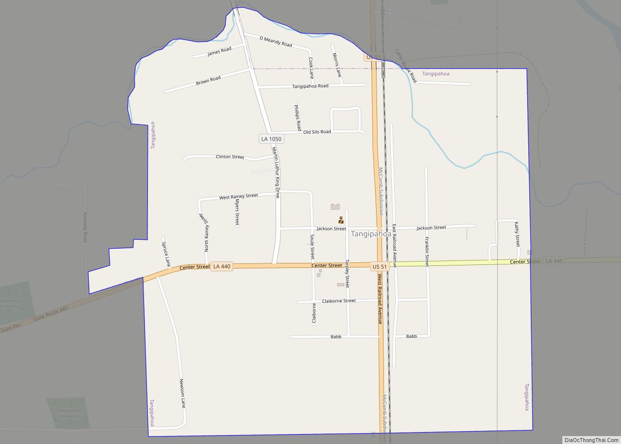
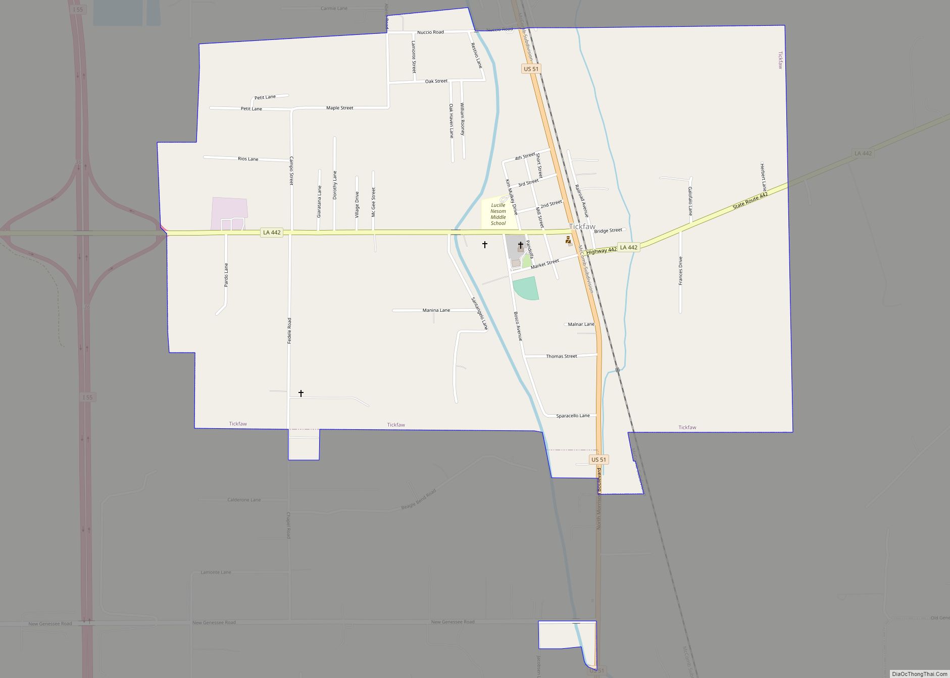
Online Interactive Map
Click on ![]() to view map in "full screen" mode.
to view map in "full screen" mode.
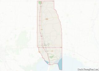
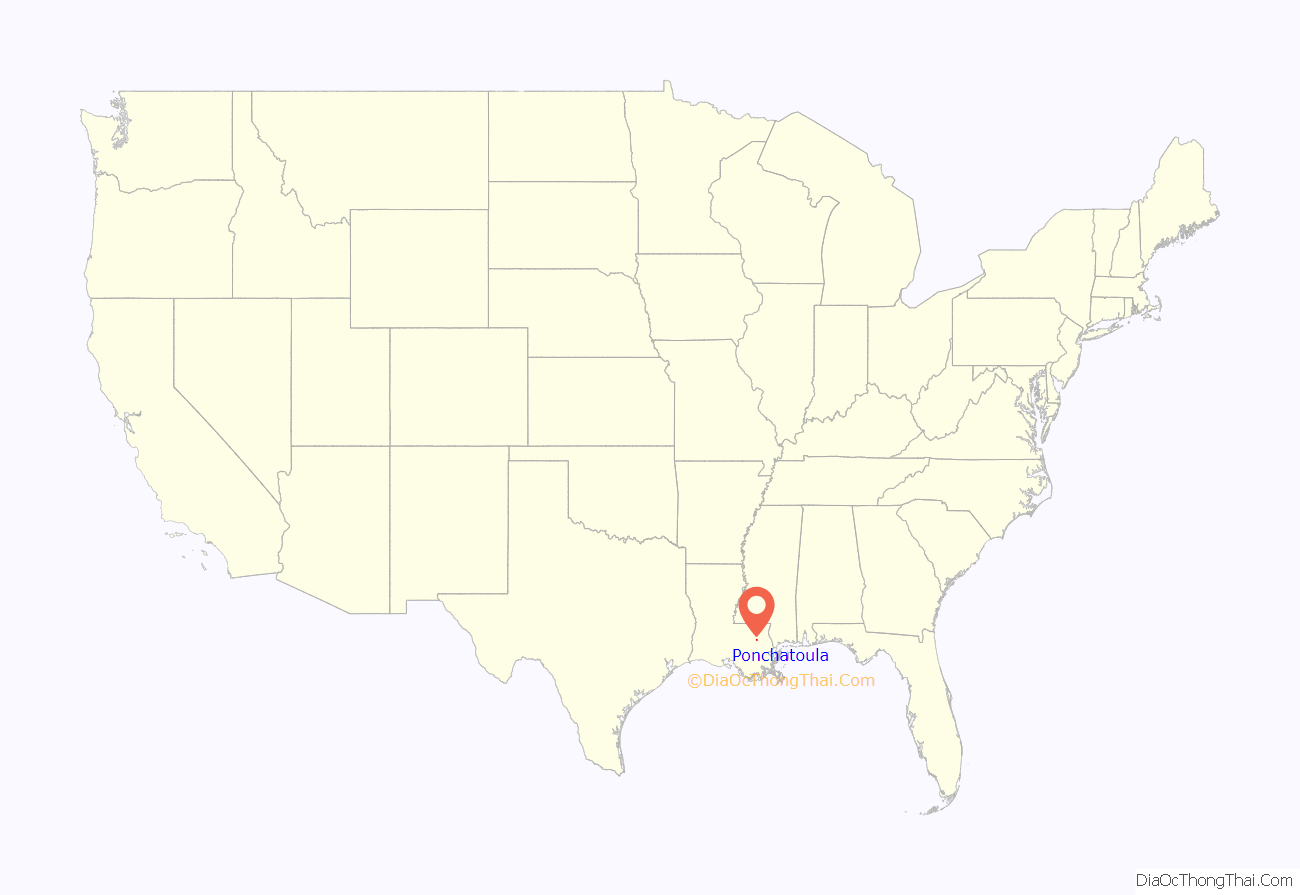
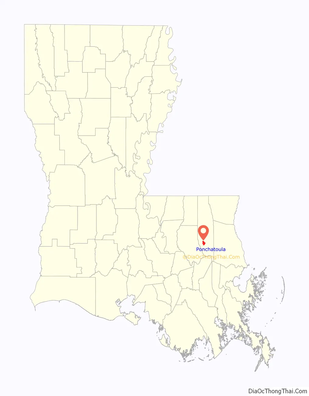
Ponchatoula location map. Where is Ponchatoula city?
History
William Akers
Ponchatoula was originally established as a small fishing village around 1820. Then in the year 1839 a man named William Akers moved into town and purchased over 1,000 acres from the United States Federal Government. William began farming and harvesting the local virgin pine timber and pulling the logs to a nearby sawmill with teams of oxen. According to some sources William Akers had several Native Americans working in his timber crew and they provided the name Ponchatoula. It was the Native American way of expressing the beauty of the location, with beautiful Spanish moss hanging from the large oak trees.
As more settlers arrived in the area William began selling his land to those families. Then on February 12, 1861, Ponchatoula incorporated as a town. William Akers was appointed as the first mayor and is credited with founding the town. In the 1880s Akers reported that he had sold nearly 700 acres of land and only had about 300 acres of land remaining. He was a leader in the Temperance movement and fought hard to keep alcoholic beverages out of Ponchatoula. He was also a member of the local Masonic Lodge and was very active in the Methodist Episcopal Church.
Early 20th century
The train depot which was destroyed during the Civil War was rebuilt in 1895 as the area began to recover from the Civil War. At the turn of the 20th century Ponchatoula began to transform from the lumber industry into a commercial farming community. The main street began filling up with beautiful brick buildings as shops, banks and restaurants were built to accommodate the growing population. The main crop grown by the local farmers was the strawberry. Many of the families who were major farmers during this era, which lasted about eighty years, have their last names engraved on a large plaque in front of city hall.
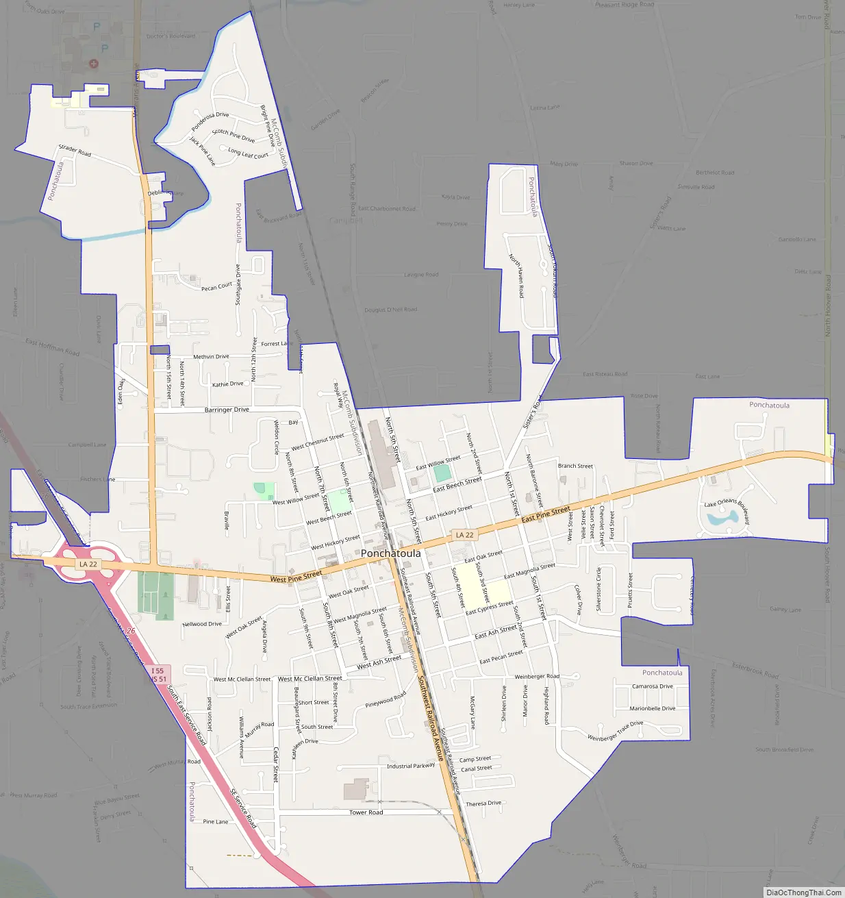
Ponchatoula Road Map
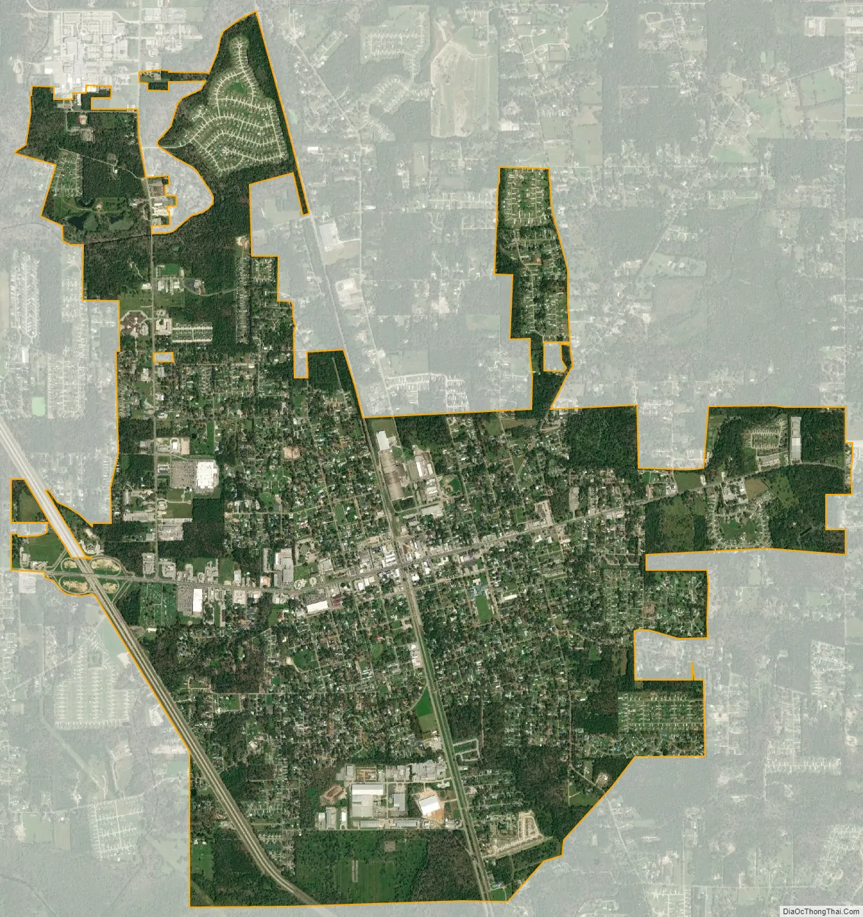
Ponchatoula city Satellite Map
Geography
Ponchatoula is located at 30°26′21″N 90°26′33″W / 30.43917°N 90.44250°W / 30.43917; -90.44250 (30.439162, -90.442507) and has an elevation of 26 feet (7.9 m). According to the United States Census Bureau, the city has a total area of 4.2 square miles (11 km), all land.
Ponchatoula is located along Interstate 55 and Louisiana Highway 22, equidistant from New Orleans and Baton Rouge. In the early 1900s, Ponchatoula was one of only two ways to reach New Orleans by land, thus earning the moniker “Gateway to New Orleans.”
See also
Map of Louisiana State and its subdivision:- Acadia
- Allen
- Ascension
- Assumption
- Avoyelles
- Beauregard
- Bienville
- Bossier
- Caddo
- Calcasieu
- Caldwell
- Cameron
- Catahoula
- Claiborne
- Concordia
- De Soto
- East Baton Rouge
- East Carroll
- East Feliciana
- Evangeline
- Franklin
- Grant
- Iberia
- Iberville
- Jackson
- Jefferson
- Jefferson Davis
- La Salle
- Lafayette
- Lafourche
- Lincoln
- Livingston
- Madison
- Morehouse
- Natchitoches
- Orleans
- Ouachita
- Plaquemines
- Pointe Coupee
- Rapides
- Red River
- Richland
- Sabine
- Saint Bernard
- Saint Charles
- Saint Helena
- Saint James
- Saint John the Baptist
- Saint Landry
- Saint Martin
- Saint Mary
- Saint Tammany
- Tangipahoa
- Tensas
- Terrebonne
- Union
- Vermilion
- Vernon
- Washington
- Webster
- West Baton Rouge
- West Carroll
- West Feliciana
- Winn
- Alabama
- Alaska
- Arizona
- Arkansas
- California
- Colorado
- Connecticut
- Delaware
- District of Columbia
- Florida
- Georgia
- Hawaii
- Idaho
- Illinois
- Indiana
- Iowa
- Kansas
- Kentucky
- Louisiana
- Maine
- Maryland
- Massachusetts
- Michigan
- Minnesota
- Mississippi
- Missouri
- Montana
- Nebraska
- Nevada
- New Hampshire
- New Jersey
- New Mexico
- New York
- North Carolina
- North Dakota
- Ohio
- Oklahoma
- Oregon
- Pennsylvania
- Rhode Island
- South Carolina
- South Dakota
- Tennessee
- Texas
- Utah
- Vermont
- Virginia
- Washington
- West Virginia
- Wisconsin
- Wyoming