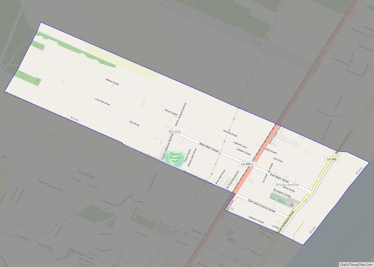
Brusly is a town in West Baton Rouge Parish, Louisiana, United States. The population was 2,589 at the 2010 census. It is part of the Baton Rouge Metropolitan Statistical Area.
| Name: | Brusly town |
|---|---|
| LSAD Code: | 43 |
| LSAD Description: | town (suffix) |
| State: | Louisiana |
| County: | West Baton Rouge Parish |
| Elevation: | 23 ft (7 m) |
| Total Area: | 2.21 sq mi (5.73 km²) |
| Land Area: | 2.21 sq mi (5.73 km²) |
| Water Area: | 0.00 sq mi (0.00 km²) |
| Total Population: | 2,578 |
| Population Density: | 1,164.93/sq mi (449.74/km²) |
| Area code: | 225 |
| FIPS code: | 2210600 |
| Website: | www.bruslyla.com |
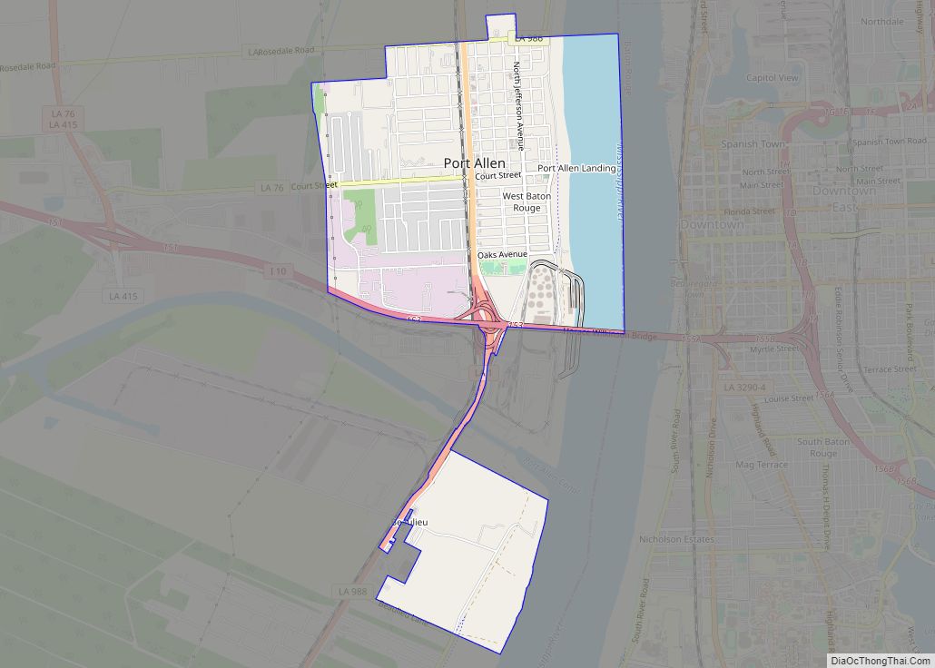
Online Interactive Map
Click on ![]() to view map in "full screen" mode.
to view map in "full screen" mode.
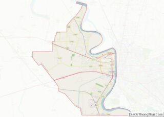
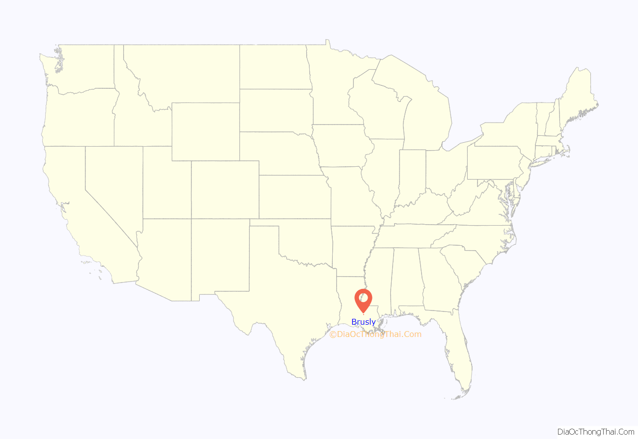
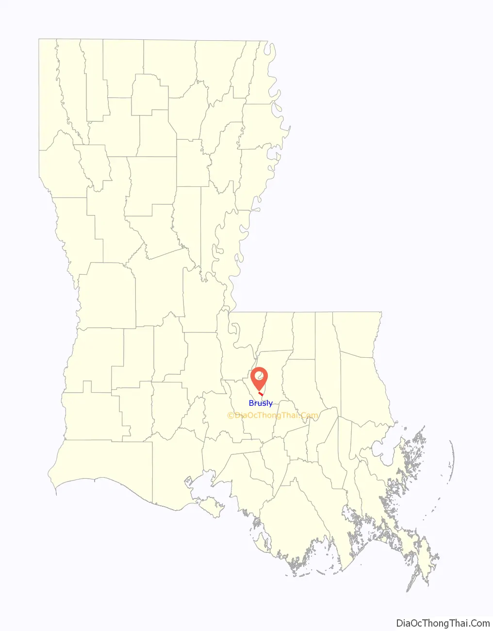
Brusly location map. Where is Brusly town?
History
The town was established in 1901. Its Brusly High School bears the nickname, the Panthers. Its colors are red, white and black. Newly elected State Representative Edmond Jordan graduated from Brusly High School in 1989.
Historic Cinclare Sugar Mill is located on LA Highway 1.
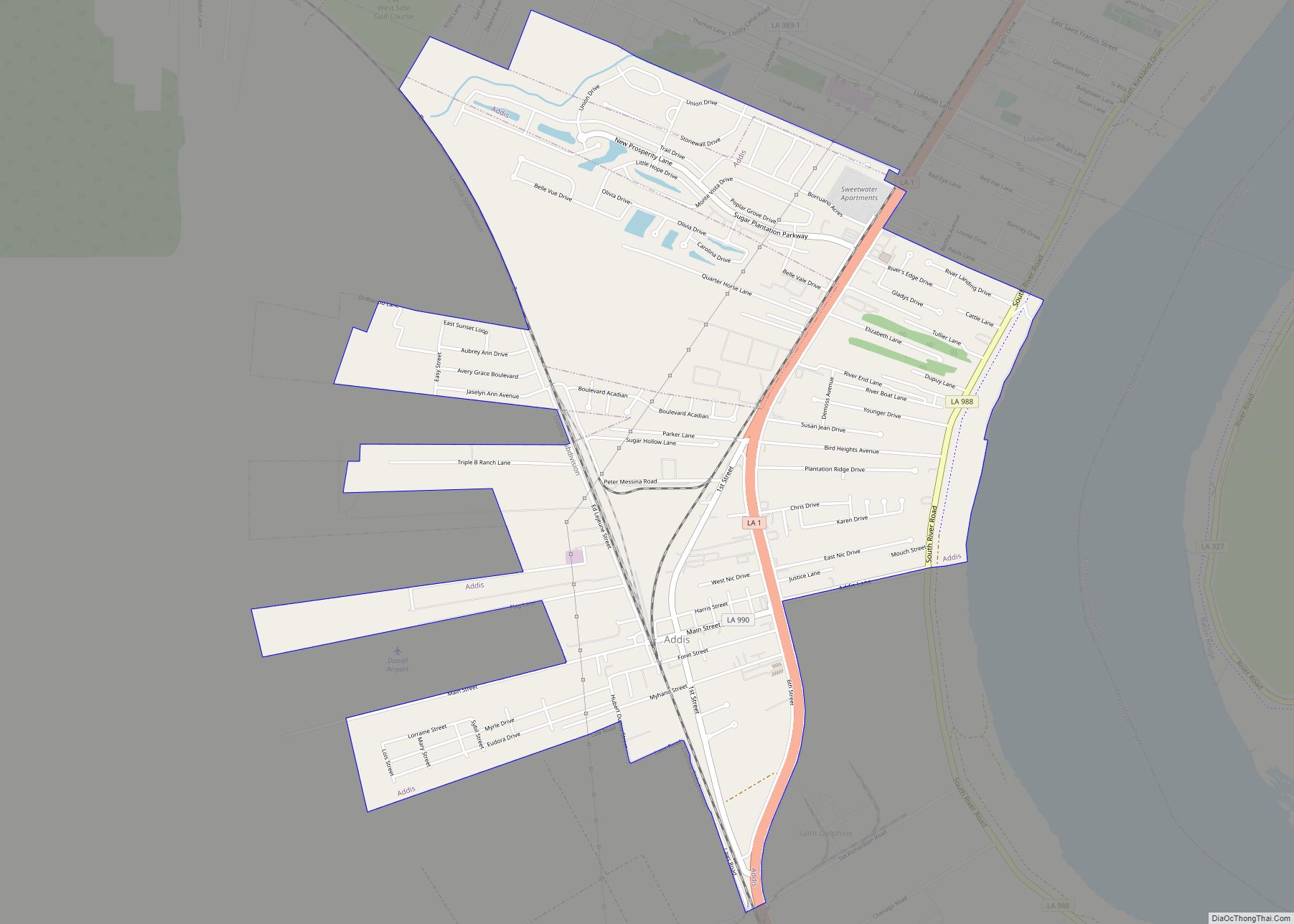
Brusly Road Map
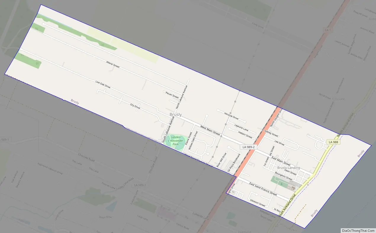
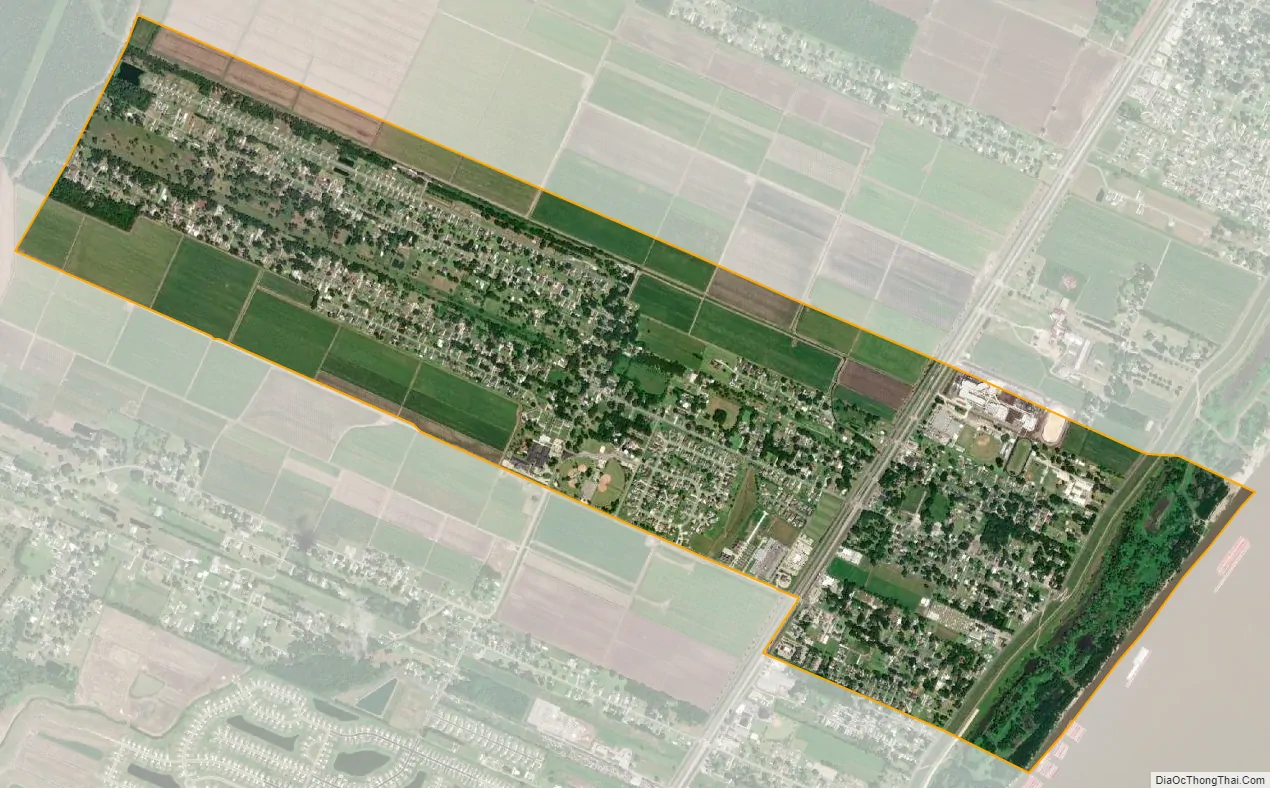
Brusly city Satellite Map
Geography
Brusly is located at 30°23′26″N 91°14′30″W / 30.39056°N 91.24167°W / 30.39056; -91.24167 (30.390470, -91.241797).
According to the United States Census Bureau, the town has a total area of 2.2 square miles (5.7 km), all land.
See also
Map of Louisiana State and its subdivision:- Acadia
- Allen
- Ascension
- Assumption
- Avoyelles
- Beauregard
- Bienville
- Bossier
- Caddo
- Calcasieu
- Caldwell
- Cameron
- Catahoula
- Claiborne
- Concordia
- De Soto
- East Baton Rouge
- East Carroll
- East Feliciana
- Evangeline
- Franklin
- Grant
- Iberia
- Iberville
- Jackson
- Jefferson
- Jefferson Davis
- La Salle
- Lafayette
- Lafourche
- Lincoln
- Livingston
- Madison
- Morehouse
- Natchitoches
- Orleans
- Ouachita
- Plaquemines
- Pointe Coupee
- Rapides
- Red River
- Richland
- Sabine
- Saint Bernard
- Saint Charles
- Saint Helena
- Saint James
- Saint John the Baptist
- Saint Landry
- Saint Martin
- Saint Mary
- Saint Tammany
- Tangipahoa
- Tensas
- Terrebonne
- Union
- Vermilion
- Vernon
- Washington
- Webster
- West Baton Rouge
- West Carroll
- West Feliciana
- Winn
- Alabama
- Alaska
- Arizona
- Arkansas
- California
- Colorado
- Connecticut
- Delaware
- District of Columbia
- Florida
- Georgia
- Hawaii
- Idaho
- Illinois
- Indiana
- Iowa
- Kansas
- Kentucky
- Louisiana
- Maine
- Maryland
- Massachusetts
- Michigan
- Minnesota
- Mississippi
- Missouri
- Montana
- Nebraska
- Nevada
- New Hampshire
- New Jersey
- New Mexico
- New York
- North Carolina
- North Dakota
- Ohio
- Oklahoma
- Oregon
- Pennsylvania
- Rhode Island
- South Carolina
- South Dakota
- Tennessee
- Texas
- Utah
- Vermont
- Virginia
- Washington
- West Virginia
- Wisconsin
- Wyoming