Port Allen is a city in, and the parish seat of, West Baton Rouge Parish, Louisiana, United States. Located on the west bank of the Mississippi River, it is bordered by Interstate 10 and US Highway 190. The population was 5,180 at the 2010 census, down from 5,278 in 2000. It is part of the Baton Rouge Metropolitan Statistical Area.
Port Allen is home to the Mississippi Riverfront Development, which provides a panoramic view of the Mississippi River and Baton Rouge, the West Baton Rouge Museum, the City of Port Allen Railroad Depot, Scott’s Cemetery, the Port of Greater Baton Rouge, and the Port Allen Lock.
| Name: | Port Allen city |
|---|---|
| LSAD Code: | 25 |
| LSAD Description: | city (suffix) |
| State: | Louisiana |
| County: | West Baton Rouge Parish |
| Incorporated: | 1916 |
| Elevation: | 26 ft (8 m) |
| Total Area: | 3.33 sq mi (8.62 km²) |
| Land Area: | 2.83 sq mi (7.34 km²) |
| Water Area: | 0.49 sq mi (1.28 km²) |
| Total Population: | 4,939 |
| Population Density: | 1,742.15/sq mi (672.66/km²) |
| ZIP code: | 70767 |
| Area code: | 225 |
| FIPS code: | 2261790 |
| Website: | www.portallen.org |
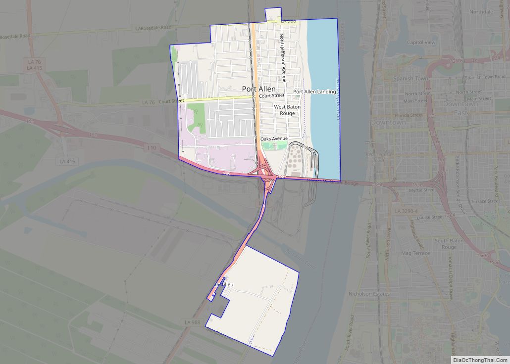
Online Interactive Map
Click on ![]() to view map in "full screen" mode.
to view map in "full screen" mode.
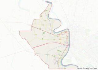
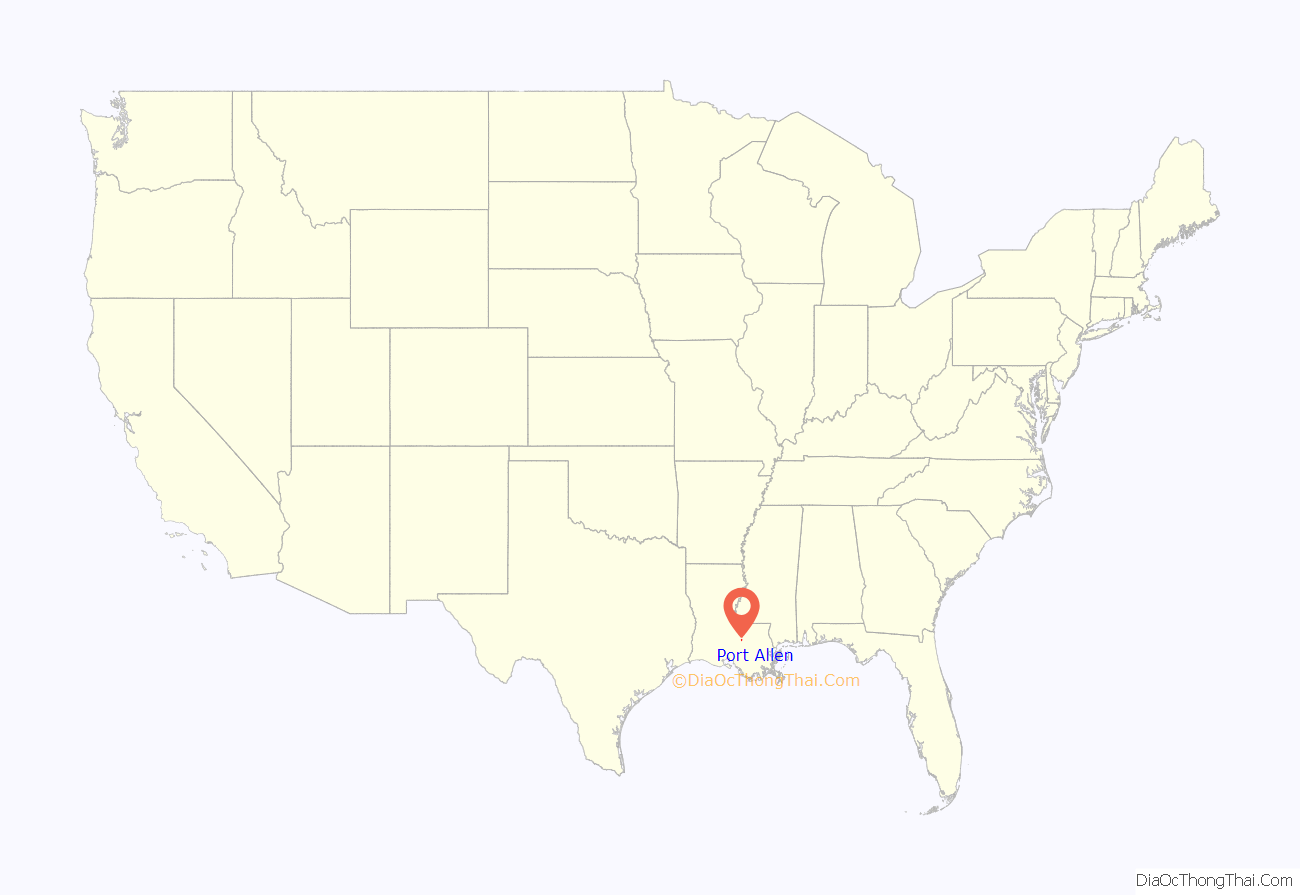
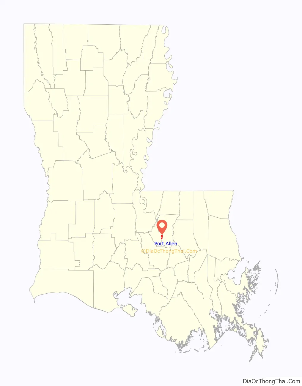
Port Allen location map. Where is Port Allen city?
History
Pre-history
The village of La Ville De St. Michel or San Miguel (1790–1817) had existed in a nearby location to what is now the city of Port Allen. Around the 1850s, a new community had started around the same location and went by the name Town of West Baton Rouge.
Founding of Port Allen
The city of Port Allen was founded in 1878. The name Port Allen is in honor of Henry Watkins Allen, a member of the American Confederate States Army and the 17th Governor of Louisiana. Allen was instrumental in the early years of the village, prior to the founding of the city, he had owned a slave-worked sugar plantation in town he had started in 1855, the Allendale Plantation, and he created his own railroad that ran through the village.
Nearby Sunrise
Around 1878, a former slave named Alex Banes was creating a small community called Sunrise, which existed just north of what is now Port Allen. Many of the inhabitants of Sunrise worked at the railroad Anchorage Depot, by 1900 the depot had been moved taking much of the communities population with it. In 1918, Sunrise had a fire that destroyed much of the town and businesses, and as a result the area integrated into the neighboring town, which by then was known as Port Allen.
Industrialization and growth
By 1916, the city had incorporated. On August 10, 1940, the Huey P. Long Bridge at U.S. Route 190 was unveiled, which joined the east and west parishes, and shaping the city towards and aiding commerce and industries. Over time there was economic shifts away from agricultural and towards industrial, and in the 1950s factories and manufacturing plants were built in town. In 1963, the town population reached 5,000 and it was renamed as a city.
For many years the city was racially segregated.
Port Allen Road Map
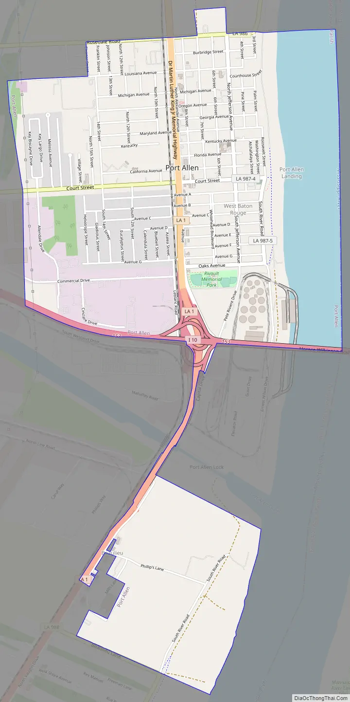
Port Allen city Satellite Map

Geography
Port Allen is located at 30°27′13″N 91°12′36″W / 30.45361°N 91.21000°W / 30.45361; -91.21000 (30.453740, −91.209957).
According to the United States Census Bureau, the city has a total area of 2.6 square miles (6.8 km), of which 2.1 square miles (5.5 km) is land and 0.5 square mile (1.3 km) (19.39%) is water. The city is adjacent to the Mississippi River, which passes to the east side of the city.
See also
Map of Louisiana State and its subdivision:- Acadia
- Allen
- Ascension
- Assumption
- Avoyelles
- Beauregard
- Bienville
- Bossier
- Caddo
- Calcasieu
- Caldwell
- Cameron
- Catahoula
- Claiborne
- Concordia
- De Soto
- East Baton Rouge
- East Carroll
- East Feliciana
- Evangeline
- Franklin
- Grant
- Iberia
- Iberville
- Jackson
- Jefferson
- Jefferson Davis
- La Salle
- Lafayette
- Lafourche
- Lincoln
- Livingston
- Madison
- Morehouse
- Natchitoches
- Orleans
- Ouachita
- Plaquemines
- Pointe Coupee
- Rapides
- Red River
- Richland
- Sabine
- Saint Bernard
- Saint Charles
- Saint Helena
- Saint James
- Saint John the Baptist
- Saint Landry
- Saint Martin
- Saint Mary
- Saint Tammany
- Tangipahoa
- Tensas
- Terrebonne
- Union
- Vermilion
- Vernon
- Washington
- Webster
- West Baton Rouge
- West Carroll
- West Feliciana
- Winn
- Alabama
- Alaska
- Arizona
- Arkansas
- California
- Colorado
- Connecticut
- Delaware
- District of Columbia
- Florida
- Georgia
- Hawaii
- Idaho
- Illinois
- Indiana
- Iowa
- Kansas
- Kentucky
- Louisiana
- Maine
- Maryland
- Massachusetts
- Michigan
- Minnesota
- Mississippi
- Missouri
- Montana
- Nebraska
- Nevada
- New Hampshire
- New Jersey
- New Mexico
- New York
- North Carolina
- North Dakota
- Ohio
- Oklahoma
- Oregon
- Pennsylvania
- Rhode Island
- South Carolina
- South Dakota
- Tennessee
- Texas
- Utah
- Vermont
- Virginia
- Washington
- West Virginia
- Wisconsin
- Wyoming