Castor is a village in Bienville Parish in north Louisiana, United States. The population was 209 at the 2000 census but increased 23% to 258 in 2010. The median age was 32.2 years. The village was established in 1900. The name “Castor” refers to the genus Castoridae or beaver, a Latin term, contrary to an oral tradition of the word being Native American in origin.
Castor’s ZIP code is 71016, and the local landline AT&T telephone numbers start with 544, with wireless number prefixes varying according to service provider. A number of surrounding smaller villages, both incorporated and not, including Roy, utilize the ZIP code of Castor.
| Name: | Castor village |
|---|---|
| LSAD Code: | 47 |
| LSAD Description: | village (suffix) |
| State: | Louisiana |
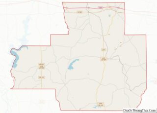
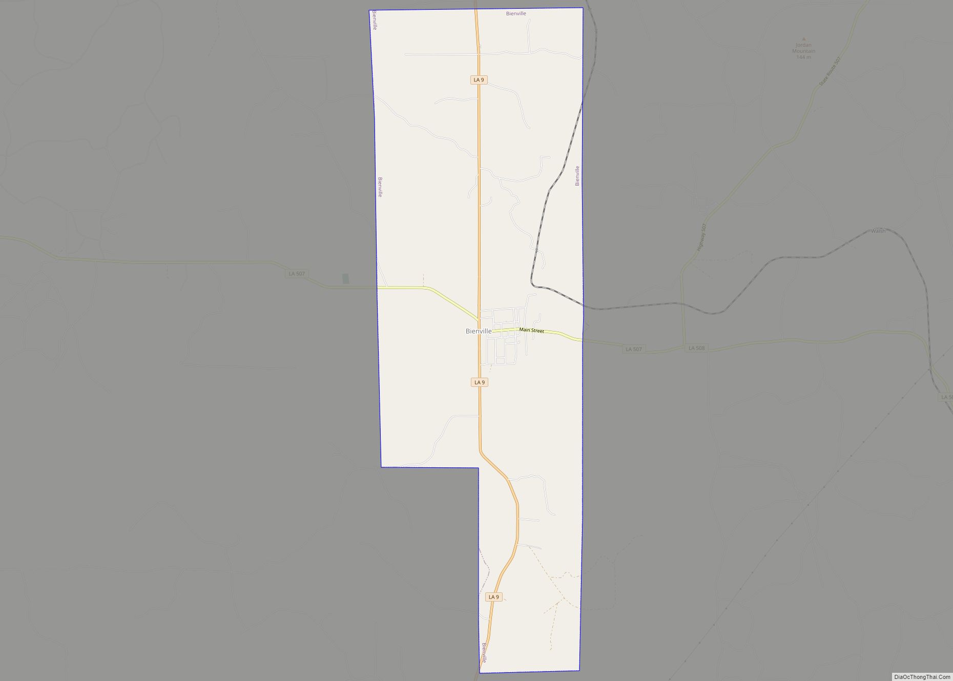
| County: | Bienville Parish |
| Elevation: | 174 ft (53 m) |
| Total Area: | 1.19 sq mi (3.08 km²) |
| Land Area: | 1.19 sq mi (3.08 km²) |
| Water Area: | 0.00 sq mi (0.00 km²) |
| Total Population: | 230 |
| Population Density: | 193.12/sq mi (74.58/km²) |
| ZIP code: | 71016 |
| Area code: | 318 |
| FIPS code: | 2213260 |
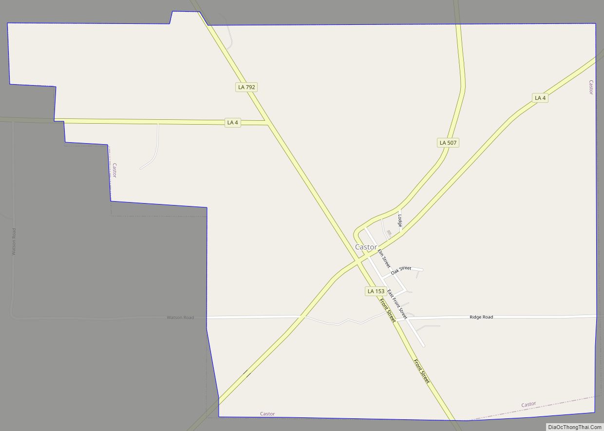
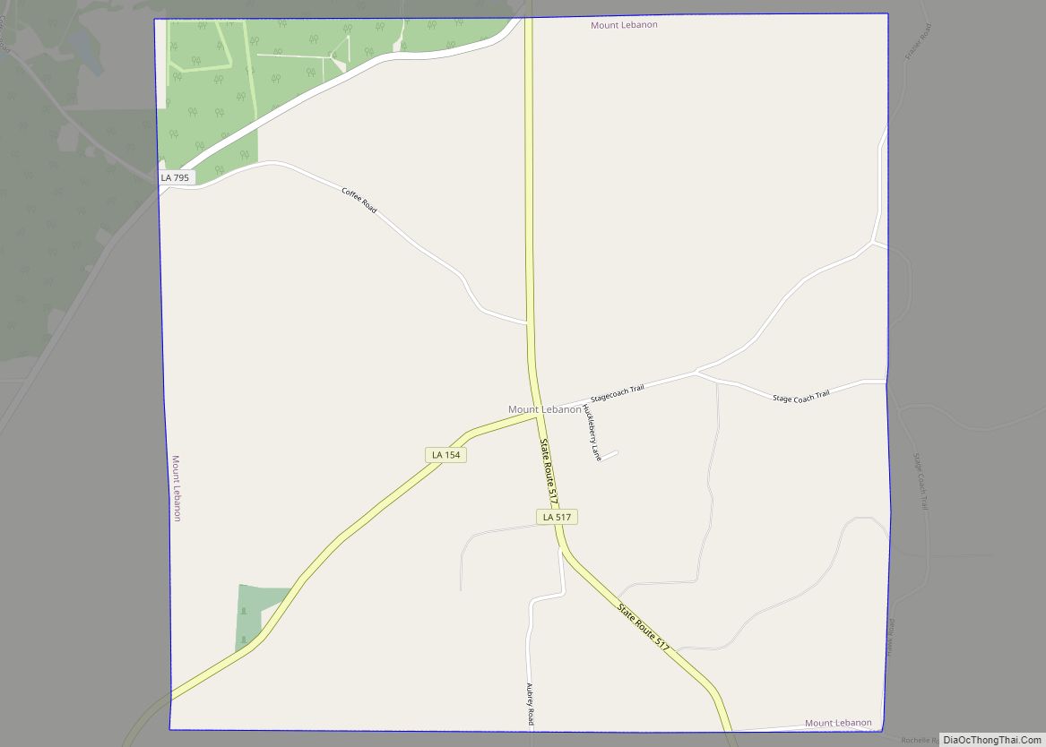
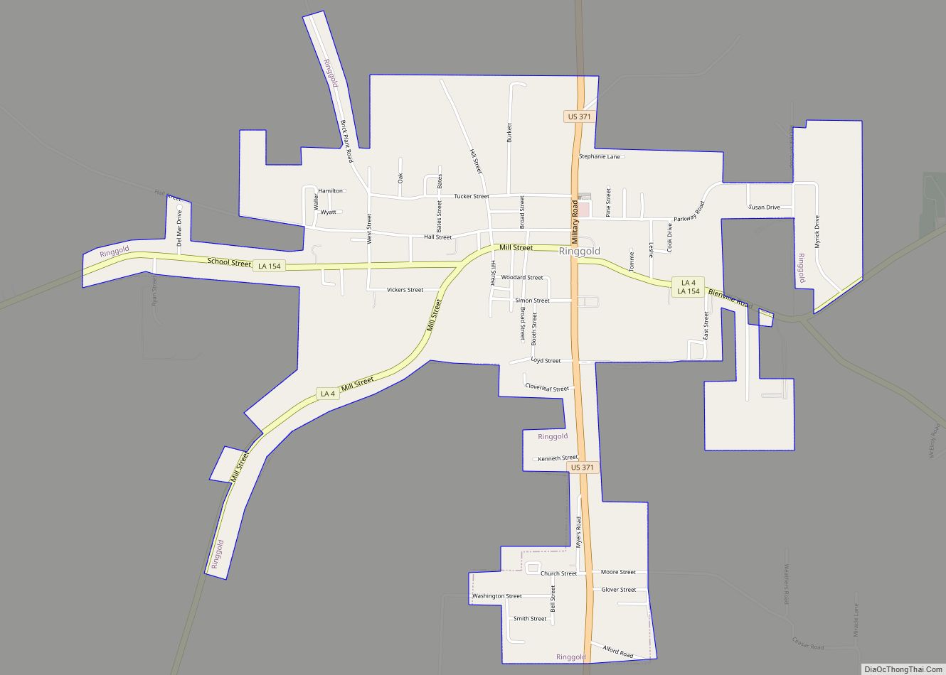
Online Interactive Map
Click on ![]() to view map in "full screen" mode.
to view map in "full screen" mode.
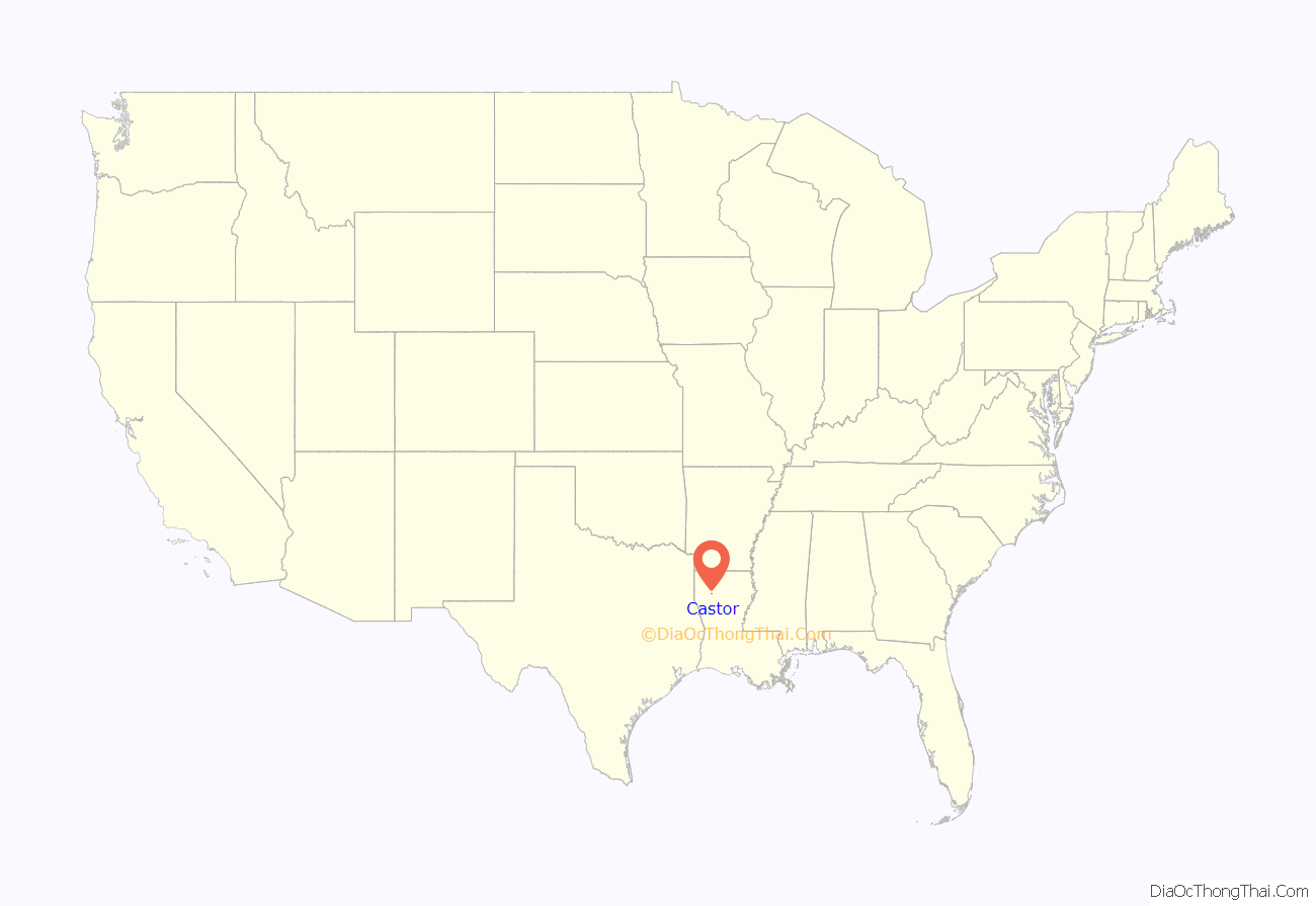
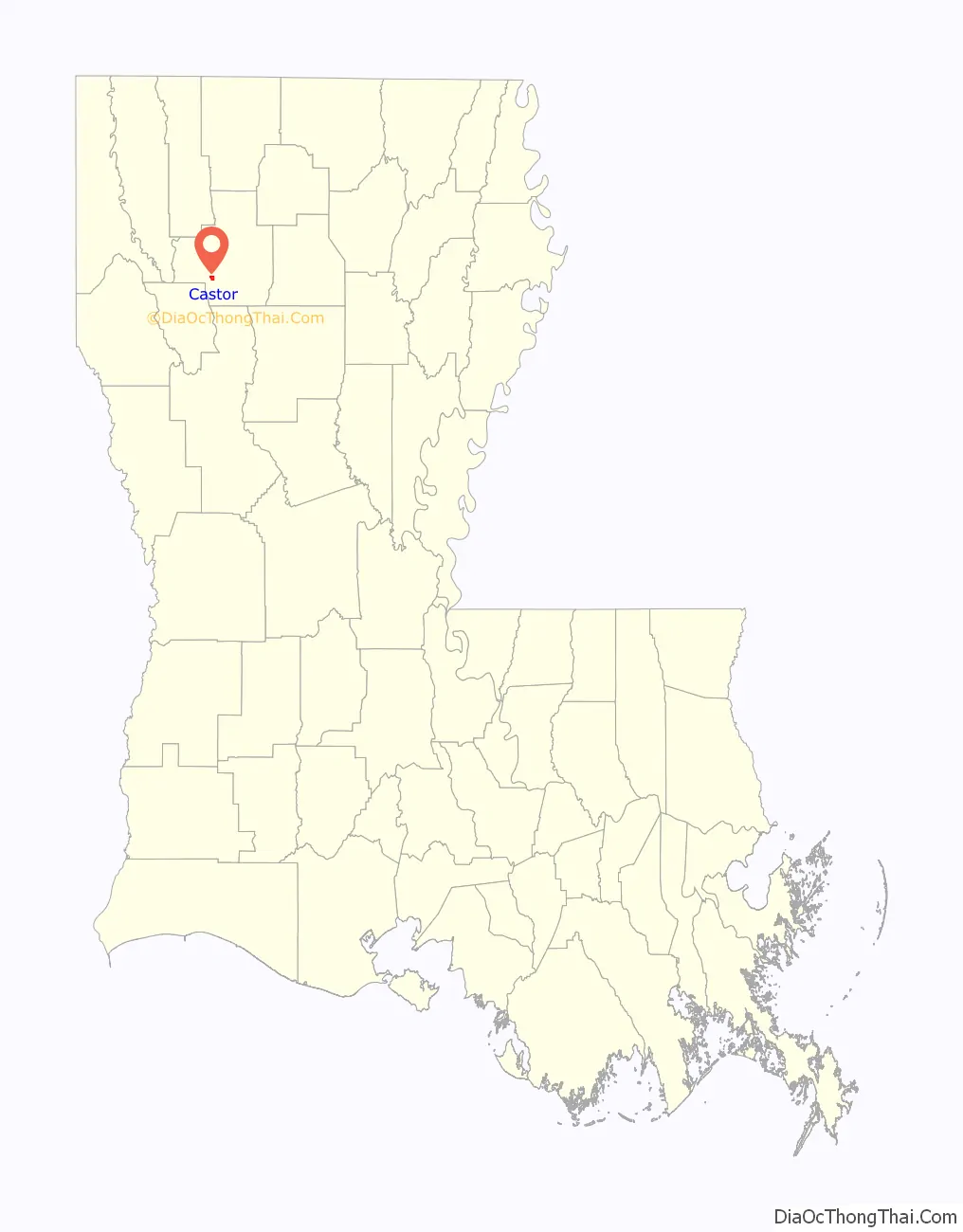
Castor location map. Where is Castor village?
History
During the Civil War, Castor supplied salt for the Confederacy. A salt works was operated west of Castor by Alfred P. King. The area supplied hundreds of young men as soldiers during the Civil War, including the Castor Guards and the Bienville Rifles.
Dr. Dempsey Sullivan was a physician who saw patients from horseback. His daughter, Willie Sullivan, married Sam Smith, and the couple had 21 children. All but one of the children who died are interred at the New Ebenezer Cemetery. Mrs. Bonnie Daniel and Mrs. Merlene Young lived the furthest away in Weatherford and Kerrville, Texas, respectively, but they too are buried at Ebenezer.
The Sam and Willie Sullivan Smith family, one of the oldest in Castor, lost six members in a tornado in 1950. Mr. and Mrs. Smith, Elaine Smith, Celia Sullivan (Mrs. Smith’s sister), Dottie Jo Knotts, and Prentice Little were all killed. The homestead was wiped clean except for a bucket on the water well which remained undisturbed. The Smith family sold most of its land to Jerry “Cotton” Guin, an employee of Libbey Glass in Shreveport, who raised bees there until 2009.
The Louisiana rails to trails project, which extends from Sibley to Winnfield, deconstructed the once Kansas City Southern Railway track to make a recreational nature trail that, on completion, runs through the center of Castor.
The first school in Castor was located in the former Masonic lodge near the site of the present United Methodist Church. By 1912, Castor State Bank joined a small group of businesses on North Front Street. The bank and other buildings burned in 1929. A new bank building, a two-story brick structure, opened with the upper floor reserved for the Masonic lodge. This bank closed in 1933, but the top floor was still maintained by the lodge and the Order of the Eastern Star, which had been chartered in Castor on June 6, 1912. In the winter of 1983, fire destroyed this building, and the lodge records were lost. A new lodge hall was constructed in 1985 across from the Methodist Church.
In the late evening of April 23, 2000, Castor was struck by a tornado with a half-mile-wide path of destruction, which caused massive damage. There were no severe injuries, but the infrastructure damage caused the closure of most small businesses as well as the public school for a period of weeks. Most of the affected buildings were demolished or renovated because of the severe damage.
Discovered in 2007-2008, the Haynesville Shale, one of the largest natural gas deposits in the United States, sits underneath northwest Louisiana, including Castor. A large pocket of the Haynesville Shale was developed at the edge of the village, but an industrial/production accident involving the site damaged the pocket, making it unusable for the time being.
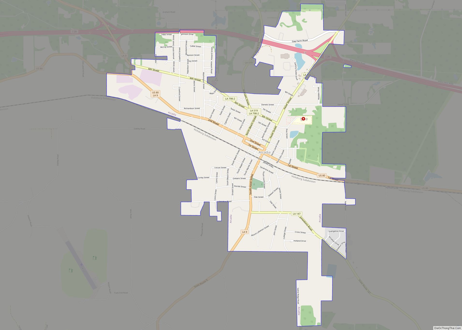
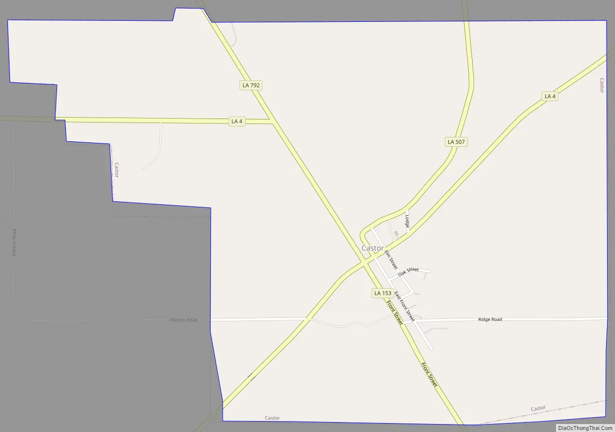
Castor Road Map
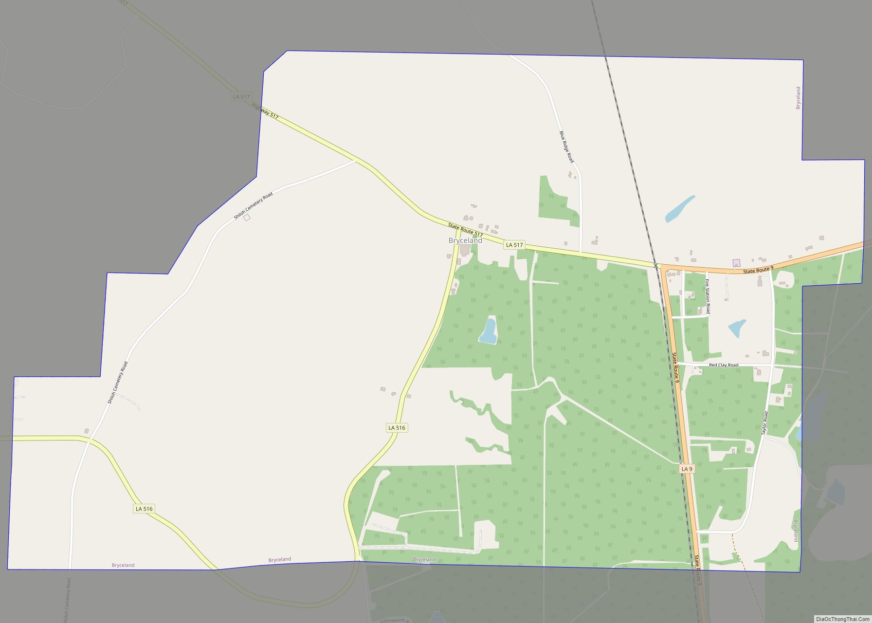
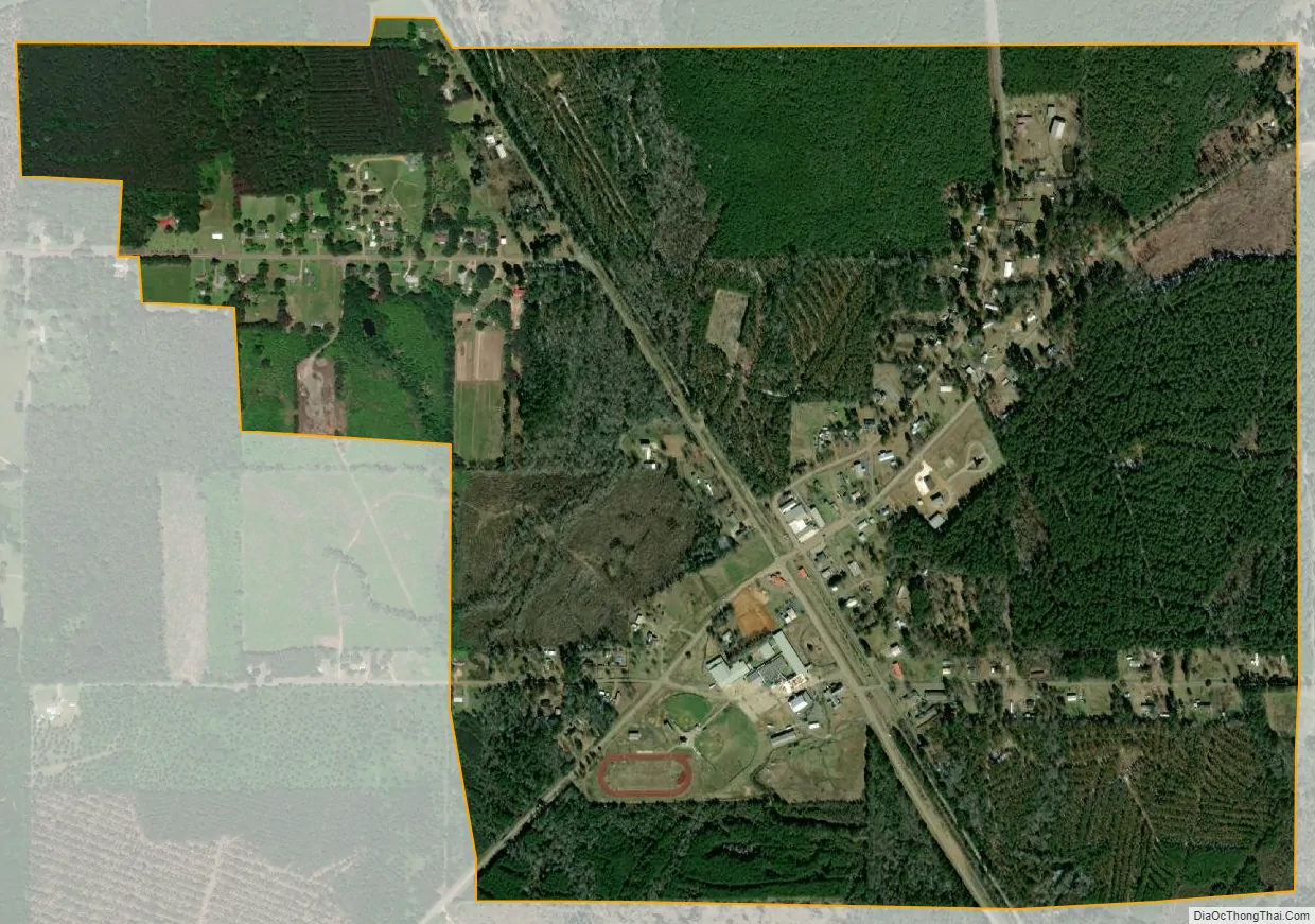
Castor city Satellite Map
Geography
Castor is located at 32°15′10″N 93°9′54″W / 32.25278°N 93.16500°W / 32.25278; -93.16500 (32.252757, -93.164933).
According to the United States Census Bureau, the village has a total area of 1.2 square miles (3.1 km), all land.
Landscape
At ground level, Castor seems flat and surrounded by trees; however, in reality it sits in a valley which makes it a dead area for cell phone coverage. Verizon recently constructed a tower within a few miles of the village, allowing satisfactory reception of the Verizon Wireless network.
The active area or center of Castor is the four-way intersection of LA 4/LA 153 and LA 507, but the city limits extend from the light for about a quarter mile in all directions.
Castor Creek is a tributary of Black Lake Bayou, which flows approximately 4 miles (6 km) southwest of Castor.
See also
Map of Louisiana State and its subdivision:- Acadia
- Allen
- Ascension
- Assumption
- Avoyelles
- Beauregard
- Bienville
- Bossier
- Caddo
- Calcasieu
- Caldwell
- Cameron
- Catahoula
- Claiborne
- Concordia
- De Soto
- East Baton Rouge
- East Carroll
- East Feliciana
- Evangeline
- Franklin
- Grant
- Iberia
- Iberville
- Jackson
- Jefferson
- Jefferson Davis
- La Salle
- Lafayette
- Lafourche
- Lincoln
- Livingston
- Madison
- Morehouse
- Natchitoches
- Orleans
- Ouachita
- Plaquemines
- Pointe Coupee
- Rapides
- Red River
- Richland
- Sabine
- Saint Bernard
- Saint Charles
- Saint Helena
- Saint James
- Saint John the Baptist
- Saint Landry
- Saint Martin
- Saint Mary
- Saint Tammany
- Tangipahoa
- Tensas
- Terrebonne
- Union
- Vermilion
- Vernon
- Washington
- Webster
- West Baton Rouge
- West Carroll
- West Feliciana
- Winn
- Alabama
- Alaska
- Arizona
- Arkansas
- California
- Colorado
- Connecticut
- Delaware
- District of Columbia
- Florida
- Georgia
- Hawaii
- Idaho
- Illinois
- Indiana
- Iowa
- Kansas
- Kentucky
- Louisiana
- Maine
- Maryland
- Massachusetts
- Michigan
- Minnesota
- Mississippi
- Missouri
- Montana
- Nebraska
- Nevada
- New Hampshire
- New Jersey
- New Mexico
- New York
- North Carolina
- North Dakota
- Ohio
- Oklahoma
- Oregon
- Pennsylvania
- Rhode Island
- South Carolina
- South Dakota
- Tennessee
- Texas
- Utah
- Vermont
- Virginia
- Washington
- West Virginia
- Wisconsin
- Wyoming