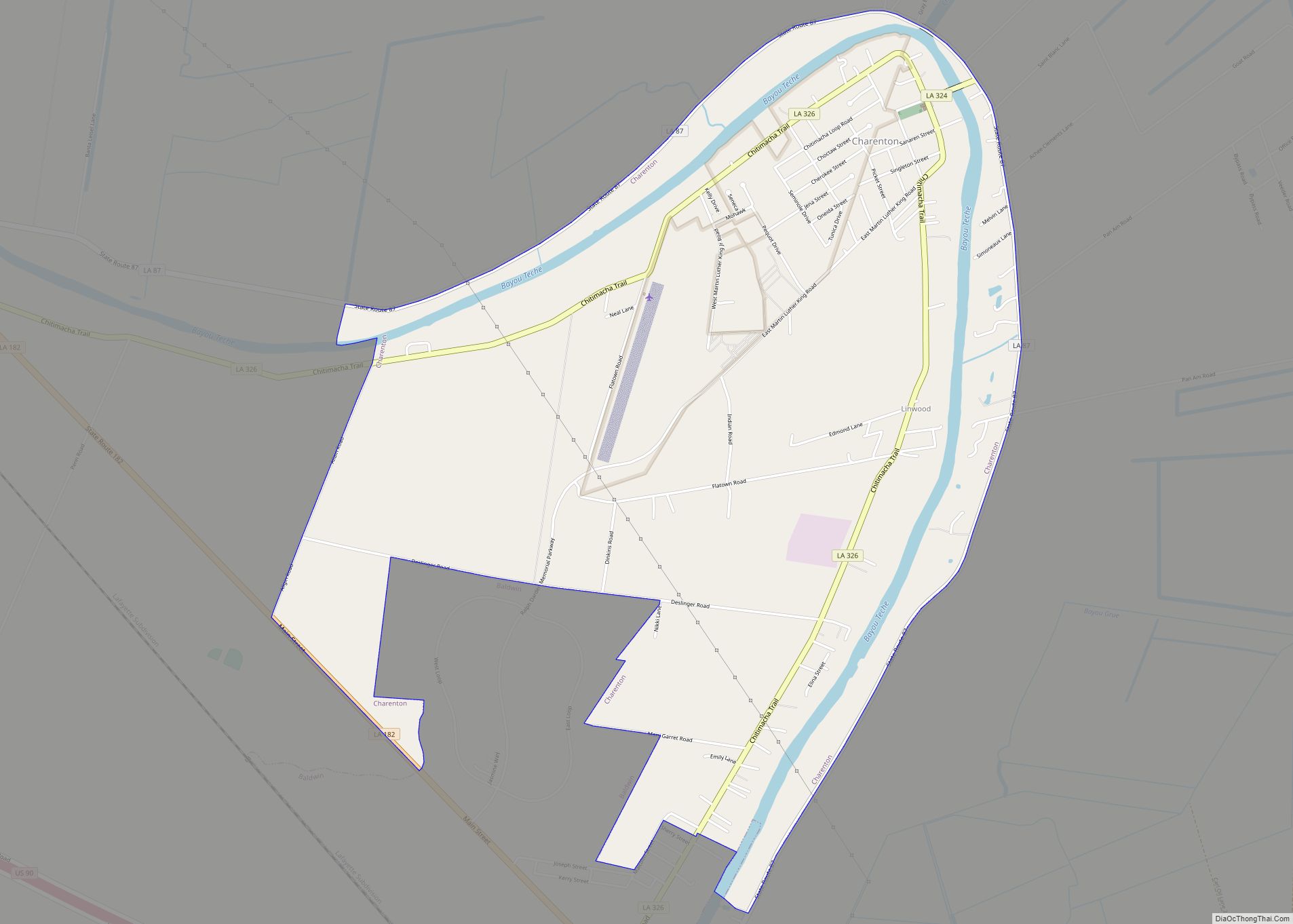
Charenton (historically French: Lieu-des-Chetimachas) is a census-designated place (CDP) in St. Mary Parish, Louisiana, United States. The population was 1,903 at the 2010 census. It is part of the Morgan City Micropolitan Statistical Area. According to legend, the community received its name from one of the earliest settlers of the region, Alexandre Frere. Frere, a native of Paris, reportedly exclaimed on his deathbed that “anyone choosing to move to that part of Louisiana belonged in Charenton!” Charenton was the name of a notorious insane asylum outside of Paris.
| Name: | Charenton CDP |
|---|---|
| LSAD Code: | 57 |
| LSAD Description: | CDP (suffix) |
| State: | Louisiana |
| County: | St. Mary Parish |
| Elevation: | 13 ft (4 m) |
| Total Area: | 5.22 sq mi (13.51 km²) |
| Land Area: | 4.97 sq mi (12.86 km²) |
| Water Area: | 0.25 sq mi (0.65 km²) |
| Total Population: | 1,699 |
| Population Density: | 342.06/sq mi (132.07/km²) |
| Area code: | 337 |
| FIPS code: | 2214310 |
| Website: | www.chitimacha.gov |
Online Interactive Map
Click on ![]() to view map in "full screen" mode.
to view map in "full screen" mode.
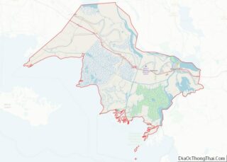
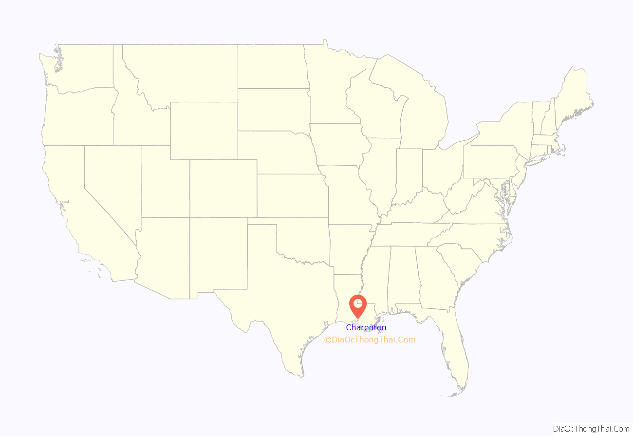
Charenton location map. Where is Charenton CDP?
History
Charenton is home to one community of Chitimacha Indians. In 1855, the Chitimacha were seriously reduced by yellow fever that struck the Region. In 1881, the Chitimacha were located on Grand Lake or Lake Fausse. The census of 1900 listed six families of Chitimacha, with a total of 55 people. During this period, the Chitimacha’s land base had continued to decline as reservation land was divided again and again among members unable to pay the annual taxes. As a result, the land was sold. A court divided the last 505 acres (2.04 km) of the reservation in 1903, but attorney’s fees claimed 280 acres (1.1 km) of it two years later. Answering a plea from the Chitimacha women, Miss Sarah Avery McIlhenney purchased the land at a sheriff’s sale in 1915 and immediately ceded it to the federal government who in turn placed the land in trust for the tribe. Federal recognition followed in 1917, and the Chitimacha became the only tribe in Louisiana to achieve such status. This new recognition and the land held in trust could not have come at a better time. World War I and the pressure it placed on oil companies led to exploration in the region and purchase of land there.
With their land secure, many Chitimacha found employment in the new Louisiana oil fields as drillers and foremen. Following the passage of the Indian Reorganization Act in 1934, the Chitimacha created a new tribal organization. Unfortunately, their small enrollment and success in finding work outside their reservation led to an attempt by the government to terminate their federal status in 1952. This move was ultimately defeated, and the Chitimacha, growing in number and organization, put into effect a constitution and bylaws in 1971 that remain in effect today.
The Chitimacha operate a museum, fish processing plant and school on the reservation. In addition, what began as a bingo operation grew into a lucrative casino that operates on the tribe’s land in Charenton. Revenue from the Cypress Bayou casino has provided the Chitimacha with funds used to recover land historically part of the reservation. Consequently, land that had dwindled to just 260 acres (1.1 km) has now swelled to over a thousand acres (4 km). The Chitimacha are an important part of Charenton’s history as well as a major part of the current community.
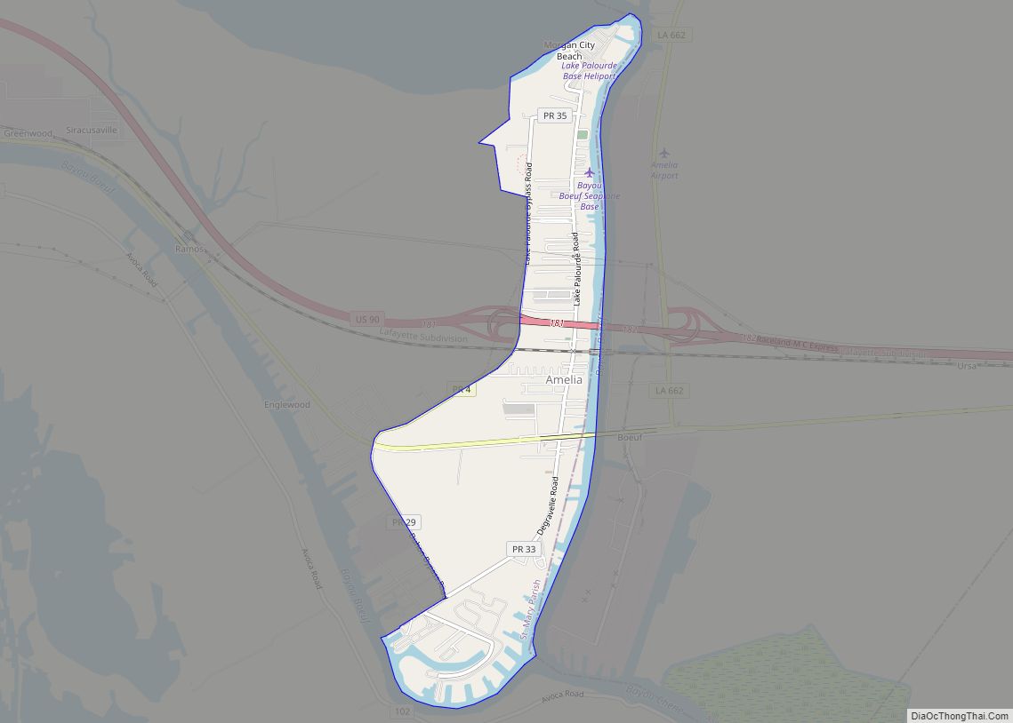
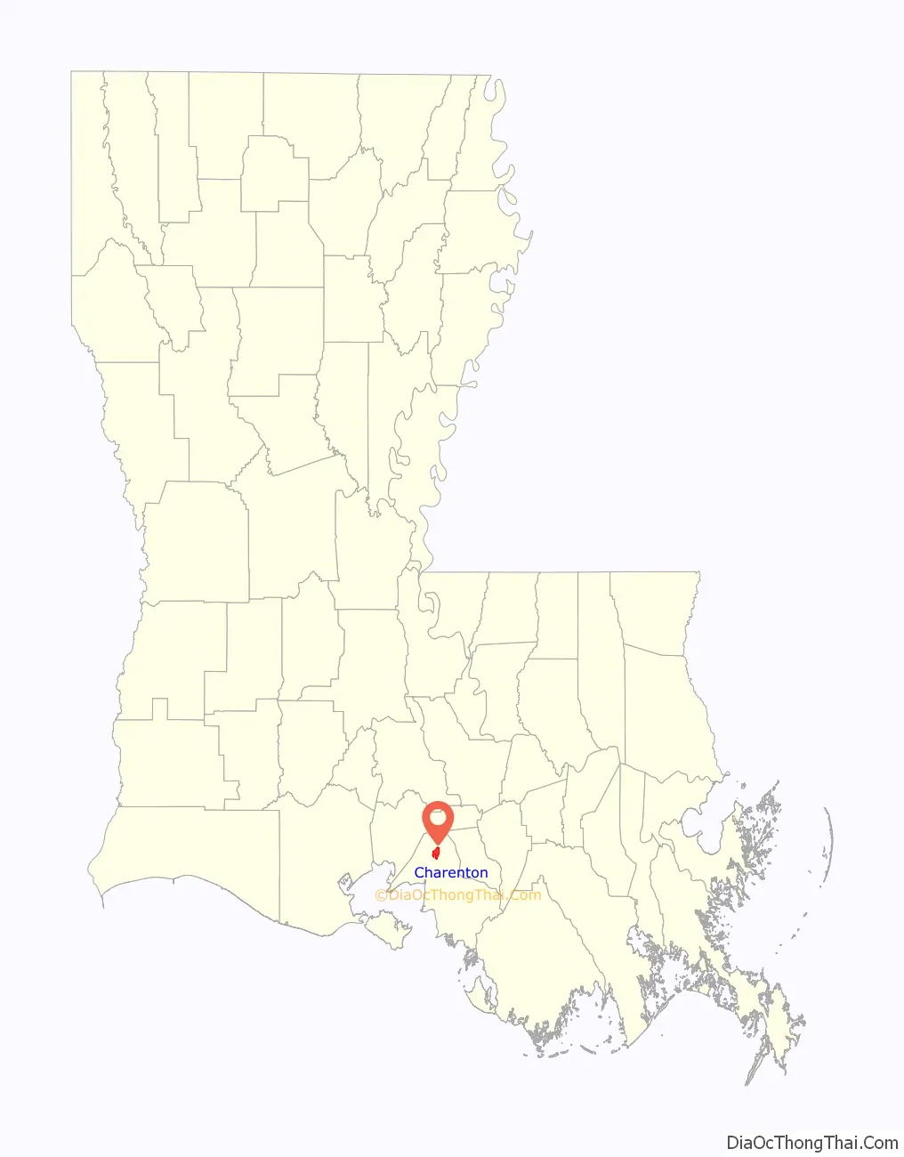
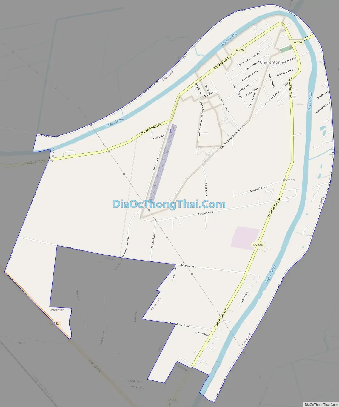
Charenton Road Map
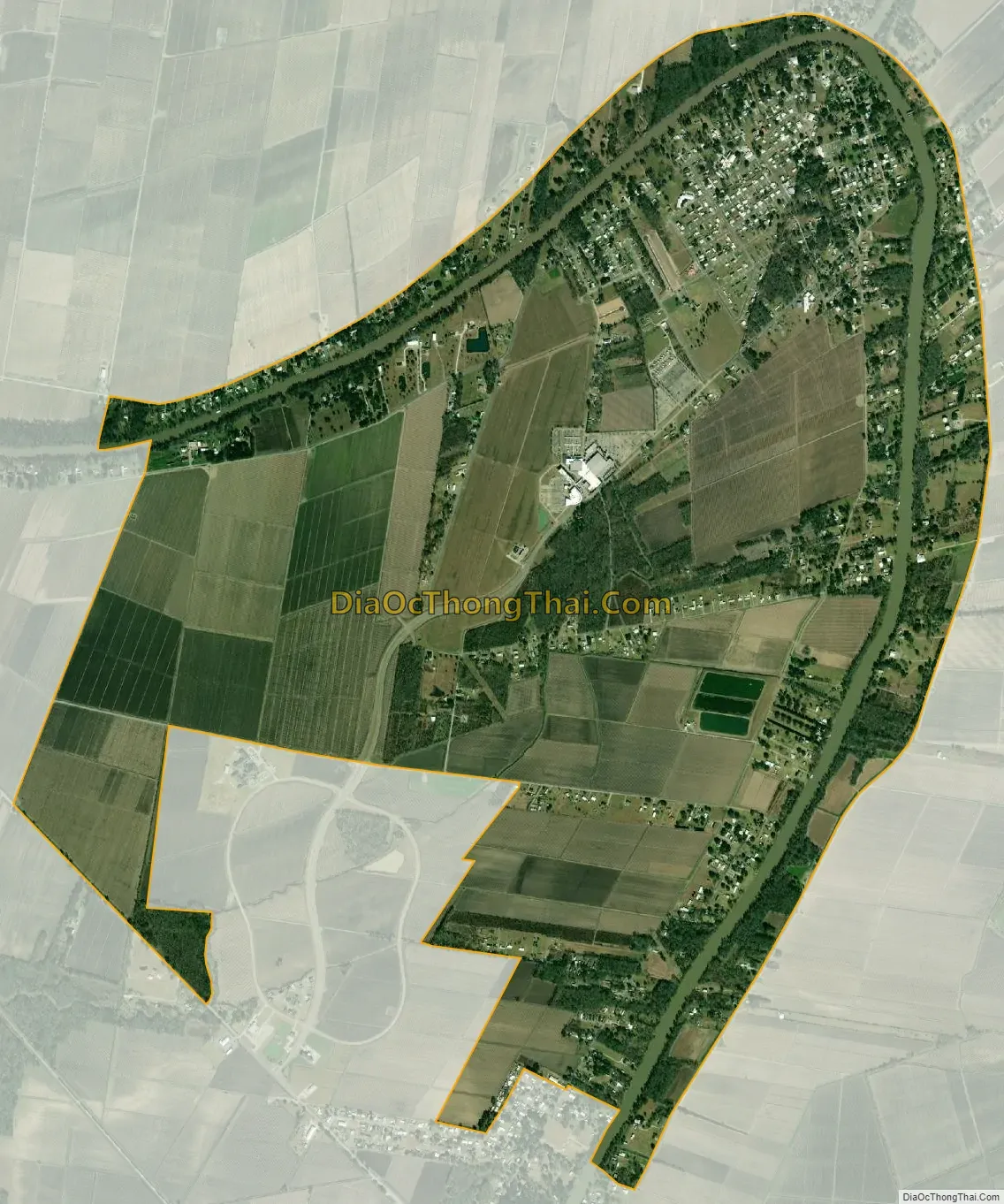
Charenton city Satellite Map
Geography
Charenton is located at 29°53′01.47″N 91°31′37.78″W / 29.8837417°N 91.5271611°W / 29.8837417; -91.5271611 (29.88436373442272,-91.5274459771368).
According to the United States Census Bureau, the CDP has a total area of 5.2 square miles (13.5 km), of which 5.0 square miles (12.9 km) is land and 0.23 square miles (0.6 km), or 4.79%, is water.
See also
Map of Louisiana State and its subdivision:- Acadia
- Allen
- Ascension
- Assumption
- Avoyelles
- Beauregard
- Bienville
- Bossier
- Caddo
- Calcasieu
- Caldwell
- Cameron
- Catahoula
- Claiborne
- Concordia
- De Soto
- East Baton Rouge
- East Carroll
- East Feliciana
- Evangeline
- Franklin
- Grant
- Iberia
- Iberville
- Jackson
- Jefferson
- Jefferson Davis
- La Salle
- Lafayette
- Lafourche
- Lincoln
- Livingston
- Madison
- Morehouse
- Natchitoches
- Orleans
- Ouachita
- Plaquemines
- Pointe Coupee
- Rapides
- Red River
- Richland
- Sabine
- Saint Bernard
- Saint Charles
- Saint Helena
- Saint James
- Saint John the Baptist
- Saint Landry
- Saint Martin
- Saint Mary
- Saint Tammany
- Tangipahoa
- Tensas
- Terrebonne
- Union
- Vermilion
- Vernon
- Washington
- Webster
- West Baton Rouge
- West Carroll
- West Feliciana
- Winn
- Alabama
- Alaska
- Arizona
- Arkansas
- California
- Colorado
- Connecticut
- Delaware
- District of Columbia
- Florida
- Georgia
- Hawaii
- Idaho
- Illinois
- Indiana
- Iowa
- Kansas
- Kentucky
- Louisiana
- Maine
- Maryland
- Massachusetts
- Michigan
- Minnesota
- Mississippi
- Missouri
- Montana
- Nebraska
- Nevada
- New Hampshire
- New Jersey
- New Mexico
- New York
- North Carolina
- North Dakota
- Ohio
- Oklahoma
- Oregon
- Pennsylvania
- Rhode Island
- South Carolina
- South Dakota
- Tennessee
- Texas
- Utah
- Vermont
- Virginia
- Washington
- West Virginia
- Wisconsin
- Wyoming