Franklin is a small city in and the parish seat of St. Mary Parish, Louisiana, United States. The population was 7,660 at the 2010 census. The city is located on Bayou Teche, southeast of the cities of Lafayette, 47 miles (76 km) and New Iberia, 28 miles (45 km), and 22 miles (35 km) northwest of Morgan City. It is part of the Morgan City Micropolitan Statistical Area and the larger Lafayette-Acadiana combined statistical area.
| Name: | Franklin city |
|---|---|
| LSAD Code: | 25 |
| LSAD Description: | city (suffix) |
| State: | Louisiana |
| County: | St. Mary Parish |
| Incorporated: | 1820 |
| Elevation: | 10 ft (3 m) |
| Total Area: | 10.49 sq mi (27.17 km²) |
| Land Area: | 9.92 sq mi (25.70 km²) |
| Water Area: | 0.57 sq mi (1.48 km²) |
| Total Population: | 6,728 |
| Population Density: | 678.09/sq mi (261.82/km²) |
| ZIP code: | 70538 |
| Area code: | 337 |
| FIPS code: | 2227155 |
| Website: | www.franklin-la.com |
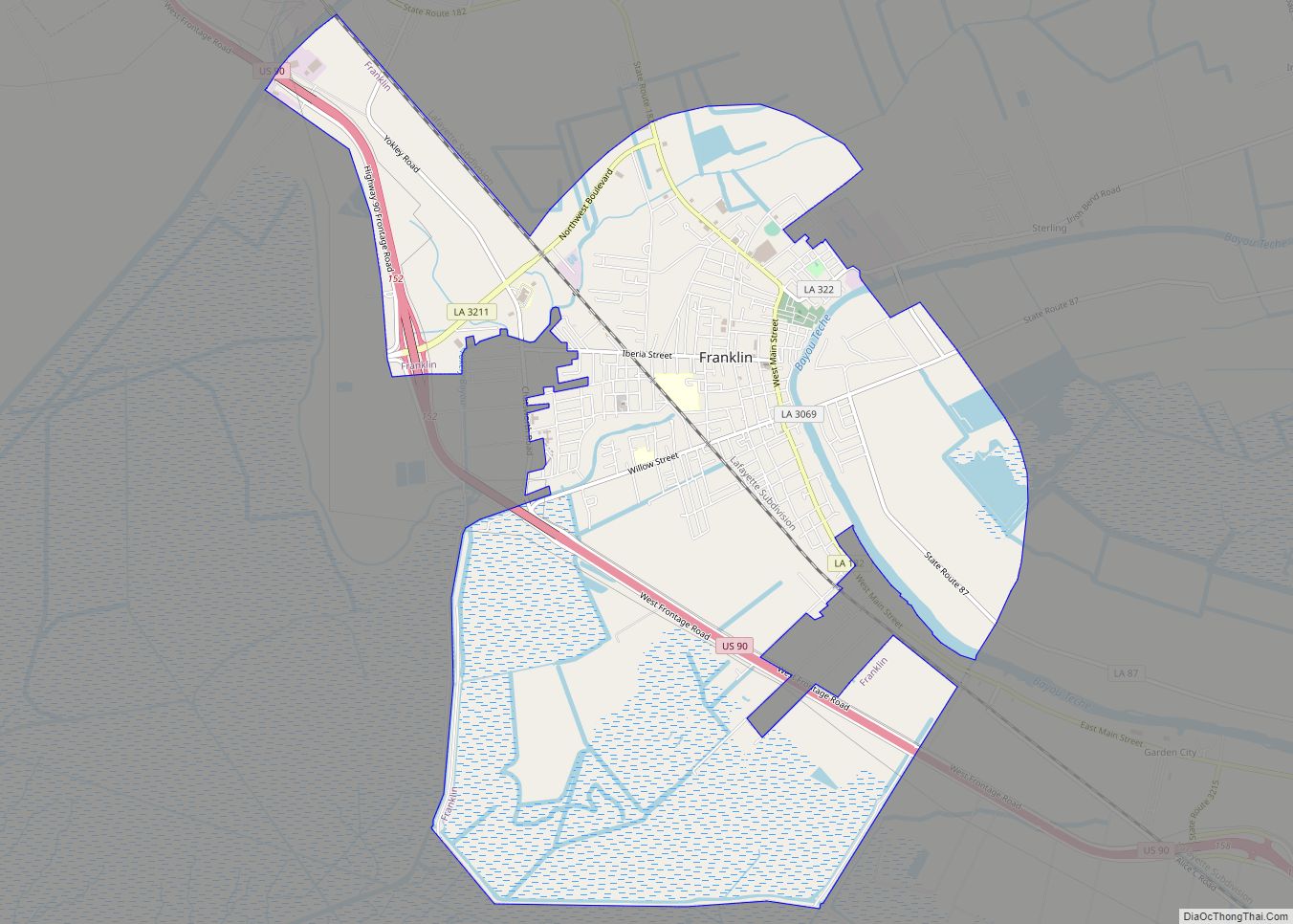
Online Interactive Map
Click on ![]() to view map in "full screen" mode.
to view map in "full screen" mode.
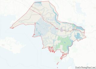
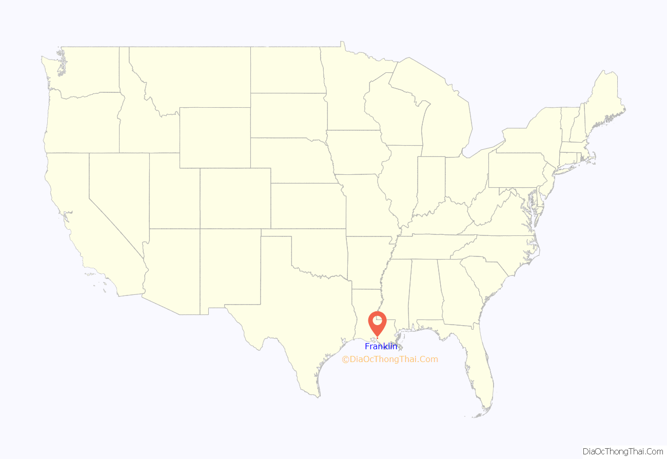
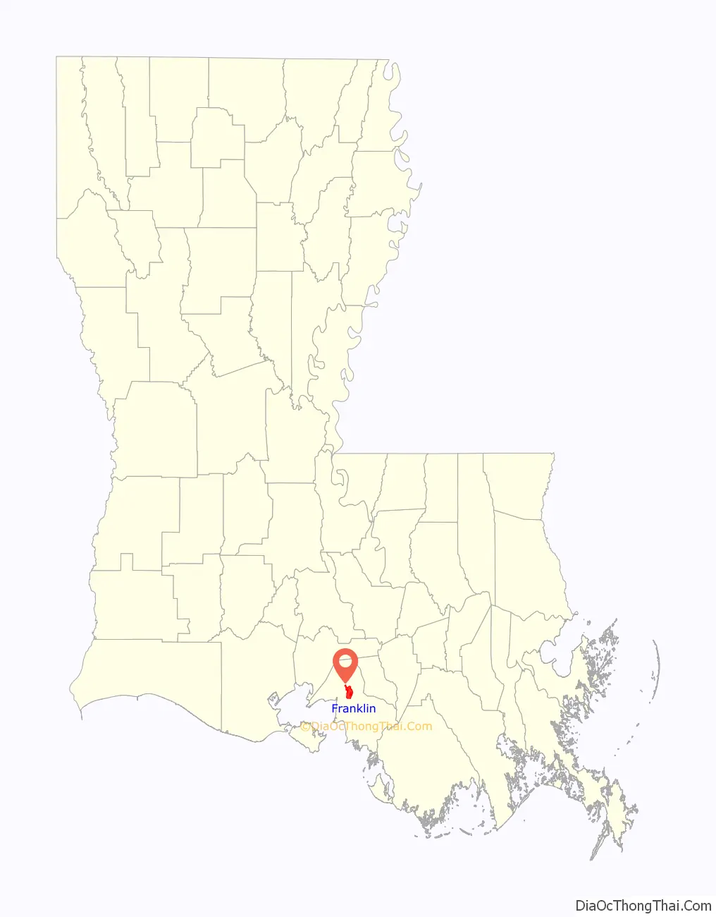
Franklin location map. Where is Franklin city?
History
Franklin, named for Benjamin Franklin, was founded in 1808 as the “Carlin’s Settlement” by French-born pioneer Joseph Carlin and his family. It became the parish seat in 1811 and the town was incorporated in 1820. Though early settlers included French, Acadian, German, Danish and Irish, the town’s culture and architecture is heavily influenced by the unusually large numbers of English that chose to settle there after the Louisiana Purchase in 1803.
Numerous large sugar plantations arose in the area, and with the development of steam-boating, Franklin became an interior sugar port. With the later advent of the railroad, it became a sawmill town.
Franklin’s First United Methodist Church was established in 1806, making it the first Protestant church established in the state of Louisiana.
Sugar plantations
By the 1830s, Bayou Teche was the main street of Acadiana, with one plantation after another. The area’s sugar cane planters were among the South’s wealthiest agriculturists. This is reflected in the grand plantation homes and mansions they built in Franklin and the surrounding countryside. Most of these magnificent structures are still standing and well preserved, giving Franklin its unique architectural flavor.
Franklin’s Historic District is listed in the National Register of Historic Places (NRHP) and encompasses over 420 notable structures. Some of the historic plantations in Franklin listed in the NRHP include the Alice C. Plantation House, Arlington Plantation House, and the Dixie Plantation House.
Civil War
During the Civil War, the Battle of Irish Bend, also known as Nerson’s Woods, was fought near Franklin on April 14, 1863. Though eventually forced to retreat, the badly outnumbered Confederate forces commanded by General Richard Taylor cost the Union troops, under General Cuvier Grover, significant losses. Four hundred men were killed or wounded in the confrontation, including Confederate Colonel James Reily, a factor in halting the Union drive to invade Texas.
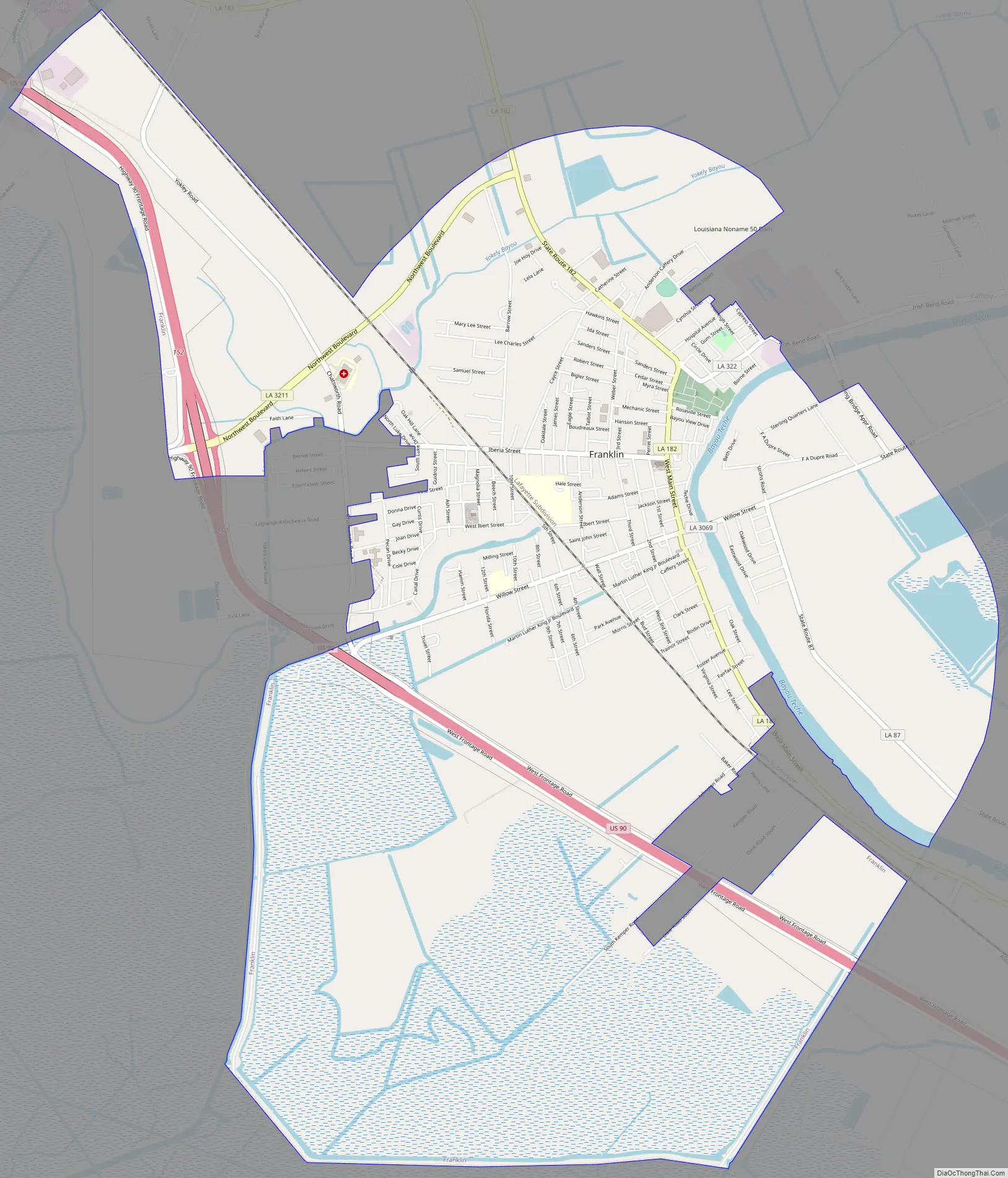
Franklin Road Map
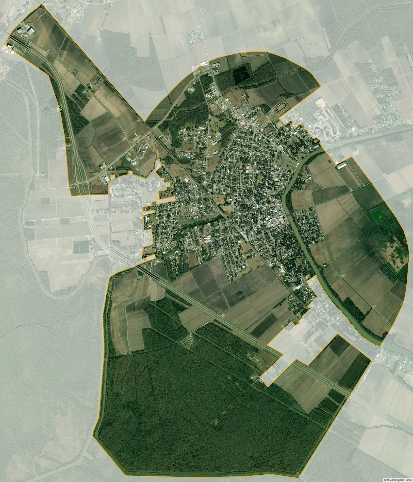
Franklin city Satellite Map
Geography
Franklin is located at 29°47′30″N 91°30′30″W / 29.79167°N 91.50833°W / 29.79167; -91.50833 (29.791759, -91.508253) and has an elevation of 10 feet (3.0 m).
According to the United States Census Bureau, the city has a total area of 10.5 square miles (27.2 km), of which 9.9 square miles (25.7 km) is land and 0.58 square miles (1.5 km), or 5.44%, is water.
Louisiana Highways 182, which runs through downtown, and 87, which is located on the outskirts of Franklin, both head north passing through the communities of Baldwin, 8 miles (13 km), Jeanerette, 14 miles (23 km), and New Iberia, 25 miles (40 km), both located in Iberia Parish. Both LA-182 and U.S. Highway 90 both head to northwest to Lafayette, 47 miles (76 km), and southeast to Morgan City, 26 miles (42 km).
Climate
See also
Map of Louisiana State and its subdivision:- Acadia
- Allen
- Ascension
- Assumption
- Avoyelles
- Beauregard
- Bienville
- Bossier
- Caddo
- Calcasieu
- Caldwell
- Cameron
- Catahoula
- Claiborne
- Concordia
- De Soto
- East Baton Rouge
- East Carroll
- East Feliciana
- Evangeline
- Franklin
- Grant
- Iberia
- Iberville
- Jackson
- Jefferson
- Jefferson Davis
- La Salle
- Lafayette
- Lafourche
- Lincoln
- Livingston
- Madison
- Morehouse
- Natchitoches
- Orleans
- Ouachita
- Plaquemines
- Pointe Coupee
- Rapides
- Red River
- Richland
- Sabine
- Saint Bernard
- Saint Charles
- Saint Helena
- Saint James
- Saint John the Baptist
- Saint Landry
- Saint Martin
- Saint Mary
- Saint Tammany
- Tangipahoa
- Tensas
- Terrebonne
- Union
- Vermilion
- Vernon
- Washington
- Webster
- West Baton Rouge
- West Carroll
- West Feliciana
- Winn
- Alabama
- Alaska
- Arizona
- Arkansas
- California
- Colorado
- Connecticut
- Delaware
- District of Columbia
- Florida
- Georgia
- Hawaii
- Idaho
- Illinois
- Indiana
- Iowa
- Kansas
- Kentucky
- Louisiana
- Maine
- Maryland
- Massachusetts
- Michigan
- Minnesota
- Mississippi
- Missouri
- Montana
- Nebraska
- Nevada
- New Hampshire
- New Jersey
- New Mexico
- New York
- North Carolina
- North Dakota
- Ohio
- Oklahoma
- Oregon
- Pennsylvania
- Rhode Island
- South Carolina
- South Dakota
- Tennessee
- Texas
- Utah
- Vermont
- Virginia
- Washington
- West Virginia
- Wisconsin
- Wyoming